coastal zone
THE COASTAL ZONE is where nature breathes its essence into poets and painters. Ancient Greeks believed it was where Neptune's energy encounters land. People living in the UNITED STATES call this transition between land and sea the shore, coast, or beach. Robert Gabler et al., define the coastal zone as “the dynamic region on land as well as areas currently submerged under water, through which the shoreline boundary fluctuates.”
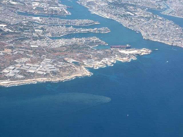
The seaward margin of the coastal zone is where the motion of approaching waves touches the seafloor. The landward boundary is the highest elevation on the land affected by storm waves. The width varies between a few meters and hundreds of meters. The surface varies from sandy to rocky. The rhythmic rise and fall of the tide causes the shoreline to fluctuate within the zone.
The coastal zone's appearance depends, in part, on its sediment budget, or the balance between sediment inputs and outputs. The budget involves mostly sand. Waves determine the balance. As waves crash (break) on shore, the turbulent surf and swash (the sheet of water that rushes up the beach) supplies inputs of sand. The undertow, which is water coaxed back into the ocean by gravity, determines sand outputs. A longshore current, which travels parallel to the shoreline and within the zone, transports sand to and from the breaking waves. Longshore currents distribute sediment that rivers discharge into the ocean. Tidal currents help distribute the sediment to sedate areas where waves are weaker and longshore currents do not exist, such as in coves, bays, and estuaries.
Shorelines whose sand inputs exceed outputs have surplus budgets and are of the depositional type. Depositional shorelines in general have large beaches. A beach has two parts: 1) a beach face, which dips gently below the water's edge; and 2) a berm, which is a flat area just behind the beach face. Broad beaches typically have sand dunes on their landward edges. Wind blowing from the sea crosses over the beach, picks up dry sand particles, and transports them to the dunes. Under the right conditions (no storms, dry weather, strong onshore winds, and ample supply of dry sand), dunes grow beyond the landward limit of the coastal zone.
The spit, barrier island, and DELTA are also depositional features of coastal zones. A spit is an offshore ridge of sand that that stands above water and runs parallel to a shoreline, but at some point, the spit connects to the shore. A longshore current delivers sand to the spit, allowing it to grow parallel to the shore. The unattached end of the spit sometimes curves shoreward but leaves a narrow opening between itself and the shoreline. A barrier island also runs parallel to the shoreline. It is usually a product of spit segmentation brought about by storm waves.
The semi-enclosed water body (estuary) on the landward sides of spits and barrier islands escapes the brunt of the ocean's wave energy. Weak waves and tidal currents build up mudflats around the quiet estuary's edges. Salt marshes and mangrove swamps thrive on the mudflats. A delta forms at the mouth of a river when the river carries more sediment than longshore currents can redistribute to other parts of the shore.
Depositional shorelines are not without erosion problems. The U.S. southeastern Atlantic Coast and Gulf Coast are examples. Severe storms cause sand deficits locally that take years, even decades, to replace. Moreover, the region's slow tectonic subsidence causes gradual erosion. A rise in sea level from human-induced global warming also plays an important role, as do the design and placement of human structures such as jetties, groins, and seawalls.
Shorelines whose sand inputs are less than sand outputs have negative budgets and are of the erosional type. The hardness of rock usually determines the shape of an eroding coastline. Pounding waves hack wall-like sea cliffs into the land. Areas that are more resistant to erosion become cliff-edged headlands (sections of land that jut into the sea). Waves focus their rage on the headlands. They carve into their faces sea caves, sea arches, and sea stacks (small rocky islands). Small bays separate the headlands. Waves are weaker there and leave behind narrow, curving strips of sandy beaches. Over time, the unrelenting waves cut into the land to create rocky submarine benches (flat areas). Many erosional shorelines occur where tectonic uplift is occurring. The U.S. West Coast is an example of such a shoreline.
The ever changing, high-energy beach is inhospitable to most life forms. Ubiquitous shorebirds scurry across the sloping beach face, probing for tiny worms, crustaceans (beach hoppers and sand crabs), and mollusks.
Life is more prolific elsewhere in the coastal zone. Rocky edges and bottoms are havens for lobsters, oysters, corals, periwinkles, mussels, barnacles, starfish, and sea anemones. The protected estuary and its fringing mudflats are habitats for an even longer list of species. The mudflats harbor salt-tolerant grasses, fiddler crabs, and tube worms. The nutrient-rich estuary is a refuge for juvenile and adult fishes, crabs, clams, and oysters. Large numbers of birds, both year-round residents and migratory, frequent the entire coastal zone.