Data and Geography Encoding
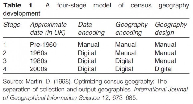
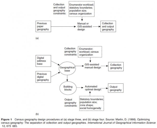
The historical development of the post enumeration processes of a census may be conceived in stages as shown in Table 1. Although the US census used some computer processing in 1950 (UNIVAC 1), most census data before the 1960s were manually encoded. Census agencies tended to adopt new computer technologies soon after they became available, and in some cases were significant contributors to new technological develop ments. The first significant use of digital technology was for data encoding, and this was followed by the devel opment of spatial digitization for geography encoding. However, it is only recently that digital methods have been used for the actual geography design of censuses. Whereas the geographical census output was driven by the imperatives of the data collection process, georefer encing of census returns has allowed the output geog raphy to be created independent of the collection geography as illustrated in Figure 1.
- Politics of Classification: Ethnicity and Religion
- Geographies and Politics of Households and Family
- Population Coverage and Undercount
- Census Enumeration and Analysis
- Census Implementation
- Census Geography
- The Future for Cellular Automata in Geographic Research
- Geographic Applications in Other Sciences
- Human Geography Applications