Geosight #3: The Niagara Falls
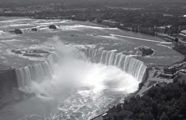
The Niagara Falls are one of the most viewable and well-visited geosights in existence. They stretch across the Niagara River between the US and Canada, interrupted by Goat Island. Just over a kilometre wide, they carry 100,000 litres of water a second. They are over 50m high, and are the biggest barrier on the short river which flows from Lake Erie to Lake Ontario. They have been there since the end of the last ice age and have existed in their present form for about 5500 years since water scoured out an old riverbed and created the distinctive whirlpool seen today.
As we saw on p.74, the falls have been eroding their way upstream since the end of the last ice age. In the last few hundred years this rate of recession has increased to around 1-1.5m a year, and, left to itself, the process would accelerate further in the future when the falls wear their way back to some softer rock upstream. However, engineers are working to slow this erosion, and have managed to reduce the falls' retreat to only about 30cm a year. Without this intervention, the falls would eventually work their way back to Lake Erie and cease to exist in about 50,000 years.