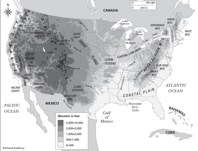
Great Basin: Terrible Thirst and Endless Sagebrush
The same forces that stretched, pulled, and uplifted the entire American Southwest also created the landscape of the Great Basin Desert, a portion of the larger Basin and Range Province, which extends from California's Sierra Nevadas down into Mexico and Texas and up to Nevada and Utah. One old survey map described the mostly north-south running mountain chains of this area as giant caterpillars, crawling haphazardly northward. The mountains rise to about 9,000 feet from the mostly flat, low-lying, down-dropped blocks of intervening desert, which lie at an elevation of 1,000 to 6,000 feet (333 to 2,000 m). Most of the mountain ranges are about 60 to 120 miles (96–192 km) long and perhaps 3 to 15 miles (5–24 km) wide.
Ecologist Ann Zwinger wrote a vivid account of the appearance of this vast desert in her book The Mysterious Lands. “The Great Basin Desert has a past-finished aspect, as if all that could be done to it has been done, and now it is old and tired and worn out, grizzled and gutted, faded and weather beaten. Sometimes the land has a worn, velvet look, tucked with arroyos, pleated with mountains, a landscape seemingly without seasons or eternally half past autumn, a landscape left out to dry, forgotten, tattered with rain, wrinkled with sun, and yet, in a peculiar sense I cannot explain, always vital and never forlorn.”
Cut off from the wet storms generated over the ocean by ranges of mountains, the Great Basin is a rain shadow desert. Most areas get just 6 to 12 inches (152–304 mm) of rain annually. Worse yet, 60 percent of that moisture comes during the cold, frost-prone, snow-dusted winters, when it can do plants and animals the least good. Moreover, the region forms a great, thirsty bowl in which almost all of the rivers and streams start in scattered, rugged mountaintops and run down to deep low points, with no exterior drainage. Therefore, the streams tend to gush during the short and unreliable wet months to collect in low-lying depressions, which once harbored great ice age lakes, but which have now turned into salt flats, made sterile by the salt and minerals left behind by the evaporation of first those giant ice age lakes and now by these fleeting, seasonal lakes. (The salt flats can be seen in the color insert on page C-8.) Most of the drainage ends up in the Humboldt Sink, which includes the saltier than seawater Great Salt Lake, an incongruous shimmer that is but a pathetic remnant of an ice age lake that once constituted a virtual inland sea.
This whole stretched, austere linear landscape was created in the tugging and pulling that took place as the western half of North America was altered in the titanic jostling of plate tectonics. The long, slowmotion collision between the North American Plate and the Pacific Plate forced the edge of the North American Plate down beneath the larger, denser edge of the Pacific Plate. The leading edge of the North American Plate melted at 50 to 100 miles (80–160 km) beneath the surface, and some of the molten rock escaped back to the surface along fractures in the overlying rock, creating chains of volcanoes like the present-day Cascade Range along the Pacific Northwest. Meanwhile, the conveyor belt movement of the Pacific Plate smashed a series of massive islands and fragments of other continents onto the western edge of the Pacific Plate, adding California and the towering Sierra Nevadas to the western edge of the Great Basin. This towering mountain range blocked moisture from the ocean and set the stage for the current landscape and climate.
At some point, a shift in the currents in the deep mantle driving the two crustal plates together shifted, transforming the head-on collision into a massive system of transverse faults that include the infamous San Andreas. This opened up the Gulf of California, put pressure on the San Andreas Fault, and created the north-south mountain chains of North American deserts. Pressure from below pushed up blocks of the crust along fault lines while dropping the intervening valleys. The landscape remains in turmoil. In many places, fresh faults cut across lava flows dating back 30 million years. Earthquakes often jiggle the mountain ranges and create fresh fault lines, although not nearly as frequently as to the west in California along the San Andreas Fault.
- Great Basin Desert: Utah, Arizona, Nevada
- Grand Canyon Reveals the History of the Earth
- Grand Canyon: A Transformed Sliver of the Mojave
- Rattlesnakes: Deadly Adaptations
- It Takes a Fungus to Make a Soil
- Desert Bursts into Flower
- The Edge of the Desert
- Joshua Tree National Monument: As Lush As the Mojave Gets
- Ice Age Desert Fish Hangs On