Idaho
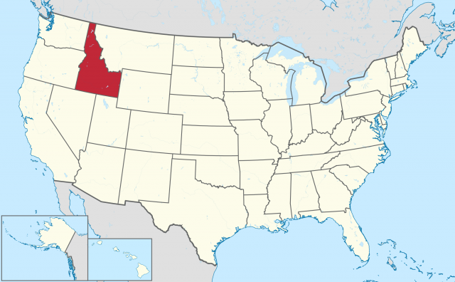
IDAHO'S VAST areas of unspoiled beauty and natural wilderness give every reason for the 1,293,953 residents (2000) to know their home as the “Gem” state. Idaho is bounded by CANADA in the north, MONTANA and WYOMING in the east, UTAH and NEVADA in the south, and WASHINGTON and OREGON in the west. The capital and largest city is Boise, but Pocatello and Idaho Falls are also important commercial/agricultural centers.
Much of the state's 83,557 square mi (216,413 square km) can be divided among three land forms (ROCKY MOUNTAINS, Columbia Plateau, and Basin and Range) sharing some of the most rugged, unspoiled beauty anywhere in the united states.
In the Rocky Mountain region, the Bitterroot Range dominates the Panhandle region of the north and along the Montana border, where just 45 mi (72 km) separates Idaho from its two neighboring states of Washington and Montana. The mountains then run south and a little east along the border with Wyoming. The names of some other important mountain ranges (Sawtooth, Lost River, Bighorn Crags, Coeur d'Alene, and Seven Devils) bring forth strong images of the natural beauty and ruggedness that sets this landscape apart from that of other states. The state is also home to the deepest gorge in North America. From the summit of the Seven Devils the Hells Canyon gorge drops nearly 7,900 ft (2408 m) to the waters of the Snake River below; deeper than the GRAND CANYON.
The Columbia Plateau region extends east out of Washington into Idaho at the base of the Idaho Panhandle then follows the path taken by the Snake River across southern Idaho. The Snake River Plain is itself a unique geography, built up from ancient lava flows that cover strips of land 20 to 40 mi (32 to 64 km) wide on each side of the Snake River. Shoshone Falls on the Snake River, drops 212 feet (64 m), making it higher than Niagara Falls. Between the Rockies and the Columbia Plateau lies the Basin and Range region, with numerous grassy plateaus, rolling hills, deep valleys, and mountains as you move toward the east.
The state's waters are divided among major rivers including the Coeur d'Alene, Snake, St. Joe, St. Maries, and Kootenai, and Pend Oreille Lake, American Falls Reservoir, Bear Lake, and Coeur d'Alene Lake.
Idaho's climate is diverse but strongly influenced by Pacific weather patterns that serve to moderate weather extremes. Generally, the northern part of the state is cooler than the southern parts with greater precipitation. Typically, summers are hot and dry, particularly in the south, with cold, snowy winters in the north.
Early economic activity in the region was tied closely to the early explorers and fur traders that moved eastward out of the Columbia River region of the Oregon country into what is today Idaho. By the 1840s, however, fur supplies from the region had been severely depleted and it wasn't until the discovery of gold in 1860 that economic activity picked up again. The typical rush of settlers followed, all hoping to strike it rich either from finding gold themselves or from taking it from the miners in one of the many towns that seemed to spring up overnight.
A second rush occurred in 1882 when gold was discovered at Coeur d'Alene. But the boom was shortlived because the results of the strike were disappointing. Fortunately, a major discovery of silver at the same time was able to sustain the mining boom. The late 19th and early 20th centuries witnessed a rise in cattle and sheep ranching as agriculture moved to the front of the state's economic activity. Recently, manufacturing has replaced agriculture as the most important industrial sector. Cattle and dairy goods are among the leading agricultural products in addition to potatoes (for which the state is famous), hay, wheat, peas, beans, and sugar beets. The state's unspoiled natural beauty has also led to a strong year-round tourist industry, with Sun Valley serving as one of the state's leading resorts.