satellites
THE GLOBAL POSITIONING System (GPS) is a constellation of earth-orbiting satellites developed by the U.S. Department of Defense to provide global, all weather and 24-hour positioning capabilities to ground-based GPS receivers. Although the original system was intended for military use, it has also found important and widespread applications in civilian positioning, navigation, and mapping. Positioning is about determining an exact location based on a coordinate referencing system. Navigation is the process of moving from one location to a destination and knowing at each stage the current position with respect to the destination. Hence a route is a series of waypoints tracing out the path from the initial location to the destination. GPS is also increasingly used as data input in GEOGRAPHIC INFORMATION SYSTEMs (GIS) for accurate positioning of geospatial map data and for the collection of field data. Effective use of a GPS receiver does not require an understanding of the technical details, but does require some training and an appreciation of the limitations of the system as a whole. GPS technology is collectively composed of a space segment, a control segment, and a user segment.
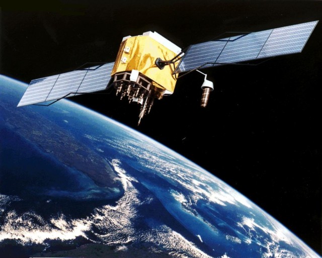
The space segment of the system consists of 27 GPS satellites orbiting the Earth at a distance of about 12,427 mi (20,000 km) above the surface. Twenty-four of these satellites are active, while three serve as replacement in case of failure. The satellites are positioned in six evenly spaced orbital planes and make two complete rotations each day. With this arrangement, at least four and as many as eight GPS satellites can be detected above the horizon from any location on the surface. Each satellite has an expensive atomic clock that generates precise time, which together with its orbital location information, is broadcast to ground receivers along two coded carrier signals. Using a three-dimensional mathematical process called trilateration, the location of the ground GPS receiver can be determined if its distance from four satellites is known. The GPS receiver automatically calculates the distances to each satellite using the travel time information encoded in the detected signals and the speed at which the signal travels (3 x 10⁸ ms-1). The GPS receiver does not contain an atomic clock to measure time differences precisely but uses instead an internal database called an almanac. The almanac gives the projected position of each satellite in its orbital plane from which time differences and the distance to the satellites can be determined. The almanac of GPS receivers is constantly updated by the satellites to adjust for any changes in predicted orbital positions.
The control segment consists of a network of tracking ground stations that measure the satellite signals, evaluate orbital information, and upload maintenance data to the GPS satellites. The user segment consists of the GPS receivers and the user community. The GPS receiver is designed as a rugged and portable device with a small viewing screen and user controls and an antenna to receive the signals from the orbiting satellites. For accurate positioning, it is recommended that the antenna of the receiver has a clear view of the sky. When the receiver is turned on, the unit takes some time to locate the satellites and to process the received information before the GPS unit location is fixed or known. In technical terminology, this fixed position is referred to as a waypoint and can be recalled for further use and analysis.
The positional accuracy that is achieved from GPS receivers depends on a number of factors. The U.S. military uses an encrypted code on one of the two GPS satellite broadcast frequencies to obtain location accuracies on the order of ±2 m on hand-held receivers. This is called the Precise Positioning Service (PPS). The broadcast signal code used by civilian GPS units is randomly degraded and scrambled (a process called Selective Availability, or SA) such that location accuracies are approximately on the order ±50 m. This is called the Standard Position Service (SPS) and is freely available to anyone with a GPS receiver unit. In 2000, commercial interests were successful in ending the SA policy with the result that civilian GPS devices now provide location information to the order of ±5 m. But there is the risk that the SPS can be again degraded or completely turned off during times of US national and global security risks, rendering civilian GPS units unreliable.
Hence, it is not advisable to depend solely on a GPS unit for navigation and other mission critical uses. Positional accuracy can also be affected by the quality and number of receivers, the number of satellites that are detected from a location, and the time taken to establish a fix. The use of multiple receivers in an approach called relative or differential positioning can greatly improve positional accuracy and overcome the problems associated with select availability. In this approach, a fixed receiver, called the base station, is positioned at a point whose coordinate is accurately known, and a mobile GPS unit is used in the field. The base station corrects with the aid of computer software tools all signals received from the GPS satellites for biases caused by clock errors, atmospheric delays, and selective availability. The base station then transmits this locally adjusted data to the mobile unit, thereby updating the relative location of the mobile unit. Accuracies on the order of centimeters can be achieved with this approach and is used predominantly in land surveying and geodesy.
Using GPS data is a relatively simple operation. Once the GPS unit receives the signals from at least four satellites and integrates that information with what is held in its electronic almanac, calculations about latitude, longitude, and altitude of the GPS unit is automatically made. The location information is based on the World Geodetic System 1984 (WGS 84) reference, which provides a standardized frame of deference so that the measurements from different GPS units are comparable. This location data is displayed on the small screen of the GPS unit using digital map files that are stored in memory. If the unit moves from this location, the “fixing” process will be repeated and a path traced out based on the changing location.
Options such as connecting to external maps, or simply saving and downloading the coordinate information for later integration with maps, are possible. The distance and time traveled, speed, and estimated times to reach some identified destination are some of the information that can be obtained by using a GPS receiver. With the increasing use of GPS units in everyday utilities (such as cars and telephones), the technology and its improvements will be a guiding force well into the next century.