Vanuatu
Area 4,758 square mi (12,200 square km)
Capital Port-Vila
Population 258,900 2014
Highest Point 6,194 ft (1,877 m)
Lowest Point 0 m
GDP $815.0 million 2014
Primary Natural Resources manganese, hardwood forests, fish.
UPON ACHIEVING independence from FRANCE and Great Britain in 1980, the peoples of the islands known as the New Hebrides renamed the island nation Vanuatu—“ forever our land”—in a strident attempt to break with one of the most turbulent colonial histories of the developing world. The Y-shaped chain of four main islands and 80 smaller islands, 1,240 mi (2,000 km) northeast of AUSTRALIA, has contended with violent competition between French and British colonial authorities, determinedly zealous Christian missionaries, and unscrupulous planters and pirates, not to mention the violence of its own indigenous intertribal conflicts and the natural dangers of life on some of the most active volcanic islands on the planet.
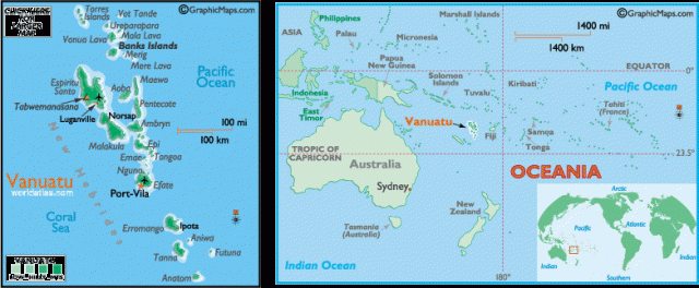
On the border between the South PACIFIC and the Coral Sea, the islands of Vanuatu were formed from volcanic activity along the colliding Pacific and Indo-Australian continental plates. Geological activity contributes frequent EARTHQUAKES, TSUNAMIS, and volcanic eruptions—more than six volcanoes are currently active— which in places has been turned to economic advantage: Mount Yasur, on the island of Tanna, is one of the most accessible erupting volcanoes in the world, and visits (primarily at night) are an important part of most tourist itineraries. The land is mostly mountainous, with low coastal plains. Espiritu Santo and Malakula are the largest islands, with nearly half of the total land area, though the capital, Port Vila, and much of the population are on Efate. The other large town is Luganville on Espiritu Santo. Some of the smaller islands are coral and limestone, rather than volcanic, but only one is purely a coral atoll.
Sir Francis Drake named the islands New Hebrides, after the islands off the coast of Scotland, when he passed through in the early 17th century. Lying between two competing colonial zones in MELANESIA, the islands were approached by rival European traders and missionaries: British from the SOLOMON ISLANDS to the north, and French from NEW CALEDONIA to the south. First attracted to the large amounts of tropical hardwood (notably sandalwood), Europeans soon shifted their interests to the population themselves, shipping them off in great numbers to work plantations in Australia, FIJI, New Caledonia and the Samoas, leaving much of the islands under-populated. Both British and French settlers established plantations and conflicts between these groups led to the establishment of an Anglo-French condominium administration in 1906. Unique in the world of colonial administrations (it has been called an “elaborate joke”), the shared government resulted in virtually no government at all.
Three separate administrations—one for the French residents, one for the British residents, and one for the Melanesians, who also continued to maintain their traditional tribal governments—meant that there was very little concerted effort at developing of roads or government, and the islands were largely unprepared for independence when it finally came in 1980. Most of the population relies on subsistence or smallscale agriculture. Most of the French population was not eager for independence, since much of the land faced confiscation by a Melanesian-run government, and pro-French militant groups had to be put down with assistance from Australia and PAPUA NEW GUINEA. France itself is wary of influence on neighboring New Caledonia, which continues to struggle for independence, and also contends with Vanuatu over possession of Matthew and Hunter islands, far to the south.