Von Thunen, Johann H. (1780–1850)
JOHANN HEINRICH von Thunen was an important theorist in the science of land use. His work brought together the fields of economics and geography to provide an illustration of the balance between land cost and transportation costs. Although his land system was designed to calculate optimal distribution in the context of preindustrialized Europe—before the development of railroads, for example—the equations and principals he developed remain the foundation of much of land management practices today, particularly in the developing world. The Von Thunen Model helps economic planners analyze the question: what effect does distance have on costs for economies at different locations?
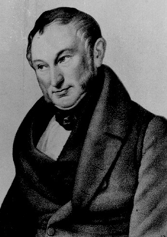
Von Thunen was a wealthy landowner from the Grand Duchy of Mecklenburg, a state in northeast GERMANY. Much of his life was spent managing his estate, Tellow, apart from his time spent at the University of Gottingen, in central Germany. His primary work is entitled Der isolirte Staat (The Isolated State), published in several stages, volume one in 1826, volume two in 1850 and 1863, and volume three in 1863. The first volume was one of the first treatises to deal with spatial economics, relating productivity and profit to distances required for transportation of raw materials and goods to markets. His model was based on a series of concentric circles, defining which sorts of economic activity would be most suitable at different distances from the center of a theoretical, isolated, state. The later volumes refined this idea and focused on the marginal productivity theory of distribution in a mathematically precise way. Areas on the margins of a city-state were seen as naturally the least productive, because of higher costs of transport, and lower population density, requiring higher wage costs.
The Von Thunen Model describes a city located centrally within an “isolated state” that is self-sufficient and has no external influences. The model relies on the theoretical state in which all of the land is geographically uniform, with no physical barriers to production or transport except distance from the center, and in which the soil and climate are uniformly consistent. The ring of the model closest to the city (where most of the population lives) would be developed for intensive farming and dairying, followed by a ring of forest, a ring of extensive field crops, and finally, ranching and animal products, before reaching the wilderness that surrounds this model state. This system would ensure that the products that needed to get to market most quickly (fruits, dairy) could do so, while more durable agricultural products (grains) could travel more slowly. Timber and firewood from the forest band would be needed for fuel and building, but because of their heaviness would be located as close to the city as possible to reduce transport costs. Similarly, the animal husbandry belt is located farthest away from the center because animals are largely self-transporting, again, reducing transport costs.
The model also has an objective function of maximization of rent per unit of land, as directly related to transportation costs to centrally located markets, and the impact of alternative markets set up in the periphery, the margins of the isolated state. The closer to the city, the higher the price of land. Much of the model's application today pertains to the productivity of the marginal areas, those farthest away from the populated and industrialized centers of the world. As globalism brings transport costs down, economic geographers are currently using von Thunen's ideas to determine what effects the rising welfare of the marginal areas will have on the economic health of those traditionally at the heart of productivity.