Andes
THE ANDES IS A mountain system in South America. The mountains form the “backbone” of South America, stretching from the Caribbean coast along the western side of the continent to its southern tip. The name Andes probably derives from either Quechua or Aymara, the two principal Native American languages of South America. Plate-tectonic forces during the Cenozoic Era created the Andes. The mountains are a result of a collision between the continental South American plate and the oceanic Nazca plate that created high peaks and steep slopes. The region is still tectonically active, as earthquakes are common and there are frequent volcanic eruptions. The Andes sometimes serve as a geographic boundary that divides countries, as is the case of the border between ARGENTINA and CHILE. The mountains also divide regions within individual countries.
The highest peaks are found in Argentina, PERU, and ECUADOR. ACONCAGUA MOUNTAIN in Argentina is the highest peak in the Western Hemisphere at 22,834 ft (6,960 m). The lowest peaks are found in the southern and northern extremes. The Andes are widest in BOLIVIA, where there are actually two distinct ranges known as the Cordillera Occidental (Western Range) and Cordillera Oriental (Eastern Range).
Much of the Andes lies in the tropics. However, altitude is generally more of a determining factor than latitude. Indeed, there are even glaciers and snow near the equator. Climate and vegetation are also determined by altitude. Furthermore, elevation affects temperatures, even at the same latitude. Temperatures tend to decrease about 3.7 degrees F for every 1,000-foot (305 m) increase in altitude. For example, Quito, Ecuador, located high in the Andes, has an average annual temperature of 54.6 degrees F (12.5 degrees C). Guayaquil, Ecuador, located at almost the same latitude, but on the coast, has an average temperature of 78.2 degrees F (25.6 degrees C).
In the tropics, different elevations are divided into several distinct categories. Altitudes up to about 3,000 ft (914 m) are referred to as tierra caliente (hot country). Elevations located between 3,000 and 6,000 ft (914 m and 1,829 m) are called tierra templada (temperate land). Tierra fria (cold land) can be found at altitudes of 6,000 to 12,000 ft (1,829 m to 3,657 m). Finally, regions above 12,000 ft (3,657 m) are classified as tierra helada (frozen land).
Much of the Andean region is arid, including the Atacama Desert. On the western side of the Andes, streams do not have well-defined headwaters. In contrast, on the eastern side, there is more rain and more significant headwaters. Two of South America's major river systems—the AMAZON and the Orinoco—both begin in the Andes.
The high altitudes of the Andes make human settlements in the region difficult. Nevertheless, shepherds in southern Peru have lived permanently at altitudes above 17,000 feet (5,181 m). Temporary mine workers have lived at altitudes around 19,000 ft (5,791 m). In general, the southern Andes are sparsely populated. There is a heavier concentration of people on the plateaus from Bolivia to COLOMBIA. Many people in countries such as Peru and Bolivia reside above 10,000 feet (3,048 m). Some of the continent's largest cities are located on these central Andean plateaus, including Santiago (Chile), Lima (Peru), Quito (Ecuador), and Bogota (Colombia).
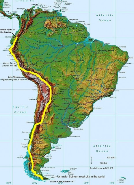
Before 600 C.E., human beings concentrated along the PACIFIC OCEAN coast rather than in the Andes. After that date, a number of advanced Native American civilizations established themselves in the Andean highlands. The two largest states before 1000 C.E. were Tiahuanaco, south of Lake TITICACA, and the Huari, centered near modern-day Ayacucho. After 1000, the most significant group was the Chimu, with its capital at Chanchan. The Chimu kingdom lasted until the 15th century, when the Incas conquered it. The great Inca Empire, with its capital at Cuzco, dominated much of the region during the 15th and 16th centuries.
In the 1530s, Spanish conquerors subdued the Incas, bringing the Andes into Spain's New World empire. The Spanish often used systems of forced Native American labor to work in Andean silver mines. The native inhabitants did not always readily accept Spanish rule. In the 18th century, there were more than 100 native rebellions, including the great uprising led by Jose Gabriel Condoranqui in 1780. In the 19th century, the Spanish colonies achieved their independence. Parts of the Andes can be found in VENEZUELA, Colombia, Ecuador, Peru, Bolivia, Chile, and Argentina.
Agriculture in the Andes has always been difficult. Crop yields are generally low. Many areas are dry or receive irregular rainfall. Temperatures are often too low for agriculture. Therefore, most agricultural production is for local consumption rather than for export. However, some products grow well enough to serve as export products. Colombian coffee is world renowned. Illegal drug traffickers utilize Andean coca to produce cocaine for export around the world.
The Andes is one of the world's most important mining regions. Among the most mined minerals are gold, silver, copper, tin, platinum, and emeralds. Silver in particular played an important part in the Spanish colonial period. Potosi, located in modern-day Bolivia, was the richest silver mine in the world and large boom town grew up around it. Along the eastern side of the Andes, there are substantial deposits of oil.
The Andes have long been a barrier to trade and communications in South America, especially to eastwest travel. Centers of agricultural and mining production have generally been located far from ports on the coasts. People in the Andes long depended on pack animals to transport goods through the mountains. Railroad and road construction has often been difficult, though air travel has made the region more accessible.