
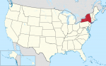
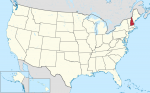
The State of New Hampshire
AT A GLANCE Name: New Hampshire was named for the English county of Hampshire. Nickname: Granite State Capital: Concord Size: 9,283 sq. mi. (24,044 sq km) Population: 1,330,608 (2015 est) Statehood: New Hampshire became the ninth state on June 21, 1788. Electoral votes: 4 (2016) U.S. representatives: 2 (until 2016) State tree: white birch State […]
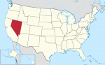
The State of Nevada
AT A GLANCE Name: Nevada means “snowcapped” in Spanish. Nicknames: Sagebrush State, Silver State Capital: Carson City Size: 110,567 sq. mi. (286,367 sq km) Population: 2,890,845 (2015 est) Statehood: Nevada became the 36th state on October 31, 1864. Electoral votes: 5 (2016) U.S. representatives: 3 State trees: single-leaf pinon and bristlecone pine State flower: sagebrush […]

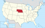
The State of Nebraska
AT A GLANCE Name: Nebraska is from the Oto Indian word nebrathka, meaning “flat water.” Nickname: Cornhusker State Capital: Lincoln Size: 77,358 sq. mi. (200,358 sq km) Population: 1,896,190 (2015 est) Statehood: Nebraska became the 37th state on March 1, 1867. Electoral votes: 5 (2016) U.S. representatives: 3 (until 2016) State tree: cottonwood State flower: […]
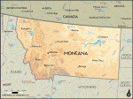
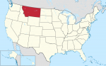
The State of Montana
AT A GLANCE Name: Montana comes from the Spanish word montana, which means “mountainous.” Nicknames: Treasure State, Big Sky Country Capital: Helena Size: 147,046 sq. mi. (380,849 sq km) Population: 1,032,949 (2015 est) Statehood: Montana became the 41st state on November 8, 1889. Electoral votes: 3 (2016) U.S. representatives: 1 (until 2016) State tree: ponderosa […]
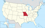
The State of Missouri
AT A GLANCE Name: Missouri is the name of a Native American tribe and means “town with the big canoes.” Nickname: Show Me State Capital: Jefferson City Size: 69,709 sq. mi. (180,546 sq km) Population: 6,083,672 (2015 est.) Statehood: Missouri became the 24th state on August 10, 1821. Electoral votes: 11 (2016) U.S. representatives: 9 […]
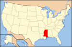
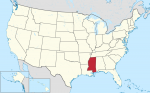
The State of Mississippi
AT A GLANCE Name: Mississippi comes from a Native American word that means “father of waters.” Nickname: Magnolia State Capital: Jackson Size: 47.695 sq. mi. (123,530 sq km) Population: 2,992,333 (2015 est) Statehood: Mississippi became the 20th state on December 10, 1817. Electoral votes: 6 (2016) State representatives: 5 (until 2016) State tree: magnolia State […]
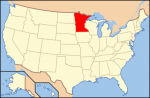
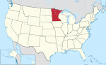
The State of Minnesota
AT A GLANCE Name: Minnesota is from Sioux words that mean “sky-tinted water.” Nicknames: North Star State, Gopher State Capital: St. Paul Size: 84,397 sq. mi. (218,587 sq km) Population: 5,489,594 (2015 est) Statehood: Minnesota became the 32nd state on May 11, 1858. Electoral votes: 10 (2016) U.S. representatives: 8 (until 2016) State tree: red […]
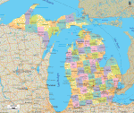
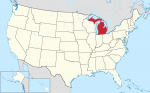
The State of Michigan
AT A GLANCE Name: Michigan comes from a Native American word that means “great or large lake.” Nicknames: Wolverine State, Great Lakes State Capital: Lansing Size: 58,513 sq. mi. (151,548 sq km) Population: 9,922,576 (2015 est) Statehood: Michigan became the 26th state on January 26, 1837. Electoral votes: 17 (2016) U.S. representatives: 16 (until 2016) […]
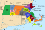
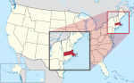
The State of Massachusetts
AT A GLANCE Name: Massachusetts was named for the Massachusett, a Native American tribe whose name means “at or about the great hill.” Nicknames: Bay State, Old Colony State Capital: Boston Size: 8,262 sq. mi. (21,398 sq km) Population: 6,794,422 (2015 est) Statehood: Massachusetts became the sixth state on February 6, 1788. Electoral votes: 12 […]
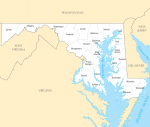
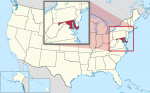
The State of Maryland
AT A GLANCE Name: Maryland was named in honor of Henrietta Maria, queen consort of King Charles I of England. Nicknames: Free State, Old Line State Capital: Annapolis Size: 12,297 sq. mi. (31,972 sq km) Population: 6,006,401 (2015 est) Statehood: Maryland became the seventh state on April 28, 1788. Electoral votes: 10 (2016) U.S. representatives: […]
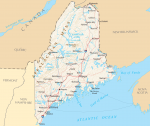
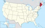
The State of Maine
AT A GLANCE Name: Maine probably comes from the word mainland. Early English explorers used the phrase “the main” to distinguish Maine from its offshore islands. Nickname: Pine Tree State Capital: Augusta Size: 33,265 sq. mi. (87,727 sq km) Population: 1,329,328 (2015 est) Statehood: Maine became the 23rd state on March 15, 1820. Electoral votes: […]
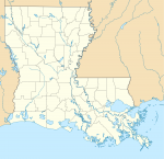
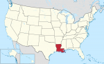
The State of Louisiana
AT A GLANCE Name: Louisiana was named for King Louis XIV of France. Nickname: Pelican State Capital: Baton Rouge Size: 47,751 sq. mi. (124,153 sq km) Population: 4,670,724 (2015) Statehood: Louisiana became the 18th state on April 30, 1812. Electoral votes: 9 (2016) U.S. Representatives: 7 (until 2016) State tree: cypress State flower: magnolia State […]
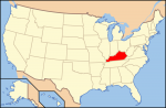
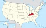
The State of Kentucky
AT A GLANCE Name: Kentucky is from the Iroquois word Ken-tah-ten, which means “land of tomorrow.” Nickname: Bluegrass State Capital: Frankfort Size: 40,411 sq. mi. (104,665 sq km) Population: 4,425,092 (2015 est) Statehood: Kentucky became the 15th state on June 1, 1792. Electoral votes: 8 (2016) U.S. Representatives: 6 (until 2016) State tree: tulip poplar […]
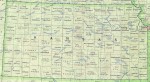
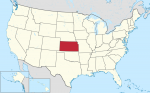
The State of Kansas
AT A GLANCE Name: Kansas is from a Sioux word meaning “people of the south wind.” Nickname: Sunflower State, Jayhawker State Capital: Topeka Size: 82,282 sq. mi. (213,110 sq km) Population: 2,911,641 (2015 est) Statehood: Kansas became the 34th state on January 29, 1861. Electoral votes: 6 (2016) U.S. Representatives: 4 (until 2016) State tree: […]
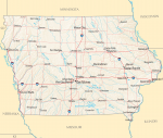
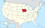
The State of Iowa
AT A GLANCE Name: Iowa is believed to have come from a Native American word meaning “this is the place” or “the beautiful land.” Nickname: Hawkeye State Capital: Des Moines Size: 56,276 sq. mi. (145,755 sq km) Population: 3,123,899 (2015 est) Statehood: Iowa became the 29th state on December 28, 1846. Electoral votes: 7 (2016) […]

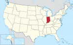
The State of Indiana
AT A GLANCE Name: Indiana means “land of Indians.” Nickname: Hoosier State Capital: Indianapolis Size: 36,420 sq. mi. (94,328 sq km) Population: 6,619,680 (2015 est) Statehood: Indiana became the 19th state on December 11, 1816. Electoral votes: 11 (2016) U.S. Representatives: 10 (until 2016) State tree: tulip poplar State flower: peony State bird: cardinal Highest […]
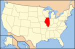
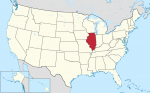
The State of Illinois
AT A GLANCE Name: Illinois is an Algonquian word meaning “tribe of superior men.” Nickname: Prairie State Capital: Springfield Size: 57,918 sq. mi. (150,007 sq km) Population: 12,859,995 (2015 est) Statehood: Illinois became the 21st state on December 3, 1818. Electoral votes: 21 (2016) U.S. Representatives: 20 (until 2016) State tree: white oak State flower: […]
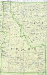
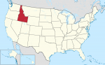
The State of Idaho
AT A GLANCE Name: The meaning of the name Idaho is unknown, although it is believed to be of Native American origin. Nickname: Gem State Capital: Boise Size: 83,574 sq. mi. (217,292 sq km) Population: 1,654,930 (2015 est) Statehood: Idaho became the 43rd state on July 3, 1890. Electoral votes: 4 (2016) U.S. Representatives: 2 […]
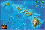
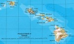
The State of Hawaii
AT A GLANCE Name: The origin of the name Hawaii is uncertain. The islands may have been named after Hawaii Loa, the chief who has traditionally been believed to have discovered them, or they may have been named after Hawaii or Hawaiki, the traditional home of the Polynesians. Nickname: Aloha State Capital: Honolulu Size: 6,459 […]
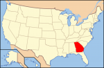
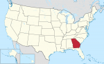
The State of Georgia
AT A GLANCE Name: Georgia was named for King George II of England. Nicknames: Peach State, Empire State of the South Capital: Atlanta Size: 58,977 sq. mi. Population: 10,214,860 (2015 est) Statehood: Georgia became the fourth state on January 2, 1788. Electoral votes: 15 (2016) U.S. Representatives: 11 (until 2016) State tree: live oak State […]
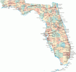
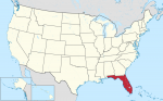
The State of Florida
AT A GLANCE Name: Spanish explorer Ponce de Leon named Florida when he landed there on Easter Sunday in 1513. He called the place Pascua Florida, which means “flowery Easter” in Spanish. Nickname: Sunshine State Capital: Tallahassee Size: 59,928 sq. mi. Population: 20,271,272 (2015 est) Statehood: Florida became the 27th state on March 3, 1845. […]
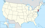
The State of Delaware
AT A GLANCE Name: The name Delaware comes from the Delaware River and Bay, which were named for Sir Thomas West, Baron De La Warr, the first governor of Virginia. Nicknames: First State, Diamond State Capital: Dover Size: 2,396 sq. mi. Population: 935 614 (2014) Statehood: Delaware became the first state on December 7, 1787. Electoral […]
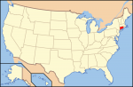
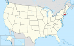
The State of Connecticut
AT A GLANCE Name: Connecticut comes from an Algonquian word meaning “place beside the long tidal river.” Nicknames: Constitution State, Nutmeg State Capital: Hartford Size: 5,544 sq. mi. Population: 3,597,000 (2014) Statehood: Connecticut became the fifth state on January 9, 1788. Electoral votes: 7 (2016) U.S. Representatives: 6 (until 2016) State tree: white oak State […]
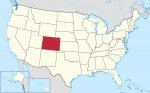
The State of Colorado
AT A GLANCE Name: Colorado is a Spanish word that means “colored red.” The name was first given to the Colorado River by Spanish explorers because it flows through red stone canyons. Nickname: Centennial State Capital: Denver Size: 104,100 sq. mi. Population: 5,356,000 (2014) Statehood: Colorado became the 38th state on August 1, 1876. Electoral […]
The State of California
AT A GLANCE Name: California is named after Califia, a mythical island paradise described by Garci Ordonez de Montalvo in his 16th-century novel Las Sergas de Esplandian. Nickname: Golden State Capital: Sacramento Size: 158,869 sq. mi. Population: 39,144,818 (2015 est) Statehood: California became the 31st state on September 9, 1850. Electoral votes: 55 (2016) U.S. […]
The State of Arkansas
AT A GLANCE Name: The word Arkansas is from the French name for the Quapaw tribe, the Arkansa, and the region the tribe inhabited. Nicknames: Natural State, Razorback State, Land of Opportunity Capital: Little Rock Size: 53,182 sq. mi. Population: 2,966,000 (2014) Statehood: Arkansas became the 25th state on June 15, 1836. Electoral votes: 6 […]
The State of Arizona
AT A GLANCE Name: Arizona comes from the Native American word Arizonac, which means “little spring” or “young spring.” Nickname: Grand Canyon State Capital: Phoenix Size: 114,006 sq. mi. Population: 6,731,000 (2014) Statehood: Arizona became the 48th state on February 14, 1912. Electoral votes: 11 (2016) U.S. Representatives: 9 (until 2003) State tree: paloverde State flower: saguaro […]
The State of Alaska
AT A GLANCE Name: Alaska comes from an Aleut word meaning “great land.” Nicknames: Last Frontier, Land of the Midnight Sun Capital: Juneau Size: 615,230 sq. mi. Population: 736 732 (2014) Statehood: Alaska became the 49th state on January 3, 1959. Electoral votes: 3 (2016) U.S. Representatives: 1 (until 2016) State tree: Sitka spruce State flower: forget-me-not State […]
The State of Alabama
AT A GLANCE Name: Alabama comes from the word Alibamu, the name of a Native American tribe that lived in the area. The name may mean “to clear the vegetation.” Nicknames: Heart of Dixie, Camellia State, Yellowhammer State Capital: Montgomery Size: 52,237 sq. mi. Population: 4,849,000 (2014) Statehood: Alabama became the 22nd state on December 14, 1819. Electoral […]
The United States Looks Ahead
Now is but a minute blip on the span of time. It is the product of countless past processes and events. By looking to the past, we can better understand the present, and the past also provides keys to predicting the future. This chapter attempts to answer a very difficult question: What does the future hold for the United […]
Living in the United States Today
For the majority of Americans, life is good. Few countries can match the level of health care, longevity, income, or educational attainment enjoyed by American citizens. The same can be said for the nation's transportation and communications infrastructure, services, and many other developments that Americans often take for granted. In 2006, the United States ranked eighth among the world's countries in […]
The United States’ Economy
With an annual gross national product (GNP) of about $13 trillion in 2006, the United States is the world's largest and most powerful economy by a wide margin. By any measure, the country is an economic giant. In fact, it is responsible for about 30 percent of all of the world's economic production and services! To place the country's economic […]
Government and Politics
Epluribus unum is perhaps the best-known motto of the United States of America. Translated from Latin, it means “From many, one,” or “Out of many, one.” In working to achieve this goal, the nation's Founding Fathers and subsequent leaders faced a challenge of herculean dimensions. You have already learned that, from the very beginning, this land has been home to […]
People and Culture
These lines, part of a poem written by Emma Lazarus, appear on the Statue of Liberty. They offer a very appropriate introduction to this chapter on the American population. The United States has been and continues to be a grand human experiment conducted on a colossal scale. It has often been called a “country of immigrants,” people who arrived from […]
The United States Through Time
American historical geography offers an amazing trip through the corridors of time. It is a journey replete with mystery, adventure, and incredible good fortune. It also chronicles occasional obstacles, detours, and hardships. This chapter investigates the country's past. Geographer Erhard Rostlund once observed that “the present is the fruit of the past and contains the seeds of the future.” Just as […]
Physical Geography
Nature has blessed and in some ways cursed the United States. No country on Earth can match America’s diverse physical conditions and the resulting natural landscapes. The United States holds the distinction of being the only country that has within its territory all of the world’s climates and ecosystems (a combination of climate, natural vegetation and animal life, soils, […]
Introducing the United States
These well-known lyrics, written by Katharine Lee Bates, hold as true today as they did in 1893, when the original verses were penned. On a trip from her Massachusetts home to Colorado Springs, Colorado, Bates was awed by the magnificent view of the Great Plains from atop majestic Pikes Peak. The United States of America truly is a beautiful […]
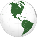
Americas
The Americas is an immense geographical region spanning two continents, North and South America, and includes the islands of the Caribbean Basin. While the Caribbean Basin is a part of the Americas, that subregion is covered elsewhere in this encyclopedia. The Americas lies fully within the Western Hemisphere. The region spans nearly 1501 of longitude extending from the eastern […]
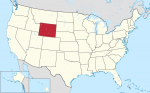
Wyoming
Wyoming is one of the ROCKY MOUNTAIN states located in the west-central UNITED STATES. Rectangular in shape, it is bordered by MONTANA to the north, SOUTH DAKOTA and NEBRASKA to the east, COLORADO and UTAH to the south and IDAHO to the west. With an area of 97,818 square mi (253,348 square km), Wyoming ranks 10th nationally in size. With […]
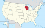
Wisconsin
Wisconsin lies on the western border of Lake MICHIGAN. Covering some 65,503 square mi (169,652 square km), the state ranks 23rd overall in size. With nearly half of the state's 5,363,675 population (2000) living in five major urban areas, the state has a comfortable country feeling with approximately 44 people per square mi (114 per square km). Madison, the state capitol, […]
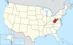
West Virginia
WITH ITS CAPITAL at Charleston, West Virginia occupies 24,181 square mi (62,629 square km). Its lowest point is the Potomac River at 210 ft (73m) near Harper's Ferry. It's highest point is Spruce Knob at 4,863 ft (1,483 m) and its primary natural resources are coal, natural gas, stone, salt, oil, and mineral springs. West Virginia (population 1,808,344) is known as the […]
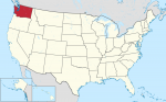
Washington
THE STATE OF WASHINGTON in the northwest UNITED STATES has an area of 71,303 square mi (184,674 square km) and a population of 5,894,121 (2000). Bordered by OREGON to the south and CANADA to the north, Washington State boasts a dramatic range of geographic diversity, including dense forests, mountain ranges, an ocean coast, and arid farmland. The capital is Olympia and the […]
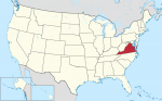
Virginia
NAMED FOR QUEEN Elizabeth I of England who was known as the Virgin Queen, the Commonwealth of Virginia is officially known as The Old Dominion State. The state is also frequently referred to as the “Mother of Presidents” because eight presidents were born in the state, including George Washington and Thomas Jefferson. Jamestown, on the banks of the James River, was one […]

Vermont
BOUNDED BY THE Canadian province of Quebec to the north, MASSACHUSETTS to the south, NEW HAMPSHIRE to the east, and NEW YORK to the west, Vermont covers an area of 9,609 square mi (24,887 square km) and is located in the westernmost portion of the New England region of the UNITED STATES. Its highest point, Mt. Mansfield, reaches an elevation of […]
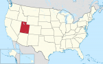
Utah
THE BEEHIVE STATE, covering an area of 84,990 square mi (220,124 square km), is located in the southwest United States and features a dry, mountainous topography. Utah is rectangular in shape, except for a small corner cut away in the northeastern portion of the state. The state is bounded to the north by IDAHO and WYOMING, to the east by COLORADO, […]
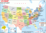
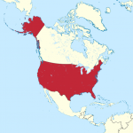
United States
Area 3,717,813 square mi (9,629,091 square km) Population 318.9 million 2014 Capital Washington, D.C. Highest Point 20,321 ft (6,194 m) Lowest Point -282 ft (-86 m) GDP $17.42 trillion 2014 Primary Natural Resources coal, copper, lead. THE UNITED STATES is a country in North America bordered by CANADA to the north, MEXICO to the south, the PACIFIC […]
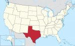
Texas
TEXAS IS A SOUTHWESTERN state of the UNITED STATES, bordering LOUISIANA, OKLAHOMA, and NEW MEXICO. MEXICO lies across the RIO GRANDE to the south. Texas also has a 350-mi (560-km) coastline along the Gulf of Mexico. Texas now ranks second among the states in both area and population. With a total area of 268,581 square mi (695,622 square km), Texas is […]
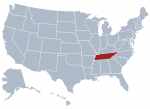
Tennessee
NAMED BY THE Cherokee Native Americans, the U.S. state of Tennessee, which is officially known as the Volunteer State, is celebrated throughout the world as the home of American country music. Tennessee is bounded on the north by KENTUCKY and VIRGINIA, on the south by GEORGIA, ALABAMA, and MISSISSIPPI, on the east by NORTH CAROLINA, and on the west by ARKANSAS and […]
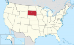
South Dakota
SOUTH DAKOTA, IN THE American Midwest, is the 17th largest state at 77,121 square mi (199,742 square km), but is small in population (just 754,844 people ranking it as 46th largest in population). Accordingly, South Dakota is a very sparsely populated state, with just under 10 people per square mile. The landscape of South Dakota varies from mainly rolling hills and […]
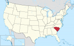
South Carolina
KNOWN AS THE Palmetto State, South Carolina was named for Kings Charles I and Charles II of England. This small state, which was one of the 13 original colonies, covers an area that extends from the ATLANTIC OCEAN to the APPALACHIAN MOUNTAINS. South Carolina is bounded on the north by NORTH CAROLINA, on the east and southeast by the Atlantic Ocean, […]
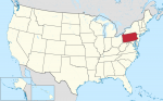
Pennsylvania
THE COMMONWEALTH OF Pennsylvania, also known as the Keystone State, is located in the northeastern UNITED STATES. With a total area of 46,058 square mi (119,290 square km), Pennsylvania extends 307 mi (494 km) from east to west and 175 mi (282 km) north to south. It is bordered by NEW YORK and Lake ERIE […]
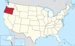
Oregon
OREGON IS A STATE located on the west coast of the UNITED STATES and has a landscape for just about everyone: mountains; FORESTS; plains; DESERTS; the Columbia River Gorge; waterfalls such as Multnomah Falls (620 ft or 189 m), the tallest in Oregon and the fourthtallest in the country; Mills End Park, the smallest park […]
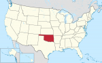
Oklahoma
LOCATED MIDWAY BETWEEN the east and west coasts of the UNITED STATES and just south of the geographic center of the United States in KANSAS, Oklahoma is one of the Great Plains states. The name comes from the Native American Choctaw language as okla meaning “people,” and humma meaning “red.” Despite images to the contrary, […]
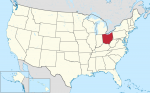
Ohio
OHIO IS A MIDWESTERN state in the Great Lakes region of the UNITED STATES. Interestingly, when the first settlers were arriving, the area was considered to be America's great northwest. In the northeast, Ohio is bordered by PENNSYLVANIA from Lake ERIE southward to the Ohio River near East Liverpool. The Ohio River forms a natural […]
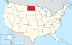
North Dakota
NORTH DAKOTA, THE Flickertail State, is a land of endless fields of corn, sunflowers, wheat, and buffalo. The state has a small population but is rich in natural resources. Located in the north central UNITED STATES, North Dakota was named after the Sioux Indians who called themselves the Dakota. Rural depopulation is a serious problem […]
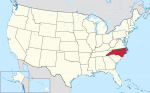
North Carolina
KNOWN AS BOTH the Tar Heel State and Old North State, North Carolina was part of colonial America. Like its sister state SOUTH CAROLINA, North Carolina was named for Kings Charles I and Charles II of England. North Carolina is bounded on the north by VIRGINIA, on the south by South Carolina and GEORGIA, on […]
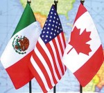
North American Free Trade Agreement
IN 1993, THE UNITED STATES, CANADA, and MEXICO signed the North American Free Trade Agreement (NAFTA), which created a regional free trade zone that lowered tariffs and trading restrictions and encouraged greater opportunities for cross-border investments and movement of goods and services between the three countries. The agreement went into effect in 1994. While all three […]
New York
NEW YORK—OFTEN called New York State to distinguish it from NEW YORK CITY—is a northeastern state of the UNITED STATES, bordering VERMONT, MASSACHUSETTS, and CONNECTICUT to the east; PENNSYLVANIA and NEW JERSEY to the south; and the Canadian provinces of Ontario and Quebec to the north. Lakes ERIE and ONTARIO form the greater part of […]
New Jersey
THE STATE OF New Jersey, located on the east coast of the UNITED STATES between NEW YORK, PENNSYLVANIA, and DELAWARE, is home to hundreds of flora and fauna. The landscape of the state is comprised of pine forests and flatlands in the interior, swampy meadowlands in the north and the dry Pinelands in central and […]
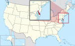
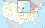
New Hampshire
LOCATED IN THE northeastern UNITED STATES, the state of New Hampshire has a total area of 9,304 square mi (23,380 square km) of land and 277 square mi (23,3380 square km) of inland water, with its geographic center lying in Belknap County, 3 mi (5 km) east of the town of Ashland. New Hampshire is […]
Nevada
KNOWN AS THE Silver State, the Battle-Born State, or the Sagebrush State, the mountain state of Nevada was admitted to the Union in 1864 as the 36th state. Covering an area of 110,540 square mi (286,297 square km), Nevada is 485 mi (780 km) north to south and 315 mi (507 km) east to west, […]
Nebraska
KNOWN AS THE Cornhusker State, the west northcentral state of Nebraska was named from a Native American word meaning “flat or broad water.” It lies within the Missouri River basin; the western part of the state also lies within the Platte River basin. Nebraska covers an area of 77,354 square mi (200,346 square km), making […]
Montana
AS THE TREASURE STATE, Montana is known for its mountains and extensive natural resources, such as copper, silver, gold, coal, lead, zinc, oil, limestone, antimony, phosphates, and gypsum. This mountain state encompasses 147,046 square mi (380,821 square km) of land area; Montana is the fourth largest state in the UNITED STATES, but it is 44th […]

Missouri
IN THE MIDWESTERN UNITED STATES, Missouri is the 19th state in terms of size of all the states. Its name is derived from a Native American word for “town of large canoes.” Missouri covers an area of 69,686 square mi (180,487 square km). A LANDLOCKED STATE, inland waters cover an area of 691 square mi […]
Mississippi
KNOWN AS THE Magnolia State, Mississippi is bordered on the north by TENNESSEE, on the south by LOUISIANA and the Gulf of Mexico, on the east by ALABAMA, and on the west by lOUISIANA and ARKANSAS. The MISSISSIPPI RIVER, which flows along most of the western boundary of the state, is the origin of the […]
Minnesota
WITH THE EXCEPTION of ALASKA, Minnesota is the northernmost U.S. state, on account of the notch in its northern border, where Lake of the Woods abuts CANADA. Long known as the “Land of 10,000 Lakes,” the state is also known for its progressive society, common Scandinavian heritage, sturdy agriculture, advanced technology, and outdoor tourism. Minnesota […]
Michigan
IN THE NORTH-CENTRAL UNITED STATES, Michigan is known as the Wolverine State. Michigan entered the Union in 1837 as the 26th state, measuring 490 mi (788 km) north to south and 240 mi (386 km) east to west. The total area of Michigan is 96,716 square mi (250,493 square km), making Michigan the 11thlargest state. Michigan ranks 8th in population. Bordering on […]
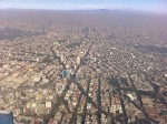
Mexico City
MEXICO CITY IS THE capital of the country of MEXICO. The city is located in the Valley of Mexico on the central Mexican plateau. The core of the city is comprised of the Federal District. However, the Mexico City metropolitan area goes well beyond the boundaries of the Federal District into the surrounding states. With […]
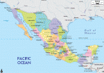
Mexico
Area 761,605 square mi (1,972,550 square km) Population 125.4 million 2014 Capital Mexico City Highest Point 18,700 ft (5,700 m) Lowest Point -33 ft (-10 m) GDP $1.283 trillion 2014 Primary Natural Resources petroleum, silver, copper, gold. OFFICIALLY KNOWN AS the Estados Unidos Mexicanos (United Mexican States), Mexico is a country in North America. It […]
Massachusetts
THE COMMONWEALTH of Massachusetts has a population of 6,379,304 (2001), more than half of whom live in the greater Boston metropolitan area. The largest city in the state is Boston (the capital), with a population of 589,141, and the smallest town is Gosnold, with a population of 86. It borders NEW HAMPSHIRE and VERMONT to […]
Maryland
“THE OLD LINE STATE,” covering an area of 12,407 square mi (32,134 square km) is located in the mid-Atlantic UNITED STATES and features a diverse geography, prompting the nickname “a miniature America.” Maryland is one of the more irregularly shaped states, with a long straight northern border and an irregular southern border that is delineated […]
Maine
MAINE IS THE easternmost state in the UNITED STATES and the northernmost of the 48 contiguous states. It is bounded to the east and south by the ATLANTIC OCEAN, to the northeast by the Canadian Province of New Brunswick, and to the northwest by the Canadian Province of Quebec. To the west, Maine is bordered […]
Louisiana
SITUATED AT THE MOUTH of the MISSISSIPPI RIVER on the coast of the Gulf of Mexico, Louisiana and its people have long been influenced by the intersection of these two major water features. The physical geography of Louisiana can be examined in terms of its five natural regions: the Coastal Marsh; the Mississippi Flood Plain; […]
Kentucky
NICKNAMED FOR the bluegrass that covers much of this U.S. state, and known for its whiskey and for the Kentucky Derby that takes place annually at Churchill Downs in Louisville, the Commonwealth of Kentucky was named for the Kentucky River, which was thought to have been named from the Iroquoian word(s) for either “meadowland” or […]
Kansas
LOCATED MIDWAY between the east and west coasts of the UNITED STATES, Kansas has a unique position as a geographic hub. Despite images to the contrary, Kansas has a unique geography as a transition between the historic farmlands of the east and the open range of the west. The land rises gently from 679 ft […]
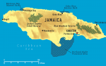
Jamaica
Area 6,829 square mi (10,991 square km) Population 2.721 million 2014 Capital Kingston Highest Point 7,401 ft (2,256 m) Lowest Point 0 m GDP $14.36 billion 2013 Primary Natural Resources bauxite, gypsum, limestone, sugarcane. JAMAICA, SOME 62 mi (100 km) south of CUBA, is the third-largest island in the CARIBBEAN SEA and is full of […]
Iowa
IOWA IS A midwestern state in the north-central part of the UNITED STATES bordered on two sides by major rivers. To the east is the MISSISSIPPI that separates Iowa from ILLINOIS and WISCONSIN. In the west, the Missouri River separates it from NEBRASKA, while the Big Sioux River separates it from SOUTH DAKOTA from Sioux […]
Indiana
KNOWN AS THE Hoosier State, the north central state of Indiana (“Land of Indians”) was formed from the Northwest Territory in 1800 and entered the Union in 1816 as the 19th state. Roughly rectangular in shape, Indiana is approximately 270 mi (434 km) north to south and 140 mi (225 km) east to west. The […]
Illinois
ILLINOIS IS A midwestern state located in the northcentral part of the UNITED STATES. Lake MICHIGAN and INDIANA border the state in the east, while WISCONSIN borders the state in the north. KENTUCKY lies to the southeast, across the Ohio River, while the MISSISSIPPI RIVER separates the state from MISSOURI and IOWA in the west. […]
Idaho
IDAHO'S VAST areas of unspoiled beauty and natural wilderness give every reason for the 1,293,953 residents (2000) to know their home as the “Gem” state. Idaho is bounded by CANADA in the north, MONTANA and WYOMING in the east, UTAH and NEVADA in the south, and WASHINGTON and OREGON in the west. The capital and […]
Hawaii
HAWAII IS a U.S. state located in the central PACIFIC OCEAN near the EQUATOR and consists of eight major islands: Hawaii, Maui, Kahoolawe, Lanai, Molokai, Oahu, Kauai, and Niihau; 129 smaller islands are also part of Hawaii. Hawaii is not the equivalent of the Hawaiian Islands or the Hawaiian Chain, which includes other islands, such […]
Georgia (U.S. state)
Georgia (U.S. state)ONE OF THE 13 original American colonies, the state of Georgia was founded by General James Oglethorpe under a charter signed by King George II of England in June 1732. Georgia is bounded on the east by the ATLANTIC OCEAN and SOUTH CAROLINA, on the west by ALABAMA, on the south by FLORIDA, […]
Florida
Florida“THE SUNSHINE State,” covering an area of 58,560 square mi (151,714 square km), is the most southern state of the UNITED STATES and is mainly a large lowlying peninsula, measuring from north to south about 430 mi (690 km), bounded by the ATLANTIC OCEAN on the east, the Gulf of Mexico on the west, and […]
Delaware
DELAWARE IS ONE OF the Middle Atlantic states of the UNITED STATES. It is also the country's second smallest state after RHODE ISLAND, covering 2,057 square mi (5,328 square km) within the DELMARVA PENINSULA. It is bordered by MARYLAND on the west and south, NEW JERSEY to the northeast across the Delaware Bay and Delaware […]
Connecticut
CONNECTICUT IS the southernmost of the New England states in the northeastern UNITED STATES and has borders with MASSACHUSETTS in the north, NEW YORK in the west, and RHODE ISLAND to the east. There is also a very small area in the very northeast corner where Massachusetts extends south creating an eastern border. To the […]

Colorado
COLORADO IS ONE of the Rocky Mountain states located in the west-central part of the UNITED STATES. All of Colorado is more than 3,300 ft (1,000 m) above sea level. With an average elevation of 6,800 ft (2,070 m), Colorado is the highest of all the states. Colorado is a Spanish word meaning “reddish colored” […]
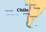
Chile
Area 302,778 square mi (756,950 square km) Population 17.77 million 2014 Capital Santiago Highest Point 22,573 ft (6,880 m) Lowest Point 0 m GDP $258.1 billion 2014 Primary Natural Resources copper, fish, agricultural products. CHILE IS A LONG and narrow country in South America, about 3,999 mi (6,435 km) long and an average of 112 […]

Central America Free Trade Agreement
THE CENTRAL America Free Trade Agreement (CAFTA) is a treaty between the UNITED STATES and the countries of Central America (HONDURAS, GUATEMALA, EL SALVADOR, NICARAGUA and COSTA RICA)—what the Russians refer to as the “near abroad.” This is a parallel to the earlier NAFTA (North American Free Trade Agreement). The objective is a free-trade association […]
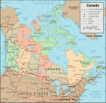
Canada
Area 3,850,000 square mi (9,984,670 square km) Capital Ottawa Population 35.54 million 2014 Highest Point 19,550 ft (5,959 m) Lowest Point 0 m GDP $1.787 trillion 2014 Primary Natural Resources iron ore, nickel, zinc, copper, gold. CANADA ENCOMPASSES the second-largest land area of any country after RUSSIA. Like its southern neighbor, the UNITED STATES, Canada's […]
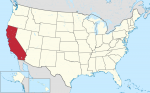
California
THE MOST POPULOUS state in the UNITED STATES, California also has the richest and most urbanized citizenry. It is the third largest state, famous for its climate, unique industries, agriculture, geographic variety, and lifestyles. California covers 158,706 square mi (411,049 square km), is 252 mi (406 km) at its widest point, and is 824 mi […]
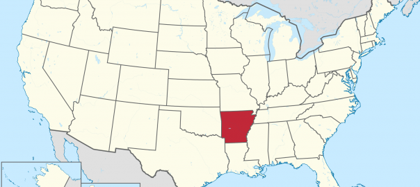
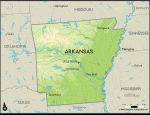
Arkansas
ITS NAME DERIVED from a French-adapted Native American term meaning “downstream people,” Arkansas is the 27th largest state at 53,104 square mi (137,539 square km). The state's shape is almost like a box, as its north-south extent is 240 mi (386 km) and the east-west extent is 275 mi (443 km). Located in the mid-Southwest […]
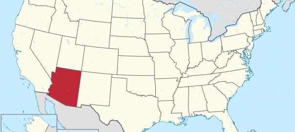
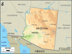
Arizona
A PLACE OF indisputable geographical interest in the U.S. Southwest, of which the GRAND CANYON of the Colorado River is but the leading example, Arizona currently exemplifies a trend toward urbanization in western states. While much of Arizona's land area of 113,635 square mi (294,315 square km) remains undeveloped, Arizona's capital and largest city, Phoenix, […]
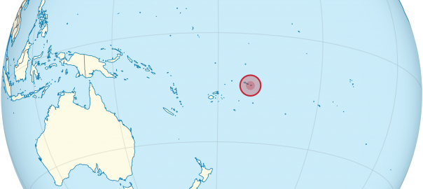
American Samoa
AMERICAN SAMOA, a territory of the UNITED STATES in the PACIFIC OCEAN, consists of the eastern half of the Samoan archipelago and comprises five volcanic islands: the main island of Tutuila and its smaller partner, Anu'u, plus the islands of Ofu, Olosega, and Ta'u (the Manu'a Islands) to the east. The territory, with its capital […]
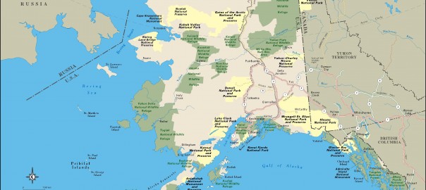
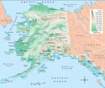
Alaska
THE 49th STATE admitted to the union in U.S. history, Alaska is located northwest of the 48 contiguous states. It borders CANADA to the east, the PACIFIC OCEAN to the south, the Bering Sea to the west, and the ARCTIC OCEAN to the north. Alaska has several distinct physical regions. The southernmost region is named the […]
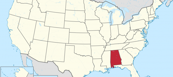
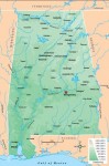
Alabama
THE HEART OF THE Confederate States of America during the Civil War, much of the state of Alabama was originally part of GEORGIA, its eastern neighbor in the south-central UNITED STATES. The British and French fought over the southernmost area until it was ceded to the British in the War of 1812. Scholars disagree on […]