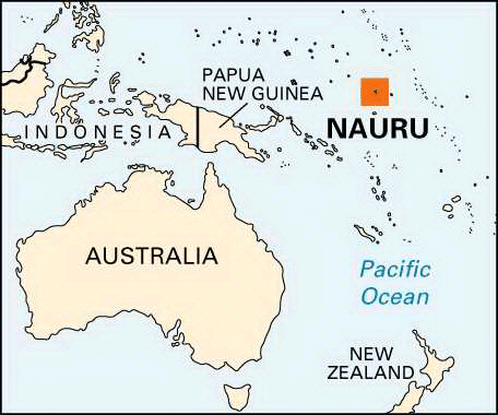
Nauru
Area 8 square mi (21 square km)
Population 12,570
Capital None, government offices in Yaren District
Highest Point 200 ft (61 m)
Lowest Point 0 m
GDP per capita $5,000
Primary Natural Resources phosphates, fish.
NAURU, LOCATED near the equator south of the MARSHALL ISLANDS in the south PACIFIC OCEAN, is the world's smallest independent republic. The country, officially known as the Republic of Nauru, gained its independence from the AUSTRALIA-, NEW ZEALAND-, and UNITED KINGDOM-administered United Nations trusteeship on January 31, 1968. The exportation of phosphate, principally to Australia, New Zealand, South KOREA, and INDIA, is the primary economic source for the island. However, the phosphate deposits are predicted to become exhausted in the coming decade. To prepare for this, the government has begun to pursue other economic strategies such as the registration of offshore banks and corporations and tourism.
Sea-faring Polynesians and Melanesians first inhabited the island. First contact with Europeans came in the 1830's when whaling ships first encountered the island. During World War II the island came under naval fire from first the Germans and then was later occupied by the Japanese. The Japanese occupied the island and forced over 1,000 Nauruan to work as laborers in the Caroline Islands, where nearly half died. Following the war, the island became a United Nations Trust Territory until its independence in 1968.
The main ethnic group on the island is the Nauruan, comprising 58 percent of the population. Other groups include Pacific Islander, 26 percent; Chinese, 8 percent; and European, 8 percent. The official language of Nauru is Nauruan which is a distinct Pacific Island language. English, though, is widely understood and spoken and used for most government and commercial purposes on the island. A majority of the population is Christian; two-thirds of the population is Protestant and the other third Roman Catholic.
The climate is tropical. The island averages 78 in (200 cm) of precipitation per year, and the monsoon season runs from November to February. Average daily temperatures range between 75 to 93 degrees F (24 to 34 degrees C) with an average humidity around 80 percent. The central plateau is where the phosphate mining takes place, and as a result, four-fifths of the total land area of the island has been lost. Jagged coral pinnacles, up to 49 ft (15 m) high, and coral cliffs dominate the resulting landscape on the plateau. The island is surrounded by a coral reef bordered by deep water on one side and sandy beach on the other. Next to the beach is a wide fertile coastal strip.