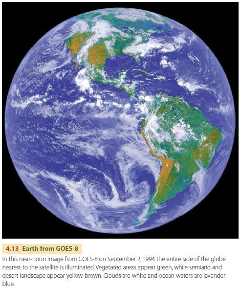
Observing Clouds from GOES
Some of the most familiar images of Earth acquired by satellite instruments are those of the Geostationary Operational Environmental Satellite (GOES) system. Images from the GOES series of satellites have been in constant use since 1974. The primary mission of the GOES series is to view cloud patterns and track weather systems by providing frequent images of the Earth from a consistent viewpoint in space provided by its geostationary orbit.
Altogether, 12 GOES satellites in three major generations have been placed in orbit since 1975. They have maintained a nearly continuous stream of images from two points on the Equator that bracket North America at latitudes 75° W and 135° W. From 135° W (GOES-West), Pacific storm systems can be tracked as they approach the continent and move across the western states and provinces. From 75° W (GOES-East), weather systems are observed in the eastern part of the continent as they move in from the west. GOES-East also observes the tropical Atlantic, allowing identification of tropical storms and hurricanes as they form and move eastward toward the Caribbean Sea and southeastern United States.