Oklahoma
LOCATED MIDWAY BETWEEN the east and west coasts of the UNITED STATES and just south of the geographic center of the United States in KANSAS, Oklahoma is one of the Great Plains states. The name comes from the Native American Choctaw language as okla meaning “people,” and humma meaning “red.” Despite images to the contrary, Oklahoma has a unique geography that serves as a transition zone between the forested mountain woodlands of the east and the deserts and mountains of the west. The land rises gently from 207 ft (87 m) above sea level in the extreme southeast to 4,973 ft (1,516 m) above sea level at Black Mesa in the northwestern corner in an area known as the Panhandle.
Oklahoma offers a variety of features, from grassland plains in the west to forests and mountains in the east. Most of the state is a great, rolling plain, sloping gently from northwest to southeast. Although the region is considered part of the Great Plains, Oklahoma has four mountain ranges: the Ouachita in the southeast, the Boston in the northeast (part of the Ozark Plateau that runs across northwestern ARKANSAS and MISSOURI), the Arbuckle in the south-central part of the state just north of the TEXAS border, and the isolated Wichita in the southwest. Approximately 24 percent of the state's total area is forested, generally in the mountainous regions along the Missouri and Arkansas border. Throughout the northwest and the Panhandle are sudden outcrops of sandstone and gypsum, sharp ravines, and stark hills. The Panhandle may be one of Oklahoma's most recognized map features; that strip of land in the northwest that extends west from the main body of the state as if it were pointing at something. In the north-central region there are several salt flats near the border with Kansas. The largest of these, the Great Salt Plains, covers about 25 square miles (65 square kilometers) near the city of Cherokee.
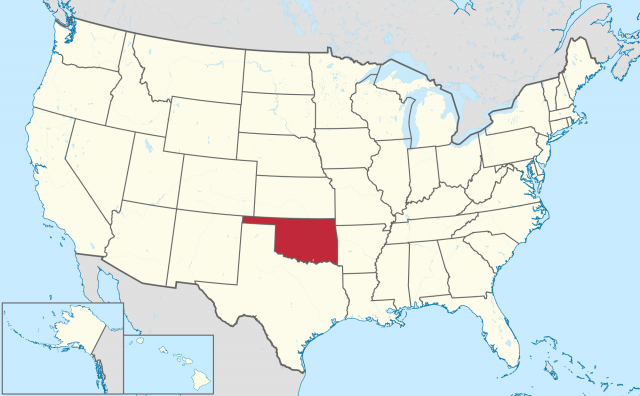
Oklahoma is bordered by COLORADO and Kansas in the north, by Texas in the south, by Missouri and Arkansas in the east, and by NEW MEXICO and Texas in the west. With a total area of 69,956 square miles (181,186 sq km) the state ranks 18th nationally in terms of size, including 1,137 square miles of water. Oklahoma's estimated resident population at the end of 2003 was 3,511,532, ranking 27th nationally. Because 41 percent of the state's population lives in the 10 largest cities, the state feels incredibly open and free. Oklahoma City, with a population of 523,303, is the state's largest city and capital, while Tulsa, with 387,807 people, is the state's other major metropolitan area.
The state has a number of important rivers, but the four major rivers are the Arkansas, Red, Canadian, and Grand (or Neosho). The Red River also forms the state's southern boundary with texas. The other significant rivers and streams, all flowing into either the Arkansas or the Red, are the Illinois, Verdigris, Poteau, Canadian, Cimarron, Salt Fork of the Arkansas, and the Washita. Several of the larger rivers in the eastern half of the state have been dammed creating a number of large lakes. Largest of the more than 60 such reservoirs are Eufaula, Texoma, the Grand Lake O' the Cherokees, and Robert Kerr.
Most of Oklahoma has a warm, dry climate. The northwestern part of the state is cooler and drier than the southeast. Precipitation varies greatly throughout the state. Annual average precipitation ranges from 50 in (128 cm) in the southeast to 15 in (38 cm) in the western Panhandle. Snowfall ranges from 2 in (5 cm) a year in the southeast to 25 in (63 cm) in the northwest; the Panhandle receives the most snow.
ECONOMY
Oil made Oklahoma a rich state, but natural-gas production has now surpassed it. Oil refining, meatpacking, food processing, and machinery manufacturing (especially construction and oil equipment) are important industries. Other major commodities include nonelectric machinery, petroleum and coal products, food products, fabricated metal products, glass, rubber and plastic products, and transportation equipment. The state's principal minerals are petroleum and natural gas, followed by helium, gypsum, zinc, cement, coal, copper, and silver. Oklahoma's rich plains produce bumper yields of wheat, as well as large crops of sorghum, hay, cotton, and peanuts. Chief agricultural products are beef cattle, sheep, hogs, poultry, milk, wheat, hay, sorghum and other grains, peanuts, pecans, and cotton.
HISTORY
Native American tribes inhabited Oklahoma when Spanish explorer Francisco Coronado ventured through the area in 1541. The land was included as part of the 1803 LOUISIANA PURCHASE. From the early 1820s until about 1846, the U.S. government waged a continuing effort to move Native Americans from the eastern United States to the Indian Territory (Oklahoma). The Five Civilized Tribes (southeastern United States) were among those tribes forcibly relocated over numerous routes during this time, the most famous being the Cherokee “Trail of Tears.”
Immediately after the Civil War, the long cattle drives from Texas to the Kansas railroad centers began, ushering in the age of the cowboy. The cattle were fattened on the rich prairie grasses of Oklahoma as they slowly made their way north to towns such as Dodge City or Abilene. With time, Western folklore became rich with names such as the Chisholm and Cimarron trails. Western expansion of the United States reached the territory in the late 1800s, sparking a major controversy over the fate of the land. The government decided to open the western parts of the territory to settlers by holding a total of six land runs between 1889 and 1895. Included in this land grab was the famous Cherokee Strip or Cherokee Outlet, a narrow piece of land in northern Oklahoma along the Kansas border. Settlers came from across the nation and even other countries to stake their claims. In part because of the discovery of oil, which made Oklahoma the “place to go to strike it rich,” statehood had become a sure thing at the turn of the 20th century, and on November 16, 1907 Oklahoma became the 46th state of the United States.