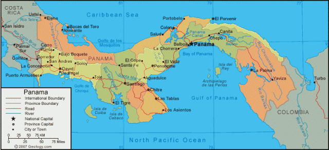
Panama
Area 30,193 square mi (78,200 square km)
Capital Panama
City Population 3.868 million 2014
Highest Point 11,400 ft (3,475 m)
Lowest Point 0 m
GDP $46.21 billion 2014
Primary Natural Resources bananas, rice, corn, coffee, sugarcane.
The Republic of Panama is a Central American country bordered both by the CARIBBEAN SEA and the PACIFIC OCEAN, between COLOMBIA and COSTA RICA. Slightly smaller than the state of SOUTH CAROLINA, the most dominant feature of the Panamanian landscape is the highlands, which form the continental divide through the center of the country. The highest constant elevations of the hills and mountains known as the Cordillera de Talamanca and the Serrania de Tabasara that create the continental divide are near Panama's borders, while the lowest elevations are along the Panama Canal, where most of the country's population is concentrated.
The country's Caribbean coastline has an abundance of natural harbors, but the only one that is significantly developed is located at Cristobal, one of the terminuses of the Panama Canal, connecting the ATLANTIC and Pacific oceans. The port of Balboa is the major trading city on the Pacific coastline, which does not have an abundance of good natural harbors as a result of extraordinarily shallow waters and an extreme tidal range. Panama has almost 500 rivers, some of which provide crucial reservoirs of water for the canal and generate significant quantities of hydroelectric power.
Panama's climate is tropical, and temperatures and humidity remain high throughout the year, with little seasonal variation, usually remaining between 75 and 87 degrees F (24 and 32 degrees C). Temperatures on the Pacific side of the highland chain are typically lower than the Caribbean. In the highlands themselves, some areas experience temperatures that are quite cooler, and frosts occur occasionally in the Cordillera de Talamanca in western Panama.
Unlike temperature, rainfall throughout Panama varies substantially from 39 to 118 in (100 to more than 300 cm) per year. The overwhelming majority of the rains come during a marked rainy season, which usually lasts from April to December. The amount of rainfall is determined by two factors in general: moisture from the Caribbean and the windshield effect of the continental highlands. Consequently, rainfall is much higher on the Caribbean side. In addition, the country is located outside the hurricane track, but is known to suffer from volatile thunderstorms.
Panama boasts a relatively strong economy, based upon its governmental stability and control over the PANAMA CANAL, which was turned over to Panama by the United States at the end of 1999. A well-developed service sector makes up the majority of its economy, mostly stemming from the Panama Canal, which continues to make its mark upon Panamanian history. Originally, U.S. plans for the Panama Canal provided the impetus for Panama's succession from Columbia in 1903, after which the new country was immediately recognized by the United States and an agreement for the commencement of construction was signed. Now, control over the canal permits Panama to continue to dominate trade in the region, as well as flagship registration and, more recently, tourism.