Seychelles
Map Page 1116
Area 177.5 square mi (455 square km)
Population 91,530 (2014)
Capital Victoria
Highest Point 2,986 ft (905 m)
Lowest Point 0 m
GDP $1.423 billion (2014)
Primary Natural Resources fish, copra, cinnamon trees.
AS A RESULT OF competing colonial claims for dominance in the INDIAN OCEAN, the island republic of the Seychelles displays an intriguing mixture of indigenous, French, and British characteristics. The population speaks a Creole, and laws are a combination of French civil law, English common law, and customary law.
Since independence from the UNITED KINGDOM in 1976, the Seychelles has steered its own course, through a period of one-party socialism to one of leadership in tourism and “positive nonalignment” in the Indian Ocean region.
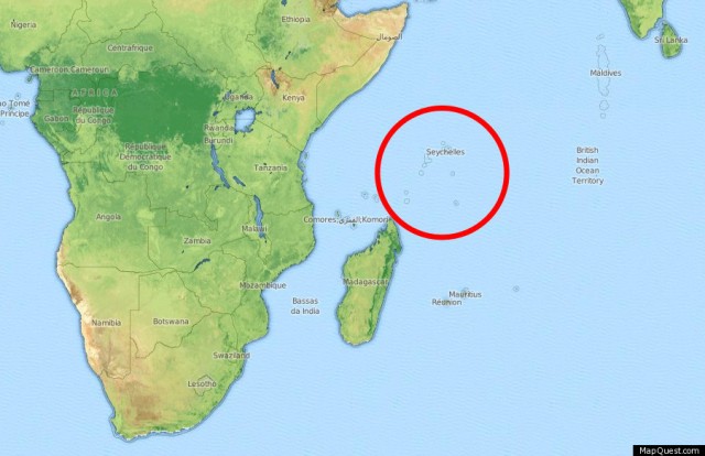
The Seychelles consists of a chain of 40 granitic islands and about 50 coralline islands, concentrated in six groups. Stretching across 744 mi (1,200 km) of open ocean, from Ile aux Vaches in the northeast to the Aldabra Islands in the southwest, the length of the chain gives the country claims to jurisdiction and fishing rights over 620,000 square mi (1 million square km) of ocean. Most of the granitic islands lie within 56 mi (90 km) of the largest island in the group, Mahe, on which is the capital city of Victoria, the nation's only city and one of the best ports in the Indian Ocean, strategically located at the center of a triangle between Mombasa (KENYA), MUMBAI (INDIA) and MAURITIUS. Mahe and the other major islands—Praslin and La Digue—are hilly, with narrow coastal plains, and ringed with coral reefs. They are the peaks of the submarine Mascarene Plateau. Some 99 percent of the population lives on these three islands, mostly on Mahe.
The coralline islands are very flat, have little fresh water, and are mostly unpopulated. They are either sand cays or uplifted coral reefs and are important ecological zones as breeding grounds for rare marine life, seabirds, and the giant tortoise. A system of national parks and animal preserves, supported by the World Bank, now covers 42 percent of the land area and 64,200 acres (26,000 hectares) of the surrounding seas, established to protect hundreds of animal and plant species found nowhere else.
The islands were visited by traders from the PERSIAN GULF and East Africa, then by Portuguese in the 16th century. The French claimed the main islands in 1742, and named them for the minister of finance, Jean Moreau de Sechelles. Not intended as a plantation colony, the islands were instead used as a reprovisioning stopover for passing trade ships, relying heavily on the turtle population for meat. Britain took over the islands in 1814 and gradually extended control over the smaller islands and coral atolls to the southwest. Governed as a dependency of Mauritius at first, the island chain became a separate colony from 1903 until independence in 1976. The Seychellois people are a fairly homogeneous mixture of African and European descent, with small numbers of immigrants.
Underdeveloped as a colony, and lacking any real space for agriculture, the Seychelles has turned to tourism as its mainstay since independence, employing about 30 percent of the workforce and providing about 70 percent of the nation's gross domestic product (high by developing world standards). Fishing is also of major importance, and Victoria's tuna canneries are among the largest in the world.