The Global Positioning System
The latitude and longitude coordinates of a point on the Earth's surface describe its position exactly. But how are those coordinates determined? For the last few hundred years, we have known how to use the position of the stars in the sky coupled with an accurate clock to determine the latitude and longitude of any point. Linked with advances in mapping and surveying, these techniques became highly accurate, but they were impractical for precisely determining locations in a short period of time.
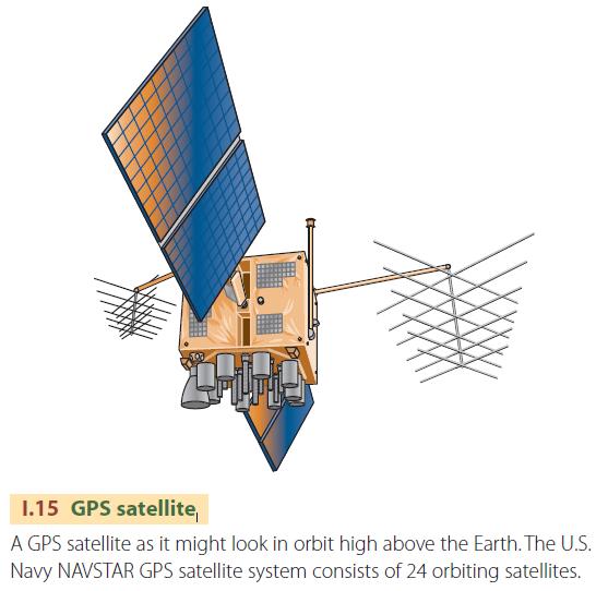
Thanks to new technology originally developed by the U.S. Naval Observatory for military applications, there is now in place a global positioning system (GPS) that can provide location information to an accuracy of about 20 meters within a minute or two. The system uses 24 satellites that orbit the Earth every 12 hours, continuously broadcasting their position and a highly accurate time signal.
To determine location, a receiver listens simultaneously to signals from four or more satellites. The receiver compares the time readings transmitted by each satellite with the receiver's own clock to determine how long it took for each signal to reach the receiver. Since the radio signal travels at a known rate of speed, the receiver can convert the travel time into the distance between the receiver and the satellite. Coupling the distance to each satellite with the position of the satellite in its orbit at the time of the transmission, the receiver calculates its position on the ground to within about 20 m (66 ft) horizontally and 30 m (98 ft) vertically.
The accuracy of the location is affected by several types of errors. One of the larger sources is the effect of the atmosphere on the radio waves of the satellite signal as they pass from the satellite to the receiver. Charged particles at the outer edge of the atmosphere (ionosphere) and water vapor in the lowest atmospheric layer (troposphere) act to slow the radio waves. Since the conditions in these layers can change within a matter of minutes, the speed of the radio waves varies in an unpredictable way. Another transmission problem is that the radio waves may bounce off local obstructions and then reach the receiver, causing two slightly different signals to arrive at the receiver at the same time. This “multipath error” creates noise that confuses the receiver.
There is a way, however, to determine location within about 1 m (3.3 ft) horizontally and 2 m (6.6 ft) vertically. The method uses two GPS units, one at a base station and one that is mobile and used to determine the desired locations. The base station unit is placed at a position that is known with very high accuracy. By comparing its exact position with that calculated from each satellite signal, it determines the small deviations from orbit of each satellite, any small variations in each satellite's clock, and the
exact speed of that satellite's radio signal through the atmosphere at that moment. It then broadcasts that information to the GPS field unit, where it is used to calculate the position more accurately. Because this method compares two sets of signals, it is known as differential GPS.
In North America, differential GPS information is now available everywhere using the Wide Area Augmentation System (WAAS), which is provided by the U.S. Federal Aviation Administration and the Department of Transportation. The system includes about 25 ground receiving stations that monitor the signals of GPS satellites and provide a stream of differential correction information. This information is uploaded to a geostationary satellite, where it is rebroadcast to receivers on the ground. A GPS unit with a built-in WAAS receiver can determine position to within a few meters.
The enhanced accuracy of differential GPS is required for coastal navigation, where a few meters in position can make the difference between a shipping channel and a shoal. It is also required for the new generation of aircraft landing systems that will allow much safer instrument landings with equipment that is much lower in cost than existing systems.
As GPS technology has developed, costs have fallen exponentially. It is now possible to buy a small, handheld GPS receiver for less than $100. Besides plotting your progress on a computer-generated map as you drive your car or sail your boat, GPS technology can even help parents keep track of children at a theme park. And with the coupling of wireless telephones and GPS, you can even get driving directions over your phone.
- Maps and Cartography
- Tools in Physical Geography
- Physical Geography, Environment, and Global Change
- Spheres, Systems, and Cycles
- Introducing Geography
- physical geography
- What Climates and Weather Would Occur Here?
- How Does the Climate System Sustain Life?
- How Do We Use Computers to Study Climate Change?