Using Different Types of Maps
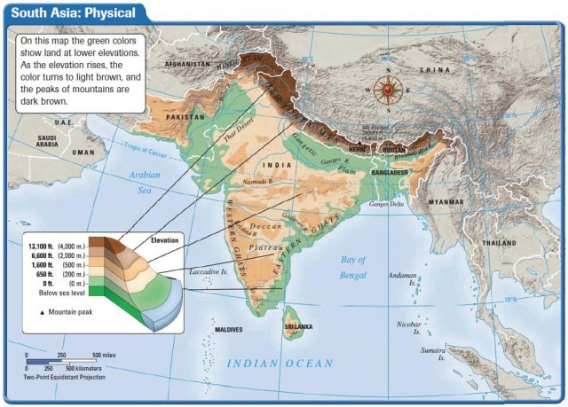
PHYSICAL MAPS
Physical maps help you see the types of landforms and bodies of water found in a specific area. By studying the map, you can begin to understand the relative location and characteristics of a place or region.
On a physical map, color, shading, or contour lines are used to indicate elevation or altitude, also called relief.
Ask these questions about the physical features shown on a map:
- Where on the earth's surface is this area located?
- What is its relative location?
- What is the shape of the region?
- In which direction do the rivers flow? How might the direction of flow affect travel and transportation in the region?
- Are there mountains or deserts? How do they affect the people living in the area?
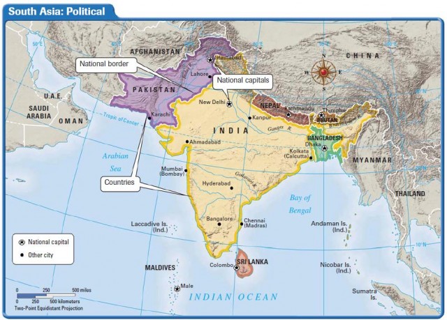
POLITICAL MAPS
Political maps show features on the earth's surface that humans created. Included on a political map may be cities, states, provinces, territories, or countries.
Ask these questions about the political features shown on a map:
- Where on the earth's surface is this area located?
- What is its relative location? How might the location affect the economy or foreign policy of a place?
- What is the shape and size of the country? How might shape or size affect the people living in the country?
- Who are the neighbors in the region, country, state, or city?
- How populated does the area seem to be? How might that affect activities there?