The United States
Exploring the United States of America The United States, excluding Alaska and Hawaii, stretches about three thousand miles from coast to coast—or east to west. Because of its great size, it is often divided into smaller geographical areas, or regions. The states in each region have many things in common, such as geography, including climate, natural resources, economic activity, and other important geographical conditions.
Mission: Explore Earth
As you know, Admiral Zorg, the spaceship that I command has been exploring the planet known as Earth for almost a year. We have discovered that Earth is very different from our planet Proteus.
We have studied its interesting physical features and life forms and reported our observations to you. Now, as our year of exploring draws to a close, there is one last place to explore—the United States of America. We will explore and report on each area of the United States. In each report we will answer questions such as: Which states make up each region? What does the land look like in this region? What plants and animals live there? What is the weather like? What kinds of jobs do people do? What do people eat and drink? What do they do for fun?
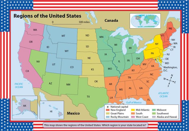
These are the regions we will report from: New England, the Mid-Atlantic, the South, the Midwest, the Great Plains, the Rocky Mountains, the Southwest, and the West Coast. There are also two states that do not belong to a region because they are not connected to any other state. They are called Alaska and Hawaii. We will send a separate report about these two states. We will gather information for our reports through observation. When we have questions, we will talk to some of the people we meet. (Of course, we will always remember to be disguised as humans!)
Right now, as I record this audio message, we are flying over a huge body of water called the Atlantic Ocean. The next land we see will be the United States of America.
A Vast and Varied Country
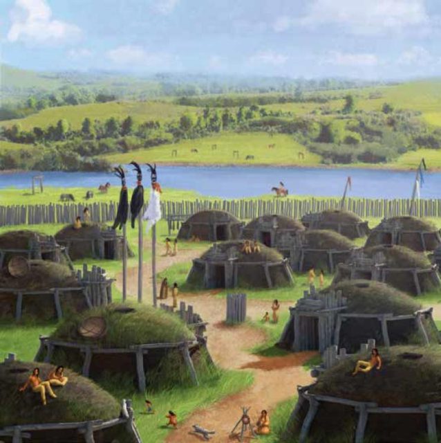
The United States of America is reported to be a huge country. Earthlings in other places have described it as having a great variety of landforms and life forms. In addition to the indigenous peoples who have lived there for thousands of years, and the descendants of the first European settlers, I have heard that people travel from all over the world to live there.
As we fly over the Atlantic Ocean, we will be looking at maps of the United States. These maps will help us find the places we want to go. They will also help us to identify the different regions of this vast country. You remember, Admiral, that Earth is shaped like a globe, or sphere. Earthlings divide their world into half-globes, or hemispheres. They speak of an Eastern Hemisphere and a Western Hemisphere. The United States is in the Western Hemisphere on the continent called North America. A continent is a large landmass that sometimes has islands off its shores. North America is made up of Canada, the United States, and Middle America, which includes Mexico, Central America, and the Caribbean islands.
Looking at our maps, we see that, excluding Alaska and Hawaii, the United States stretches all the way across the continent of North America—a distance of about three thousand miles. On each side of the country, there is a huge body of water called an ocean. On the east side, the United States is bordered by the Atlantic Ocean. On the west side, it is bordered by the Pacific Ocean.
The United States also controls territories beyond these borders. In the Caribbean Sea, which is south of the United States, Puerto Rico and the U.S. Virgin Islands are U.S. territories. In the Pacific Ocean, Guam, American Samoa, and the Northern Mariana Islands are all U.S. territories. We will not be sending reports about these territories. Lieutenant Koola just informed me that she has sighted land below us. She is pretty sure that it is the state of Maine in the northeastern United States. Our map shows that the country is divided into fifty smaller units, or states. I expect that’s why the country is called the United States!
Each of the fifty states has its own government and its own capital city. This is because the United States is a democracy. In other words, it has a system of government in which the people rule through elected representatives. The head of the national government, or all fifty states, is called the president. He lives in a place called Washington, D.C., which is the capital of the United States.
Now we are flying low over the coast of Maine. Through our spaceship’s porthole, I can see huge, gray waves crashing against rocky cliffs. We will look for a place where people live and land nearby. We are all very excited to meet our first Americans. In my next report, I hope to have plenty to tell you about this interesting country.
I have given the order to turn on the invisibility shield and start our descent.

- Weather: The United States
- CASE STUDY. Diverse Societies Face Change
- Urban Sprawl
- The Fight Against Terrorism
- Subregions of the United States
- Economy and Culture of the United States
- History and Government of the United States
- The United States and Canada: Human–Environment Interaction
- The United States and Canada: Climate and Vegetation