Pacific Ocean
THE PACIFIC OCEAN HAS an area of approximately 68,767,000 square mi (178,106,000 square km) with its adjacent seas; 65,329,000 square mi (169,202,000 square km) without them. As the world's largest ocean, it has the following characteristics.
Volume: 160,489,000 cubic mi (674,052,000 cubic km) including adjacent areas; 158,065,000 cubic mi (663,871,000 cubic km) if they are not included.
Average depth: with adjacent seas -13,480 ft (-4,110 m); without them -14,038 ft (-4,280 m).
Greatest depth: -35,798 ft (-10,911 m) in the Challenger Deep in the Mariana Trench.
Width: varies from north to south reaching about 12,300 mi (19,800 km) between INDONESIA and the coast of COLOMBIA in South America.
Coastline: 84,300 mi (135,663 km); adjacent areas include the Bering Sea (in the north); the Gulf of California (in the east); Ross Sea (in the south); and the Sea of Okhotsk, the Sea of Japan, and the Yellow, East China, South China, Philippine, Coral, and Tasman seas (in the west).
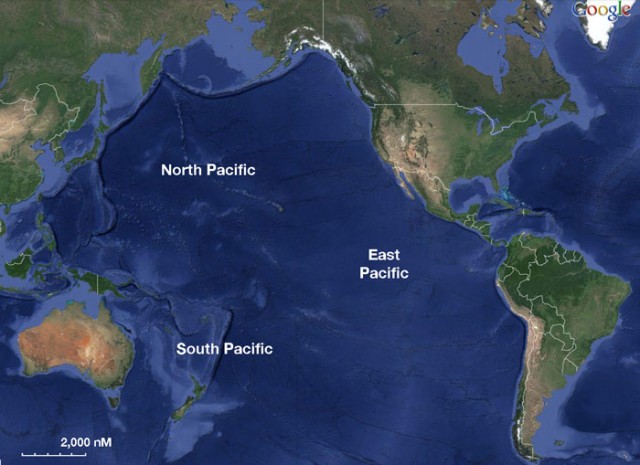
Because the ATLANTIC OCEAN was home to extensive exploration and commercial use long before the Pacific, research on the Pacific is not as well developed as that on the Atlantic. The Pacific BASIN is almost triangular in shape, narrow in the Arctic north and broad in the Antarctic south. In the west, it touches Asia and AUSTRALIA, while in the east it borders the Americas. Its north to south extent between the Bering Strait in the north and ANTARCTICA in the south is more than 9,300 mi (15,000 km). In the tropics, between the MALACCA STRAITS to PANAMA, the Pacific reaches its greatest width, spanning a distance of nearly 12,427 mi (20,000 km).
If you include all of its adjacent seas, the Pacific covers about one-third of the Earth's surface and 40 percent of the surface area of the world's oceans, an area greater than that of all of the continents combined. The boundary between the Pacific and INDIAN oceans follows a line from the Malay Peninsula through SUMATRA, JAVA, Timor, Australia at Cape Londonderry, and Tasmania. From Tasmania to Antarctica, it follows the meridian from the South East Cape on Tasmania at 147 degrees E.
The dividing line between the Atlantic and the Pacific follows the line of shallowest depth between Cape Horn and the Antarctic Peninsula. In the north, the boundary between the North Pacific and the ARCTIC OCEAN lies along the shallow shelf of the Bering Strait that extends between the Chukchi Peninsula in eastern SIBERIA and the Seward Peninsula in western ALASKA. There is also a boundary between the Pacific's northern and southern zones, formed by the equatorial countercurrents that circulate just north of the equator in an area known as the Intertropical Convergence Zone (ITCZ).
PHYSICAL FEATURES
Typically, the depth of the Pacific basin is only 1.8 to 2.5 mi (3 to 4 km), so the horizontal dimension of the basin is about 1,000 times greater than its vertical dimension. Another unique feature of the Pacific Ocean is its large number of seamounts, particularly in the Northwest and Central Pacific Basins. Seamounts are found in all oceans, but the volcanism of the northwestern Pacific Ocean produces them in such numbers that in some regions they cover a fair percentage of the ocean floor.
Because the rim of the Pacific Basin is ringed with volcanoes, it is often referred to as the RING OF FIRE. This ring, which extends from Alaska through the UNITED STATES, MEXICO, and South America, then on to NEW ZEALAND and up to JAPAN and RUSSIA includes about 75 percent of all the world's volcanoes.
In great contrast to the Atlantic, the Pacific contains thousands of islands. These are usually one of four basic types: continental islands, high islands, coral reefs, and uplifted coral platforms. In the west, there are a number of large islands such as Japan, TAIWAN, BORNEO, and NEW GUINEA. In the south, there is a cluster of smaller islands included in POLYNESIA that extend east as far as TAHITI. Further away still to the east are several isolated islands such as PITCAIRN, EASTER ISLAND, and the Galapagos, which is just 621 mi (1,000 km) west of ECUADOR in South America.
All of the Pacific's adjacent seas are grouped along its western edge. Some of them are large shelf seas, while others are deep basins. In contrast to the Indian and Atlantic oceans, adjacent seas of the Pacific Ocean have only a small influence on the hydrology of the main ocean basin. The Australasian Mediterranean Sea, the only Mediterranean-type sea in the Pacific Ocean, is a major region of water mass formation and an important element in the mass and heat budgets of the world ocean system. Unlike the CARIBBEAN SEA in the Atlantic, however, its influence on the Pacific's hydrology is of only minor importance.
In the Atlantic and Indian oceans, an interoceanic ridge system divides the basins into compartments of roughly equal size. In the Pacific Ocean, the ridge system runs close to the eastern boundary, producing divisions in the southeastern Pacific Ocean similar in size to those of the Atlantic and Indian basins. The vast expanse of deep water in the central and northern Pacific Ocean, on the other hand, is subdivided more by convention than topography into the Northeast Pacific, Northwest Pacific, Central Pacific, and Southwest Pacific Basins. Further west, New Zealand and the Melanesian islands provide a natural boundary for two adjacent seas of the Pacific Ocean, the Tasman and Coral seas, while in the north the West and East Mariana Ridges and the Sitito-Iozima Ridge offer a natural subdivision.
WATER AND CLIMATE
In the Pacific the systems of winds and currents follow a clockwise movement in the Northern Hemisphere and counterclockwise in the South. Between the two run the Equatorial Currents. The North Equatorial Current runs 9,000 mi (14,416 km) from PANAMA to the PHILIPPINES and is the longest westerly running current in the world. When the North Equatorial Current reaches Japan, it turns north and is known as the Japan Current. The Japan Current is the western Pacific's counterpart of the Gulf Stream in the Atlantic. When it meets the cold waters of the Arctic, fogs and storms are caused, just as they are at the meeting of the Labrador Current and the Gulf Stream. In the southern half of the ocean, the Humboldt Current flows north from Antarctica along the coast of South America.
At regular intervals a vast area of the Pacific's surface waters becomes warmer. This change in temperature and level causes an alteration in the pattern of the winds, a phenomenon known as EL NINO. As the warm water travels across the Pacific, it deflects the Humboldt Current near Peru and cuts off the food supply to plankton. The warmer waters along the coast of Peru also cause increased rainstorms and flooding in many parts of South and Central America. The monsoon rains in Southeast Asia are also interrupted, often leading to crop failures in Australia and New Guinea. Every time there is an El Nino, there is even crop damage as far away as Africa, where the maize crop in zimbabwe has been known to decline. On the other hand, in israel, El Nino years bring more rain and the crops are more abundant.
Few rivers shed their waters into the Pacific Ocean, and the few that do have very small catchments. The largest rivers all enter the marginal seas along the western rim of the North Pacific basin, where they have a strong impact on the hydrology. Although the rivers coming down from the mountain ranges are small, they are numerous and their combined freshwater output is comparable to that of the MISSISSIPPI RIVER. This also constitutes about 40 percent of all the freshwater input into the northeast Pacific Ocean. In the Southern Hemisphere river contributions are negligible because the river catchments are restricted by the ANDES in the east and Australia's Great Dividing Range in the west.
HISTORY AND ECONOMY
The Pacific is the world's oldest ocean. Theories of the Pacific's origin are related to PLATE TECTONICS, where movement of the land masses of the Earth are either drifting apart or sinking and sliding under one another. The role of humans in the Pacific has been the result of migration and exploration. The island peoples of MELANESIA, MICRONESIA, and Polynesia traveled extensively settling in Australia, New Zealand, Hawaii, and thousands of other islands.
People such as Thor Heyerdahl believe the migration might have been in the opposite direction because the sweet potato, a native plant of PERU, grew in Polynesia before the arrival of western explorers. The first European to see the Pacific was the Spanish explorer Balboa in September 1513. Later, Ferdinand MAGELLAN set sight on the Pacific after sailing round Cape Horn at the southern tip of South America in 1520. The first English explorers were Francis Drake in the 16th century and Captain James Cook in the 18th century.
Although there is no written proof, it is believed that ships from the great Chinese voyage of discovery under Zheng He may have sailed around Cape Horn sometime between 1421 and 1423 on the return trip to CHINA. For the remainder of the 16th century, Spanish influence was paramount, with ships sailing from SPAIN to the Philippines, PAPUA NEW GUINEA, and the SOLOMON ISLANDS. During the 17th century, the Dutch, sailing around southern Africa, dominated discovery and trade. The 18th century marked a burst of exploration by the Russians in Alaska and the ALEUTIAN ISLANDS, the French in Polynesia, and the British in the three voyages of James Cook.
The Pacific Ocean is a major contributor to the world economy and particularly to those nations its waters directly touch. It provides low-cost sea transportation between East and West, extensive fishing grounds, offshore oil and gas fields, minerals, and sand and gravel for the construction industry. One of the Pacific Ocean's greatest assets is fish, including herring, salmon, sardines, snapper, swordfish, tuna, and shellfish. Pearls are harvested along Australia, Japan, Papua New Guinea, NICARAGUA, Panama, and Philippine coasts.
ENVIRONMENTAL ISSUES
There are a number of endangered marine species in the Pacific, including the dugong, sea lion, sea otter, seals, turtles, and whales. Current major environmental issues include oil pollution in the Philippine Sea and South China Sea. There is also a zone of violent volcanic and earthquake activity known as the Ring of Fire surrounding it. Southeast and East Asia are subject to typhoons from May to December, while hurricanes may form south of Mexico and strike Central America and Mexico from June to October. The monsoon region lies between Japan and Australia in the far western Pacific. The greatest typhoon frequency exists within the triangle from southern Japan to the central Philippines to eastern Micronesia. The southern shipping lanes are subject to icebergs from Antarctica.
- Indian Ocean
- Atlantic Ocean
- Arctic Ocean
- Do Other Oceans Display Oscillations?
- What Connects Equatorial Atmospheric and Oceanic Circulation?
- How Are the Atmosphere, Oceans, and Cryosphere Coupled?
- What Processes Affect Ocean Temperature and Salinity in Tropical and Polar Regions?
- What Are the Global Patterns of Temperature and Salinity?
- What Causes Water to Rise or Sink?