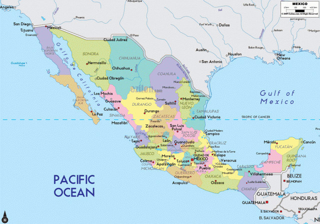
Mexico
Area 761,605 square mi (1,972,550 square km)
Population 125.4 million 2014
Capital Mexico City
Highest Point 18,700 ft (5,700 m)
Lowest Point -33 ft (-10 m)
GDP $1.283 trillion 2014
Primary Natural Resources petroleum, silver, copper, gold.
OFFICIALLY KNOWN AS the Estados Unidos Mexicanos (United Mexican States), Mexico is a country in North America. It is bordered by the UNITED STATES to the north, by the PACIFIC OCEAN to the west and south, by the Gulf of Mexico and CARIBBEAN SEA to the east, and by GUATEMALA and BELIZE to the southeast. Mexico has historically been a country of great mineral resources, ranging from silver to oil. The country has also become largely urban, as some two-thirds of the national population lives in cities, including MEXICO CITY, one of the largest metropolitan areas in the world.
Before the arrival of Europeans in the early 16th century, Mexico was home to several great Native American civilizations, including the Olmecs, Maya, and Aztecs. From the early-1500s until the 1820s, Mexico was part of the Spanish Empire in the New World. After gaining independence from SPAIN, Mexico became a republic in the 19th century. However, the country lost much of its territory to the United States, including much of the present-day U.S Southwest from TEXAS to CALIFORNIA.
The altiplano, also called the Mexican Plateau, rises from the border with the United States to the central Mexican highlands. Close to the U.S. border, the plateau reaches heights of about 4,000 ft (1,219 m); south of Mexico City, the altiplano has an altitude of some 8,000 ft (2,438 m). The altiplano is comprised of two parts. The northern section, from the U.S. border to San Luis Potosi, is a largely arid region known as the Mesa del Norte. To the south is the Mesa Central, which is higher, moister, and flatter. The Mesa Central contains a number of intermontane basins, many of which are fertile, and contains the country's largest settlements. The Guanajuato basin has historically been the “bread basket” of Mexico, providing much of the country's food.
VALLEY OF MEXICO
The largest basins are those of Mexico, Puebla, and Guadalajara, all of which contain large cities of the same names. The Valley of Mexico, for example, has been the site of many great ancient Mexican civilizations, including the city of Teotihuacan, famous for its Temples of the Sun and Moon. The Aztec capital of Tenochtitlan was also in this basin. After the Spanish conquest of Mexico, the Spaniards built their colonial capital over the ruins on Tenochtitlan. Today, as part of a Federal District, Mexico City serves as the country's capital. Many of the valleys once had lakes that European settlers later drained and filled. In cities such as Mexico City, this practice has led to weak and unstable soils, often causing buildings to sink.
The altiplano is flanked by mountain ranges on each site. To the west is the Sierra Madre Occidental, which can reach 8,000 to 9,000 ft (2,438 to 2,743 m). River erosion in these volcanic mountains have led to the formation of many canyons, including Copper Canyon, the so-called Grand Canyon of Mexico. To
the east is the somewhat lower Sierra Madre Oriental. To the east and west of the two mountain ranges are low plains that extend to the coast.
The altiplano is cut off by a string of volcanoes known as the volcanic axis that stretches from the Pacific to the Gulf coast. A number of the volcanoes are still active. Many of the volcanoes retain their Nahuatllanguage names from the pre-Hispanic period. Located near Mexico City, Popocateptl, or “smoking mountain,” and Ixtaccihuatl, or “white lady,” reach over 17,000 ft (5,181 m).
To the east of the Cordillera Oriental is the Gulf Coast Plain. This lowland region stretches 900 mi (1,448 km) from Texas to the YUCATAN PENINSULA. It consists of many lagoons and swamps to the east of the abrupt escarpment of the Cordillera. On the western side of Mexico is the narrower, less well-defined Pacific Coastal Lowlands. It runs for some 900 miles from the Mexicali Valley to Tuxpan. Despite the region's name, most of it actually faces the Gulf of California, not the Pacific Ocean. This lowland area is largely arid. However, it has also seen a rise in the importance of irrigated agriculture.
Baja California, or lower California, is a long, narrow peninsula that separates the Gulf of California from the Pacific Ocean. Most of the peninsula is mountainous and arid. However, agriculture has developed around Mexicali. There are also important fisheries on the peninsula. Tourism became an important economic activity at the end of the 20th century in areas such as Ensenada and Cabo San Lucas. Near the border with the United States, there are many factories known as maquiladoras, which use inexpensive Mexican labor to assemble products manufactured elsewhere.
South of the volcanic axis are the Southern Highlands, an area of old crystalline rock. This region is one of the most rugged areas of Mexico. The highlands are located to the south and east of “Old Antillia,” which is believed to have once connected the Caribbean to the mainland. The Southern Highlands consist of steep ranges and valleys. On the southwestern side of the highlands is a series of ranges known as the Sierra Madre del Sur. These relatively low mountains often reach the sea, forming a rugged coastal margin. This areas is sometimes called the Mexican Riviera because of the important tourist destinations such as Acapulco. The inland basins of the region are much less hospitable. To the northeast is the Mesa del Sur, with numerous valleys between 4,000 and 5,000 ft (1,219 and 1,524 m). The largest and most densely settled is the Oaxaca Valley, with its large native population.
THE YUCATAN
Located north of “Old Antillia,” the Yucatan Peninsula, sometimes called the Antillean Foreland, is a flat area of limestone. The parts of the foreland that are above sea level form the Yucatan Peninsula, the largest lowland plains in Mexico. Because of the limestone's porous nature, there are few surface streams in the Yucatan. Water can be found instead in sinkholes known as cenotes. With the lack of water and a poor-quality soil, this region possesses little fertile land. Historically, henequen was one of the region's most important crops. In the 20th century, resort areas such as Cancun and Cozumel located here, drawing tourists. The oil industry also developed in the area Yucatan in the 20th century.
The Chiapas Highlands are an extension of mountain ranges in Central America. The region consists of a series of mountains that surround the high rift valley of the Grijalva River. This hot and humid region of southern Mexico is remote and sparsely populated. Chiapas possesses rapidly shrinking forests of dyewoods and hardwoods. The region has also been a retreat for Native American groups such as the
Lacondones. In the 1990s, a group known as the Zapatistas began a rebellion in Chiapas to protest the plight of Mexico's Native American poor.