Arizona
A PLACE OF indisputable geographical interest in the U.S. Southwest, of which the GRAND CANYON of the Colorado River is but the leading example, Arizona currently exemplifies a trend toward urbanization in western states. While much of Arizona's land area of 113,635 square mi (294,315 square km) remains undeveloped, Arizona's capital and largest city, Phoenix, alone accounts for more than a quarter of the state's total population of 5,130,632 (2000 U. S. census).
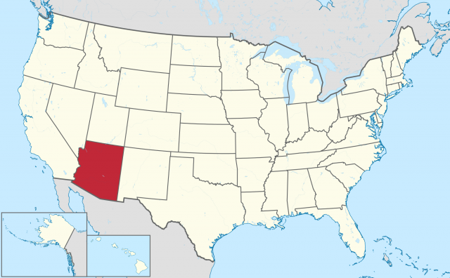
Arizona was the last of the contiguous UNITED STATES to be granted statehood, in 1912. Statehood followed a long territorial history, beginning with the combination of a portion of the land area ceded to the United States by MEXICO in 1848 and the Gadsden Purchase of 1853 in the Territory of New Mexico. Arizona was organized as a separate territory in 1863. The state is bounded by UTAH, NEW MEXICO, CALIFORNIA, and NEVADA, and by Mexico to the south. The propriety of including the extreme northwestern land area, known as the Arizona strip, has long been a matter of dispute with adjoining Utah, due to its relative inaccessibility from greater Arizona across the Colorado River.
Three physiographic provinces divide the state into a continuity of diverse regions. To the north, the Colorado Plateau Province rises to a maximum altitude at Humphreys Peak (12,633 ft or 3,851 m). Composed primarily of Paleozoic sedimentary strata, the plateau is joined from several interlocking uplifted blocks, terminating on the southern boundary at the Mogollon Rim. The Grand Canyon cuts through the southwestern corner of the plateau, exposing a vast geological column that terminates in pre-Cambrian gneiss at the level of the Colorado River. Volcanic activity, seen in a field of cinder cones to the south of the canyon, has been recent; Sunset Crater, a cinder cone northeast of Flagstaff, is less than 1,000 years old. South of the Mogollon Rim are the Central Highlands, a province that is also termed the Transition Zone because the province shares characteristics of the Colorado Plateau and of the Basin and Range to the south and west. The southern and western extents of Arizona are the Basin and Range Province, a region of mountain ranges composed of volcanic rocks, separated by deep grabbens choked with alluvium.
Most of the Basin and Range Province is arid and is classified as desert. The SONORAN DESERT, which dominates the province and continues into Mexico and California, has two seasons of rainfall—in summer and winter—in its central portion, known as the Arizona Upland. This biannual rainfall provides up to ten inches of precipitation annually, making the Arizona Upland the most lush of American desert landscapes. Its unique plants include the saguaro, a columnar cactus that can reach 50 ft (15 m) in height. High temperatures in summer easily reach into the 110s degrees F (40s degrees C) in portions of the region. Because of its altitude, the Colorado Plateau enjoys a more moderate climate, although it too is arid. In a swath that crosses the Grand Canyon and extends along the Mogollon Rim above 6,000 ft (1,800 m), ponderosa pine form the largest continuous forest of this species in the United States. Winter snowfall is common on the plateau but can occur throughout the state, infrequently in the mountains surrounding Tucson in the south.
HUMAN GEOGRAPHY
Humans have had a presence within the state's boundaries for more than 10,000 years, and relatively arid conditions have preserved “soft” artifacts from much of that range in time. Evidence of permanent and semipermanent settlements, dependent in part on agriculture, begins appearing in the archaeological record about 2000 B.C.E. From these roots, two great civilizations with urban centers, the Puebloan (often called Anasazi) on the Colorado Plateau and the Hohokam in the Sonoran Desert, arose to exploit the region's resources. Both of these civilizations dispersed from
urban centers around 1400, following periods of civil strife, decreasing annual rainfall, and the expansion of the Dine (Navajo) and Apache from the north. Descendants of Puebloans include the Hopi; the Hohokam left descendants among the Pima, Maricopa, and Tohono O'Odham.
Although the Spanish perfunctorily explored the region after the conquest of Mexico, the inhospitable landscape combined with resistance from native peoples stopped Spanish colonization at Tucson. Further incursions of Euro-Americans did not occur until Anglo-Americans began to exploit the region's mineral resources, which included silver and copper; marginal grazing lands; and timber in the 19th century. Agriculture had a lesser place in the region's territorial economy until after 1911, when the Roosevelt Dam on the Salt River opened the desert around and south of
Phoenix to dependable irrigation for cotton and other crops. Improvements in transportation and air-conditioning technology, following World War II, drove a real estate boom and led to a rise in Arizona's population and a diverse and technologically modern economy.