precipitation
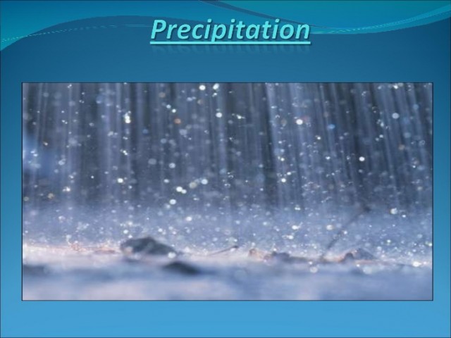
PRECIPITATION IS WATER falling from clouds. In the tropics, rain is the common form. In colder climates, precipitation also falls as snow, sleet, or hail, if the air temperature is 32 degrees F (0 degrees C) or less. Water's descent from clouds begins when the size of water droplets or ice crystals becomes large enough for gravity to pull them toward Earth's surface. Precipitation occurs because humid air rises, expands, and cools to form clouds with sufficient moisture to cause a storm. Precipitation will not occur unless there is ample water vapor in surface air, enough air rising from the surface, and sufficient condensation nuclei.
Water vapor is the source of precipitation and bearer of energy that drives storms. The bulk of this vital gas enters the atmosphere when solar energy heats and evaporates surface water and when plants transpire water through leaves. The change of water from a liquid to a gas requires energy that resulting water vapor holds on to, storing it in air as latent heat of vaporization. Latent energy is nonsensible, meaning neither human skin nor a thermometer can detect it. However, this seemingly trivial energy converts to sensible heat when condensation takes place in clouds. As we shall see, this heat (heat of condensation) is the energy that gives birth to storms of all types, including hurricanes and tornadoes.
Condensation occurs because moist air rises, expands, and cools, diminishing the air's capacity to hold water vapor. Condensation starts when air temperature falls below the dew point (the temperature at which air is unable to hold all its water in vapor form). Water vapor collects (condenses) around tiny solid particles (condensation nuclei) to form visible water droplets. The tiny droplets are the beginnings of a cloud.
LIBERATED HEAT
A cloud grows as condensation liberates water vapor's latent energy as heat of condensation. The liberated heat keeps air inside the cloud warmer (and therefore less dense and lighter) than the surrounding air. The warm temperature buoys airlifting inside the cloud and continues condensation and heating by drawing more moisture-laden surface air into the cloud. The circular process of lifting, expansion, cooling, condensation, heat release, and more lifting promotes precipitation. Precipitation stops when moist surface air stops lifting into the cloud.
The principal cause of precipitation is upward movement of moist air resulting from convective, frontal, orographic, and cyclonic (convergent) lifting. Each type of lifting produces a characteristic type of precipitation. Convective lifting starts when air over a hot surface warms, becomes lighter than the surrounding air, and rises. Cooler surface air then moves in over the hot surface, warms and lifts as well. Airlifting continues as long as surface heating warms air to a temperature that is higher than that of the surrounding air. Convectional precipitation occurs mainly in equatorial and tropical regions and in summer in middle latitudes. The hot summer afternoon thunderstorm, which generates heavy precipitation, thunder, and lightning, is precipitation of this type.
Frontal lifting occurs along boundaries between relatively cold and warm air masses. Meteorologists call these boundaries fronts. Lifting along fronts occurs mainly in the middle latitudes (about 35 degrees to 55 degrees) where polar and subtropical air masses typically meet. The physical basis of frontal lifting is that the cold polar air is denser and of a higher pressure than warm subtropical air, so that the cold air tends to hug Earth's surface and the warm air tends to lift relatively easy. Frontal lifting causes precipitation in two ways: (1) a wedge of cold surface air moves against adjoining warm (lightweight) air to form a cold front; and (2) a warm surface wind overtakes and ascends above the edge of a cold air mass to develop a warm front.
Orographic lifting takes place when a mountain barrier forces a warm, moist wind to rise. Precipitation takes place over the windward (upwind) side of a mountain, as the barrier forces the flowing air to rise, expand, and cool there. Precipitation ceases when the air descends the leeward side, as cooling by expansion ceases. Orographic lifting causes rain shadows (areas of scant precipitation) on leeward (downwind) sides of mountains if moisture-bearing winds come from only one direction during the year. The rain shadow effect is more obvious on western sides of continents in middle latitudes, where mountains block moisture-laden westerlies from oceans from entering leeward areas.
Cyclonic or convergent lifting describes airlifting in two types of storms—extratropical and tropical cyclones. The lifting results from widespread convergence of surface winds toward a low pressure. Moist winds converge in a circular pattern into the center of the low pressure where air is rising in a signature cyclonic spiral. In the Northern Hemisphere, the wind direction is counterclockwise and in the Southern Hemisphere, it is clockwise.
In an extratropical cyclone, the lifting trigger is a small meander in the polar front JET STREAM, a highspeed wind that flows above the front. The jet stream's meander forces upper air to descend and surface air to rise in close proximity. The two resulting surface fronts—cold front and warm front, respectively—join to form the low-pressure center. The storm grows as cold and warm surface winds converge from all directions toward the center. Meteorologists call this type of storm an extratropical cyclone (or middle latitude cyclone) to distinguish it from a low latitude tropical cyclone, which involves convective (not frontal) lifting.
The tropical cyclone forms over hot tropical oceans as prodigious amounts of heat and moisture transfer into the air. Precipitation begins as a disorganized cluster of relatively small convective thunderstorms. A low surface pressure center develops to centralize the inflow of energy into a rainy tropical depression. Moist air of converging winds lifts, cools, creates dark, moisture-laden clouds, and feeds a massive tropical storm. If wind speeds exceed 73 miles per hour (116 km per hour), the storm is officially a hurricane.
GEOGRAPHICAL DISTRIBUTION
The general occurrence of precipitation in the tropics conforms to latitude. The equatorial zone (roughly latitudes 0 degrees to 10 degrees) receives more precipitation than any other latitudinal zone on Earth; surface heating and convection brought on by the sun's direct rays is the lifting mechanism. The Intertropical Convergence Zone (ITCZ)—an area of convective lifting into which moist trade winds converge—dominates equatorial precipitation. The ITCZ shifts back and forth across the equator as it follows the seasonal path of the sun's most direct rays. The shifts bring precipitation to the equatorial zone all year.
On poleward edges of the ITCZ (about latitudes 10 degrees to 15 degrees), annual precipitation levels drop off rapidly, as convectional showers occur only in the summer. A dry winter is due to the invasion of highpressure air masses, whose source areas are the subtropics (about latitudes 20 degrees to 35 degrees). The subtropical highs result from descending air, which limits cloud formation. Consequently, the world's greatest deserts are located in subtropical latitudes. Major exceptions to dryness in the subtropics are in Southeast Asia and the Himalayas. In these areas, summer (convective) monsoon showers in combination with orographic lifting bring extremely high levels of precipitation to about 20 degrees N and 30 degrees N, respectively.
The middle latitudes (from about 30 degrees to 60 degrees ) have a more complex spatial pattern of precipitation than that of the tropics. Generally, coastal areas are more humid than interior areas, because of onshore flow of marine air. A major exception is severe summer dryness on west coasts between latitudes 30 degrees and 40 degrees. Subtropical high-pressure curbs airlifting there in the summer. In contrast, high amounts of precipitation on west coasts between latitudes 40 degrees to 60 degrees occur because of lifting by of the westerlies by frontal, cyclonic and orographic means. Mountain barriers contribute to rain shadow areas (giving rise to DESERTs) in interiors of North America and Asia. In Europe, open terrain allows westward moving extratropical cyclones greater access to the continental interior. The eastern section of continents in the middle latitudes tends to be humid, as precipitation comes from weather fronts and extratropical cyclones in fall, winter, and spring, and convective showers and weak cold fronts in summer. Tropical cyclones or their remnants add to precipitation totals in the eastern section in the summer and fall.
Cold, dry air masses dominate polar and arctic latitudes (from about 60 degrees to 90 degrees) all year. Precipitation amounts are comparable to those in subtropical deserts. Airlifting is ineffective in generating much precipitation because the region's low temperatures suppress evaporation levels. Cold air subsidence also lessens chances of precipitation occurring. Lower latitudes of this zone receive most of the precipitation, as occluded parts of extratropical cyclones brush the equatorward fringe the year round.