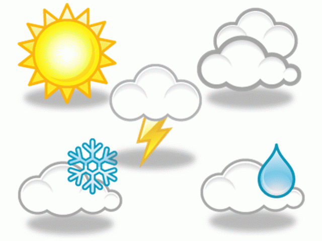
weather
THROUGHOUT HISTORY, humankind has always been in awe of the weather. Ancient civilizations considered it to be the work of the gods. Even as recently as the 1700s, it was thought that weather occurred in only one place and simply stayed put. Benjamin Franklin was one of the first who published his speculations that this was untrue when he learned that a storm he experienced in Philadelphia, PENNSYLVANIA, was followed by a suspiciously similar one in Boston, MASSACHUSETTS the next night.
In the years that followed, forecasts continued to be based on folk knowledge as well as emerging science, such as the observations of courageous balloonists who went aloft in search of approaching storms. With the progression of technology, instruments were sent aloft instead. Today, SATELLITES do much of the work of watching weather patterns. Weather information-sharing takes place on a global level. Many countries' weather forecasts incorporate data gathered by U.S. satellites, which are shared with the entire world—even during times of disagreement.
Weather plays a big part in our daily lives. It affects many of the things that we do, from the clothes we wear and the food we eat to where we live and how we travel. As a result, weather is of great interest to people everywhere, from meteorologists, the scientists who study it in great depth, to ordinary citizens pursuing everyday lives. A safe topic of polite conversation is always the weather, particularly in areas where the weather is changeable and unpredictable.
The cowboy philosopher Will Rogers once commented about the constantly changing weather in his native OKLAHOMA: “If you don't like the weather, wait ten minutes.” Such change is not exclusive to Oklahoma. Hawaiian rental car operators chuckle at the familiar site of newly arrived tourists driving away from the airport only to stop suddenly and jump out of the car to snap photos of a rainbow. The newcomers do not realize that Hawaii's weather can vary on opposite sides of the street—with sunshine on one curb and rain on the other, and lots of resulting rainbows.
WHY DOES WEATHER CHANGE?
We live and breathe in a blanket of air known as the atmosphere. The atmosphere is constantly moving and changing all around the Earth. In some locations, weather factors such as temperature change very little, such as in the mountains of Central America. There, high altitudes and proximity to the equator keep temperatures within a narrow range; 50 degrees F (10 degrees C) is regarded locally as quite chilly and 80 degrees F (26 degrees C) as extraordinarily hot.
In the darkest regions of deep space, the temperature is a frigid -450 degrees F (-267 degrees C). Closer to the sun, temperatures reach thousands of degrees. Yet on our planet, the temperature seldom drops below -50 degrees F (-45 degrees C) even on the North or South Pole. In the most arid areas, it rarely rises above 130 degrees F (54 degrees C). What makes Earth's climate so moderate? Separating Earth from the extremes of space is a 500-mi- (805-km-) thick blanket of gases, the atmosphere. Most planets have an atmosphere, a layer of gases that surrounds them. Jupiter and Saturn appear to be mostly atmosphere. Mercury has very little atmosphere since it is so close to the sun and its gases are burned away. Pluto appears to have very little atmosphere since it is so cold and the gases have frozen and accumulated on the surface of the planet. Our moon also has virtually no atmosphere. However, Mars does, as evidenced by the airborne dust that gives the planet its reddish hue. Its thin atmosphere does not protect it as well as Earth's, with resulting temperatures ranging from frigid at the Martian poles to a comfortable 80 degrees F (26 degrees C) at the equator. Scientists have monitored huge dust storms swirling on Mars. Evidence of erosion indicates that Mars once had rain and water runoff as well.
Jupiter has turbulent weather. What we can see of the planet are actually gas bands in the highest clouds of a thick atmosphere of hydrogen and helium. Traces of the other gases produce bright ribbons of color. Jupiter's most familiar feature is a swirling mass of clouds that are higher and cooler than the surrounding ones. Called the Great Red Spot, it is like a vast hurricane and is caused by tremendous winds that develop above the rapidly spinning planet. Winds blow counterclockwise around this disturbance at about 250 mi (402 km) per hour. In comparison, the most destructive hurricanes on Earth rarely generate winds over 180 mi (289 km) an hour. The Red Spot is twice the size of Earth and has been raging for at least 300 years. Our sun has an atmosphere, too, made up of hydrogen.
Earth's atmosphere is made up primarily of nitrogen and oxygen. Carbon dioxide, ozone, and other
gases are also present. These gases keep our planet warm and protect us from the direct effects of the sun's radiation. Without this protection, Earth could not sustain life.
Earth's atmosphere has layers: the troposphere, stratosphere, mesosphere, ionosphere, and exosphere. Closest to Earth is the troposphere. Most of the clouds in the sky are found in this layer. Extending up about 10 mi (16 km) above Earth's surface, the troposphere is primarily nitrogen and oxygen but also contains water vapor, carbon dioxide, methane, and nitrous oxide. These help retain heat, some of which is radiated back to warm the surface of the Earth.
Above the troposphere is the stratosphere, which includes the ozone layer. The stratosphere extends from about 10 to 30 mi (16 to 48 km) above the Earth. Ozone molecules, which are concentrated in this layer, absorb ultraviolet radiation from the sun and protect us from its harmful effects—making life as we know it possible. The coldest part of the atmosphere, the mesosphere, lies 30 to 50 mi (48 to 80 km) above the surface.
Above the mesosphere, in a layer called the ionosphere, things start to heat up. Temperatures there, about 50 to 180 mi (80 to 289 km) above the surface of Earth, can reach up to several thousand degrees. Beyond the ionosphere is the exosphere, which extends to roughly 500 mi (805 km) above the surface of Earth. This is the outermost layer of the atmosphere, the transition zone into space.
CLIMATE
The normal pattern of weather experienced in a particular area over a long period of time is known as the climate. The climate tells us how hot, cold, or wet it is likely to be in different parts of the world at different times of year. For example, tropical countries have hot climates and the Antarctic has a cold climate. In the mainland UNITED STATES, CANADA, and Europe, the climate is characterized by four seasons: winter (December through February), spring (March through May), summer (June through August) and autumn (September through November). However, it is not the same all over the world. The high plateaus of Central America's Republic of GUATEMALA experience only two seasons: the wet season, from May to October, and the dry season, from November to May.
In the South American nation of CHILE, winter is mild and rainy in the capital, Santiago, with temperatures ranging from 20 degrees F (-6 degrees C) to 50 degrees F (10 degrees C) and begins in June, spanning July and August. Spring is September through November, followed by summer in December, January and February. Autumn leaves fall in March, April, and May.
The island of Molokai in the Hawaiian chain experiences only two annual seasons. Kau is the fruitful season from May through September, when the sun is directly or almost directly overhead, the weather is warmer and drier, and the trade winds are constant. Hooilo is the season from October through April when the sun is in the south, the weather is cooler, and the trade winds are often interrupted by other winds.
The African country of UGANDA experiences four annual seasons, the first dry season, followed by the rainy season, then the second dry season, and the humid season. Seasonally, daily temperatures average within several degrees. The average high temperature is 80 degrees F (25 degrees C) from June to September, rising only to a daily average of 85 degrees F (27 degrees C) during the months of January and February. Uganda's first annual dry period lasts from January through February. The second dry season is from June through September.
However, even in the dry seasons, afternoon rain is common. During the rainy season, from March to May, the country's mostly dirt roads are impassable because of long periods of constant rain lasting for days. The fourth, humid season, during October and November, is sultry and hot.
THE SCIENCE OF WEATHER FORECASTING
Weather experts today use computer technology and data from stations and satellites all over the world to attempt to predict weather. By carefully monitoring conditions it is possible to forecast what will occur. However, conditions can change abruptly and without warning, frustrating even the most well-trained meteorologist. Computers have greatly improved the accuracy of such forecasting.
In 1904, the Norwegian hydrodynamist Vilhelm Bjerknes suggested that the weather could be accurately predicted by applying a set of hydrodynamic and thermodynamic equations to carefully analyze atmospheric states. However, 44 years passed before two technological developments made mathematical weather forecasting as suggested by Bjerknes possible. The first development was the establishment of a network of weather stations that measured upper-air conditions. The second was the arrival of the first electronic computers.
In 1948, a young meteorological theoretician, Jule Charney, succeeded in deriving simplified mathematical models of the atmosphere's motions, based on Bjerknes' work. The results were dramatic: air flow patterns over North America were accurately forecast 24 hours in advance with greater skill than ever before. With today's increasing number of satellites providing observations from the upper atmosphere as well as computers' increased computing power and speed, such forecasting has improved dramatically.
But it is not just scientists who predict the weather. Farmers and sailors have been doing it for years. As well as looking at the skies, they base their predictions on the behavior of animals, birds, and plants, watching for clues about what will happen next. One of the most reliable of all natural weather indicators are pinecones. These have traditionally been used to forecast the weather, because they change shape according to whether it is wet or dry. In dry weather, pinecones open out as the scales shrivel up and stand out stiffly. When it is damp, they absorb moisture, and as the scales become flexible again, the cone returns to its normal shape. There are a number of flowers that indicate what the weather will be like. The scarlet pimpernel's flowers open in sunny weather but close tightly when rain is expected. The petals of the morning glory act in a similar way—with wide-open blooms indicating fine weather and shut petals predicting rain and bad weather. This opening and closing also occurs with the South African magic carpet flower. In coastal areas, seaweed is often used as a natural weather forecaster. Kelp shrivels and feels dry in fine weather but swells and becomes damp if rain is in the air.
Animals are also frequently observed in age-old weather predictions. It is said that when cows lie down in a field, rain is on its way. This is explained by the fact that cows sense the moisture in the air and are making sure they have somewhere dry to lie down. Squirrels are often used to forecast the weather over the coming winter. If their tails are very bushy or they collect big stores of nuts in autumn, then a severe winter should be expected. Although little scientific evidence has been found to support this, weather forecasting is not always completely science-based.
Meteorologists in training, taught to rely on their own real-world observations as much as computers, are also told the story of a retired TV weatherman whose neighbors believed he could forecast the weather. What he didn't tell them was that he just repeated what he heard on the local TV broadcasts. One autumn, his neighbors asked him whether it would be a cold or mild winter. Having no idea, he said it would likely be cold and that everyone should stock up plenty of firewood. A few days later, he called up his successor at the TV station and asked what the winter would bring. “It is going to be a cold winter,” said the new meteorologist. So the retired broadcaster told his neighbors that, indeed, a cold winter was coming. With renewed vigor, they chopped or bought more firewood. A few days later, the retiree was watching the TV weather report and was startled when the meteorologist warned that there were increasing signs that a very harsh winter was ahead. So he passed the word along to his neighbors, who took his warning very seriously and began gathering even more firewood and stacking large stocks in their back yards in anticipation of heavy snows and difficult driving conditions.
A few days later, the retired weatherman decided to call his replacement at the TV station and ask why he believed a harsh winter was in the making. “Oh,” explained the meteorologist, “just look around you. People all over town are hoarding firewood like crazy.”
DO TRADITIONAL METHODS WORK?
The weather can affect the way we feel. When damp, cold weather is expected, some people experience aches and pains. Others say they can feel the onset of thunder. Household pets sometimes seem to sense storms before we are aware of them. Is there any scientific basis to substantiate the dependability of folklore? The old saying, “Evening red and morning grey, two sure signs of one fine day” is, believe it or not, quite dependable. Weather tends to move from west to east. A red sky in the evening often means the setting sun in the western sky is shining on clouds in the eastern part of the sky. Precipitation in the east will often move away since weather tends to move east. A gray morning sky as the sun rises in the east means the precipitation is already to the east of the area and will thus not move into the area. However, these signs are not foolproof. Storms do not always move west to east. Also, clouds are not always associated with approaching or exiting storm systems.
“A ring around the sun or moon means rain or snow coming soon” actually is accurate in cooler times of the year, when storm systems and fronts are more common. It is also applicable to tropical storms and hurricanes since there are thin, high clouds around the periphery of the storm system. As an upper-level air disturbance or a warm front approaches, the first clouds to arrive are high in the sky. The ring around the sun or moon is caused by ice crystals within such clouds. The refraction causes light to shine into a ring. However, this method is not foolproof, since wispy cirrus clouds not associated with a storm system will produce a ring as well.
One of the oldest sources of weather prediction in the United States is the Old Farmer's Almanac, an annual publication filled with advice for the self-sufficient. The Almanac claims an 80 percent success rate in forecasting the weather—18 months ahead. How? “For years, readers have asked us how the Almanac does it,” wrote spokesperson Janice Stillman in an editorial note: “First, we don't divine the weather by counting onion layers, measuring woolly-bear bands, or tabulating the acorns that squirrels sock away—although such phenomena may well be indicators of upcoming weather. Neither do we guess.”
Instead, she wrote, the Almanac's methodology is scientific, state of the art, and based on a secret formula devised by Almanac founder Robert B. Thomas around 1792. That formula is “locked in a black box here in Dublin, New Hampshire, and shall not be divulged in my lifetime,” wrote Stillman. Thomas believed that solar magnetic storms influence Earth weather. “He didn't originate the idea,” she wrote, “it evolved after Galileo first noted sunspots in 1610.” She went on to assert that the notion that solar events could affect our weather might have been dismissed by the meteorological and academic community for years, but “more recently, the idea has been receiving serious consideration.”
THE TROPOSHPERE
All the Earth's weather takes place in the lowest part of the atmosphere, the troposphere, which is affected strongly by the sun. It is the troposphere that contains most of our atmosphere's water vapor. Without water there would be no clouds, rain, snow, or other weather features. The air in the troposphere is constantly moving. As a result, aircraft flying through this layer can give passengers a very bumpy ride—as planes are bounced around by what airline pilots casually warn the passengers will be “a bit of turbulence up ahead.” Because of this turbulence, most jet airlines fly in the stratosphere. There, up above the clouds, the air is clear and much more still.
The various layers of our atmosphere press down on the Earth's surface, exerting a force called atmospheric pressure or air pressure. This varies constantly based on the temperature of the air. Cool air is denser and heavier than warm air. Cool air will sink. Warm air is lighter than cool air and will rise. All air has weight, regardless of its temperature. One reason is that the air is filled with varying degrees of water vapor. If you live in the United States, there are 40 trillion gallons (151 trillion liters) of water above your head on an average day.
Each day, about 4 trillion gallons (15 trillion liters) of this water fall to Earth as precipitation, such as rain, snow or hail. Some of the water that falls to Earth soaks into the ground and provides runoff to rivers, lakes, and oceans. The remainder—more than 2.5 trillion gallons (9.4 trillion liters)—returns to the atmosphere through evaporation, and the process begins again.
Of the 326 million cubic mi (525 million cubic km) of water on our planet, 3,100 cubic mi (4,991 cubic km) are found in the atmosphere. As water evaporates from the oceans, it enters the atmosphere and collects on small particles in the air as droplets or ice (a process called condensation) and forms clouds. When enough water or ice collects in a cloud, it rains. If the temperature is low enough, it snows. There are many kinds of clouds. Each signals a different kind of weather. Cirrus clouds, for example, are high up in the troposphere. Winds in the upper troposphere make these clouds look wispy and thin. Though they are composed of ice, they are usually associated with pleasant weather. Stratus clouds, which form in lower parts of the troposphere, consist of water droplets and cover most of the sky with an even, gray color similar to a fog. These clouds (as well as some cumulus, nimbostratus, and other cloud types) can signal light rain. Cumulonimbus clouds are tall, dense clouds shaped like a block or anvil. They signal thunderstorms and also spawn tornadoes, as well as other violent weather effects such as hail and lightning.
The continuous process of precipitation and evaporation is called the water cycle, or hydrologic cycle. It's been going on ever since oceans were formed on this planet. In the atmosphere, rivers, oceans, groundwater, and elsewhere on Earth there are an estimated 525 cubic km (326 million cubic mi) of water. Less than 1 percent of that water is present in rivers, lakes, and groundwater: we use these sources for our drinking water. Most of it, 97 percent, is in the oceans. The oceans distribute heat around the planet, keeping heat and cold circulating by way of surface currents.
Air currents occur when areas of high pressure are created. That happens when cool air sinks and presses on the ground. In areas experiencing high pressure, the weather is usually dry and clear. In contrast, when warm air rises, it causes an area of low pressure. In areas of low pressure, the weather is often wet and cloudy. When air rises or sinks, another result is wind. Air moves from areas of high pressure to areas of low pressure, and this produces currents as the atmosphere flows from one area to another—wind.
Each day's conditions are influenced by these high and low pressure zones, caused by air temperature. The temperatures are caused by the area's position on this planet and the angle at which the sun's rays hit. It is the sunlight that heats the air, causing the high and low pressure conditions and the resulting air flow as the atmosphere's gases rise and sink.
The angle at which the sun hits each location on Earth changes because the Earth is tilted at an angle on its axis. As the Earth moves around the sun during the year, different parts of the Earth are tilted towards the sun at different times. In the Northern Hemisphere, when the North Pole tilts away from the sun, the sun is low in the sky and days are short, bringing winter. When the North Pole tilts toward the sun though, more light and heat reaches the Northern Hemisphere. The sun is high in the sky and days are long. This change brings summer.
Two main features combine to create most of our daily weather changes: the sun and moisture in the air. Together, these two are responsible for clouds, rain, thunderstorms, and winds. Without the sun there would be no weather. Sunlight is the energy that powers the world's weather systems.
By warming the air above the Earth, the atmosphere is kept in constant motion, creating weather features such as wind, rain, snow, hail and thunder, as well as sunshine itself.
EXPERT PROGNOSTICATIONS
Today, powerful computer systems used by the U.S. National Weather Service combine data from radar, satellite images, computer models, high-tech weather balloons, and hourly observations from virtually every airport in the country, as well as measurements taken by commercial jets as they fly about. The computer then puts all this data in the hands of forecasters. That data is combined with old-fashioned human ingenuity and occasional gut instinct to make predictions. But the reality is that today's forecasts, while more accurate than ever, can dazzle with precision one day, then be totally off the mark the next.
Despite science's advancements in storm prediction, errors still occur. It is said that little can be certain about the weather. Actually one thing is certain: Weather is constantly changing and there remains a high degree of uncertainty in all weather predicting. Each weather system requires a slightly and sometimes drastically different approach.