Oregon
OREGON IS A STATE located on the west coast of the UNITED STATES and has a landscape for just about everyone: mountains; FORESTS; plains; DESERTS; the Columbia River Gorge; waterfalls such as Multnomah Falls (620 ft or 189 m), the tallest in Oregon and the fourthtallest in the country; Mills End Park, the smallest park in the world at 24 in (61 cm) across; and Hells Canyon, the deepest gorge in North America.
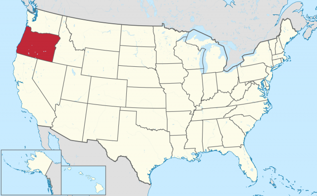
Oregon, bordered by CALIFORNIA and NEVADA to the south, WASHINGTON to the north, and IDAHO to the east, has an area of 97,073 square mi (251,419 square km). Its population is 3,521,515, the capital is Salem, and the highest point is Mount Hood at 11,239 ft (3,428 m). The lowest point is sea level at 0 m. Eight regions divide Oregon: the Coast Range, Willamette Valley, Cascade Mountains, Klamath Mountains, Great Basin, Blue Mountains, Columbia Plateau, and Snake River.
The PACIFIC OCEAN and Willamette Valley border the Coast Range. The highest point is Mary's Peak, which is still lower than many Cascade Range passes. The rolling hills force the ocean winds through the narrow strip of land between the range and the ocean. The Coast Range also acts as a wind and moisture barrier to regions east of the range. Many coastal lakes dot the landscape, which consists primarily of sandstone and shale.
Oregon's largest cities, including Portland (529,121 people) and Salem (136,924), are located in the Willamette Valley, east of the Coast Range and west of the Cascade Range. The Willamette River travels north through the valley to the Columbia River, where Portland serves as a major ocean port. Westerly winds moderate the climate, and the year-round precipitation is responsible for the lush forests.
The Cascade Plateau is a mountainous strip east of the Willamette Valley, running from the Columbia River to the California border, and is the recreational jewel of the state, including the Columbia River Gorge, waterfalls, much of the Oregon forest, and volcanic formations, including Mt. Hood and the famous Crater Lake.
The Coast and Cascade mountain ranges border the Klamath Mountains in the southwest corner of the state. The Rogue and Klamath rivers are among many that dissect this primarily conserved area, home to the richest mineral deposits in the state. In addition to the regional lumber and dairy industries, the Oregon National Cave Monument makes this region popular among tourists and the nearby residents. The area is generally moderate in climate, except for the Rogue River valley, which varies from -10 to 110 F (-23 to 43 degrees C).
The Great Basin (30,000 square mi or 48,270 square km) covers most of the southeastern corner of Oregon with the topography continuing into California and Nevada. The Cascade Range to the west cuts off this high desert from eastward winds. Although sparsely populated, some small towns persist, mainly by ranching, but manufacturing and telecommunications, as well as new work on the geothermal potential of the area have kept the towns from diminishing.
North of the Great Basin, the Blue Mountain area is primarily comprised of lava plateaus and several higher mountain ranges, which drain rainwater to the Columbia River. Outdoor recreation, along with some cattle grazing, is the main activity of the region.
Wedged in north and east of the Great Basin, and west of the Cascade Range, the Columbia Plateau is what remains after lava flowed from cracks all over the region, and erosion began forming deep canyons and irregular, mountainous “plateaus.” Wheat ranches are a main staple of the area, and several cities and towns sprinkle the region.
Finally, the Snake River region occupies a strip of land along the eastern border of Oregon. The Snake River and Hells Canyon, which descends in some places to a depth of 7,900 ft (2,400 m), dominate the region. Hydroelectric power from the three dams on the Snake River is one of the key economic resources of the area. From border to border, the landscape's diversity finally inspired the travelers on the Oregon Trail to make a home.