A Collision of Continents
This collision of continents created the topography of the western United States and Mexico. Initially, the collision built up the Sierra Nevadas, pasted California and parts of Washington and Oregon onto the western edge of North America, and isolated the terrain that would one day become the deserts of North America behind this rain-stealing rampart of rising granite. Later, the forces driving this collision from deep beneath the surface shifted, causing the Pacific plate to start sliding north toward the North American plate. The resulting shearing force fractured the surface of Earth, creating the San Andreas Fault, which runs from the Gulf of California up to San Francisco. Now the two plates moved past one another at about the speed fingernails grow. This titanic, ongoing movement created the modern landscape of the American Southwest. These forces stretched and pulled the surface, which created a whole series of north-south mountain ranges, separated by low basins. This basin and range topography runs throughout the four deserts of North America, including the Mojave.
After this continental stretching and sinking created the basic pattern of the southwestern landscape, periods of uplift took place. By the time they had finished, the shifts had created the differences in elevation that distinguish the four great American deserts.
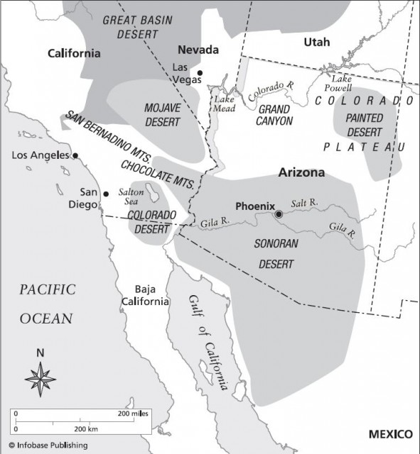
About 20 million years ago, due to changing plate motions out west, a great slab of what would one day become the western United States began a rapid rise. The uplifting continues to this day in a huge area centered on the Four Corners region where Utah, Arizona, Colorado, and New Mexico meet. The rising Colorado Plateau is a sprawling region just west and south of the Rocky Mountains. As it rose, the Colorado River cut the Grand Canyon from its leading edge as it ran its long course down toward the Gulf of California. Along its course farther south, it largely defines the boundary between the Mojave and the Sonoran deserts.
Some 2 million years ago, another period of uplift separated the Mojave Desert from the much larger and lusher Sonoran Desert. This shift made the Mojave Desert transitional between the lower, largely snowfree, summer monsoon–graced Sonoran Desert and the high, cold, desolate Great Basin Desert.
This sequence of geologic events created a landscape of dramatic extremes in the Mojave Desert. The Mojave's dry, hot summers and sometimes frost-prone winters exclude many of the desert-adapted species of the Sonoran Desert, like the distinctive saguaro cactus. Instead, the world's largest yucca, the Joshua tree, serves as the signature plant of the Mojave Desert.
Two national monuments capture those extremes: Death Valley and Joshua Tree National Monument.
- Mojave Desert: California, Arizona
- A Massacre That Shocked the Nation
- A Fragile Desert at the Mercy of Human Beings
- Gila River: Plight of the Desert
- Buenos Aires: The Grassland Boundary
- The Lethal Secret of the Lost Dutchman
- Flowers Blossom in the Desert
- Superstition Mountains and the Legend of the Lost Dutchman
- Casa Malpais: Death by Religious Warfare?