Saint Kitts and Nevis
Area 102 square mi (261 square km)
Population 54,940 2014
Capital Basseterre
Highest Point 3,815 ft (1,156 m)
Lowest Point 0 m
GDP $852.2 million 2014
Primary Natural Resources arable land, sugarcane, rice, yams, vegetables.
THE FEDERATION OF SAINT KITTS and Nevis together form one of the newest nations in the Western Hemisphere. Formerly part of the British Leeward Islands Colony, the islands achieved independence in 1983, but retain the British monarch as their sovereign and strong links with other Commonwealth nations. Saint Kitts is the larger of the two islands, separated from Nevis by a 2-mi (3-km) channel called the Narrows. The island of ANGUILLA, roughly 55 mi (90 km) to the north, was formerly administered as a dependency of the colony, but its residents chose to remain a British dependency rather than join Saint Kitts and Nevis in independence. The people of Anguilla are not alone in the defense of their local identity, however, and calls for independence on Nevis itself were only recently defeated in a referendum of 1998. The islands have a distinctive feel from each other, with Saint Kitts being more urban, and Nevis (with only 9,000 people) retaining a quieter atmosphere.
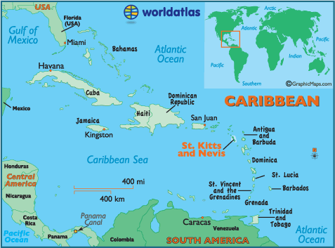
The islands are located south of Sint Eustatius (NETHERLANDS ANTILLES), west of ANTIGUA AND BARBUDA, and north of MONTSERRAT. They were discovered by Christopher Columbus in 1493 and named for his patron saint (Saint Christopher, which became known to locals as Saint Kitts) and Santa Maria de la Nieves, for the clouds atop the smaller island, which appeared at first to be snow (“nieves”). Evidence of pre-Columbian settlements remain, but the islands' native inhabitants were wiped out by European disease and conflict by the 18th century. Saint Kitts was the first British colony in the West Indies (1623) but was initially settled by both British and French planters. The islands were contested for nearly a century before being ceded formally to Great Britain in 1713, becoming the jewels in Britain's West Indian crown.
Like most European possessions in the Caribbean, the sugar industry dominated the islands for the next four centuries and remains the main crop today, though tourism has become a larger business since the 1970s, along with some manufacturing and offshore banking. A new deepwater cruise ship berth has been built in Basseterre, promising even further development in this sector.
The islands are part of the inner arc of the Antilles island chain, which were formed by much later volcanic activity and are therefore higher and wetter than their neighbors to the east (notably Antigua). Both Saint Kitts and Nevis are fairly mountainous, consisting of a chain running the length of both islands, reaching heights of 3,815 ft (1,156 m). Mount Liamuiga (which is Carib for “fertile land”) is a dormant volcano but potentially active. Saint Kitts extends into an elongated peninsula at its southern end (called “the baseball bat”), creating almost a third island, formed around Saint Anthony's Peak (1,053 ft or 319 m).
This southern point is also dominated by the Great Salt Pond and some of the island's best beaches. Nevis is nearly circular and also has good beaches on all sides. The islands are about 17 percent forested. The islands are well within the dangerous hurricane belt, and suffered tremendous damage to its ports and beaches as recent as Hurricane Luis in 1995. Volcanoes, earthquakes and hurricanes have all affected the settlement of the islands. The main town is Basseterre, on the southwest coast of Saint Kitts, and it is relatively large by West Indian standards (15,000 in 1998). Charlestown, the main town on Nevis, is much smaller and much older than Basseterre and is one of the best preserved old towns in the Caribbean. Together, these two islands have attained one of the highest per capita income rates in the region.