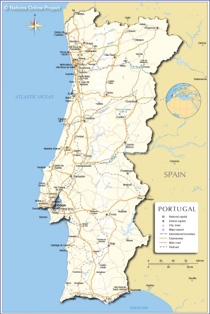
Portugal
Area 35,672 square mi (92,391 square km)
Population 10.40 million 2014
Capital Lisbon
Highest Point Pico 7,713 ft (2,351 m)
Lowest Point 0 m
GDP $229.6 billion 2014
Primary Natural Resources forests, cork, marble, fisheries.
THE PORTUGUESE REPUBLIC is located in southwestern Europe, sharing the Iberian Peninsula with SPAIN, which it borders to the north and east. To the west and south it borders the ATLANTIC OCEAN. Portugal is a parliamentary democracy. The prime minister leads the government and the president is the chief of state. The capital and largest city is LISBON (Lisboa).
The country is organized in 18 districts in the mainland and two Autonomous Regions, the archipelagos of Madeira and AZORES (Acores), located in the North Atlantic Ocean. The state is highly centralized, with only the autonomous regions enjoying a high degree of self-governance. Recently, a more geographic division comprising 5 major regions and 28 minor ones was designed and utilized for statistical purposes.
The area that became the country of Portugal has had a varied human presence since prehistoric times, in part because of its position as the crossroads between the MEDITERRANEAN SEA and northern Europe and the fact that several natural harbors existed along the coast. Settlers included Phoenicians, Carthaginians, Lusitanians, Romans, Suevi, and Visigoths, among others. Roman and Muslim influences endured, especially in the south of Portugal. The country's name seems to have originated from the Roman designation of the area around Porto as Portus Cale (Port of Cale). Muslims from North Africa invaded the peninsula in 711 C.E., sparking a crusade effort by Christians that originated several kingdoms and feudal holdings in the area.
In 1143, Afonso Henriques (Afonso I) obtained independence from the kingdom of Castile and Leon and became the first king of Portugal, then confined to the area between the Douro and Minho rivers. He proceeded with the reconquest from the Moors southward, seizing Lisbon in 1147, and the coast of Algarve was reached in 1250. The Portuguese borders have remained almost unchanged since 1297.
Cornered in one extreme of Europe and motivated by the will to find a sea route to coveted Asian goods while spreading Christianity, Portugal turned to the sea from the beginning of the 15th century. It first occupied the stronghold of Ceuta (1415), then discovered Madeira (1419), and, supported by the vision of Prince Henry the Navigator, launched the Age of Discoveries that would allow the European expansion into new worlds and shift commerce to the Atlantic.
Portuguese mariners sailed south along the African coast on the way to INDIA and in 1500 claimed the lands that became BRAZIL. The country obtained great economic, political, and cultural influence during the 15th and 16th centuries, culminating its expansionist period with colonies in Africa, Asia, and South America.
In the 1600s and 1700s, Portugal faced increasing competition from other European nations, and lost much of its power with the Napoleonic wars and the independence of Brazil (1822).
After deposing the monarchy in 1910, the country experienced an unstable and short-lived republicanism. In 1926, a military coup initiated a long period of repressive fascist dictatorship, during which the country stagnated and grew more isolated from the world, leading many Portuguese to emigrate. Portugal lost the colony of Goa to India in 1961, and a war for independence erupted in the African province of ANGOLA, soon spreading to the colonies of MOZAMBIQUE and GUINEA-BISSAU.
In 1974, a peaceful military-led revolution reinstated democracy, and the following year Portugal granted independence to its five African possessions, triggering the return of many Portuguese settlers and an influx of immigrants. In 1999, the country's imperial age would finally come to a close, when Macao, the last colonial holding, was returned to China. As if to seal its return to the European boundaries, Portugal became a member of the EUROPEAN UNION in 1986 and was in the first group of countries adopting the euro as official currency in 2002.
LAND AND RESOURCES
Despite its modest dimensions (roughly 342 by 124 mi or 550 by 200 km), mainland Portugal displays surprising physical diversity. The territory is situated on the edge of the Mediterranean basin, bordering the Atlantic Ocean, in the Subtropical Zone of the Northern Hemisphere. This transition area experiences both Atlantic and Mediterranean influences with expression in the climate and in the vegetation. Differences result mainly from the combination of latitude, elevation, and distance to the large Atlantic Ocean, as demonstrated by the complex plant cover. The main limiting factor of the natural vegetation is the irregular precipitation on account of latitude, and botanical domains have organized mostly from north to south.
The climate is maritime temperate (cool, rainy) in the northwest and markedly Mediterranean (warmer, drier) in the south. The northeast suffers similar hot and dry summers but has colder winters. On an average year, Porto receives 50 in (128 cm) of rain, and Lisbon 31 in (78 cm), with some areas in the southeast receiving less than 12 in (30 cm). A few mountainous areas get limited amounts of snow. The main climatic features of Portugal are summer drought and the irregular precipitation, with sequences of dry and wet years alternating frequently. Along the west seaboard, a steady wind blows from the northwest on typical summer afternoons, in response to a pronounced coastal upwelling effect. This process keeps the sea water cool year-round.
In Portugal, the natural conditions also combined with a long human presence to produce diverse landscapes, where native and many introduced plant species coexist. The former provincial division has some geographical meaning and is still used to designate the different regions.
Mainland Portugal sits mostly to the west of the large platform that dominates the center of the Peninsula, called Meseta. The area suffered major tectonic activity during the Miocene era: It was more intense in the north, where the main mountain ranges are found. This activity also originated the Central Range, rising from the southwest to the northeast and culminating in the Serra da Estrela, with the highest elevation of peninsular Portugal (6,539 ft or 1,993 m). The rivers flowing to the west from the interior of the peninsula have cut deep valleys through the western mountains on their way to the ocean. Main rivers, including the Tagus (Tejo), Douro, Minho, and Guadiana, have their sources in Spain and are heavily dammed, generating some dispute for the water between the two countries.
To the south of this core of older rocks, the basins of the rivers Tagus and Sado filled with sediments during the tertiary Era. Two platforms, starting to form 200 million years ago, spread to the west of the Central Range and along the southern coast of Algarve.
The Portuguese coastline stretches for about 517 mi (832 km). The coast is generally straight and sandy north of Peniche, interrupted by a few rocky capes. In some places it is indented by river estuaries and shallow saltwater lagoons. The broad estuaries of the Tagus and Sado provide good natural harbors, utilized as such since ancient times. The southwest has rocky shores interrupted by sandy beaches.
The Central Range is usually considered the main division between the mountainous north and the south, characterized by rolling plains and a few scattered small ranges.
In the northwest region of Minho, the ranges of granite mountains facing the ocean receive more than 79 in (200 cm) yearly and are the source of the rivers Lima, Cavado, and Ave. The flat coastal areas and river valleys are intensively cultivated, typically with corn fields or pastures surrounded by vines, and dairy farms are common. This green region has the highest population density of Portugal, with numerous villages and houses dispersed along the roads.
RAIN SHADOW
East of the mountains and experiencing a rain shadow effect, the drier northeast is basically a series of plateaus interrupted by valleys. Some of the broader ones are rich agricultural areas, as in Chaves and Vilarica. Isolated villages are surrounded by orchards, vineyards, and grain fields.
In part due to the pronounced summer drought, this region of Tras-os-Montes displays some similarities to the south of the country, with cork oak trees dotting the wide landscapes. Marking the oriental border with Spain, the Douro River runs for 62 mi (100 km) inside a rocky canyon before entering the deep, large valley, where port wine has been made since the 1700s. For thousands of acres on both sides of the river, the slopes were terraced by human hand to sustain the vineyards, in an endeavor of daunting proportions.
South of the Douro, the central region of Portugal is mostly mountainous, with forests covering the lower slopes and sheep and goats grazing at higher elevations. These mountains are the source of important water courses, such as the Zezere and the Mondego, the latter is the longest river whose source is in Portugal.
People have initially settled along these river valleys, and some towns in the interior regions of Beira Baixa and Beira Alta are still walled or protected by castles, attesting the wars once opposing Iberian kingdoms. In the Beira Litoral, closer to the ocean, crops occupy the flat lower river valleys, and forests of pine trees now cover ancient coastal dunes.
ESTREMADURA
In the hilly region of Estremadura, north of Lisbon, the varied agriculture includes grain, orchards, vineyards, and vegetables to supply the metro area. To the west of the capital city, the humid Serra de Sintra stands out as an island of lush vegetation protected by old palaces and fortresses. South of the 621-mi- (1,000-km-) long Tagus River spreads the savannalike landscape (called montado) of the Alentejo, where wheat fields or cattle pastures are punctuated by cork oak trees. The declining population concentrates in settlements of low white houses. Part of the wild coast, with small beaches between rocky cliffs, is protected as a natural park.
The wooded mountains of the Serra de Monchique and Serra do Caldeirao separate the rolling plains from the southernmost region of Algarve. Here, the land slopes gently toward the calm ocean, with orchards and greenhouses for growing vegetables occupying the lower reaches. Along the coast, fishing gave way to tourism as the main activity, with villages becoming summer resorts and golf courses replacing cropland.
AZORES AND MADEIRA
The archipelagos of the Azores and Madeira have a volcanic origin and were both discovered and settled in the 1400s. The nine islands of the Azores occupy 896 square mi (2,322 sq km) and have 241,763 inhabitants (2001). The archipelago straddles the MID-ATLANTIC RIDGE and displays secondary forms of volcanism, such as geysers and fumaroles. The rainy climate and fertile soil allows for agricultural use and presence of lush vegetation cover.
Located 560 mi (900 km) southwest of Lisbon, off the coast of North Africa, the autonomous region of Madeira occupies 303 square mi (785 sq km) and has a population totaling 245,000 (2001). The archipelago includes the namesake island, as well as Porto Santo and two uninhabited group of islets, the Desertas and the Selvagens. The landscape of Madeira, the main island, is heavily eroded, with the mountainous interior revealing deep valleys amid jagged peaks. Fishing villages dot the rugged and rocky coast, almost devoid of sand. A rare and primitive type of forest dating from pre-glacial times occupies the intermediate elevations, giving way to pastures above that. A complex system of canals, called levadas, allows the watering of cereals and vegetables grown at lower elevations and on terraced slopes.
The climate is mild year-round with a mediterranean tone, enabling the presence of semi-tropical vegetation and production of sugarcane and bananas for export. Wine is also a hallmark product of the island, originating from the vineyards that cover the southern slopes. The area around Funchal, the main city, concentrates 70 percent of the population and the chief economic activities. The city is an important port of call for transatlantic cruises, and tourism is a major source of revenue. However, a long history of emigration still causes the population of Madeira to decrease.
Portugal has scarce natural resources, and is heavily dependent on imported fossil fuels. Hydropower accounts for 30 percent of the energetic needs, with the rest coming from coal-based power plants. Use of other renewable sources is slowly increasing. Mining included coal, gold, uranium, wolframite, and copper, but activity has been declining. The south has large reserves of copper and zinc still in exploitation, as well as marble quarries.
AGRICULTURE
The combination of poor soil and Mediterranean climate results unfavorable for intensive agriculture in Portugal. The soils tend to be rocky or sandy, with the exception of fertile alluvial plains, notably along the lower Tagus. Olives, vineyards, and orchards remain important permanent crops, despite the recent increase in irrigated agriculture. Agriculture, forestry and fishing employ 13 percent of the workforce and create 4% of the GDP. Main agricultural products include wine, tomatoes, corn, potatoes, wheat, olives and olive oil, fruits, grapes, beef, and dairy products. Animal production also includes hogs, sheep, and goats. Farms are generally small, but diverse types of land ownership have contributed to differences in farm structure.
Forests cover about one-third of Portugal, but wildfires are a recurrent hazard in the summer, due to drought caused by the mediterranean climate: 1,047,700 acres (424,000 hectares) burned in 2003, the worst year on record. Oak and chestnut trees characterize the north, while pine occupies in the north and center. Introduced for wood pulp production, the eucalyptus has rapidly expanded in the last 20 years. In the south, the cork oak has great economic importance, with Portugal being the leading world producer of this material. Natural shrubs also cover large areas, with mediterranean-type maquis dominating in the drier south.
Portugal has the largest EEZ (exclusive economic zone) of the European Union (617,775 square mi or 1,600,000 square km), but the sea is under-exploited. Commercial fishing is in decline, yet the Portuguese remain important consumers of seafood. Aveiro, Lisbon, Leixoes (Porto), and Peniche are major fishing ports.