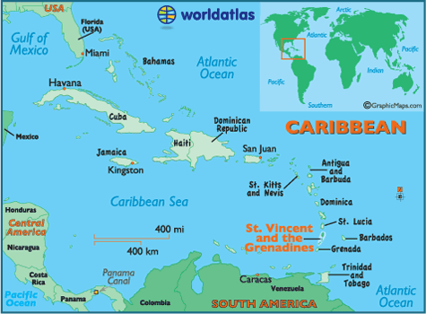
Saint Vincent and the Grenadines
Area 152 square mi (389 square km)
Population 109,400 2014
Capital Kingstown
Highest Point Soufriere 4,072 ft (1,234 m)
Lowest Point 0 m
GDP $729.3 million 2014
Primary Natural Resources hydropower, cropland.
THE COUNTRY OF Saint Vincent and the Grenadines is located in the Windward Islands section of the Antilles chain, between SAINT LUCIA and GRENADA in the CARIBBEAN SEA. Unlike its neighbors, the nation consists of more than just one main island; it has over 30 smaller islands and cays, known as the Grenadines (the southernmost of these are part of Grenada). Saint Vincent has one of the most potentially dangerous active volcanoes in the Caribbean, Soufriere, on the northern end of the island, which last erupted in 1979.
The main island was named by Christopher Columbus on Saint Vincent's feast day, January 22, 1498, while the smaller islands were named (like Grenada) for the kingdom of Granada in southern Spain, finally taken from the Moors by Columbus's patrons Ferdinand and Isabella in 1492. It consists of a chain of volcanic mountains running from north to south, surrounded by lowlands and valleys filled with fertile soil. The largest of the Grenadines are Bequia, Mustique, Canouan, Mayreau, and Union Island and are known mostly to yachtsmen and upmarket tourists from Europe. Mustique, for example, is privately owned and is home to luxury villas of royalty (the late Princess Margaret) and rock stars (Mick Jagger).
Like most of the islands in the Caribbean, colonial possession of Saint Vincent was disputed between Britain and France. It was held by Britain since 1783, but resistance to European settlement by native Caribs was stronger than on other islands. They were finally subdued by the British in 1797 and deported to the eastern coast of HONDURAS. Some later returned and were assigned to a reservation, where most native Caribs still live. Large-scale sugar plantations were introduced in the 19th century but fell into decline following a serious hurricane in 1898 and the Soufriere eruption of 1902 (within two days of the more devastating Mont Pelee on Martinique), destroying numerous plantations and killing about 1,600 people. The nation turned to cultivation of bananas as its main crop, and arrowroot, a plant used for starch and baby foods and now increasingly in demand for the production of computer paper. Saint Vincent is the world's largest producer of this crop.
Saint Vincent and the Grenadines became independent from the UNITED KINGDOM in 1979 but retains the British monarch as head of state, and remains a full member of the British Commonwealth. The capital, Kingstown, on the southern coast, is home to about a quarter of the population. About 8 percent of the population lives on the Grenadines. Attempts to follow the models of some of its neighbors in diversifying its economy through increased tourism and offshore financial services have met with limited success. The country's international reputation suffers from secrecy laws for its businesses (involving accusations of drug money laundering, and political bribery) and from its status as the largest grower of marijuana in the eastern Caribbean and as a transshipment point for South American illegal narcotics (mostly in the southern Grenadines). The country has the lowest per capita income of the Lesser Antilles.
Besides the continual threat of volcanic eruption (and accompanying earthquakes) and occasional drought, Saint Vincent frequently lies in the path of dangerous hurricanes: Allen destroyed most of the banana crop and almost all roads in 1980, while successive hurricanes in 1987, 1994, 1995, and 2002 continued to damage agricultural output. Tourism has the greatest potential for growth, thanks to mostly unspoiled and undiscovered coasts with green valleys and lush forests. Saint Vincent's rugged interior is also a potential source of hydroelectric power.