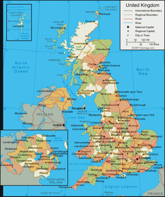
United Kingdom
Area 94,526 square mi (244,820 square km)
Population 64.51 million 2014
Capital London
Highest Point 4,406 ft (1,343 m)
Lowest Point -13.2 ft (-4 m)
GDP $2.989 trillion 2014
Primary Natural Resources coal, petroleum, natural gas.
THE UNITED Kingdom of Great Britain and Northern Ireland (UK) is the full name of a state in western Europe composed of England, Scotland, and Wales on the island of Great Britain, plus roughly one-sixth of the island of IRELAND. The United Kingdom is also sovereign over the crown dependencies of the Isle of Man and the Channel Islands, and 13 former colonies, now known as Overseas Territories, around the globe.
These dependencies are the remnants of the largest global empire the world has ever seen, which, at its height in the late 19th century, covered roughly a fourth of the Earth's surface and included roughly a fourth of the world's population. Today, the British Empire has transformed itself into the British Commonwealth of Nations, of which the United Kingdom and its monarchy is the symbolic head. The United Kingdom itself has been transformed into a modern European state, with one of the strongest economies in Europe. Closer membership within the EUROPEAN UNION (EU) is still an issue in today's Britain, however, as is the constitutional relationship of the United Kingdom's component parts.
NATIONS UNITED
As the name indicates, the United Kingdom is a state composed of more than one historic nation. The peoples of the island of Great Britain formed into several states in the early Middle Ages: the Germanic Angles and Saxons as England in the south, and the Celtic Scots and Welsh in the north and west. Wales was conquered by the English in 1284 and fully incorporated into the English legal and political structure by the Act of Union of 1536. Scotland defended its independence from the English for several centuries until 1603 when the Scottish king, James VI, inherited the English throne. One hundred years later, the parliaments of the two kingdoms merged by the Act of Union of 1707, and the Kingdom of Great Britain was formed.
Just to the west of Great Britain, the island of Ireland had its own language and culture, Celtic in origin, divided into four kingdoms. Starting in the 11th century, English kings began the conquest of Ireland, completed only in the 17th century. The Kingdom of Ireland was formally united to Great Britain in 1800, creating the United Kingdom of Great Britain and Ireland, which was modified to “and Northern Ireland” after the southern Irish counties became independent in 1922.
The six northern counties of Ireland with a Protestant majority chose to remain in the union, but decades later, tensions remain between those who wish to retain this position and those who wish to join the Republic of Ireland. Devolution is a prevalent word in UK constitutional politics, as the component parts of the union reconsider their position with relation to the central government in London. New parliaments and assemblies were opened in 1999 in Edinburgh, Cardiff, and Belfast. Several regional assemblies for England, particularly in the far north, are also under consideration. As the European Union exerts its influence more and more over the British Isles, it is thought that these local governing bodies may press for even more autonomy.
COLONIES ABROAD
Having limited natural resources, the British have relied on foreign trade since the Middle Ages. The growth of colonies abroad and the development of the INDUSTRIAL REVOLUTION at home stimulated tremendous economic growth in the 18th and 19th centuries. Following the heavy cost of two world wars and the Great Depression, the United Kingdom was forced to give up its empire, starting with INDIA and PAKISTAN in 1947. Today's British Commonwealth of Nations consists of 54 sovereign nations, some of which—like CANADA, AUSTRALIA, BAHAMAS, PAPUA NEW GUINEA, and TUVALU—retain the British monarch as head of state (16 in total), while others—such as India, NIGERIA, and FIJI—are republics. Still others are states with their own monarchs, such as MALAYSIA, TONGA, and LESOTHO.
The UK continues to control the foreign and defense affairs of 12 overseas territories: ANGUILLA, BERMUDA, the BRITISH INDIAN OCEAN TERRITORY, the British Virgin Islands, the CAYMAN ISLANDS, the FALKLAND ISLANDS, GIBRALTAR, MONTSERRAT, PITCAIRN ISLAND, ST. HELENA (and its dependencies, ASCENSION and Tristan da Cunha), SOUTH GEORGIA AND SOUTH SANDWICH ISLANDS, and the TURKS AND CAICOS ISLANDS. The Crown administers two other territories separately from the UK: the Isle of Man, located in the Irish Sea, between northern England and Ireland, and the Channel Islands (Jersey, Guernsey, and Alderney), located off the northwest coast of FRANCE.
Today, the UK has one of the world's five largest economies and is one of only four countries in western Europe whose gross domestic product (GDP) exceeds $1 trillion. It is one of the busiest trading hubs and a major center for international finance, encouraged by its geographical position between Europe and North America, and its enduring strong ties with the developed and developing nations of the Commonwealth. By one estimate, London's traders control roughly 30 percent of all global foreign exchange trading. The UK has a large agricultural sector, and an extremely efficient one, which means that only 1 percent of the country's labor force produces 60 percent of its food needs. Its largest crops are grains (wheat and barley), potatoes, and oilseed. Sheep and cattle are also ubiquitous in the British countryside, occupying about two-thirds of all agricultural land. The major export products of the UK include finished and semi-finished manufactured products, oil and natural gas, foodstuffs, chemicals, and motor vehicles.
Because of large reserves of North Sea oil, pumped since the 1970s, the UK is one of the EU's largest energy exporters, but it is also one of the world's largest energy consumers. Twenty-three percent of UK electricity is generated from nuclear power. There are projections of great potential for wave and tidal power, but this is so far unexplored. Coal mining and heavy industry have declined sharply since the mid-20th century, being replaced mostly by the service industry, particularly banking, insurance, and business services (nearly 75 percent of the GDP).
Tourism is also very important, catering to an average of 25 million visitors per year, though the business is suffering from increasingly inexpensive flights to sunnier climates of southern France and SPAIN. A large social welfare system built up in the aftermath of World War II has been partially dismantled in recent decades. Similarly, most state-owned companies, such as British Airways and British Telecom, have been privatized, although the government retains a large percentage of shares. Britain joined the European Union in 1973, but has been reluctant to go “all the way” and remains outside the common currency and some of the EU's common social and economic policies.
In general geographic terms, the United Kingdom is mainly composed of the island of Great Britain, one of the British Isles, which generally also include Ireland and the surrounding island groups of the Hebrides, the Shetlands, the Orkneys, the Isle of Man and the Isle of Wight. “Little Britain” refers to Brittany, across the English Channel in France. The term Britain is frequently used to refer to the UK, and the term British refers to its people.
The island of Great Britain is just under 620 mi (1,000 km) in length, from Dunnet Head on the north coast of Scotland to Lizard Point in Cornwall, and just under 300 mi (500 km) across its widest point from Wales to East Anglia.
Because Britain is an island, its history and culture have been heavily influenced by the sea. The UK has a total coastline of 7,706 mi (12,429 km), and with numerous inlets and estuaries on all sides, no location is more than 78 mi (125 km) from the sea. Besides its frontier with the Republic of Ireland, the UK shares no other land borders. Its nearest neighbors—France, BELGIUM, NETHERLANDS, and NORWAY—lie across the North Sea and the English Channel. Since 1994, Britain has been connected to the mainland for the first time since the last Ice Age, via the Channel Tunnel.
The seas also affect the British climate, which is warmer than other countries of the world that are located at the same latitudes (London and Irkutsk, SIBERIA, for example, are both between 51 and 52 degrees N). The warm waters of the GULF STREAM bring warmer temperatures and a great deal of moisture from the tropics, particularly on Britain's western coasts.
Weather in the UK is unpredictable but has few extremes of temperature, rarely surpassing either 86 degrees F (30 degrees C) or 14 degrees F (-10 degrees C). On average, cloud cover and rain can be expected for 50 percent of the year in most locations. Highest rainfalls occur in the higher elevations on the western coast, including the Lake District and the Scottish Highlands, as well as the uplands of southern Wales, Devon and Cornwall. Extreme conditions range from the Isle of Wight, with an average of more than 8.5 hours of sunlight per day in summer, to the Scottish Highlands, with an average of less than half an hour of sunlight per day in December.
London is famous for its fog, but it is the area of lowland Scotland, between the Clyde and the Forth, that generally has the most fog. The far north of Scotland has the least fog, because of high winds and less pollution. Fog in general has decreased significantly all over the UK, following the reductions in air pollution since the 1960s. Britain's air currents are dominated by the warm Gulf Stream along the western coast, and cold Arctic air along the east coast. Where these two contrasting patterns meet, along the north coast of Scotland, the weather is frequently turbulent in the extreme.
Most of the United Kingdom is composed of rolling hills, with higher mountains in the western and northern parts of Great Britain, and some areas of flatland in the eastern parts of England. The following are the four component states of the United Kingdom.
ENGLAND
In addition to having the largest area of the component states of the United Kingdom (50,854 square mi or 130,395 square km), England is by far the most populous. Its 49.5 million people comprise more than 80 percent of the total. England takes its name from the Germanic invaders of the 5th and 6th centuries, the Angles, though interestingly, the Celtic name for England (Sasana in Irish) derives from the other major invading group, the Saxons. The English population is thus made up of a mixture between the original Celtic inhabitants, Germanic and Nordic invaders, and later continental elements brought across the channel from France after the Norman conquest of 1066. And although Norman impact on the racial composition of the general English population was minimal, their dialect of French heavily influenced the creation of modern English. The resulting hybrid language is one of the most flexible languages in the world, lending itself well to its position as the leading international language in use today.
England is divided into a variety of regional, local and municipal governments, reflecting numerous changes, especially since World War II. Historically, England was divided into shires (counties). Thirty-four of these remain, with governing powers divided between county and district councils. More recent creations include six metropolitan county areas and 47 unitary authorities (unitary indicating a lack of division between county and district councils). England's historic shires and major unitary authorities (created in 1974 but redivided in the late 1990s, thanks in part to the Restore Rutland campaign) include:
- Avon (divided into four unitary authorities, or UAs)
- Bedfordshire
- Berkshire (divided into West Berkshire and five UAs)
- Buckinghamshire
- Cambridgeshire
- Cheshire
- Cleveland (now divided into five UAs)
- Cornwall (including the Isles of Scilly)
- Cumbria
- Derbyshire
- Devon
- Dorset
- Durham
- East Sussex
- Essex
- Gloucestershire
- Hampshire
- Herefordshire
- Hertfordshire
- Humberside (now divided into East Riding of
- Yorkshire and three other UAs)
- Isle of Wight
- Kent
- Lancashire
- Leicestershire
- Lincolnshire
- Norfolk
- Northamptonshire
- Northumberland
- North Yorkshire
- Nottinghamshire
- Oxfordshire
- Rutland
- Shropshire
- Somerset
- Staffordshire
- Suffolk
- Surrey
- Warwickshire
- West Sussex
- Wiltshire
- Worcestershire
The six metropolitan counties are Greater Manchester, Merseyside (around Liverpool), South Yorkshire (around Sheffield), Tyne and Wear (around Newcastle), West Midlands (around Birmingham) and West Yorkshire (around Leeds). Set apart from these, Greater London maintains its own regional government, made up of the Cities of London and Westminster, and 32 boroughs (occupying most of the former shire county of Middlesex).
Since 2000, the Greater London Authority, including a directly elected mayor and assembly, has sought to integrate the administration of the city and its suburbs. London is England's capital, as well as the capital of the United Kingdom. With 7.2 million people in its metropolitan area, it is Western Europe's largest city, and one of the top 20 metropolitan areas in the world. Home to a large percentage of Britain's West Indian and South Asian population, it is one of the most colorful and culturally diverse cities in the world. Famous attractions range from the medieval fortress the Tower of London and the stately pomp of Buckingham Palace to the boisterous international markets along Portobello Road and the annual Afro-Caribbean festivities of the Notting Hill Carnival.
More recently, England has been divided yet again, this time into nine regions: North East, North West, Yorkshire and the Humber, East Midlands, East of England, London, South East, and South West. These regions put English local governments on par with the regional governments forming in several other EU nations, such as Spain and France. As larger self-sustaining economic units, they are increasingly responsible for their own regional affairs, and discussions are currently under way regarding devolution of political autonomy to them as well, in the same manner as Scotland and Wales in 1999. The first region to hold a referendum on this question was the North East in late 2004.
England's physical geography can be roughly divided in two by a line called the Tees-Exe Line, which stretches from the mouth of the River Tees in the far northeast to the River Exe on the southwest coast. West of this line, the countryside is hilly, with several ranges of low peaks aligned in a generally north-south direction. East of the line, England is increasingly flat, until it reaches the fens and marshes of East Anglia. Much of the soil in this eastern coastal area is composed of newer, alluvial soil and is thus the richest agricultural region of the United Kingdom. Canals and pumps have drained and reclaimed much of the fenland since the early Middle Ages, particularly in the lowlands around the large inlet known as The Wash.
English rock formations west of the Tees-Exe line are generally igneous and metamorphic, while east of the line, they are sedimentary. Western geological formations are complex and in strangely folded patterns, especially in Cornwall and Devon. This is thought to have been caused by the creation of the ALPS, which pushed up many of the ridges and folds that make up Britain's hill systems. There are great varieties of rock types and irregular features caused by differing degrees of resistance to erosion, such as the large granite massifs in the North Yorkshire Moor and Dartmoor in Devon. The southeast coast is famous for its chalk cliffs, particularly around Dover, ancient seabeds now raised hundreds of meters in the air.
Glaciation during the last Ice Age carved out deep valleys in the Cumbrian Plateau, creating one of England's one scenic natural areas, the Lake Country, containing England's highest peaks (the Cumbrian Fells, including Scafell Pike, 3,227 ft or 978 m), as well as its only significant lakes (Derwent Water, Ullswater, and Windermere). The peaks of the Lake Country form the northern end of the long range of mountains known as Britain's “spine,” the Pennines, which also include the Peak District and the Yorkshire Dales. Further south are lower ridges: the Cotswolds, the Chilterns, and the North and South Downs.
England's main lowland valley is the Thames Valley, which flows for 150 mi (239 km) from the Cotswold Hills in the west past the most quintessentially English countryside and the historic cities of Oxford and London before entering the North Sea through the wide Thames estuary. Other major rivers include the Trent and the Great Ouse, which also flow toward the east. The only major river system to flow toward the west is the Severn, the UK's longest river (200 mi or 322 km), which rises in central Wales and empties into a large estuary, the Bristol Channel. The Trent and Northern Ouse together form the Humber Basin, the UK's largest drainage system, covering 9,750 square mi (25,000 square km) of east-central England. The Thames River and estuary drains 5,850 square mi (15,000 square km).
Almost all the rivers in England have been completely canalized—a network of English canals was completed just in time to become nearly obsolete by the invention of the locomotive. The earliest canals provided the cheap transportation of raw materials essential for the genesis of the Industrial Revolution in the British Midlands. Heavy industry was concentrated in the Midlands in the 19th century, creating almost overnight the cities of Birmingham, Manchester, Sheffield, and Leeds, today the UK's four largest cities after London. These cities were built in proximity to the coalbeds and to the thriving Atlantic ports of Liverpool and Bristol. Other large coal exporting cities were located on the eastern coast, notably Newcastle and Hull.
Older ports along the coast of the English Channel include Dover, Portsmouth, Southampton and Plymouth. Today England is still highly urbanized in some parts of the Midlands and the south, notably around greater London. Air and water pollution remains a problem in some of these areas, as well as oil pollution in some of the port cities. More seriously damaging, however, are acid rains that are carried north from England's industrial south that fall on the forested slopes of northern Wales and southwestern Scotland.
WALES
The name Wales is not Celtic, but a Germanic word meaning foreigners (similar to the names given to other non-German-speaking areas of Europe: Wallonia and Wallachia). The Welsh name for their country is Cymru, meaning “friends” or “countrymen.”
Out of a total population of just over 2.9 million, roughly 70 percent have no knowledge of Welsh and only about 5 percent use it as their primary language, mostly in rural areas of the far west. The Principality of Wales has been legally merged with England since the 16th century, but a majority of its people continued to speak Welsh until the 19th century. Welsh language schools were established in the 1980s, and the number of children learning Welsh is increasing each year, aided by a Welsh language television station and a Welsh language university at Aberystwyth. The title Prince of Wales has been given to the eldest son of the British monarch since the 14th century, but most Welshmen see little relevance to their history and culture (despite the elaborate ceremony staged at Caernarvon Castle in 1969), and the prince has no role in actual governance of the country. Wales is still primarily a land of light agriculture and herding, with some concentrations of heavy industry in the south.
Physically, Wales is almost entirely mountainous. The main range, known as the Cambrian Mountains, runs from north to south. To the northwest of the main range lie the mountains of Snowdonia, the only area showing evidence of volcanism, including the highest peak in Wales, Mount Snowdon (Yr Wyddfa), at 3,581 ft (1,085 m). The Cambrian Mountains, which derive their name from the same word as Cymru, are largely carboniferous and rich in coal. The southern valleys of Wales were heavily populated during the 19th century to mine and process this coal and have suffered greatly since the closure of a majority of the collieries in the 1980s.
An earthwork wall, Offa's Dyke, was built on the eastern edge of these mountains by an early Anglo-Saxon king to keep out the Britons living to the west. It was the earliest boundary between what were to develop into England and Wales. Today's border is formed in part by two of Wales's major rivers, the Wye in the south and the Dee in the north. The coastline of Wales is one of its primary natural attractions, including numerous rocky bays, peninsulas, and cliffs. Immediately off the northwest coast is the large island, Anglesey (“Island of the Angles”).
Wales was divided into historic counties (mostly decided by the English) and given a national capitol, Cardiff (Caerdydd), in 1955. Cardiff grew into a large city based on exports of coal in the 19th century, as did Wales's two other large cities, Swansea and Newport. About two-thirds of the population live in the southern valleys and coastal areas of South Wales.
Starting in 1974, Wales was divided into eight counties: Clwyd, Dyfed, Gwent, Gwynedd, Mid Glamorgan, Powys, South Glamorgan, and West Glamorgan). In 1996, Wales was redivided into 22 unitary authorities (similar to the English unitary authorities), including nine counties, 10 county boroughs, and five cities:
- Carmarthenshire (Gaerfyrddin)
- Ceredigion
- Conwy
- Denbighshire (Ddinbych)
- Flintshire (Fflint)
- Gwent (today divided into five UAs)
- Gwynedd
- Glamorganshire (Morgannwg, divided into six UAs)
- Isle of Anglesey (Ynys Mon)
- Monmouthshire (Fynwy)
- Pembrokeshire (Benfro)
- Powys
- Wrexham (Wrecsam)
Wales remains one of the least developed parts of the United Kingdom, with over 25 percent of the land designated as a National Park or Area of Outstanding Natural Beauty. Particularly attractive are the Brecon Beacons and the Pembrokeshire coast.
SCOTLAND
The Scottish kingdom was formed by the joining of several major lowland clans in the 9th and 10th centuries and the gradual absorption of the more independent-spirited Highland clans in the following centuries. Anglo-Norman influences from the south influenced the government, language, and culture of the Lowlands from the 12th century, leading to centuries of warfare over borders and Scottish independence. The Highland clans were not entirely subdued by the English (and indeed by the other Scots) until the middle of the 18th century, but the following century saw the rise of Scottish culture as one of the major fads in Victorian Britain.
Kilts and bagpipes and summer homes in the Highlands were seen as very fashionable in London society, aiding the Scots in their integration into the union as a whole—by the end of the 19th century a significant percentage of Britain's colonial administrators and military commanders came from Scotland. Today, Scotland retains its own sense of heritage—Scottish legal and educational systems differ significantly from the rest of Britain—and despite the devolution of a high degree of local autonomy with the restoration of the Scottish Parliament in 1999, calls for outright independence from the UK within the EU are louder here than anywhere else.
The 5 million people who live in Scotland comprise only 8.5 percent of the total UK population. Its land area of 30,725 square mi (78,782 square km) gives Scotland the lowest population density in the UK and one of the lowest in Europe. Three-quarters of the population live in the central Lowlands, where Scotland's two largest cities are located: Glasgow (577,000) and Edinburgh, the capital (448,000). Stirling is also a major city in the central Lowlands. Scotland's three other large cities are located in the Lowland areas along the eastern coast of Scotland: Aberdeen, Inverness, and Dundee.
Scotland, like England and Wales, was traditionally divided into shire counties, particularly in the Lowlands, where English language and culture predominated. In 1974, the country was divided politically into twelve regions: Borders, Dumfries and Galloway, Strathclyde, Lothian, Central, Fife, Tayside, Grampian, Highland, Western Isles, Orkney, and Shetland. Since the 1990s, these have been redivided into 32 Council Areas, many returning to the names of their former county shires:
- Aberdeenshire (and Aberdeen City)
- Angus (and Dundee City)
- Argyll & Bute
- Ayrshire (East, North, and South)
- Clackmannanshire
- Dumfries & Galloway
- Dunbartonshire (East and West, and Glasgow City)
- Eilean Siar (formerly known as Western Isles, or
- the Outer Hebrides)
- Falkirk
- Fife
- Highland
- Inverclyde
- Lanarkshire (North and South)
- Lothian (West, Mid, and East, and the City of
- Edinburgh)
- Moray
- Orkney Islands
- Perth & Kinross
- Renfrewshire (and East Renfrewshire)
- Scottish Borders
- Shetland Islands
- Stirling
The Highlands district is by far the largest of these districts, but the least populated. Its chief town is Fort Williams, in the shadow of Scotland's (and the UK's) tallest peak, Ben Nevis (4,406 ft or 1,343 m). The surrounding areas of Scotland have some of the oldest rocks in Europe. The Caledonian Highlands and the islands of the Hebrides are geologically related to GREENLAND and the CANADIAN SHIELD, to which they were joined nearly 200 million years ago. At that time, Scotland and North America were joined together, while England and Wales were joined to the European continent. The gap between them closed only around 20 million years ago. This tectonic activity also caused some volcanism in western Scotland, leaving behind basalt formations on some of the western isles, like Mull and Skye. Other islands included within the broader term of Inner Hebrides are Islay, Jura, Tiree, Coll, Eigg, Canna, and the famous monastic island of Iona.
Across the channel known as The Minch lie the Outer Hebrides, consisting mainly of the Isle of Lewis, North Uist, South Uist and Barra. The islands of Arran and Bute are also off the western coats, in the broad bay known as the Firth of Clyde. A firth is the Scots term for a bay or fjord, while loch is the Scots term for lake. Scotland's thousands of firths and lochs are the result of heavy glaciations during the last several periods of Ice Age. Many of the gouges cut by glaciers and now filled by lochs are quite deep, including the deepest lake in the UK, Loch Morar (1,023 ft or 310 m). Other lochs well known for their scenic beauty include Loch Fyne, Loch Shiel, and Loch Lomond. Loch Ness is one of the longest lochs and is famous for its mythical sea creature but is not particularly scenic.
Scotland has three major regions of mountains: the Highlands, the Grampians (including the Cairngorm Mountains) and the Southern Uplands, which include the Cheviot Hills, a dividing line between Scotland and England. Hadrian's Wall formally signified this border, running roughly from Solway Firth to Tynemouth. The wall was built by the Romans in 122 C.E. to keep out the Celtic barbarians of the north (similar to Offa's Dyke in Wales) and remains a chief tourist attraction for the region. The Highlands are full of glens, narrow valleys between mountain peaks, known as bens. One of the most famous of these is Glen Coe, known for its stark, barren landscape and for the massacre of most of its residents (the MacDonalds) by Clan Campbell in 1692. Visitors come to the Highlands, mostly in summer, for extraordinary hiking and natural solitude. Aside from tourism, the major economic activity of the Highlands is sheepherding and wool-related industries.
The Lowlands are mainly concentrated in a band across central Scotland, from the Clyde estuary to the Firth of Forth. This is the center of much of Scottish population, as well as much of its history and nearly all of its industry. This depression between the Highlands of the north and the Southern Uplands is possibly an ancient fault line. The same could be true for the long narrow valley that nearly bisects the Highlands, from the Firth of Lorn and the town of Fort William in the west to the city of Inverness and the Moray Firth in the east. This valley, known as Glen Mor (the “Great Glen”), includes Loch Ness and is navigable from end to end via the Caledonian Canal. The Forth & Clyde Canal similarly connects the west and east coasts in central Scotland.
Scotland's major rivers include the Clyde, the Tay and the Tweed, which forms part of the border with England. The River Tay has the second largest discharge of any river in the UK, after the Humber, at 5,648 cubic ft (160 cubic m) per second. Other rivers are the Ayr, the Don (which gives its name to Aberdeen), and two rivers called Dee.
Scotland's outer islands—the Hebrides, Shetlands, and Orkneys—have a bit more local authority than other local governments. For example, Shetland controls oil development in its own waters. The Orkneys consist of the Mainland and several smaller islands. Shetland (or Zetland) is similarly composed of the Mainland and several smaller islands, the northernmost called Unst, with Britain's northernmost post office, Haroldswick.
About 300 mi (480 km) northwest of the Hebrides, in the North Atlantic, rises the summit of an extinct volcano, about 83 ft (25 m) wide at its base and approximately 72 ft (22 m) tall. This is Rockall, which is currently claimed by the UK, mostly for the exclusive rights sovereignty would convey to the valuable seas around it. Its status is disputed with Ireland, DENMARK, and ICELAND, and it has also been symbolically claimed by the environmental activist group Greenpeace (which occupied the tiny rock for a short time in 1997, renaming it Waveland) as a protest against oil exploration.
NORTHERN IRELAND
The territory now known as Northern Ireland (Tuaisceart Eireann in Irish), was historically known as Ulster, one of the four historic provinces of Ireland. When the southern 26 counties of southern Ireland left the union in 1921, the northern six countries—mostly populated by Protestants—opted to remain a part of the United Kingdom. The six original counties (Antrim, Armagh, Down, Fermanagh, Tyrone, and Derry) have today been replaced by 26 District Council Areas (equivalent to unitary authorities in England and Wales). Belfast, population 274,000, is the capital and major city. Other cities include Derry, Armagh, Newry and Lisburn.
Northern Ireland occupies about one-sixth of the area of the island of Ireland, covering 5,399 square mi (13,843 square km) and sharing the UK's only land boundary with another member of the EU. Its 1.7 million people speak mostly English but also maintain a tradition of speaking the local dialects of Irish Gaelic and Ulster Scots (a dialect of English brought over by Scottish settlers in the 17th century). Belfast has a large Chinese immigrant population, making Chinese the second-largest language group after English.
Most of the population is divided religiously and politically between a Protestant majority who are mostly Unionist (favoring continued membership in the United Kingdom) and a Catholic minority who are mostly (but not entirely) nationalist (favoring union with the Republic of Ireland). Tensions emerging from this divide became violent between the 1960s and 1990s, the period known as “The Troubles,” and although quieter in the mid-2000s, the conflict has yet to be fully resolved.
The landscape of Northern Ireland consists mostly of low hills. There are two areas of low mountains: the Mournes, from South Down to Strangford Lough in the east, and the Sperrins in the northwest. The Mournes are granite massifs, with deposits of gold, and include the highest point in Northern Ireland (Slieve Donard, 2,798 ft or 848 m). The northeast, in Antrim, is also significantly hillier, the result of ancient volcanism that has left behind one of the most interesting geologic features in the United Kingdom, the Giant's Causeway.
These geometric pillars face the North Channel, which separates Ireland from Scotland at the nearest point by only 13 mi (21 km). Much of the center and western part of Northern Ireland are lowlands, much of this occupied by several large lakes, including the largest lake in the UK, Lough Neagh (153 square mi or 396 square km), and the long series of lakes, Upper and Lower Lough Erne, the waters of which ultimately flow out into the Atlantic through County Donegal in the Republic of Ireland. The rivers Bann and Blackwater feed Lough Neagh, but only the Bann flows out the other side. Other important rivers include the Foyle on the northwest border and the Lagan, which flows through Belfast into the Belfast Lough.
Northern Ireland had its own parliament from 1921 to 1973, when it was suspended because of The Troubles. The struggles began as Catholic minority protests against discrimination in housing and jobs and representation in government. Much of the violence was led by the Irish Republican Army (IRA) and its political wing, Sinn Fein. The death toll since 1969 has surpassed 3,600.
In April 1998, the Good Friday Agreement was signed, which created a new Northern Ireland Assembly and called for formal cooperation between the governing institutions of Northern Ireland and the Republic of Ireland. The assembly was created in 1999, but its history has been rocky, and direct rule from London was instituted once again in October 2002. New elections were held in November 2003, but the assembly remained suspended.