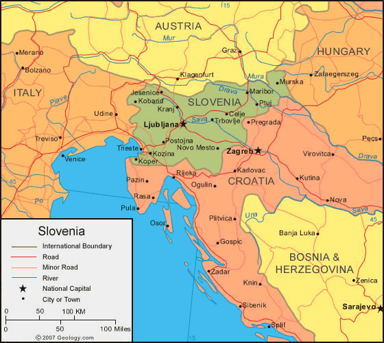
Slovenia
Area 7,906 square mi (20,273 square km)
Population 2.062 million 2014
Capital Ljubljana
Highest Point 9,396 ft (2,864 m)
Lowest Point 0 m
GDP $49.49 billion 2014
Primary Natural Resources lignite coal, lead, zinc, mercury, uranium.
SLOVENIA IS LOCATED in Central Europe on the ADRIATIC SEA between AUSTRIA and CROATIA. The country's transitional area lies between the ALPS, the Dinaric area, the PANNONIAN PLAIN, and the Adriatic Sea. Because Slovenia is just half the size of SWITZERLAND, it is possible to ski in the morning, go wine tasting in the afternoon, and relax by the Adriatic in the evening.

The Alpine mountains, hills, and plains in northern Slovenia comprise two-fifths of the country. The mountains contain most of the country's limestone. Fourfifths of the land is covered by dense forest, primarily beech. Southeast of the mountains, the Alpine hills are primarily composed of dolomite and limestone. Isolated farmhouses and small villages comprise the population, which is declining. The western hills also contain a region known for its lace-making, abandoned mercury mines, and the medieval town of Skofja Loka (12,340 people). The country's capital, Ljubljana (267,008), and several other urban centers are located in the Alpine plains region.
The Dinaric plateaus and valleys run from the northwest to the southeast part of the country, and comprise the majority of southern Slovenia. Limestone and dolomite make up almost all of the Dinaric area and forest covers nearly three-quarters of the plateaus. Without much surface water, this region is prone to drought and forest fires, and the few villages in the region are decreasing in population. Only about twofifths of the valleys of the Dinaric area are covered by forest, with several cities and towns in the east. In the west, the land is prone to flooding. Attempts to dam the intermittent Cerknica Lake have caused sinkholes to appear. Belowground, a fantasy world of over 7,000 caves rules this region, which is home to the Skocjan Caves, famous for the largest underground canyon in the world at 1.6 mi (2.5 km) long and 492 ft (150 m) high.
The Pannonian hills and plains comprise one-fifth of the eastern part of Slovenia. Forest makes up less than a third of the region, creating a place for orchards and vineyards. The plains separate the hills from three of Slovenia's rivers: the Mura, Drava, and Krka. The city of Maribor (103,961), second only to Ljubljana in population, is located on the Drava plain. Smaller cities and the Krska nuclear power plant are also in this region. The forest is least prevalent on the Pannonian plains.
Mediterranean hills and plateaus make up the southwest part of the country, which includes only 10 percent of the country's land. Almost completely limestone, the Mediterranean Kras region is where the science of karstology began, and many Slovene words now make up the international language of karst studies. Slovenia's largest port town, Koper (24,704), is located here, along with several other tourist and fishing towns.
In spite of its small size, Slovenia serves as a major European transit route, beginning with its port to the world on the Adriatic Sea. It connects ITALY, Austria, HUNGARY, and Croatia via railways and roads.