What Is Physical Geography?
PHYSICAL GEOGRAPHY IS THE STUDY of spatial distributions of phenomena across the landscape, processes that created and changed those distributions, and implications for those distributions on people. Geography is both a natural and social science. Geographers think broadly, emphasizing interconnections and complex issues, solving complicated problems such as resource management, environmental impact assessment, disease diffusion, and urban planning. Although many such occupations do not have the title of geographer, they require a geographic perspective. Let's have a closer look at what the geographic perspective entails.
What Approach Do Geographers Use to Investigate Important Issues?
Geographers approach problems from different perspectives than other natural and social scientists. Specifically, geographers think spatially, meaning they emphasize the setting, such as location, in addressing problems, and holistically, integrating ideas from a wide variety of the natural and social sciences. In many ways, it is not what is studied that makes it geography, but instead how it is studied. The decision of whether to drill for oil in Alaska's Arctic National Wildlife Refuge (ANWR) is a complicated issue that can be best understood using the geographic approach.
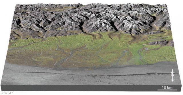
1. This figure shows a three-dimensional perspective of the central part of ANWR, looking south with the ice-covered Arctic Ocean in the foreground. ANWR is well known for its abundant caribou and other Arctic animals. Before reading on, examine this scene and think about all the information you would need if you wanted to understand how drilling for oil and gas might impact the caribou.
2. To understand this issue, you might ask a series of questions. Where do the caribou live? Since they migrate seasonally, where are they at different times of the year? What do they eat, where are these foods most abundant, and what factors control these abundances? Where is water available, and how much rain and snow do different parts of the region receive? Is the precipitation consistent from year to year? When is the mating season, and where do the mothers raise their young?
3. You could also ask questions about the subsurface oil reserves. Where is the oil located, and what types of facilities will be required to extract and transport the oil? How much land will be disturbed by such activities, and how will this affect the caribou?
4. The issues of ANWR nicely illustrate why we would use a geographic approach. Most of the questions we asked here had a spatial component, as indicated by the word “where” and could be best answered with some type of map. The questions also have an explicit or implicit societal component, such as how development could affect the traditional way of life of the native people of the region.
5. The spatial perspective allows us to compare the locations of the physical, environmental, economic, political, and cultural attributes of the issue. On this map, ANWR is the large area outlined in orange. Its size is deceptive since Alaska is huge (by far the largest state in the U.S.). For comparison, ANWR is only slightly smaller than the state of South Carolina.
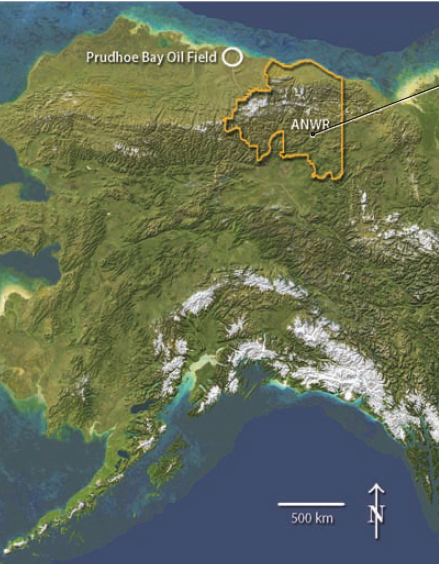
6. Directly to the west of ANWR is the Prudhoe Bay oil field, the largest oil field in North America. Not all of ANWR is likely to contain oil and natural gas, and an assessment of the oil resources by the U.S. Geological Survey (USGS) identified the most favorable area as being near the coast. To properly consider the question about oil drilling, we would want to know where this favorable area is, how much land will be disturbed by drilling and subsequent activities, when these disturbances will occur, and how these compare with the location of caribou at different times of the year, especially where they feed, mate, and deliver their young.
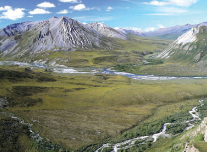
7. The holistic perspective allows us to examine the interplay between the environment and the aesthetic, economic, political, and cultural attributes of the problem. Most of ANWR is a beautiful wilderness area, as well as being home to caribou, various plants and animals, and native people.
How Does Geography Influence Our Lives?
Observe this photograph, which shows a number of different features, including clouds, snowy mountains, slopes, and a grassy field with horses and cows (the small, dark spots). For each feature you recognize, think about what is there, what its distribution is, and what processes might be occurring. Then, think about how these factors influence the life of the animals and how it would influence you if this were your home.
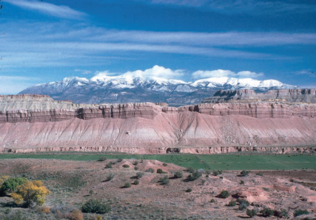
The snow-covered mountains, partially covered with clouds, indicate the presence of water, an essential ingredient for life. The mountains have a major influence on water in this scene. Melted snow flows downhill toward the lowlands, to the horses and cows. The elevation and shape of the land influence the spatial distribution and type of precipitation (rain, snow, and hail) and the pattern of streams that develop to drain water off the land. The horses and cows roam on a flat, grassy pasture, avoiding slopes that are steep or barren of vegetation. The steepness of slopes reflects the strength of the rocks and soils, and the flat pasture resulted from loose sand and other materials that were laid down during flooding along a desert stream. The distribution of vegetation is controlled by steepness of slopes, types of soils and other material, water content of the soil, air temperatures, and many other factors, all of which are part of physical geography. The combined effect of such factors in turn affect, and are affected by, the human settlements in the area to make every place, including this one, distinctive and unique.
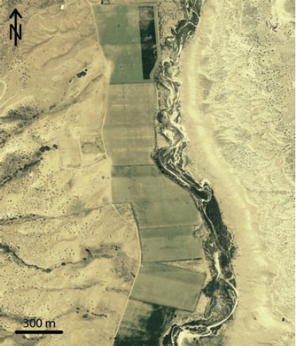
A better view of the spatial distribution of the green pasture is provided by this aerial photograph (a photograph taken from the air, like from a plane). This view of the pasture and adjacent areas reveals the shape of the pasture, and we could measure its length, width, and area. Such measurements would help us decide how many horses and cows the land could support.
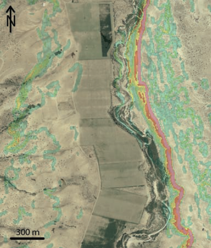
Geographers calculate various measures of the landscape, like the steepness of slopes, and then overlay this information on the original map or image. In the figure above, red shading shows the steepest slopes, along and below the pinkish cliff. Yellow and green indicate less steep slopes, and relatively flat areas are unshaded. Such a map would help us decide which areas could be new pastures.
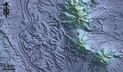
This image shows the shape of the land across the region, including the mountains (the pasture is on the left part of the map). Colors indicate the average amount of precipitation with green showing the highest amounts. As we might predict, the mountains receive more rain and snow.