Argentina
Area 1,068,302 square mi (2,766,890 square km)
Capital Buenos Aires
Population 41.80 million 2014
Highest Point 22,834 ft (6,960 m)
Lowest Point -344 ft (-105 m)
GDP $540.2 billion 2014
Primary Natural Resources iron ore, petroleum, uranium.
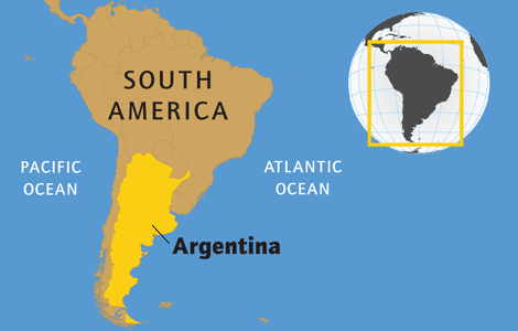
ARGENTINA IS A COUNTRY located in southern South America, the second-largest country on the continent. Argentina shares a long border with CHILE to the west. The two countries have disputed territory around the Beagle Channel in Tierra del Fuego. Argentina also borders on URUGUAY, PARAGUAY, BRAZIL, and BOLIVIA.
The country possesses a nearly 3,100-mi- (5,000-km-) long coastline on the ATLANTIC OCEAN. Argentine claims over the Islas Malvinas, or FALKLAND ISLANDS, has led to a dispute with Great Britain, which also claims the islands. The two countries fought a war over the Malvinas/Falklands in 1982, when the Argentina military invaded the islands. After a short but costly conflict, the British forcibly retook control of the islands.
Argentina can be divided into four main geographic regions: the ANDES, the North, the Pampas, and Patagonia.
The Andes Mountains form the “backbone” of Argentina along the western border with Chile. In the northern Andes, peaks average between 11,000 and 13,000 ft (3,353 and 3,962 m), although some can reach as high as 19,000 ft (5,791 m). There are a number of valleys in the north, including the broad quebradas that historically provided access to the Atlantic. There has been some mining in the northern Argentine Andes, including lead, zinc, copper, silver, and beryllium. As the Andes make their way south, the range narrows and the peaks get higher. Some of the highest mountains in the world can be found in the Central Argentine Andes. Among these high peaks is ACONCAGUA MOUNTAIN, the highest mountain in the Western Hemisphere at 22,834 ft.
NORTHERN ARGENTINA
The northern part of the country can be divided into two parts: the Chaco region and the so-called Mesopotamia area. The Chaco is a large alluvial plain that stretches over territory in Argentina, Paraguay, Brazil, and Bolivia. The soil is made up of deposits that wash down from the Andes Mountains. The Chaco region is subject to major flooding during the summer rainy season. Much of the Chaco consists of woodlands of deciduous scrub trees that often grow densely packed together. There are also areas of grassy savannahs.
A subtropical climate and some of the highest temperatures in Latin America lead to rapid evaporation, which makes agriculture difficult without irrigation. These difficult physical conditions limited the agriculture practiced by the native inhabitants. Historically, the economy of the Chaco region depended on the quebracho forests, which provided a source of tannin used for the early Argentina leather industry. Many settlers moved to the region in the 19th century to exploit these forests after the defeat of the native peoples in the 1880s. In the 1930s, more settlers were attracted to the Chaco by cotton, which could withstand the sometimes long drought period in the region.
The Mesopotamia region, so named because of its location between the Parana and Uruguay Rivers, includes the western Parana plateau and a large lowland. Iguacu Falls is located in the region along the border with Brazil and Paraguay. Spanish settlers came to the region starting in the sixteenth century.
In the 17th century, Jesuit missionaries arrived in the area, giving the region the name of Misiones. Misiones is the center of production for yerba mate, used to make a tealike beverage. The Mesopotamia region also possesses some excellent grazing land for cattle and sheep.
The plains area known as the Pampas is the heartland of Argentina. Historically, it has been the demographic, economic, political, and cultural center of the country. During the Spanish colonial period, the Pampas were an area of open grasslands with wild herds of horses and cattle derived from the animals that European settlers brought. The region's fertile soil has made agriculture easy and profitable. By the 19th century, ranching and grain farming dominated the Pampas. Wheat has been the key crop of the Pampas, although corn, barley, and flax have also been successfully grown. Traditionally, the Pampas was divided into large estates known in Argentina as estancias. The Pampas accounts for about 8 percent of the country's agricultural production.
Some 70 percent of the Argentine population resides in the Pampas region. Buenos Aires, the country's largest city and Argentina's capital, is located in there. Buenos Aires has long been the country's commercial and manufacturing center. It serves as the main port along the Rio de la Plata. In the 19th century, the advent of the railroad connected the city with the surrounding Pampas, bringing agricultural products to the port quickly and cheaply. Other major cities in the region include Rosario, Cordoba, and Mar del Plata. In addition to being the demographic center of the country, the Pampas region is home to more than 80 percent of Argentina's industry.
The southern lowlands of South America south of the Colorado River are known as Patagonia. The region consists mostly of cool, arid, and windswept STEPPES. The climate of Patagonia is generally mild. Inland and to the south, there are moister, more productive grasslands that can be used for grazing. However, much of the region is desert, with rainfall under ten inches annually. The lack of rainfall is due to the barrier created by the Andes Mountains and the Falkland Current.
Patagonia was unsettled by Europeans until the second half of the 19th century. In the 1860s, immigrants from Wales settled along the Chubut River. After the “Conquest of the Desert” in the 1880s, when the Argentine government militarily subdued the Native Americans in Patagonia, Argentine and European settlers moved into the region. The wave of migrants led to the establishment of large sheep ranches in Patagonia. Other economic activities included fruit orchards, vineyards, dairy farms, and coal mining. In the early 20th century, petroleum became an important resource in the region and led to the creation of Comodoro Rivadavia, which serves as the center of Argentina oil production.
The region is sparsely populated. Patagonia accounts for about one-fourth of the country's land but possesses only about 1 percent of the population. The most developed part of Patagonia is in the north, close to the Pampas. The principal city in the region is Neuquen, located in the upper Rio Negro Valley. The southern part of Patagonia is much less developed. Ushuaia is the southernmost town in the world.