
climate classification
CLIMATE IS an average or aggregate of daily weather conditions over a period of years. Latitude, distance from oceans, atmospheric and oceanic circulation pattern, elevation, and local geographical features control the climate of a place. The controls of climate result in a plethora of interrelated elements of climate, ranging from temperature, pressure, wind, humidity, clouds, […]

climate
THE TERM climate refers to the long-term averages of insolation (solar radiation absorbed by Earth), temperature, precipitation, cloud cover, air masses, atmospheric pressure, winds, and cloud coverage. Of these, temperature and precipitation are the most important factors in establishing climate type. A place may have rain on one day, clear conditions for a week, and […]

civilizations, early river
Early river valley civilizations arose in Mesopotamia, EGYPT, the INDUS RIVER Valley, and CHINA. Earlier agricultural societies (8,000 to 13,000 years ago) were largely subsistence cultures. The river civilizations had food enough to provide for classes of people other than just farmers. These societies all used agricultural surpluses to establish civilizations with cities and trade and […]

Christaller, Walter (1893–1969)
A GERMAN geographer, Walter Christaller helped bring quantitative and statistical disciplines to the study of geography. Christaller was born in Berneck, GERMANY; his father was a clergyman and his mother an author. Before 1914, he attended university in Heidelberg and in Munich. He enlisted during World War I, and became an officer. Returning after the […]

choke point
A CHOKE POINT IS ANY narrow passage that restricts traffic. It literally connotes a location where the flow could be choked off. As a military term, it refers to areas in lines of sea, ground, air or space communications (physical travel) that restrict freedom of movement by slowing and confining. This allows an adversary to […]

central business district
Methods for the delimitation of the CBD include mapping land use intensities referring to the central business height index, recording the percentage of the land uses of each floor of each building within the CBD, and calculation of high-level pedestrian flows. The Manhattan CBD is, for example, characterized by very high offices blocks and a […]

Central America Free Trade Agreement
THE CENTRAL America Free Trade Agreement (CAFTA) is a treaty between the UNITED STATES and the countries of Central America (HONDURAS, GUATEMALA, EL SALVADOR, NICARAGUA and COSTA RICA)—what the Russians refer to as the “near abroad.” This is a parallel to the earlier NAFTA (North American Free Trade Agreement). The objective is a free-trade association […]
Catholic Church
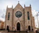
SINCE THE BEGINNING OF Christianity, the extension and growth of the Catholic Church were a means to explore, map, and discover the world. Explorations were the first step in establishing missions in foreign lands, the cause of great travels around the globe. The Acts of the Apostles, and also ancient and medieval legends, tell about […]

cartography
A TERM DERIVED from the word for chart (charte) or drawing, cartography is traditionally defined as the art and science of making maps. But over the years, a great deal of theoretical and practical research has been done in all aspects of the subject, including work on map projections, map designs, map visualization, cartograms, terrain models, and the incorporation of new computer-based […]
cartogram
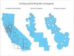
ONE OF THE LIMITATIONS of the traditional paper map is that real world areas with large populations are usually small in physical size and therefore represented as small area units on a map. As such, traditional paper maps have tended to mask geographic patterns in small area units that are of importance and interest on the map. The […]
capitals
A CAPITAL IS A CITY or town that serves as the administrative center of a political unit such as a country, state, or province. The word capital is ultimately derived from the Latin word for “head” (caput). Capitals of counties in the UNITED STATES are generally known as “county seats”; in England and IRELAND such […]

canyon
A CANYON IS A deep, narrow passage cut through the surface of the Earth with steep cliffs on both sides. Sometimes called a gorge or ravine, canyons are often formed in mountainous, arid, or semiarid regions where riparian EROSION is much greater than erosion from general weathering. They range in size from an arroyo, or […]
Canadian Shield
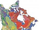
THE CANADIAN or Laurentian Shield, the largest natural region of North America at 1.1 million square mi (3 million square km), is located north of the St. Lawrence Lowland and east of the Interior Plains. It is composed of igneous and metamorphic rock of Precambrian origin, some of the oldest rock on Earth. More than […]

British Indian Ocean Territory
THE BRITISH Indian Ocean Territory (BIOT) is an archipelago in the INDIAN OCEAN, south of INDIA, about one-half of the way from Africa to INDONESIA. On November 8, 1965, the British government created the (BIOT). The BIOT consisted of the Chagos Archipelago, excised from the British Crown Colony of Mauritius; and the Aldabra and Farquhar […]
British East India
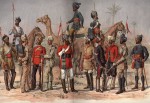
IT CAN BE ARGUED that Portuguese, Dutch, and French merchants exploited India; Britain remade the subcontinent. British East India grew from a series of coastal trading posts to encompass the part of the Indian subcontinent taken by the current states of INDIA, BANGLADESH, and PAKISTAN. The subcontinent's southern peninsula extends to the HIMALAYAS mountains that […]

boundaries, political
POLITICAL BOUNDARIES are frequently defined as borders constructed and imposed on or around a geographic territory in order to distinguish between areas of governance or types (strategies) of political control. They function both as a tool for managing a group of peoples and as a way of minimizing conflict and organizing efficient political units. Political boundaries […]
boundaries, natural
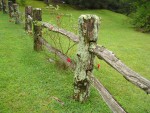
GOVERNMENTS USE physical features as boundaries of political units: boundaries of countries, states, counties, cities, and so forth. (Not all political boundaries follow natural features. A boundary can be geometric, meaning it is be composed of straight-line segments and arcs. There is a cultural type of boundary, as well. This boundary usually separates different ethnic […]
Biosphere
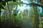
THE ENVIRONMENT of the Earth can be broadly divided into four major systems: the atmosphere, hydrosphere, lithosphere, and biosphere. Russian scientist Vladimir Vernadsky coined the term biosphere in 1929. The term refers to the life zone of Earth that includes the air, land, and water occupied by all organisms including humans. This life zone distinguishes […]
bioreserve
BIORESERVES, also known as BIOSPHERE reserves, are an internationally recognized type of conservation reserve. In 1970, the 16th General Conference of UNESCO (part of the United Nations), acting on the recommendations of the conference, launched the long-term intergovernmental and interdisciplinary program known as Man and the Biosphere (MAB). Crucial for the program was a project […]

Biome
A BIOME IS A classification of large areas of plant formations. The world's vegetation communities can be described in many ways depending on scale and controlling factors. The early plant geographers, notably F. E. Clements and V. E. Shelford, working in the UNITED KINGDOM and the UNITED STATES in the early 20th century, defined and […]

Bight of Benin
A “BIGHT” REFERS TO a bend or curve, most often a crescent shape, that forms an open bay in a coastline. The Bight of Benin is a roughly 500-mi- (800-km-) long bend in the West African coast, stretching from near the mouth of the Volta River (Cape Saint Paul) in GHANA eastward across the coastlines […]
Benelux
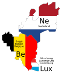
BENELUX IS THE name of the customs union created in 1956, named for the initial syllables of its three member states: BELGIUM, NETHERLANDS, and LUXEMBOURG. The name originally applied to the economic pact between the three countries, the Benelux Economic Union, but is now also used to refer to the three countries as a geopolitical […]
Benares
BENARES (also Banaras, Varanasi) is an ancient city in the state of Uttar Pradesh, in northern INDIA. Its population is just over 1 million (1991). Although the name Benares appears on many maps, it is actually a corruption of the official Indian name of the city, Varanasi. In addition to many religious institutions and festivals, […]
Bay of Bengal
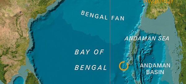
THE BAY OF BENGAL is a triangle-shaped water body, which is an extension of the INDIAN OCEAN to the north. It is stretched over an area of 5.7 million square mi (14.7 million square km) with an average depth of approximately 8,530 ft (2,600 m). Countries that surround the bay are SRI LANKA, INDIA, BANGLADESH, MYANMAR […]
basin
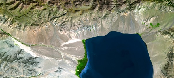
BASINS ARE LARGE-SCALE depressions in the land surface or seafloor. Their sides may dip gently or steeply, but their bottoms are always wider than they are deep. Streams flowing into basins often fill their floors with sediments. Lakes typically occupy lower parts of the basins on land, thus they may fully emerge as lakes dry […]
bases of trade
GEOGRAPHIC BASES of trade are places established for the trade or exchange of commodities and/or the transshipment or warehousing of goods. While a base of trade may develop into a multifunctional administrative and/or ceremonial center, its original function as a nodal point at the intersection of at least two discreet networks remains the center's primary […]
basaltic flows
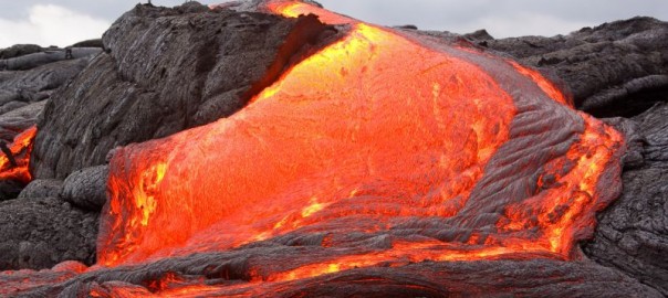
THE WORD basalt is said to have an Ethiopian origin, meaning “black stone.” Basalt is a dark gray to black, dense to finely grained igneous rock that is the result of lava eruptions. Basalts are not only the most abundant lavas, but they are also the most voluminous. Basalt, when exposed to the air, becomes […]
Baluchistan
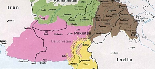
BALUCHISTAN, A SOUTHWESTERN province of PAKISTAN, extends from the Gomal River in the northeast to the ARABIAN SEA in the south and from the borders of IRAN and AFGHANISTAN in the west and northwest to the Sulaiman Mountains and Kirthar hills in the east. In its continuity to the west lies Iranian Baluchistan. The land […]
Baikonur
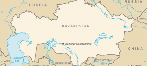
BAIKONUR IS THE former Soviet Union's primary space launch facility. In the early days of the Soviet space program, rockets were launched from Kasputin Yar, a small field in the lower VOLGA RIVER basin not far from Stalingrad (modern Volgograd). However, this launch facility had numerous problems. Mists rising from the Volga River frequently delayed […]
Bab el Mandeb
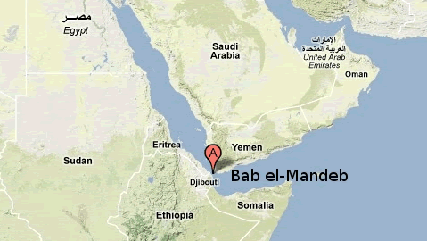
CONNECTING THE RED SEA with the Gulf of Aden and the ARABIAN SEA, bounded by DJIBOUTI, ERITREA, and YEMEN, the Bab el Mandeb is a STRAIT and CHOKE POINT. It separates the Arabian Peninsula from East Africa (HORN OF AFRICA). As its Arabic name implies (“Gate of Tears”), it is a place of worry for […]
Aurora borealis
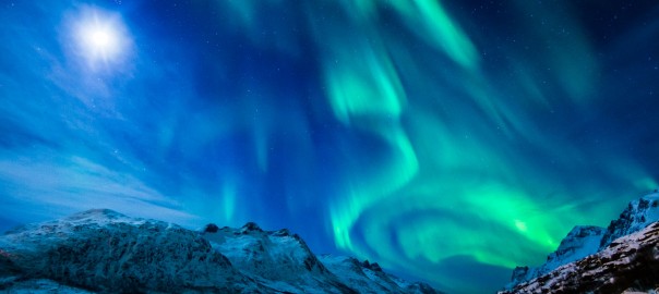
NORTHERN LIGHTS, or the aurora borealis, are shimmering lights that shine above the Earth near the geomagnetic North Pole. The lights, often bright enough to read by, are usually green or red. The phenomenon is caused when a solar storm discharges high-energy particles that are channeled into a ring by the Earth's magnetic field. The […]
Arctic National Wildlife Refuge
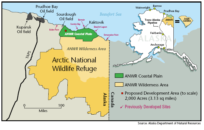
LOCATED IN northeastern ALASKA and managed by the U.S. Fish and Wildlife Service, the Arctic National Wildlife Refuge (ANWR) encompasses the largest diversity of wildlife of any protected area in the circumpolar north, earning it the nickname “the American Serengeti.” Efforts to preserve the refuge began in 1960 with the establishment of the Arctic National Wildlife […]
Arctic Circle
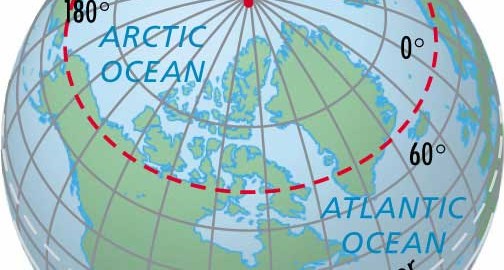
LOCATED AT 66.5 degrees north latitude or 23.5 degrees southward of the North Pole, the Arctic Circle forms an imaginary line marking the northernmost location where the sun can be seen during the northern hemisphere's winter solstice (December 21). On June 22 and again on December 21, the circle of illumination (formed by the sun's […]
Arab geographers
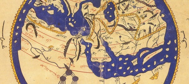
IN THE MIDDLE AGES, the Arabs, inspired by Mohammed's faith, conquered the FERTILE CRESCENT, North Africa, southern SPAIN, and much of Central Asia, including IRAN and AFGHANISTAN. Arriving from the deserts of Arabia with a rich linguistic tradition but few material possessions, they soon were introduced to the ancient thought of INDIA, Persia, and GREECE. […]
Aquifer
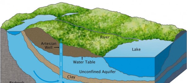
AN AQUIFER IS a subsurface structure or formation that provides a sufficiently permeable condition to yield significant quantities of water to wells and springs. Soil water movement is determined by two factors: porosity, which is the ability to hold on to water particles, and permeability, which is concerned with movement. The word aquifer comes from two […]
Antipode
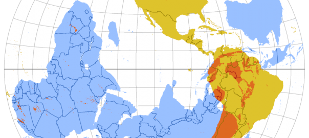
DURING THE TIME of Plato and Aristotle (circa 390 B.C.E.), the term antipode was used in reference to a natural balance thought to be sustained by the existence of a continent south of the equator, equal in size to the northern continent. Ptolemy (100–170 C.E.) described this southern landmass as Terra Australis Incognita (unknown southern […]
Antarctica
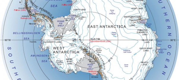
THE WORLD'S fifth-largest continent, Antarctica is home to the South Pole. This continent of almost 98 percent ice and 2 percent barren rock holds the distinction of being the coldest, windiest, driest, and highest continent. Antarctica covers some 5.4 million square mi (14 million square km), and has no indigenous people, but seasonal staff from […]
Antarctic Circle
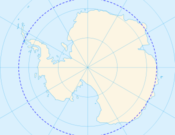
THE ANTARCTIC CIRCLE is an imaginary line located at 66.5 degrees south latitude or 23.5 degrees northward of the South Pole. It marks the southernmost location where the sun can be seen on June 22 (the Southern Hemisphere's winter solstice) and the northernmost location where the midnight sun is visible on December 21 (the Southern Hemisphere's […]
Amazon Rainforest
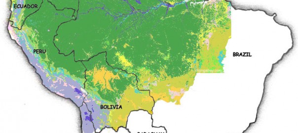
THE AMAZON RAINFOREST is the largest rainforest in the world. It extends for 3,000 mi (4,828 km) from the ANDES mountains to the ATLANTIC OCEAN. The rainforest covers parts of BRAZIL, PERU, ECUADOR, COLOMBIA, BOLIVIA, and VENEZUELA, encompassing over a billion acres and covering one-third of South America. The 6,500 mi (10,461 km) of the […]
Alluvium
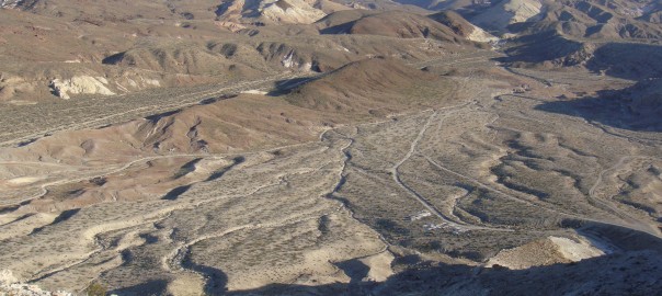
THE SEDIMENT DEPOSITED by rivers is called alluvium. The name derives from the Latin word alluvius, meaning “washed up.” Alluvium comprises clay, silt and sand (in some definitions gravel is included) and derives from the erosion of rocks and soils in the upper reaches of river basins. The mineral characteristics of the alluvium thus reflect […]
Alluvial fan
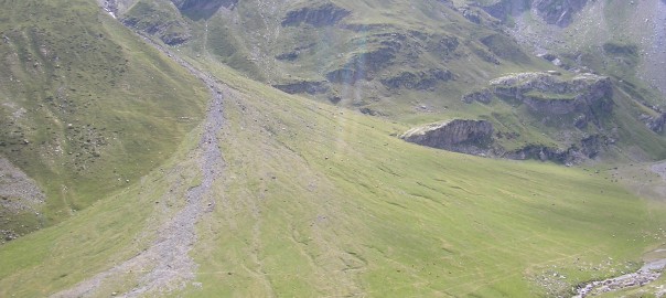
THE U.S. COMMITTEE on Alluvial Fan Flooding recently defined an alluvial fan as “a sedimentary deposit located at a topographic break, such as the base of a mountain, escarpment, or valley side, that is composed of streamflow and/or debris flow sediments and that has the shape of a fan either fully or partially extended.” The […]
Agricultural Revolution
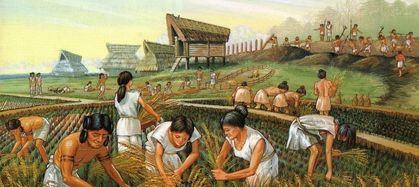
AROUND 11,000 B.C.E., human beings began to domesticate and cultivate plants. This new activity, which eventually changed populations, lifestyles, and the environment in profound ways, proceeded in sporadic bouts. Although the development of agriculture took place over millennia on different continents, its initial beginning is sometimes referred to as the Agricultural Revolution. Archaeological evidence shows […]
Afars
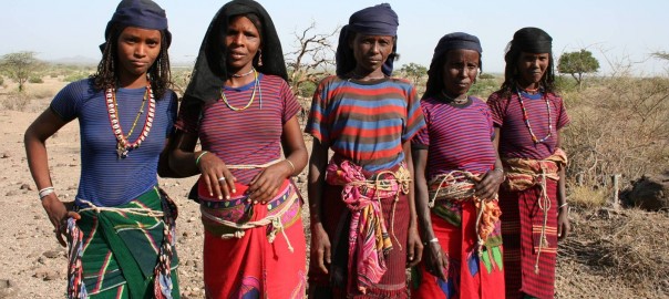
THE AFAR PEOPLE live in the rocky desert terrain of eastern Africa, in an area called the HORN OF AFRICA. Most of them live in the countries of DJIBOUTI, ETHIOPIA, and ERITREA. The territory, once known as the French Territory of the Afars and Issas, became Djibouti in 1977, when France gave the people their […]
Aceh
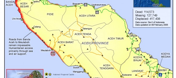
ACEH (full name: Naggroe Aceh Darussalam, meaning “the Abode of Peace”) is one of the three “special territories” among the 27 administrative provinces of indonesia. Its location, on the large island of SUMATRA in the northeast corner of the Indonesian archipelago, facing the Andaman Sea and the Straits of Melaka, makes it the closest Indonesian […]
Abyssal plain
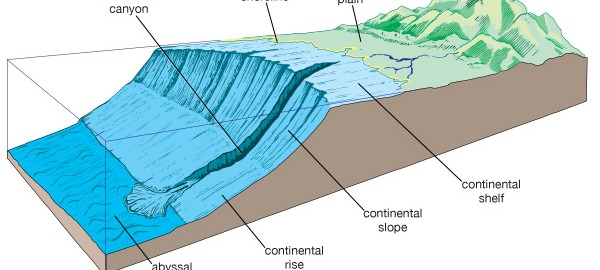
LOCATED IN THE world's oceans, an abyssal plain is a depositional surface on the seafloor. The plain is generally 13,000 to 20,000 ft (4,000 to 6,000 m), extending seaward from the base of a continental slope or from the seaward edge of an oceanic trench to the midocean ridge. The term plain implies that this […]
Chronology of Geography
200 million B.C.E. Present-day continents were part of a supercontinent known as Pangaea or Pangea (Greek or “all-Earth”). Over millions of years, this supercontinent broke up through the creation of rifts, cracks in the crust that moved apart and allowed magma to rise from lower levels and form new seabeds. Water moved into the broken landmass […]