Huang (Yellow) River
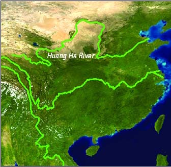
THE YELLOW RIVER, called the Huang He by the Chinese, is the second longest river in CHINA reaching 5,500 km (3,000 mi), second only to the CHANGJIANG (Yangzi River). The regions to the north and south of the Huang River are called, respectively, the Hebei (north) and Henan (south). The chief tributaries of the Huang River are the Wei and Fen Rivers. The Huang River originates in the Yekuzonglie basin at an elevation of 4,500 m (13,500 ft) in the Bayan Kera Mountains and flows in an easterly direction through nine regions: Qinghai, Sichuan, Gansu, Ningxia, Inner Mongolia, Shanxi, Shaanxi, Henan, and Shandong, where it finally reaches the Bohai Sea. The Huang River has made at least five major direction changes from 602 B.C.E. to today. It is believed that the most devastating direction change occurred in 1194, killing hundreds of thousands of Chinese and destroying the economy. The latest direction change occurred from 1855 to 1897, resulting in the current easterly flow.
The Huang River gets its name from its color caused by the sediment carried by the flow. Large-scale erosion occurring in the northern regions continues to be a problem for the Chinese government, as it increases the danger level of the river through buildup of sediment farther downstream. In fact, the Huang River remains the most dangerous river in China.
The Huang River basin is where Chinese civilization originates. Some historians believe this is because of a unique land structure found only here and no where else in the world. The land structure is called Tai Yuan, meaning a table land on a plateau. What is left on the Tai Yuan gives researchers an idea of the landscape prior to it being carved up by the river. Researchers explain that these land structures were ideal for agricultural development, community activities, and unrestricted movement because it is believed that the current Tai Yuans were once much closer together, if not a single unit.
A large problem associated with the Huang River is the continuous flooding, due in large part to the heavy sediment that is carried off by erosion and left to rest in the lower regions, causing the flow to slow and preventing the river from reaching the Bohai Sea. The river, on an annual basis, fails to reach the sea onethird of the time, which is largely attributed to an increase in ciphering off of water by families, factories, and farmers and, of course, the large amount of sediment left behind in the lower regions from erosion in the upper regions. In 1955, the Upper and Middle Huang River Administration Bureau was created under the Huang River Conservancy Commission to initiate soil conservancy and sediment reduction.
Silt deposition has created large problems for certain areas of the Huang River. In some areas the river bed is elevated 60 to 70 ft (18 to 21 m) above the surrounding towns. Since the 2nd century B.C.E., the Huang River has broken the levees some 1,500 times, inundating the surrounding towns. For example, in 1642 the levees broke, killing some 300,000 people. And again in 1938, the Chinese government decided to flood the levees in an attempt to stop the Japanese invaders, resulting in the deaths of 900,000 Japanese and Chinese combined.
Currently, the Chinese government has undertaken a project that rivals no other water project in the world: to transport water from the overflowing Changjiang in the south to the Huang River in the north. Three canals will deliver the water to the drier regions at a distance of 750 mi (1,250 km). A conservative cost estimate for this project is $30 billion; however, that can easily reach up to $60 billion or higher as the routes that the government wants to take are dangerous and, in some cases, require almost impossible engineering feats.
Work has begun on two of the south-north canals and engineers from the east are working on an ancient waterway called the GRAND CANAL. These two canals are expected to serve a population of 20 million, a population that must ration water until the project is built. The most expensive canal is the third, which is planned to deliver water from the higher regions of the Changjiang to the higher regions of the Huang through rugged mountains. This water will provide farmers of the most important agricultural regions the resources to adequately produce corn, sorghum, winter wheat, vegetables, and cotton.
Finally, it must also be noted that the canal project put forward by the Chinese government is highly controversial because of the nature of the project, the amount of money needed to finance it, and the impact it will have on the surrounding environment.