Kenya
Area 224,900 square mi (582,488 square km)
Capital Nairobi
Population 44.86 million (2014)
Highest Point 17,058 ft (5,199 m)
Lowest Point 0 m
GDP $60.94 billion (2014)
Primary Natural Resources coffee, tea, corn, vegetables, livestock.
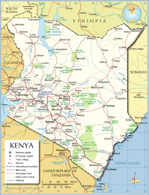
KENYA, WHICH LIES astride the equator on the eastern coast of Africa, is bordered in the north by SUDAN and ETHIOPIA, in the east by SOMALIA, on the southeast by the INDIAN OCEAN, on the southwest by TANZANIA and to the west by Lake Victoria and UGANDA.
The country is notable for its' geographical variety. While most people immediately think of African wildlife and great expanses of GRASSLAND, the land is made up of several distinctive geographical regions. The first is a narrow, low-lying, fertile coastal strip along the shores of the Indian Ocean that is fringed with coral reefs and islands. A series of low hills separates the coastal region from the vast bush-covered plains of the eastern plateau forelands, which sprawl between the central highlands to the west and the coastal strip on the east and slope gently toward the sea.
In the southwestern corner of the country is the Lake Victoria basin, which extends eastward from the lake to the central rift highlands, in which about 85percent of the population and the majority of economic enterprise are concentrated. The central rift highlands run from north to south down the western half of Kenya and are split by the famous Rift Valley into two sections, the Mau Escarpment on the west and the Aberdare Range and accompanying highlands on the east. The Mau Escarpment in the west rises above 9,000 ft (2,740 m) and stretches for more than 200 mi (320 km) northward from the Tanzanian border to the westcentral border with Uganda.
The Aberdare Range to the east, which forms the eastern border of the Rift Valley, rises to nearly 10,000 ft (3,050 m). In the high plateau area, known as the Kenya Highlands, lie Mt. Kenya 17,058 ft (5,200 m), Mt. Elgon 14,176 ft (4,322m), and the Aberdare Range rising to over 13,000 ft (3,963 m). The plateau is bisected from north to south by the Rift Valley. The Great Africa Rift Valleys runs from North to South through the whole of Kenya. The Kenyan Rift Valley is a section of a 3,700 mi (6,000 km) rift system that stretches from the Dead Sea in the MIDDLE EAST, south through the RED SEA, Ethiopia, Kenya, Tanzania, MALAWI, and into MOZAMBIQUE. The whole area contains several lakes, extinct volcanoes, and numerous small game parks. The scenery in the Rift Valley is breathtaking, particularly at the viewing points just north of Limuru and Naivasha or from the top of the Mau escarpment. In the south, the valley narrows and deepens with walled escarpments rising 2,000 to 3,050 ft (610 to 930 m) above the valley floor, while in the west, the plateau descends to the plains that border Lake Victoria.
A network of small, seasonal rivers and streams drains most of the Kenyan landscape. Kenya's most important river, the Tana, rises in the central highlands and drains some 16,300 square mi (42,200 square km), roughly 7 percent of the country's total land area, before flowing into the Indian Ocean. Northern Kenya receives little rainfall, but regions in the southern part of the country are plentifully watered. Kenya has two rainy seasons: the long rains from late March to May and the short rains from October to December. Evergreen forests can be found in the highlands along with wide expanses of bamboo grass. East and west of the highlands, the vegetation gives way to low trees that are casually scattered throughout a predominantly grassy landscape. Semidesert conditions exist below 3,000 ft (915 m) in the north, with thick expanses of thornbush interspersed with massive baobabs trees. In the coastal belt, dense, high bush alternates with limited areas of forest.
Kenya is noted for its wildlife, safaris, and much of our image of Africa. Game and national parks, such as the Masai Mara National Reserve and the Ambosili National Park, are filled with lions, leopards, wild dogs, elephants, buffaloes, rhinoceroses, zebras, antelopes, gazelles, hippopotamuses, and crocodiles. Equally famous, but not a part of Kenya, are the Serengeti National Park and Mt. KILIMANJARO, both of which lie just across the border in Tanzania. Only about 4 percent of the land is arable and nearly all of this is cropped, mainly with corn and other grains.
Kenya became an independent country in 1963. Jomo Kenyatta, a member of the Kenya African Nation Union (KANU), became the country's first president on December 12, 1964. Kenya soon became a one-party state, after the voluntarily dissolving of the Kenya African Democratic Union (KADU).
After Kenyatta's death in 1978, Vice President Daniel arap Moi became the interim president. Under Moi's presidency, political oppression continued with the outlawing of political activities. Thus, many aspiring politicians and political parties went underground for many years. Sensing an opportune time because of resentment of the government in the 1990s, many of the underground parties emerged to challenge KANU. Finally in 2002, a coalition of opposition parties ended the 24-year presidency of arap Moi. Mwai Kibaki became the country's third president.
In 1998, terrorists bombed the American Embassy in Nairobi. Many people, particularly Kenyans, were killed in the horrific violence. The incident further damaged the Kenyan struggling tourism industry. A major challenge to Kenya's stability is population growth. With so many people being added to the total population, there will be severe pressure on land, and subsequent intensity in the rural-urban migration phenomenon.