Rio Grande
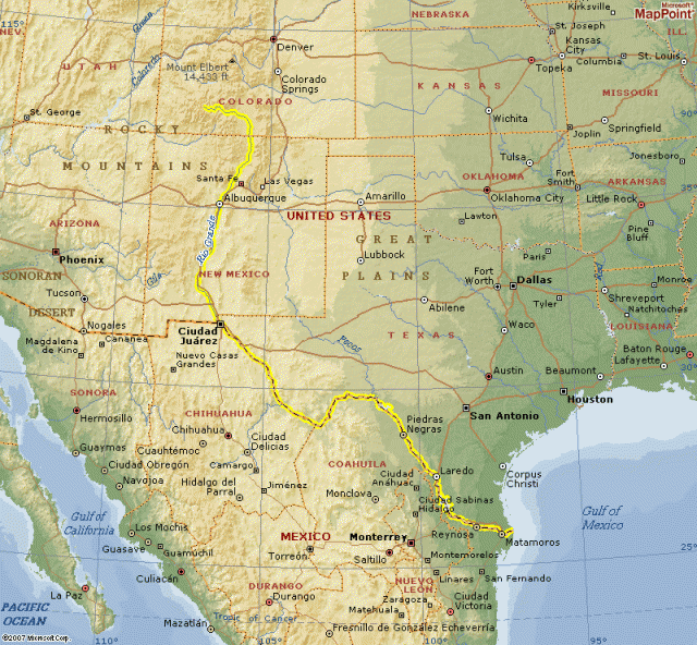
THE RIO GRANDE was once known as “Rio del Norte,” and the first to describe it to Europeans was Captain General Juan de Onate, whose party of exploration first visited the river on April 20, 1598. The river was then called Corre del Norte, meaning that its current ran from the north. It is the second-largest river in North America, running more than 1,800 mi (2,897 km) from its source in the southern ROCKY MOUNTAINS in COLORADO, to Brownsville, TEXAS, where it drains into the Gulf of Mexico. Its size is exceeded only by the MISSISSIPPI-Missouri river system in the central UNITED STATES, and the Rio Grande is the predominant drainage for the state of NEW MEXICO. The river delineates the southern border of the United States from El Paso, Texas, to the Gulf of Mexico.
A systematic and careful monitoring of the movement of the Rio Grande shows that it enters New Mexico via a spectacular gorge and flows south through a series of alluvium-filled basins produced over millions of years by the rifting process. Rising at an elevation of 9,842 ft (3,000 m), the Rio Grande flows southward about 746 mi (1,200 km) to the United States-MEXICO border, separating El Paso from Cuidad Juarez, Chihuahua. From there, the it flows in a more southeast direction for approximately 1,243 mi (2,000 km), until it reaches its mouth at the Gulf of Mexico.
The Rio Grande was once useful as a major supplier of surface and ground water for residential, commercial, and agricultural use in the Albuquerque, New Mexico area and in other villages, towns, and cities of the state through which the river flows. (Its international frontier in Texas is largely devoid of urban settlement from El Paso to the more southern reaches of the valley at Del Rio and Laredo.) Due to the extensive 20th-century degradation in water quality and natural habitat—a result of its extreme subjugation to agricultural exploitation—the Rio Grande is considered one of North America's most endangered river systems.
DEGRADATION
Being one of the longest rivers in the United States, and as an international border outside the exclusive control of any nation, perhaps it was inevitable that the Rio Grande would experience serious and uncontrolled degradation of water quality, quantity, and associated habitat. Despite the ability of the river to move about and change flow and location in its river course over most of the Rio Grande valley, it has experienced more frequent periods of stability and equilibrium as hydrological engineers have attempted to control its floods with dams and artificial lakes. Prior to this period of river engineering, riparian (riverine) ecosystems had more opportunities to become established on riverbanks and islands, and deposition and erosion of sediments allowed colonization of riparian vegetation across wide areas of the valley as it proceeded southward.
Over the course of the 20th century, the patterns of change in the Rio Grande have been radically diminished or stopped completely. It has, within the last 100 years, gone from a braided and sinuous set of channels to the flow of a single channel, in many places dredged and engineered so that it actually dries up for whole seasons, as its river waters are diverted to irrigation canals.
The Rio Grande's variegated flow over the last century has caused havoc in the Albuquerque area, as the city and its environs have suffered from major flooding. The record cites severe floods occurring on a fairly regular cycle, with major events in 1874, 1884, 1909, and 1920, to mention a few. In the 1874 flood, it was estimated that water covered 24 square mi (62 square km), filling the area between Bernalillo and Albuquerque for more than three months. While the river's ecology has been seriously compromised, it continues to provide services to towns and farms along its course, supplying irrigation water and drainage, and recharging the Ogallala aquifer that lies beneath its route. It continues to support natural habitats, particularly cienega (swamp) structures, which provide avian life with important stopovers in north-south migrations.