How Do We Use Global Positioning Systems and Remote Sensing?
THE GLOBAL POSITIONING SYSTEM GPS and remote sensing have greatly increased the accuracy of geographic field studies and given geographers new methods for performing geographic analyses. GPS helps geographers define spatial relationships among Earth's surface features, and a wide variety of remote sensing techniques help geographers define regional patterns and monitor changing environmental conditions.
What Is GPS?
Most people think of GPS as a navigation system in our cars, or embedded in our cellular telephones, or a handheld device used for location and guidance while hiking across the countryside. GPS provides the accurate position on Earth's surface including latitude, longitude, elevation, and even how fast we are traveling. This information comes from a series of satellites orbiting Earth that send radio signals to ground-based receivers, like the ones on our dashboards, in our phones, or in our hands when we go hiking.
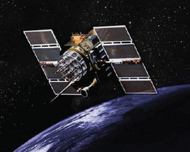
The U.S. government launches, controls, and monitors a constellation of 24 satellites orbiting in six different planes around Earth. Two generations of satellites currently operate in the GPS constellation. A third type will soon be deployed to improve the accuracy and reliability of satellite signals.
The time required for a radio signal from a satellite to reach a receiver on Earth is related to its distance to the receiver. A GPS receiver “knows” where each satellite is located in space at the instant when the GPS unit receives the signal. Calculating the distances from four or more satellites allows the GPS unit to calculate its own position, commonly with a precision and accuracy of several meters (for a handheld GPS unit). Higher precision can be achieved by occupying a single site for a long interval of time and then averaging the measurements.
How Do We Use GPS to Study Geographic Features?
GPS is used in a variety of applications from tracking wildlife migration or package delivery, to improving ocean and air travel. Even farmers use GPS to harvest crops and improve yield. Geographers use GPS for a variety of activities, including monitoring changes in the environment, collecting more accurate field data when surveying or mapping, and making decisions about how to best prevent or address natural disasters. Geographers employ two types of GPS devices, the familiar handheld GPS and the Differential GPS (DGPS).
A handheld GPS device is a navigation tool for finding a location. These instruments operate on the same principles as all other GPS devices in that they receive radio signals from orbiting satellites that contain information about the position and distance of the satellite. GPS works best outside and with a clear view of the sky, but it can operate with reduced accuracy in forested areas, deep canyons, and other settings where parts of the sky, and therefore view of the satellites, is partially blocked.
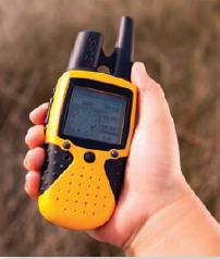
Geographers use handheld GPS mostly for field work, including mapping the locations of landscape features, determining locations of water and soil samples, and inventorying populations of plants and animals.
Differential GPS (DGPS) is the same as GPS but with a correction signal added to improve the precision and accuracy. Accuracy is enhanced because the correction signal performs an independent check of each GPS satellite's signal. DGPS can provide accuracy of less than several meters.
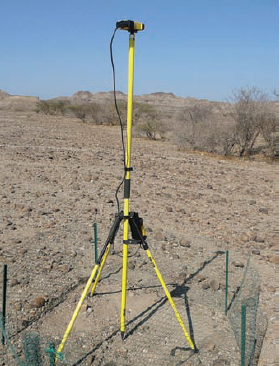
Geographers use DGPS when precision is important, such as in surveys of changes in the land surface over timescales of decades or to gauge the erosion effects of a recent hurricane on a shoreline and its communities.
What Is Remote Sensing?
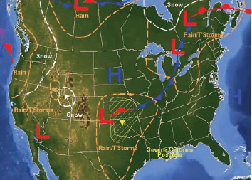
The term remote sensing refers to techniques used to collect data or images from a distance, including the processing of such data, and the construction of maps using these techniques. Remote sensing can be carried out using a helicopter, airplane, satellite, balloon, ship, or other vehicles, or it can be performed with instruments fixed on the land surface. The instrument-carrying vehicle or site is called the platform, and the instrument that collects the images and other data is the sensor. There are two general types of remote-sensing systems: passive systems and active systems.
Passive Remote Sensing
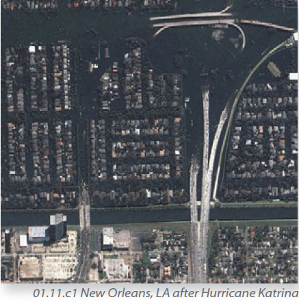
In passive remote sensing, the sensor points at the area of interest and records whatever light, heat, or other energy is naturally coming from that region. Aerial photography and most satellite images, like the one to the left, are recorded by passive sensors. The sensors are tuned to collect specific types and wavelengths of energy, such as infrared, visible, and ultraviolet energy. Most sensors collect an array of similar frequencies.
Active Remote Sensing
In active remote sensing, an energy source, usually on the same platform as the sensor, directs a beam of energy downward or sideways toward the area of interest. Such energy can include radar, as shown here, microwaves, laser light, or other types of energy. The sensor then measures how much of this energy returns to the platform and whether this energy has been modified by its interaction with the surface or atmosphere.
What Types of Remote Sensing Are Used By Geographers?
Geographers use a variety of remote sensing techniques, measuring various types of energy, to study Earth's atmosphere, hydrosphere, lithosphere, and biosphere. Geographers also document and investigate patterns in land use, vegetation cover, erosion rates, extent of pollution, atmospheric water content and circulation, and ocean temperatures.
Visible and Near Infrared (IR)
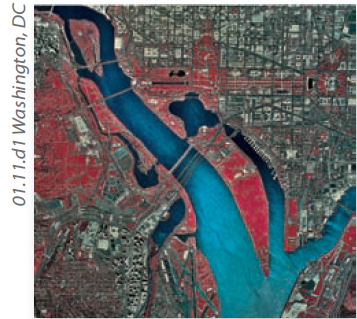
Aerial photographs typically record visible light reflected off an area, but some photographs and many satellite images also record adjacent bands of infrared energy (near-IR). On near-IR images, vegetation commonly is depicted with a reddish tone, as in this image of Washington, D.C.
Thermal Infrared (IR)
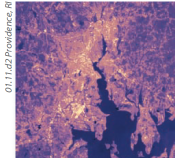
Objects also emit energy at thermal infrared wavelengths, either from the internal heat of an object or from heat initially gained from the Sun. This image shows thermal-IR derived temperatures of Providence, Rhode Island, with lighter colors showing hotter areas in the city.
Microwave
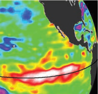
Images from microwave-sensing satellites and ground-based stations provide us with weather images in nightly newscasts. Microwaves can penetrate clouds and haze, providing a clear view of the ground at all times. They also can measure the height of the sea surface, as shown here.
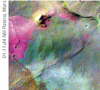
Multispectral
Some multipurpose satellites collect data at multiple wavelengths of energy, therefore the name multispectral. Multispectral data are used for studying natural hazards, inventorying plant communities, tracking forest fires, and observing landscapes on other planets, as shown here.
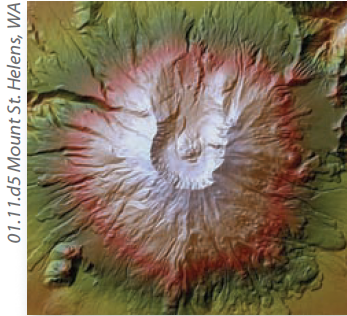
Radar, Sonar, and Lidar
Radar, sonar, and a newer technique called lidar all involve emitting waves of a certain wavelength and then measuring how much is reflected back to the sensor and the time required for the various beams to return. These data allow us to map the surface, like volcanic features.
- How Do We Use Maps and Photographs?
- How Do Map Projections Influence the Portrayal of Spatial Data?
- What Are Some Other Coordinate Systems?
- What Do Latitude and Longitude Indicate?
- How Do We Depict Earth’s Surface?
- How Do Earth’s Four Spheres Interact?
- What Are Some Important Earth Cycles?
- How Do Natural Systems Operate?
- How Do We Investigate Geographic Questions?