surveys, land
IT IS POSSIBLE THAT from our very earliest origins, modern humans have had an interest in putting things into perspective; being able to say where things are. As the Earth's population grew and hunting grounds became more removed from the places people lived, there was a need to be able to tell others how to get there. Or perhaps on meeting others, there was some need to tell them how to get to their village or water or good hunting. Such early descriptions were often based on physical features that stood out in the landscape; important points of reference that would be recognizable from a distance.
With time and human development, it is also likely that such descriptions were sketched in the dirt, or drawn on a rock for increased clarity. These early maps, whether oral or physical, were simple reference devices where distance and accuracy were not as important as relationships and how long it might take to go so far. When the Greeks, very early in the 5th century B.C.E., came to view the world as a sphere, there was a need for increased precision so that places might be properly positioned on maps. But there was no standard format at the time, and as far as we know, the early Greeks had no knowledge of spherical trigonometry; something that is necessary if you are going to map a globe. That meant that most early mapping efforts were built around geometry, a mathematical skill well developed by the Greeks and Egyptians.
The use of geometry probably has its origins in architecture, where both angles and distance were critical to the layout of buildings both on the ground and during construction. To begin a building, you first needed to define the space it would occupy on the ground, a system we today describe as surveying. Because construction has been one of the identifying features of human existence, surveying has been an essential element in the development of the human environment since the beginning of recorded history.
Land surveys can be traced back even before the Egyptians, who, every year after the Nile River overflowed its banks and washed out farm boundaries, would reestablish the boundaries by surveying. The nearly perfect squareness and orientation of the Great Pyramid of Giza, built c. 2700 B.C.E., is clear affirmation of the ancient Egyptians' command of surveying. Even today, it is a requirement in the planning and execution of nearly every form of construction. Its most familiar modern uses are in the fields of transportation, building, apportionment of land, and communications, all of which depend on the fundamental functions of measuring the Earth and boundaries upon it. Surveying has also been one of the more notable forms of work for many famous Americans including names such as George Washington, Daniel Boone, Captain John C. Fremont, Thomas Jefferson, and LEWIS AND CLARK.
Land surveys, however, are quite different from building surveys where corners are established and distance measured with precise geometry. As indicated above, the earliest land survey techniques relied on physical features as points of reference, and by connecting points it was possible to describe an area or territory. And of course, once territory is described, boundaries are created. This system of describing points with direction came to be known as the metes and bounds survey system and was used extensively in Europe prior to the founding of the UNITED STATES.
The original colonies continued the British system of metes and bounds until 1785, describing property lines based on what meets the eye and bounds (boundary lines) drawn by humans. A typical yet simple description under this system might read, “From the point on the north bank of Ten Mile Creek one mile above the junction of I-70 and Middle Creek Road, north for 400 yards, then northwest to the large standing rock, west to the southwest corner of the municipal pump house, south to Ten Mile Creek, then down the center of the creek to the starting point.” The problem with this system was that sometimes these important points of reference such as the big standing rock or the course of a stream or river might change or become obsolete.
The metes and bounds system was also used to describe towns, which were generally rectangular shaped, 4 to 6 mi (6 to 10 km) long per side. Within this boundary, a map or plat was maintained that showed all the individual lots or properties. In the 1783 Treaty of Paris recognizing the United States, Britain also recognized American rights to the land south of the Great Lakes and west to the MISSISSIPPI RIVER. The Continental Congress passed the Land Ordinance of 1785, creating the Public Land Survey System. The law was later modified when Congress passed the Northwest Ordinance of 1787 to control the survey, sale, and settling of the new lands. The system is in use in all states except the first 13 and VERMONT, TEXAS, and HAWAII. The basic units of area under the system are the township and section, and it is often referred to as the rectangular survey system.
The Public Land Survey System is coordinatebased, with all distances and bearings made from north-south-running meridians and east-west base lines. In 1796 the office of U.S. Surveyor General was created to survey lands as the nation expanded westward with distances measured using chains and links. A chain measured 66 feet long, contained 100 links of 7.92 inches each, and 80 such chains put together equaled 1 mile.
COMPASS ALIGNMENT
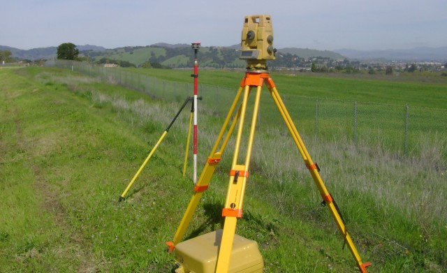
Alignment was determined using a compass or a solar compass. In areas where measuring by chains was not possible, such as lakes or hilly terrain, distances were calculated using triangulation. To demarcate the boundaries of townships and sections, surveyors usually needed to establish a baseline for east-west measurement and meridian for north-south measurement. Using these lines as reference points, surveyors would place monuments (typically wooden posts) at township and section corners and at quarter-section corners.
To ensure that these corners could be found if the posts were destroyed, surveyors also marked “bearing trees” or other more permanent objects nearby. In prairie areas, they built earth mounds around the posts, and when a corner fell in a body of water, a “meander corner” was established until a true corner could be determined by triangulation or direct measurement.
Meander corners marked the intersection of section lines and a water body. A “witness corner” was used to designate a section or quarter corner when it was located where it was impractical to place a monument. The largest subdivision of land is the Public Land Survey Township, which measures 6 mi square (36 square mi or 93.25 square km). Each township contained 36 sections, and each section (640 acres or 259 hectares) has an area of 1 square mi (2.6 square km). Each township is numbered based on its relative position from these lines starting in the northeast corner. The first row is numbered east to west, while the second row (sections 7 through12) is numbered west to east. This process continues until section 36 is reached in the southeast corner. In this context, township becomes a unit of length as well as area. Township boundaries are multiples of 6 mi (10 km) north or south of the baseline.
The unit of length for east-west measurement is the range; range boundaries are multiples of 6 mi (10 km) east or west of the meridian. The result is a spatially coordinated section designation such as T2N, R3E. There are five major exceptions to the application of this system: LOUISIANA, Texas, CALIFORNIA, Hawaii, MAINE, and OHIO.