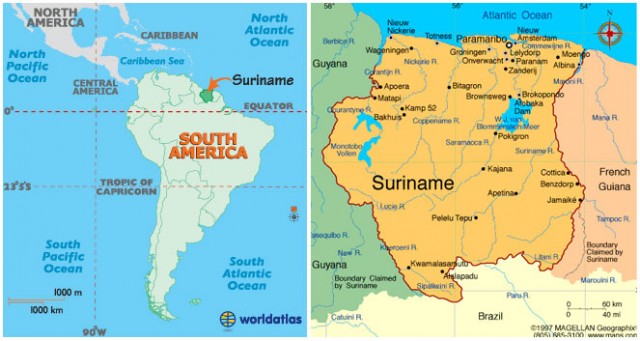
Suriname
Area 63,039 square mi (163,270 square km)
Population 538,200 2014
Capital Paramaribo
Highest Point 4,059 ft (1,230 m)
Lowest Point -6.6 ft (-2 m)
GDP $5.210 billion 2014
Primary Natural Resources timber, hydropower, fish, kaolin.
SURINAME IS THE SMALLEST independent country in South America. Known formerly as Dutch Guiana, it has had a troubled history since independence in 1975, in part because of conflicts between its very different populations of varied East Asian and African background. Stabilization since the 1990s has brought renewed ties to the international community, both for foreign investment and for badly needed economic aid from the NETHERLANDS.
Like its neighbors, GUYANA to the west and FRENCH GUIANA to the east, Suriname is one of the most underpopulated and extensively forested areas of the world. Most of the Surinamese live along the narrow coastal plain (about half the population in the capital city of Paramaribo), with scattered settlements—notably of indigenous Carib and Arawak tribes—in the interior. The interior RAINFORESTS are also home to several groups known as Maroons (also called Bush Negroes), descendants of escaped slaves from the 17th and 18th centuries, who have retained many customs of their west African ancestors (dance, architectural style, dress, and parts of African languages). Attempts to forcibly resettle these groups (or to set up logging concessions) met with fierce resistance and a guerrilla movement in the 1980s.
AGRICULTURAL PRODUCTS
Some of the northern coastal plain has been drained and cultivated for paddy rice and other agricultural products. Other tropical products include bananas, coconuts, and shrimp from the area's many estuaries. There is also a large lowland lake, with one of the world's most curious names: Prof. Dr. Ir. W.J. van Blommestein Meer.
The interior rises to highlands, in which the country's mineral wealth can be found. The chief of these is bauxite, produced from weathered granite rocks in tropical conditions, used to produce aluminum. Bauxite production generates around 15 percent of the gross domestic product and 70 percent of all export earnings. At the furthest inland point are the Tumuc-Humac Mountains on the border with BRAZIL.
The Guiana coast was settled and contested variously by the three European powers of England, FRANCE, and the Netherlands in the 17th century. In 1667, the Dutch received all of what was then known as “Surreyham” (named for the English county Surrey), including much of what is now Guyana, in exchange for New Amsterdam (renamed New York City). Early settlers grew tobacco and cotton, and later started larger plantations for the chief cash crop of the Caribbean region, sugarcane. The Dutch were used to building dikes and drainage systems (half of the Netherlands is below sea level), so this portion of the coast thrived.
After the abolition of slavery in Dutch colonies in the early 19th century, indentured laborers were brought in from Dutch colonies in Southeast Asia, who brought rice paddy cultivation with them. Rice is today a larger economic activity than sugar. As all three colonies explored inland toward the mineral-rich highlands, boundary disputes came forth, which remain to this day.
Many Javanese Muslims left Suriname in the 1970s, fearing discrimination from the larger Christian and Hindu populations. Almost 40 percent of the population, most of them educated or skilled, left the country, which fell into further chaos after a bloody military coup in 1980. Free elections began again in the 1990s, but the country remains very divided.