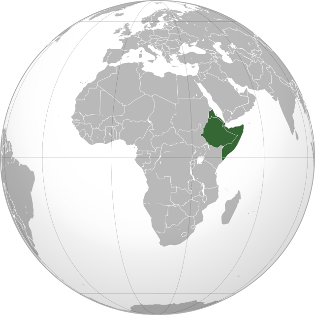
Horn of Africa
THE PENINSULA OF NORTHEAST Africa is called the Horn of Africa. It lies opposite of the southern Arabian Peninsula. This area is also known as the Somali Peninsula because within it lies the countries of SOMALIA and eastern ETHIOPIA. It is the easternmost extension of the African continent separating the Gulf of Aden from the INDIAN OCEAN. It is sometimes also used as a name for the entire region of countries in northeast Africa including ERITREA, DJIBOUTI, Ethiopia, and Somalia and sometimes even including parts of SUDAN and KENYA. The Horn of Africa also alludes to the shape of this area because it sticks out like that of a rhinoceros horn from the continent of Africa.
The Horn of Africa is made up of a wedge of land that is cut north to south by two great geographical features: the NILE RIVER Valley and the Great RIFT VALLEY. Between these two features are high plateaus and rugged volcanic mountains. West of the White Nile River spans the great and vast SAHARA DESERT. The Great Rift Valley rises to just over 1 mi (1.6 km) above sea level in central Ethiopia and then drops well below sea level in the Danakil (or Dallol) Depression. Some places in the depression are over 328 ft (100 m) below sea level making it one of the lowest places on Earth not covered in water.
It is known as one of the most inhospitable places on Earth because the landscape is sand and volcanic rock. Much of the area is still active volcanically and tends to have intermittent earthquakes. It is also the hottest place on earth with temperatures that can reach up to 145 degrees F (63 degrees C) in the sun. From the coast of Eritrea, the Danakil Depression drops even further into the depths of the Red Sea.
The coastal lowlands along the Gulf of Aden and the Red Sea are mainly desert, as is most of Eritrea and northern Sudan. Southern Sudan is covered in savanna. Much of Ethiopia is covered in highlands that were once thickly forested. Over millennia, this area suffered from deforestation but there are still some small isolated areas of tropical forest. Much of this area could be used for agriculture but has yet to be truly developed. All of the countries of the Horn have petroleum, natural gas, gold, silver, copper, and iron ore but not much of this has really been developed either.
The main reason this area is important is that the Horn of Africa commands the Red Sea and the northwestern portion of the Indian Ocean. There are many good ports on both sides of the Horn. Ships traveling in the area headed for the suez canal and the Mediterranean from Asia, the Persian Gulf, and East Africa all have to navigate through the narrow waterway at BAB EL MANDEB, the entrance to the Red Sea. Thus, its importance is not only geographical but political as well. The people of the Horn subsist in vastly different styles ranging from those that are hunter-gatherers and fishermen to nomads and farmers to industrial workers and more urban modern professions.
Most of the people of the Horn are farmers who still use draft animals to turn the land. Per capita income, literacy, and life expectancy are among the lowest in the world on the Horn. There are over 200 languages and dialects spoken over the Horn. There are even more ethnic groups that are further broken down into tribes and clans many of these who have deeply divided loyalties. There has almost always been conflict on the Horn for some reason or another, whether if be for political, ethnic, economic, or religious purposes and it does not look like that will change any time soon.