Sahara Desert
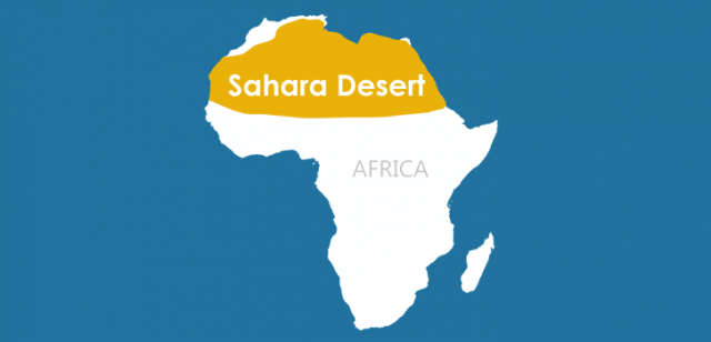
THE SAHARA IS THE world's largest desert. Covering about 3,320,000 square mi (8,600,000 square km) it is roughly the size of the UNITED STATES. It extends across the whole of North Africa from the ATLANTIC OCEAN to the RED SEA, a distance of more than 3,500 mi (5,630 km). It stretches south for at least 1,200 mi (1,930 km).
The Sahara covers parts of the countries of MOROCCO, ALGERIA, TUNISIA, LIBYA, EGYPT, WESTERN SAHARA, MAURITANIA, MALI, NIGER, CHAD, and SUDAN. In the north, the Sahara bounds the Atlantic Ocean and the MEDITERRANEAN SEA, excluding the ATLAS MOUNTAINS in Morocco, Algeria, and Tunisia and the NILE Valley in Egypt. Some geographers include these areas. The Sahara's southern boundary is roughly on a line beginning on the Atlantic at Nouakchott (Mauritania) through Timbuktu (Mali) to KHARTOUM (Sudan) where it curves northward to the Red Sea skirting the higher elevations to the south.
South of the Sahara is an arid transition belt called the SAHEL in Arabic. It stretches across North Africa from the Atlantic to the Sudan. It is an area into which the Sahara has been slowly expanding. At the Sahara's desert edge in western Sudan is the semi-mountainous Darfur region, which is about the size of arizona and at least half of NEW MEXICO combined. Some local areas of the Sahara are also called deserts. These include the Libyan Desert in Libya, the Western Desert west of the Nile River in Central Egypt, and the Eastern Desert and the Nubian Desert (Arabian Desert) located east of the Nile.
The landforms found in the Sahara are mountains, plateaus, rocky plains, and sand dunes called ERGs. In addition, in several places there are depressions that are below sea level. Some of the depressions contain salt lakes, while others have fresh water. An important feature of the Sahara in Egypt is the Qattara Depression. This desert area is 436 ft (133 m) below sea level at its lowest point. There are several other depressions in the Sahara.
The major mountain areas are the AHAGGAR (Hoggar) MOUNTAINS in Algeria. These rise to a height of 9,573 ft (2,918 m). Northeast of the Ahaggar Mountains is an upland area called the Tassili-n-Ajjer. In the south Sahara, the Tibesti Mountains in Chad reach a height of 11,204 ft (3,415 m) at Emi Koussi. This is the highest point in the Sahara. The al-Hamra' in Libya is a region of stony desert with a pavement-like surface (hammada). Other stony plains are located in different areas.
The name Sahara comes from an Arabic word, sahra', meaning “desert.” There are also local names in indigenous languages for areas such as the Tanezrouft, which is a pebbly plain in southwest Algeria, and the Tenere (Land of Fear) in Niger. Sand dunes (ergs, edeyin, or ramlah) cover great areas of the Sahara. The largest of these are the Great Western Erg (Algeria), Great Eastern Erg (eastern Algeria), and Erg Chech (southwestern Algeria). Other vast sand seas are in Libya and Egypt.
The Sahara is the world's driest hot desert. Some places receive an average of 4 in (10 cm) of rain a year. Most areas receive much less. Some areas may not receive any rain for 100 years or more. Rare thunderstorms occur which can have disastrous effects. Whole desert towns built from dried mud brick have been destroyed in the sudden storms. The Sahara has become much drier over the last 10,000 years. Paleolithic and Neolithic people left numerous rock carvings and paintings throughout the Sahara that show elephants, giraffes, and other animals. About 6,000 years ago, the Sahara began to dry. The forests and grasslands were replaced with barren desert. Human activity has also aided the desiccation process.
There are an estimated 2.5 million people living in the Sahara. Large areas are totally unpopulated. Most people live in some of the mountainous areas or in the scattered oases that are found in other areas. Most are either Arabs or Berbers, like the Tuareg. The Moors are of mixed Arab and Berber blood and are mostly in northwestern Sahara. The Toubou are a Negroid people in the Tibesti Mountains.