Southern African Development Community
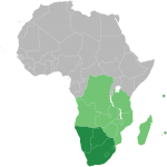
IN 1980, NINE FRONTLINE southern African countries came together as the South African Development Coordination Conference (SADCC) to promote economic stability, increase interdependence, mitigate poverty, and battle the issue of apartheid in SOUTH AFRICA. In 1992, SADCC became the Southern African Development Community (SADC). By 1997, SADC had grown to 14 nations, including South Africa, where apartheid had been abolished. The geography of the […]
Skeleton Coast
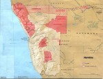
THE SKELETON COAST is part of Africa's southwestern coastline. It runs from NAMIBIA's Cape Cross north to the Kunene River. Much of the plant, insect, and animal life here has adapted to a continued shortage of fresh water because most of the coast is part of the Namib Desert. Many species have unique ways to harvest water from morning fogs, helping […]

Silk Road
BETWEEN MESOPOTAMIA and CHINA stretched Central Asia, large, barren, hostile—a wasteland. Through this vast area, the one link that allowed the two civilizations to trade with each other was the loosely defined cluster of trails known as the Silk Road. Even today, the Silk Road runs through one of the harshest desert environments in the world, with little water or vegetation or […]
shifting cultivation
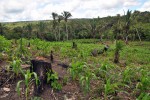
OF THE MANY different types of agriculture that exist worldwide, shifting cultivation is today most common in forested tropical and subtropical regions. It was once much more widespread in areas where permanent agricultural systems now exist, such as the temperate and Mediterranean zones, as agriculture emerged from hunting and gathering and spread from centers of origin in the Near and Far East. […]

shield
A SHIELD IS A large, tectonically inactive mass of Precambrian crystalline rock that underlies most of a continent. (Another name for a shield is craton.) A shield's rocks are igneous and metamorphic in origin and contain some of the oldest rocks on Earth. In zones of tectonic plate convergence, mountain systems that are actively building often mark the edges of shields. […]

severe weather
IN THE UNITED STATES, severe weather is defined as a tornado, winds greater than 58 mi per hour (93 km per hour) or hail greater than .75 in (1.9 cm) in diameter. Other countries sometimes include heavy precipitation or a large amount of lightning in their definitions of severe weather. Severe weather is usually considered to come from thunderstorms but other storms, […]
service industries
SERVICES HAVE become a driving force in the global economy and the rise of the “new economy” amplifies this trend. However, for a long time, services were viewed as nonproductive activities. This situation was also justified in terms of services as invisible and intangible inputs to other material products that were largely supplied on an individual basis rather than in an integrated, […]
seasons
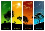
A GREAT DEAL OF the variation that exists in the Earth's physical phenomena is caused by the revolution and the ROTATION of the earth. The rotation of the Earth on its axis every 24 hours and the revolution of the earth around the sun every 365 days regulate the amount of electromagnetic energy received by the Earth's surface. Another factor which […]
scale
SCALE IS A FUNDAMENTAL component of geographic events and processes. Climate change occurs at global scales, while human diseases such as measles occur at essentially local and regional scales. Many geographic processes also occur across multiple scales, and more important, some processes behave differently at various scales. Consequently, an explicit statement of scale is required to understand and compare these geographic processes. One […]

Sauer, Carl O. (1889–1975)
CARL ORTWIN SAUER was one of the most influential American geographers. Throughout his long and distinguished career, he shaped and fundamentally changed the field of cultural and anthropogeography in the UNITED STATES. Sauer was of German descent, and his ancestors were members of a German pietistic sect affiliated with the Methodists who had settled in Warrenton, MISSOURI, Sauer's place of birth. After […]
satellites
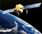
THE GLOBAL POSITIONING System (GPS) is a constellation of earth-orbiting satellites developed by the U.S. Department of Defense to provide global, all weather and 24-hour positioning capabilities to ground-based GPS receivers. Although the original system was intended for military use, it has also found important and widespread applications in civilian positioning, navigation, and mapping. Positioning is about determining an exact location based on […]
Saint-Pierre and Miquelon
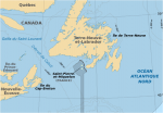
AS FRENCH TERRITORIES (93 square mi or 242 square km) and a curious leftover from the chessboard games of colonial diplomacy of the 18th-century great powers, the tiny islands of Saint-Pierre and Miquelon are the only remaining fragments of the once mighty French North American empire. Consisting of two small islands, no more than barren rocks with two small settlements, the territory's […]

Sahel
SAHEL (OR SAHIL) MEANS “edge or border” in Arabic. The Sahel is a semiarid transitional zone between the southern edge of the SAHARA DESERT and the humid savannah zone of Africa. On average it is 187 mi (300 km) wide. It has a fragile ecology but is also diverse in plant and animal species. The Sahel stretches across North Africa from […]
Ruhr Valley
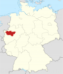
IN TERMS OF LENGTH and volume, the Ruhr River is not one of GERMANY's major rivers. But considered as a center of economic activity, the Ruhr is among the most prominent rivers in Europe. Starting in the early 19th century, the coal that was mined in this region was processed in factories all along the river's course, creating one of the […]

rotation, Earth axis
EARTH HAS TWO primary motions: revolution and rotation. The first refers to the earth's annual orbit of the sun, which takes a bit more than 365 days per year (hence, a leap year with 366 days every four years in order to “catch up”). As it revolves around the sun, the Earth rotates on its axis once every 24 hours, […]

riparian
RIPARIAN IS DERIVED from the Latin riparius, meaning “of the river bank.” The term was historically used to describe the area of land lying adjacent to a body of water: primarily streams or rivers but also lakes. Riparian areas are ecotones—transition areas or interfaces between terrestrial and aquatic ECOSYSTEMs. As such, riparian areas possess features and processes influenced by adjacent ecosystems as […]

Ring of Fire
The Pacific Ring of Fire is an arc of intense EARTHQUAKE (seismic) and volcanic activity stretching from NEW ZEALAND, along the eastern edge of Asia, north across the ALEUTIAN ISLANDS of ALASKA, and south along the coast of North and South America. It is made up of over 75 percent of the world's active and dormant volcanoes. The Ring of Fire […]

rift valley
A RIFT VALLEY IS A trenchlike basin with steep parallel sides. The valley is essentially a down-faulted crustal block (grabben) between two parallel faults. A rift valley is different from an ordinary grabben for its remarkable length and depth. Such extraordinary basins typically occur where tectonic plates diverge. The release of Earth's interior energy creates most rift valleys in the processes of […]

resource
THE WORD resource is derived from the Latin resurgere, meaning to “rise again.” Therefore, a resource can be part of a cyclical process that can change and return over time and space. Resources are those elements that humans have the knowledge and technology to utilize to provide desired goods and services. Resources are subjective, functional, and dynamic. They can be tangible things […]

religion
RELIGION CAN BE DEFINED as a unified set of beliefs, values, and practices of an individual or a group of people that is based on the teachings of a spiritual leader. It includes codes of behavior, faith in and devotion toward a supernatural power or powers, and a framework for understanding the universe. Religion is an important component of many individuals' […]
regionalism
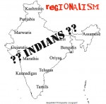
REGIONALISM IS A COMPLEX and contested concept. As such, there is no straight or simple answer to what regionalism is. One thing for sure is that regionalism is closely related to REGION. Since a region may connote geographical contiguity ranging from a small neighborhood to a few cities right up to several states and continents, regionalism thus can exist within a state, […]

region
THE NOTION OF REGIONS has been central to geographic thinking, first because of the importance of the observation and its corollary, and second because of the classification in classic geography emphasized by the empiricism and primacy of the field survey. The term region originates from Old French and stems from the Latin regio, meaning “direction and district,” and from regere, meaning “to […]
redistricting
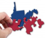
THE PROCESS OF redistricting means dividing anew into districts or, in particular, to revise the legislative districts of a certain area, typically of a city or state. In the UNITED STATES, the process of redistricting is also referred to as “legislative reapportionment,” which the U.S. Constitution requires so that Congressional representatives are elected according to population. The process of redistricting redraws the […]
rainforests
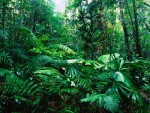
THE WORLD'S RAINFORESTS are often considered the world's “hot spots” since they are often found in tropical climates and they are home to the majority of the world's species. As of 2000, studies and surveillance indicated that rainforests may have from one-half to two-thirds of the world's species, despite only covering 5–7 percent of the world's surface. Biodiversity is just one of […]

Quaternary geography
THE QUATERNARY PERIOD is the time in which people became fully human and the dominant animal species on earth. The Quaternary is Earth's most recent geological period and includes the Pleistocene and Holocene epochs. (Eras, periods, and epochs comprise the geological calendar. An era is the longest unit of geologic time. Traditionally, geologists identify periods as beginning and ending with the appearance […]

Puncak Jaya
PUNCAK JAYA, THE highest peak of the Sudirman Range of Papua, is also the highest mountain between the ANDES and the HIMALAYAS, rising to 16,503 ft (5030 m) on the tropical island of New Guinea. It was first named Mount Carstenz after the Dutch navigator Jan Carstenz, who first sighted the peak from the coast […]

Ptolemy
KLAUDIOS PTOLEMAIOS, known as Ptolemy in English, lived in Alexandria, EGYPT, in the second century C.E. He is considered one of the most important scientists of the later Classical era, with two major treatises in the areas of astronomy and geography. His geocentric model of the universe was the standard accepted view of the cosmos […]

projection, maps
THE EARTH CAN BE assumed as a perfect sphere for purposes of simplicity. However, in reality there is a large difference between the pole-to-pole distance and the equator distance. The Earth is about 1/300th smaller in its pole to pole distance. This unique shape is called an oblate ellipsoid or spheroid. An estimate of the ellipsoid […]
precipitation
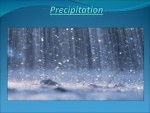
PRECIPITATION IS WATER falling from clouds. In the tropics, rain is the common form. In colder climates, precipitation also falls as snow, sleet, or hail, if the air temperature is 32 degrees F (0 degrees C) or less. Water's descent from clouds begins when the size of water droplets or ice crystals becomes large enough for […]
prairie
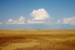
BEFORE NORTH AMERICA was populated by settlers who developed the land, most of the continent was covered by flat grass-covered areas known as prairie, stretching from CANADA to MEXICO. By the beginning of the 21st century, 99 percent of the original prairie had been destroyed. The provinces of Alberta, Saskatchewan, Manitoba, and Ontario are part […]
Polynesia
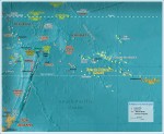
POLYNESIA, MEANING “many islands” (Greek), is one of the three main divisions (the others being MICRONESIA and MELANESIA) of Oceania. This division is based upon the ethnological background of the different islands' inhabitants. Geographically, Polynesia is a triangle area of islands, with the Hawaiian Islands at one corner, NEW ZEALAND at another, and EASTER ISLAND […]

Polo, Marco (1254–1324)
MARCO POLO IS THE best known of all Western travelers along the SILK ROAD. He traveled Asia for 24 years, all the way to CHINA, where he became confidant of Kublai Khan (1214–94.) He also wrote of his travels. Marco was born in ITALY, either in Curzola off the Dalmatian coast or in Venice, in […]

political geography
POLITICAL GEOGRAPHY IS the study of the ways geographic space is organized within and by political processes. It focuses on the spatial expression of political behavior. Boundaries on land and on the oceans, the role of capital cities, power relationships among nation-states, administrative systems, voter behavior, conflicts over resources, and even matters involving outer space […]
Po Valley
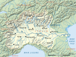
THE PO RIVER VALLEY is the largest and most important economic region in ITALY. It is the center of most Italian industry as well as Italy's agricultural heartland. More than 16 million people—nearly a third of all Italians—live in this fertile basin, in which are located 12 cities with populations surpassing 100,000, including Turin and […]
Pleistocene geography
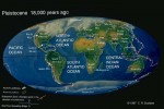
THE PLEISTOCENE EPOCH was Earth's most recent Ice Age. The epoch began around 1.8 million years ago (mya) or 2.6 mya. Traditionally, scientists have based the starting date of the epoch on faunal grounds and have estimated it to be about 1.8 mya. A growing number of climate scientists and glaciologists tend to use 2.6 […]

playa
PLAYAS ARE SHALLOW basins that periodically fill with rainwater. They have been described as among the most dynamic geomorphic features, reacting to seasonal and sometimes daily changes in the environment. The term playa owes its origin to the Spanish word for “beach” or “shore.” A large number of playas began as lakes, drying later as […]

plateau
A PLATEAU IS A LARGE area of mostly level land elevated high above the surrounding land. Most plateaus have one steeply cliffed side. The rock layers in a plateau are un-deformed and remain flat, unlike the rock layers in mountains, which are tilted. Basaltic plateaus are formed when molten rock forces its way up through […]

plate tectonics
PLATE TECTONICS IS A geological theory that explains many important features of the Earth's surface through the movement of sections of the crust, known as plates. Among the observed data explained by plate tectonics are the known similarities of features on the east and west sides of the ATLANTIC OCEAN, similarities of plant and animal […]

planning
WHILE PLANNING IN ITS MOST literal form refers to the creation of a plan in an urban context, in reality the term has a far broader and more complicated definition. For example, planning can refer to matters of safety, that is, the prevention of natural disaster, as well as issues such as aesthetics, the environment, […]
place
NOTHING IS MORE important to all geography, descriptive or analytical, natural or human, than place or location. Place can be divided into at least three distinct aspects: geometric location defined by precise latitude and longitude; relative location of where a place is relative to other places, especially in the context of history; and finally, the […]

physical geography
PHYSICAL GEOGRAPHY IS AN integral part of a much larger area of understanding called geography. Most individuals define geography as a field of study that deals with maps. This definition is only partially correct. A better definition of geography may be the study of natural and human phenomena relative to a spatial dimension. The discipline […]

Phoenicia
ANCIENT PHOENICIA, A LOOSE confederation of city-states existing between 3000 B.C.E. and 146 B.C.E., was located where LEBANON is now. The culture was known for seafaring commerce and trade, and colonizing. The most important legacy left by the Phoenicians, though, was a 22-character alphabet that became the basis of Hebrew, Greek, and Roman script. In […]
Petra
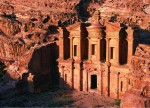
PETRA HAS BEEN described in National Geographic magazine as being “JORDAN's city in the rock.” There is no doubt, however, that Petra, located south of Amman on a semiarid site at the edge of the Wadi Araba mountainous desert, is a wonder of the ancient world. Originally developed at the crossroads of overland trading routes, […]
Persepolis
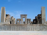
ONE OF THE MOST magnificent cities of the ancient world, Persepolis was the political, cultural, and religious center of the Achaemenian PERSIAN EMPIRE for over 200 years before its complete destruction at the hands of Alexander the Great in 330 B.C.E. The ruins of Persepolis lie at the foot of Kuh-i-Rahmat, the “Mountain of Mercy,” […]

Pantanal
LOCATED IN SOUTH-CENTRAL BRAZIL and extending into the adjacent parts of BOLIVIA and PARAGUAY, the Pantanal is the world's largest wetland. It can expand during the rainy season to cover about 77,000 square mi (200,000 square km), which is about one-third the size of FRANCE. Water depths may exceed 18 ft (6 m), with only the […]

Pannonian Plain
ALSO KNOWN AS the Hungarian Plain, the Pannonian Plain is one of the flattest parts of Central Europe and one of the most agriculturally productive. The plain occupies a wide depression between the Alpine ranges to the west and south and the Carpathian chain to the north and east. At its greatest extent, the plain […]
Panama Canal
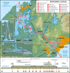
A CANAL THAT LINKS the ATLANTIC and PACIFIC oceans through the isthmus of PANAMA from northwest to southeast, the Panama Canal is 51 mi (82 km) long. A trip through the canal takes approximately eight hours. The Panama Canal consists of a system of six locks that help ships negotiate the water levels of the […]
pampas
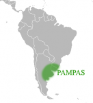
THERE ARE MANY types of GRASSLANDs worldwide, especially in the continental interiors of temperate to subtropical regions. That of South America is known as the pampas, a Spanish term. The pampas occupies some 270,270 square mi (700,000 square km) in the countries of ARGENTINA, URUGUAY, and southeast BRAZIL. Here, there are extensive plains with isolated […]
orographic precipitation
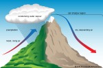
OROGRAPHIC PRECIPITATION is caused or enhanced by one or more of the effects of mountains on the Earth's atmosphere. These effects include the upward or lateral motions of air directly caused by mountains acting as a barrier as well as the thermal effects of the mountains that cause them to be elevated heat or cold sources. […]

orogeny
OROGENY, A GEOLOGIC CONCEPT, comes from the Greek oros, meaning “mountain,” and genes, meaning “stemming from.” The etymology associates the term with the concept of building mountains, and in the past, orogeny was associated with mountain formation. Its specific use, today however, relates to the deformation of rocks that leads to postorogenic mountain building. The thrusting, […]

Olduvai Gorge
OLDUVAI GORGE IS LOCATED in the East African Rift Valley of northeastern TANZANIA, on the eastern edge of the Serengeti Plain. Discoveries of fossils dating back 1.8 million years were made there by Louis and Mary Leakey, and Donald Johansen. The gorge is now part of the Ngorongoro Conservation Area and lies just to the […]
Nubia
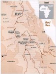
NUBIA, KNOWN AS THE Gateway to the SUDAN, does not exist as a political entity in the 21st century. Geographically, the section of Northeast Africa that was once Nubia has been encompassed into northern Sudan and southern EGYPT, with cataracts (areas where geological forces have formed outcroppings of rock) along the NILE RIVER determining Nubia's […]

North Slope
THE NORTH SLOPE of ALASKA stretches from the high mountains of the Brooks Range to the ARCTIC OCEAN on the north. Miles of barren coastal plains and low, rolling hills, caused by freezing and thawing of the ground, make up the region. No trees are in evidence, as the short growing season will support only […]
North Atlantic Treaty Organization
AT THE END OF World War II (1939–45), Europe lay in wasted ruin with most industrial and transportation infrastructure damaged or destroyed. Some 40 million deaths had occurred in Europe and RUSSIA in the six years of conflict. Approximately 25 million displaced persons were stranded far from original homelands with little resources. The UNITED STATES […]
North American Free Trade Agreement
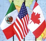
IN 1993, THE UNITED STATES, CANADA, and MEXICO signed the North American Free Trade Agreement (NAFTA), which created a regional free trade zone that lowered tariffs and trading restrictions and encouraged greater opportunities for cross-border investments and movement of goods and services between the three countries. The agreement went into effect in 1994. While all three […]

Newton, Isaac (1642–1727)
SIR ISAAC NEWTON WAS one of the most famous and influential men in the world of science, in both mathematics and natural philosophy. His laws of gravity and motion formed the basis of classical mechanics, principles that are at the heart of modern engineering, physics, and astronomy. His work provided a mathematical mechanism to prove […]

New Mexico
NEW MEXICO IS THE “Land of Enchantment.” Nowhere else in the UNITED STATES can such a variety of landscapes, histories, and traditions be found. Located in the American southwest, New Mexico is part of the dry and warm Four Corners region. Although primarily arid in the southern deserts to semi-arid in the high deserts, there […]
Netherlands Antilles
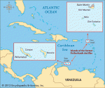
AN OVERSEAS TERRITORY of the NETHERLANDS, the Netherlands Antilles consists of four and a half islands, separated by about 545 mi (880 km) of the CARIBBEAN SEA. The southern group, Curacao and Bonaire, known as the Windward Islands, lie 40 to 50 mi (60 to 80 km) off the northern coast of VENEZUELA. Formerly known […]

needs and wants
WANTS AND NEEDS are concepts that have come to be developed around three different spheres of discussion, biological, social, and economic. Each is an expansion in size and scale over the one preceding it. In addition, it is important to remember that the subject is biological in character. This means that we do not discuss […]
nautical mile
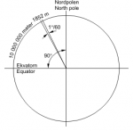
A UNIT OF DISTANCE used primarily at sea and in aviation, the nautical or sea mile is based on the average meter distance on the Earth's surface represented by one minute of latitude. Because it is based on the earth's dimensions, the nautical mile is extremely convenient to use for any type of navigation. Adopted […]

nationalism
THE MODERN CONCEPT of nationalism was born with the Treaty of Westphalia in 1648. Before then, Europe was a checkerboard of small states, cities, principalities, and alliances united by religions, language, history, and politics. As recently as the 1800s, such nations as CHINA, INDIA, and even ITALY looked nothing like they do today but instead […]
Nap of the Earth
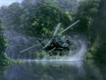
NAP OF THE EARTH, or NOE, is a Vietnam War-era term for very low-level flight, particularly of helicopters. The concept behind this type of flying is that a pilot guides his or her craft as close to the Earth's surface as terrain, vegetation, and other obstructions will allow and maintains that low altitude while approaching […]
Mozambique Channel
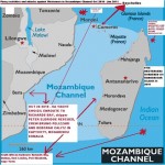
LOCATED OFF the country of MOZAMBIQUE in Africa, the Mozambique Channel lies within the INDIAN OCEAN, between the African continent and the island of MADAGASCAR. The currents in the Mozambique Channel usually form an anticyclonic system but sometimes they do flow directly south into the Agulhas Current off the coast of SOUTH AFRICA. This area […]
Mosquito Coast
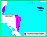
THE MOSQUITO COAST, or Mosquitia, is located on the east coast of NICARAGUA and HONDURAS. The name is derived from the Miskito, the indigenous people of the region. The Miskito are descendants of the Chorotega, an aboriginal people of South America. Because of the absence of historic ruins, little is known of the Chorotega people, […]
monsoon
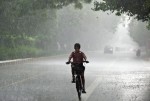
THE HEAVY RAINS of the monsoon appear in June and subside in September every year in the Northern Hemisphere. Meteorologists and scientists are greatly helped by the development of sophisticated weather analysis and forecasting technology in understanding monsoon mechanisms. Numerous people on the earth are affected by this significant climatic system. The monsoon directly governs […]
military geography
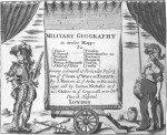
FROM EARLIEST HISTORICAL writings, the nature of warfare is shown to be a struggle for positional advantage at the tactical, operational, and strategic levels. Xenophon writing of the fate of the 10,000 Greeks fighting in Persia in the 4th century B.C.E., tells of the constant consideration commanders gave to all aspects of the terrain and […]

migration
MIGRATION IS referred to as “any residential movement which occurs between administrative units over a given period of time,” according to geographers Paul White and Robert Woods (1980). Other scholars have defined migration as the change in the center of gravity of an individual's mobility pattern. The destinations of the mobility flows need not, themselves, […]
Middle East
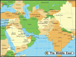
THE TERM Middle East came to modern use after World War II, and was applied to the lands around the eastern end of the MEDITERRANEAN SEA including TURKEY and GREECE, together with IRAN and, more recently, the greater part of North Africa. The old Middle East began at the river valleys of the Tigris and […]
Mid-Atlantic Ridge
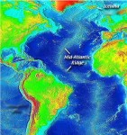
A MID-OCEAN RIDGE is a system of rifts and parallel mountain ranges or hills found in all major oceans. It is thought to be the site of upwelling new ocean floor material from Earth's mantle, from which ocean floors are gradually spreading out laterally. The Atlantic ridge is the most striking bottom relief feature of the […]

microclimates
MICROCLIMATES ARE climates of small areas, such as gardens, cities, lakes, valleys, and forests. A microclimate is an expression of the temperature, humidity, and wind within a few feet or meters of the ground. Such expressions exist because surfaces vary in their ability to absorb, store, or reflect the sun's energy, making some areas warmer […]

metric system
LEGALLY RECOGNIZED in the UNITED STATES by the Metric Act of 1866 but devised by French scientists in a 1791 report to the French National Assembly, the metric system of measurement is the decimal system of weights and measures based on the meter, liter, and gram with the prefixes deci-, deca-, and kilo-. Originally not […]
MERCOSUR
ON MARCH 26, 1991, the presidents of ARGENTINA, BRAZIL, PARAGUAY, and URUGUAY signed a common market agreement, the Treaty of Asuncion, that set the basis for the creation of the Common Market of South America (MERCOSUR, or Mercado Comun del Sur). MERCOSUR was the final step in a long struggle for economic and political cooperation […]

Mercator, Gerardus (1512–1594)
GERARDUS MERCATOR is the Latin name of Gerhard Kremer, one of the greatest geographers and cartographers, who lived in the 16th century. He was born on March 5, 1512, in Rupelmonde in the Flanders (now in BELGIUM), seventh child of Hubert and Emerentia Kremer. His father was a shoemaker. Thanks to his paternal uncle Gisbert […]
Melanesia
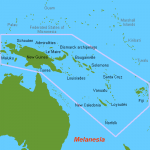
BEGINNING WITH THE FRENCH explorer Jules d'Urville Dumont in the 1830s, geographers have grouped the far-flung islands of the PACIFIC OCEAN into three great island worlds: Melanesia, MICRONESIA, and POLYNESIA. Melanesia, derived from the Greek words for “black” and “islands,” consists of those islands that extend from New Guinea in the northwest to the FIJI […]
megaliths
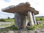
A GREEK-DERIVED word meaning “large stone,” megaliths refer to huge, uncut, or roughly cut boulders that people have moved to stand upright from the ground. Some megaliths, also called menhirs, have been in place for thousands of years, and the reasons for their positions are not fully known. They are found all over the world. […]
Martinique
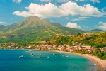
MARTINIQUE, IN the CARIBBEAN SEA, is one of the four French overseas departments and regions. Temperatures range from 25 to 30 degrees C (76 to 86 degrees F) and the climate is tropical and humid. The dry season runs from December to May (careme). Drought is relatively common from February to April. During the rainy […]

market geography
MARKET GEOGRAPHY is a subfield of ECONOMIC GEOGRAPHY that focuses on the spatial nature of market forces. It derives its rationale from the central place theory, first argued in 1933 by German economic geographer Walter CHRISTALLER in his book on central places in southern Germany. Central place theory is fundamentally concerned with the patterns through […]
maps and globes
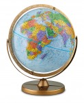
A MAP IS AN abstract representation of a selected set of features on or related to the surface of the Earth. The map reduces these selected Earth features to points, lines, and areas, using a number of visual resources such as size, shape, value, texture or pattern, color, orientation, and shape. Whereas aerial photographs and […]
Malacca Straits
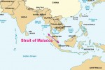
A PLAQUE IN THE gardens of the sultan's palace in Melaka reads: “Whoever is lord of Malacca has his hand on the throat of Venice.” For centuries this passage of water, 620 mi (1,000 km) long, connecting the INDIAN OCEAN and the South China Sea, running generally northwest to southeast, lived up to this reputation […]

Magna Graecia
MAGNA GRAECIA (or “Greater GREECE”) was the geographic expression of Greek colonization originating from many different Greek cities. It was a process that began in the 7th century B.C.E., largely because of overpopulation. Competing city-states such as Sparta, Corinth, and Athens began to found new cities (colonies) that, in turn, became centers of an economically […]
Maghreb
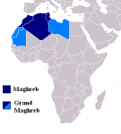
BROADLY DEFINED, the Maghreb is the triangular region of northwest Africa bounded by the ATLAS MOUNTAIN ranges, the ATLANTIC OCEAN from the border of western SAHARA to the Strait of Gibraltar, and the MEDITERRANEAN SEA from the Strait of Gibraltar to the northeast of LIBYA. Politically, the Maghreb includes the countries of MOROCCO, ALGERIA, TUNISIA and […]

Magellan, Ferdinand (1480–1521)
FERDINAND MAGELLAN, one of the most distinguished explorers in world history, was born in to a middle-class Portuguese family. In his youth, Magellan was awed by Christopher Columbus's seafaring adventures, and he developed a strong interest in the sea and enlisted in the navy in 1505. While serving as a naval officer, Magellan participated in […]

Mackinder, Halford J. (1861–1947)
HALFORD JOHN MACKINDER was born on February 15, 1861, in Gainsborough, a small port and market town at the river Trent in England. He was the eldest of six children born to Dr. Draper and Mrs. Fanny Anne Mackinder. His father was well educated and trained as a scientist. It was he who taught Mackinder […]
Macau
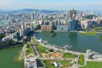
MACAU IS LOCATED in the southern part of CHINA's Guangdong Province, near the tip of the peninsula formed by Pearl River on the east and Xinjiang River on the west. Macau is situated 37 mi (60 km) west of HONG KONG and comprises the Macau Peninsula and the islands of Taipa and Coloane. Macau has […]

Louisiana Purchase
THE LOUISIANA PURCHASE (1803) included all of the present-day states of ARKANSAS, OKLAHOMA, MISSOURI, KANSAS, IOWA, and NEBRASKA, as well as parts of MINNESOTA, SOUTH DAKOTA, NORTH DAKOTA, MONTANA, WYOMING, COLORADO, NEW MEXICO, TEXAS, and, of course, LOUISIANA. The area is approximately one-third of the continental UNITED STATES. Initially, it included portions of CANADA—southern Manitoba, […]

Lop Nor
ALSO SPELLED Lob-Nor, Lop Nur, and Lop Nuur, this name invites confusion as it has been applied to a lake (actually two), a village, and a region in eastern XINJIANG province (CHINA). Lop is also the name of a “great desert” and a “large town” that Marco Polo mentioned and Faxian described. The city of […]
loess
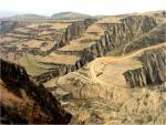
LOESS (PRONOUNCED “LUSS”) is a very fine light soil, often buff, yellow, or gray in color. The word stems from the German word loss or “loose,” and loess is generally easily eroded by water or blown by wind. Major loess deposits are found in Shaanxi, CHINA, in some of the U.S. plains states, notably western […]
llanos
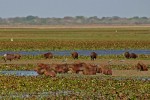
ALSO KNOWN AS the Orinoco River plains, the llanos of COLOMBIA and VENEZUELA are the northernmost section of the central lowlands of South America. The llanos are formed by a large geologic depression that once was an arm of the sea. This location is an alluvial basin between the northern ANDES MOUNTAINS and the Guyana […]
littoral
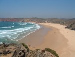
THE WORD LITTORAL comes from the Latin root littus, or “seashore.” The littoral zone of a lake or ocean refers to the shallow waters closest to shore. In lakes, this is the zone dropping from the shoreline to roughly 10 ft (3 m) deep where there is enough sunlight for rooted plants to exist. Only […]

Lewis and Clark
IN 1804, MERIWETHER Lewis and William Clark began an expedition across the newly acquired LOUISIANA PURCHASE territory. These two army captains were chosen by the American president, Thomas Jefferson, to explore new land the UNITED STATES had purchased from FRANCE one year earlier, and to find a direct water route across the nation. For a […]

leeward and windward
THE TERMS leeward and windward are used in a number of ways to describe specific places, physical features, and climatic processes. In one sense, windward and leeward generally refer to the location of a place relative to the prevailing wind direction. A windward location is one that is exposed to the prevailing winds. Conversely, a […]

latitude and longitude
LATITUDE AND LONGITUDE are points on lines that graph the Earth and allow cartographers and others, by assigning measurements to the lines, to fix the location of any place. Latitude lines run east and west and are also called parallels; longitude lines run north and south and are known as meridians. The measurements for both […]
landlocked
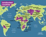
APPROXIMATELY ONE-FIFTH of the world's countries have no access to the oceans or ocean-connected seas, classifying them as landlocked. Today, there are 42 landlocked countries, including LIECHTENSTEIN and UZBEKISTAN, considered doubly landlocked because they have no access to the oceans and neither does any country that surrounds them. The main issues to consider with a […]
land bridge
IN GEOMETRICAL TERMS, a square also qualifies as a rectangle—a four-sided plane figure with four right angles—but a rectangle does not always meet the criteria to be a square—a figure having four equal sides. Such is the case with land bridges and isthmuses. An isthmus qualifies as a land bridge—a strip of land linking two […]
lacustrine plain
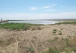
ALSO CALLED A lake plain, a lacustrine plain is an area created out of deposition largely related to the past existence of lakes in the area, although in some cases, the original lakes still exist, having shrunk in size over time. Lacustrine refers to the condition of being affected by a lake or several lakes. […]
Kyrghiz Steppes
THE KYRGHIZ STEPPES is a historic name for the region currently forming central and eastern KAZAKHSTAN. It is a broad plain with few to no trees and little moisture. It is a land of horses and cattle and wideopen plains. The name is confusing, and thus used less frequently today, since the actual Republic of […]

Kashmir
KASHMIR IS THE name given to the Vale of Kashmir, a valley situated on the Jhelum River between the Pir Panjal range and the main range of the HIMALAYAS. By extension, the name is used to refer to the Indian state of Jammu and Kashmir and to a portion of the old preindependence territory that […]
karst
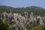
KARST IS A TERRAIN characterized by sinkholes, caves, and disappearing streams that have been created by chemical weathering in thick carbonate bedrock. Karst is named for the Krs Plateau along the ADRIATIC SEA and comes from an old Slavic word meaning “barren land.” In the karst hydrologic cycle, moving water slowly dissolves away the limestone […]

Junngar Basin
THE JUNNGAR BASIN (also Dzungar) is one of the two major basins that make up much of northwestern CHINA's XINJIANG province (Xinjiang Uygur Autonomous Region). The basin, covering some 69,500 square mi (180,000 square km), is located to the north of the TIAN SHAN MOUNTAINS and has a mixed landscape that includes mountains, deserts, steppes, […]

Jordan Valley
THE JORDAN VALLEY is part of the Great Rift Valley stretching from East Africa to northern SYRIA. Massive cracking of the Earth's crust caused by tectonic plate movements under the continents of Africa and Asia formed a trench over 4,000 mi (6,438 km) long. The northern section created by this faulting activity is the Jordan […]