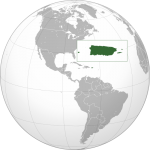
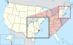
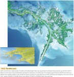
Puerto Rico (USA)
AT A GLANCE Name: Puerto Rico means “rich port” in Spanish. Capital: San Juan Size: 3,515 sq. mi. (9,103 sq km) Population: 3,474,182(2015) Statehood: Unincorporated Electoral votes: 0 U.S. Representatives: 1 (nonvoting) THE PLACE Puerto Rico is an island about 1,000 miles (1,600 km) southeast of Florida, between the United States and South America. Puerto […]
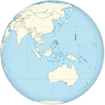
Northern Mariana Islands (USA)
AT A GLANCE Nickname: America's Best Kept Secret Capital: Saipan (38,896) Size: 184 sq. mi. (477 sq km) Population: 53,467 (2016) Statehood: Unincorporated Electoral votes: 0 U.S. Representatives: 1 (nonvoting) THE PLACE The Commonwealth of Northern Mariana Islands is a chain of 16 islands in the Pacific Ocean, south of Japan and east of the […]
Guam (USA)
AT A GLANCE Capital: Hagatna (Agana) Size: 209 sq. mi. (541 sq km) Population: 162,742(2016) Government: Unincorporated territory of United States Electoral votes: 0 U.S. Representatives: 1 (nonvoting) THE PLACE Guam is located in the Pacific Ocean at the southern end of the Mariana Islands. It lies about 1,300 miles (2,100 km) east of the […]
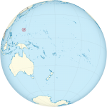
American Samoa (USA)
AT A GLANCE Name: Samoa is a native Polynesian word. Capital: Pago Pago Size: 77 sq. mi. (199 sq km) Population: 54,194 (2016) Statehood: Unincorporated Electoral Votes: 0 U.S. Representatives: 1 (nonvoting) THE PLACE American Samoa is a group of seven islands located about 2,600 miles (4,184 km) southwest of Hawaii. The U.S. federal government […]
District of Columbia
AT A GLANCE Government: The District of Columbia has been the seat of the U.S. government since 1800, and a municipal corporation since February 21, 1871. Area: 68.25 sq. mi. (177 sq km) Population: 672,228 (2015) Electoral votes: 3 U.S. Representatives: 1 (nonvoting) THE PLACE The city of Washington covers the entire District of Columbia, […]
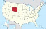
The State of Wyoming
AT A GLANCE Name: Wyoming comes from an Algonquian phrase meaning “large prairie place” or “at the big plain.” Nicknames: Equality State, Cowboy State Capital: Cheyenne Size: 97,818 sq. mi. (253,349 sq km) Population: 586,107 (2015 estimate) Statehood: Wyoming became the 44th state on July 10, 1890. Electoral votes: 3 (2016) U.S. representatives: 1 (until […]
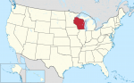
The State of Wisconsin
AT A GLANCE Name: Wisconsin is believed to be taken from one of three possible Indian words—Ouisconsin, Mesconsing, or Wishknosing. The words' meanings are unclear. Nickname: Badger State Capital: Madison Size: 56,145 sq. mi. (145,414 sq km) Population: 5,771,337 (2015 est) Statehood: Wisconsin became the 30th state on May 29, 1848. Electoral votes: 10 (2016) […]
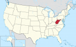
The State of West Virginia
AT A GLANCE Name: West Virginia was once part of Virginia, which was named for England's Queen Elizabeth I. She was known as the Virgin Queen because she never married. Nickname: Mountain State Capital: Charleston Size: 24,231 sq. mi. (62,759 sq km) Population: 1,844,128 (2015 est) Statehood: West Virginia became the 35th state on June […]
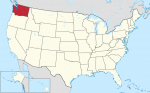
The State of Washington
AT A GLANCE Name: Washington is named after President George Washington Nickname: Evergreen State Capital: Olympia Size: 68,126 sq. mi. (176,446 sq km) Population: 7,170,351 (2015 est) Statehood: Washington became the 42nd state on November 11, 1889. Electoral votes: 11 (2016) U.S. representatives: 9 (until 2016) State tree: western hemlock State flower: western rhododendron State […]
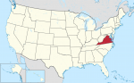
The State of Virginia
AT A GLANCE Name: Virginia was named for Queen Elizabeth I of England, who was known as the Virgin Queen because she never married. Nicknames: Old Dominion, Mother of Presidents Capital: Richmond Size: 40,598 sq. mi. (105,149 sq km) Population: 8,382,993 (2015 est) Statehood: Virginia became the 10th state on June 25, 1788. Electoral votes: […]
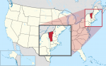
The State of Vermont
AT A GLANCE Name: Vermont is a combination of the French words vert and mont, which mean “green” and “mountain.” Nickname: Green Mountain State Capital: Montpelier Size: 9,615 sq. mi. (24,903 sq km) Population: 626,042 (2015 est) Statehood: Vermont became the 14th state on March 4, 1791. Electoral votes: 3 (2016) U.S. representatives: 1 (until […]
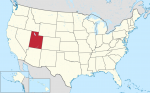
The State of Utah
AT A GLANCE Name: Utah was named for the Ute tribe. Ute means “higher up.” Nickname: Beehive State Capital: Salt Lake City Size: 84,904 sq. mi. (219,902 sq km) Population: 2,995,919 (2015 est) Statehood: Utah became the 45th state on January 4, 1896. Electoral votes: 5 (2016) U.S. representatives: 3 (until 2016) State tree: blue […]
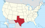
The State of Texas
AT A GLANCE Name: Texas is a Spanish version of a Native American word meaning “friends” or “allies.” Nickname: Lone Star State Capital: Austin Size: 266,874 sq. mi. (691,201 sq km) Population: 27,469,114 (2015 est) Statehood: Texas became the 28th state on December 29, 1845. Electoral votes: 34 (2016) U.S. representatives: 30 (until 2016) State […]
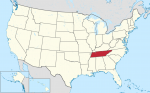
The State of Tennessee
AT A GLANCE Name: The region may have been named after Tanasie, a group of Cherokee villages on the Little Tennessee River. Nickname: Volunteer State Capital: Nashville Size: 42,146 sq. mi. (109,158 sq km) Population: 6,600,299 (2015 est) Statehood: Tennessee became the 16th state on June 1, 1796. Electoral votes: 11 (2016) U.S. representatives: 9 […]
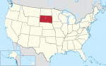
The State of South Dakota
AT A GLANCE Name: Dakota is a Sioux word meaning “friends” or “allies.” Nicknames: Coyote State, Mount Rushmore State Capital: Pierre Size: 77,121 sq. mi. (199744 sq km) Population: 858,469 (2015 est) Statehood: South Dakota became the 40th state on November 2, 1889. Electoral votes: 3 (2016) U.S. representatives: 1 (until 2016) State tree: Black […]
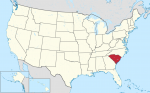
The State of South Carolina
AT A GLANCE Name: South Carolina was named after King Charles I of England. Nickname: Palmetto State Capital: Columbia Size: 31,117 sq. mi. (80,593 sq km) Population: 4,896,146 (2015 est) Statehood: South Carolina became the eighth state on May 23, 1788. Electoral votes: 8 (2016) U.S. representatives: 6 (until 2016) State tree: palmetto State flower: […]
The State of Rhode Island
AT A GLANCE Name: Some historians believe that Rhode Island was named by a Dutch navigator who called it Roode Eylandt (“red island”) because of its red clay. Rhode Island may also have been named for the Greek Isle of Rhodes. Nicknames: Ocean State, Little Rhody Capital: Providence Size: 1,212 sq. mi. (3,142 sq km) […]
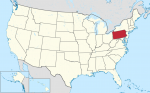
The State of Pennsylvania
AT A GLANCE Name: Pennsylvania was named by King Charles II of England in honor of Admiral Sir William Penn, the father of William Penn, who governed the area. The name means “Penn's woods.” Nickname: Keystone State Capital: Harrisburg Size: 45,310 sq. mi. (117,351 sq km) Population: 12,802,503 (2015 est) Statehood: Pennsylvania became the second […]
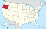
The State of Oregon
AT A GLANCE Name: The exact origin of Oregon's name is unknown, but it may have come from the Native American name for one of the area's rivers—the Ouragon. Nickname: Beaver State Capital: Salem Size: 97,052 sq. mi. (251,365 sq km) Population: 4,028,977 (2015 est.) Statehood: Oregon became the 33rd state on February 14, 1859. […]
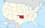
The State of Oklahoma
AT A GLANCE Name: Oklahoma comes from the Choctaw words okla humma, which mean “red people.” Nickname: Sooner State Capital: Oklahoma City Size: 69,903 sq. mi. (181,048 sq km) Population: 3,911,338 (2015 est) Statehood: Oklahoma became the 46th state on November 16, 1907. Electoral votes: 7 (2016) U.S. representatives: 6 (until 2016) State tree: redbud […]
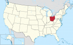
The State of Ohio
AT A GLANCE Name: Ohio is an Iroquois word for “fine or great river.” Nickname: Buckeye State Capital: Columbus Size: 41,330 sq. mi. (107,040 sq km) Population: 11,613,423 (2015 est) Statehood: Ohio became the 17th state on March 1, 1803. Electoral votes: 20 (2016) U.S. representatives: 19 (until 2016) State tree: buckeye State flower: scarlet […]
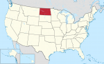
The State of North Dakota
AT A GLANCE Name: Dakota is a Sioux word that means “friends” or “allies.” Nicknames: Sioux State, Flickertail State, Peace Garden State, Rough Rider State Capital: Bismarck Size: 70,704 sq. mi. (13,123 sq km) Population: 756,927 (2015 est) Statehood: North Dakota became the 39th state on November 2, 1889. Electoral votes: 3 (2016) U.S. representatives: […]
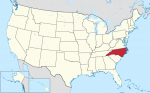
The State of North Carolina
AT A GLANCE Name: North Carolina was named after King Charles I of England. (The Latin word for the name Charles is Carolana.) Nicknames: Tar Heel State, Old North State Capital: Raleigh Size: 52,672 sq. mi. (136,421 sq km) Population: 10,042,802 (2015 est) Statehood: North Carolina became the 12th state on November 21, 1789. Electoral […]
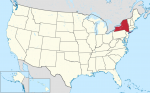
The State of New York
AT A GLANCE Name: New York was named in honor of England's Duke of York. Nickname: Empire State Capital: Albany Size: 49,112 sq. mi. (127,200 sq km) Population: 19,795,791 (2015 est) Statehood: New York became the 11th state on July 26, 1788. Electoral votes: 31 (2016) U.S. representatives: 31 (beginning in 2016) State tree: sugar […]
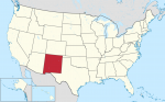
The State of New Mexico
AT A GLANCE Name: New Mexico was named after Mexico by Spanish explorers in the 16th century. Nickname: Land of Enchantment Capital: Santa Fe Size: 121,598 sq. mi. (314,939 sq km) Population: 2,085,109 (2015 est) Statehood: New Mexico became the 47th state on January 6, 1912. Electoral votes: 5 (2016) U.S. representatives: 3 (until 2016) […]
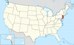
The State of New Jersey
AT A GLANCE Name: New Jersey was named after Jersey, an island in the English Channel. Nickname: Garden State Capital: Trenton Size: 7,790 sq. mi. (20, 175 sq km) Population: 8,958,013 (2015 est) Statehood: New Jersey became the third state on December 18, 1787. Electoral votes: 15 (2016) U.S. representatives: 13 (until 2016) State tree: […]
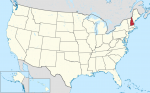
The State of New Hampshire
AT A GLANCE Name: New Hampshire was named for the English county of Hampshire. Nickname: Granite State Capital: Concord Size: 9,283 sq. mi. (24,044 sq km) Population: 1,330,608 (2015 est) Statehood: New Hampshire became the ninth state on June 21, 1788. Electoral votes: 4 (2016) U.S. representatives: 2 (until 2016) State tree: white birch State […]
The State of Nevada
AT A GLANCE Name: Nevada means “snowcapped” in Spanish. Nicknames: Sagebrush State, Silver State Capital: Carson City Size: 110,567 sq. mi. (286,367 sq km) Population: 2,890,845 (2015 est) Statehood: Nevada became the 36th state on October 31, 1864. Electoral votes: 5 (2016) U.S. representatives: 3 State trees: single-leaf pinon and bristlecone pine State flower: sagebrush […]
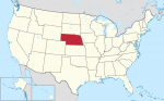
The State of Nebraska
AT A GLANCE Name: Nebraska is from the Oto Indian word nebrathka, meaning “flat water.” Nickname: Cornhusker State Capital: Lincoln Size: 77,358 sq. mi. (200,358 sq km) Population: 1,896,190 (2015 est) Statehood: Nebraska became the 37th state on March 1, 1867. Electoral votes: 5 (2016) U.S. representatives: 3 (until 2016) State tree: cottonwood State flower: […]
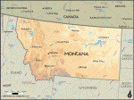
The State of Montana
AT A GLANCE Name: Montana comes from the Spanish word montana, which means “mountainous.” Nicknames: Treasure State, Big Sky Country Capital: Helena Size: 147,046 sq. mi. (380,849 sq km) Population: 1,032,949 (2015 est) Statehood: Montana became the 41st state on November 8, 1889. Electoral votes: 3 (2016) U.S. representatives: 1 (until 2016) State tree: ponderosa […]
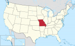
The State of Missouri
AT A GLANCE Name: Missouri is the name of a Native American tribe and means “town with the big canoes.” Nickname: Show Me State Capital: Jefferson City Size: 69,709 sq. mi. (180,546 sq km) Population: 6,083,672 (2015 est.) Statehood: Missouri became the 24th state on August 10, 1821. Electoral votes: 11 (2016) U.S. representatives: 9 […]
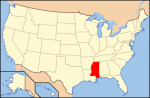
The State of Mississippi
AT A GLANCE Name: Mississippi comes from a Native American word that means “father of waters.” Nickname: Magnolia State Capital: Jackson Size: 47.695 sq. mi. (123,530 sq km) Population: 2,992,333 (2015 est) Statehood: Mississippi became the 20th state on December 10, 1817. Electoral votes: 6 (2016) State representatives: 5 (until 2016) State tree: magnolia State […]
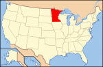
The State of Minnesota
AT A GLANCE Name: Minnesota is from Sioux words that mean “sky-tinted water.” Nicknames: North Star State, Gopher State Capital: St. Paul Size: 84,397 sq. mi. (218,587 sq km) Population: 5,489,594 (2015 est) Statehood: Minnesota became the 32nd state on May 11, 1858. Electoral votes: 10 (2016) U.S. representatives: 8 (until 2016) State tree: red […]
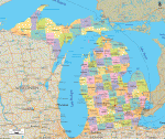
The State of Michigan
AT A GLANCE Name: Michigan comes from a Native American word that means “great or large lake.” Nicknames: Wolverine State, Great Lakes State Capital: Lansing Size: 58,513 sq. mi. (151,548 sq km) Population: 9,922,576 (2015 est) Statehood: Michigan became the 26th state on January 26, 1837. Electoral votes: 17 (2016) U.S. representatives: 16 (until 2016) […]
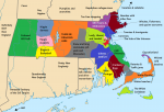
The State of Massachusetts
AT A GLANCE Name: Massachusetts was named for the Massachusett, a Native American tribe whose name means “at or about the great hill.” Nicknames: Bay State, Old Colony State Capital: Boston Size: 8,262 sq. mi. (21,398 sq km) Population: 6,794,422 (2015 est) Statehood: Massachusetts became the sixth state on February 6, 1788. Electoral votes: 12 […]
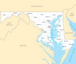
The State of Maryland
AT A GLANCE Name: Maryland was named in honor of Henrietta Maria, queen consort of King Charles I of England. Nicknames: Free State, Old Line State Capital: Annapolis Size: 12,297 sq. mi. (31,972 sq km) Population: 6,006,401 (2015 est) Statehood: Maryland became the seventh state on April 28, 1788. Electoral votes: 10 (2016) U.S. representatives: […]
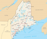
The State of Maine
AT A GLANCE Name: Maine probably comes from the word mainland. Early English explorers used the phrase “the main” to distinguish Maine from its offshore islands. Nickname: Pine Tree State Capital: Augusta Size: 33,265 sq. mi. (87,727 sq km) Population: 1,329,328 (2015 est) Statehood: Maine became the 23rd state on March 15, 1820. Electoral votes: […]
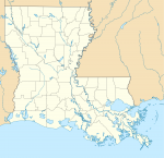
The State of Louisiana
AT A GLANCE Name: Louisiana was named for King Louis XIV of France. Nickname: Pelican State Capital: Baton Rouge Size: 47,751 sq. mi. (124,153 sq km) Population: 4,670,724 (2015) Statehood: Louisiana became the 18th state on April 30, 1812. Electoral votes: 9 (2016) U.S. Representatives: 7 (until 2016) State tree: cypress State flower: magnolia State […]
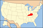
The State of Kentucky
AT A GLANCE Name: Kentucky is from the Iroquois word Ken-tah-ten, which means “land of tomorrow.” Nickname: Bluegrass State Capital: Frankfort Size: 40,411 sq. mi. (104,665 sq km) Population: 4,425,092 (2015 est) Statehood: Kentucky became the 15th state on June 1, 1792. Electoral votes: 8 (2016) U.S. Representatives: 6 (until 2016) State tree: tulip poplar […]
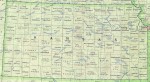
The State of Kansas
AT A GLANCE Name: Kansas is from a Sioux word meaning “people of the south wind.” Nickname: Sunflower State, Jayhawker State Capital: Topeka Size: 82,282 sq. mi. (213,110 sq km) Population: 2,911,641 (2015 est) Statehood: Kansas became the 34th state on January 29, 1861. Electoral votes: 6 (2016) U.S. Representatives: 4 (until 2016) State tree: […]
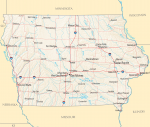
The State of Iowa
AT A GLANCE Name: Iowa is believed to have come from a Native American word meaning “this is the place” or “the beautiful land.” Nickname: Hawkeye State Capital: Des Moines Size: 56,276 sq. mi. (145,755 sq km) Population: 3,123,899 (2015 est) Statehood: Iowa became the 29th state on December 28, 1846. Electoral votes: 7 (2016) […]
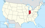
The State of Indiana
AT A GLANCE Name: Indiana means “land of Indians.” Nickname: Hoosier State Capital: Indianapolis Size: 36,420 sq. mi. (94,328 sq km) Population: 6,619,680 (2015 est) Statehood: Indiana became the 19th state on December 11, 1816. Electoral votes: 11 (2016) U.S. Representatives: 10 (until 2016) State tree: tulip poplar State flower: peony State bird: cardinal Highest […]
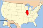
The State of Illinois
AT A GLANCE Name: Illinois is an Algonquian word meaning “tribe of superior men.” Nickname: Prairie State Capital: Springfield Size: 57,918 sq. mi. (150,007 sq km) Population: 12,859,995 (2015 est) Statehood: Illinois became the 21st state on December 3, 1818. Electoral votes: 21 (2016) U.S. Representatives: 20 (until 2016) State tree: white oak State flower: […]
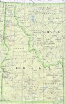
The State of Idaho
AT A GLANCE Name: The meaning of the name Idaho is unknown, although it is believed to be of Native American origin. Nickname: Gem State Capital: Boise Size: 83,574 sq. mi. (217,292 sq km) Population: 1,654,930 (2015 est) Statehood: Idaho became the 43rd state on July 3, 1890. Electoral votes: 4 (2016) U.S. Representatives: 2 […]
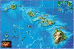
The State of Hawaii
AT A GLANCE Name: The origin of the name Hawaii is uncertain. The islands may have been named after Hawaii Loa, the chief who has traditionally been believed to have discovered them, or they may have been named after Hawaii or Hawaiki, the traditional home of the Polynesians. Nickname: Aloha State Capital: Honolulu Size: 6,459 […]
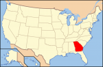
The State of Georgia
AT A GLANCE Name: Georgia was named for King George II of England. Nicknames: Peach State, Empire State of the South Capital: Atlanta Size: 58,977 sq. mi. Population: 10,214,860 (2015 est) Statehood: Georgia became the fourth state on January 2, 1788. Electoral votes: 15 (2016) U.S. Representatives: 11 (until 2016) State tree: live oak State […]
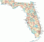
The State of Florida
AT A GLANCE Name: Spanish explorer Ponce de Leon named Florida when he landed there on Easter Sunday in 1513. He called the place Pascua Florida, which means “flowery Easter” in Spanish. Nickname: Sunshine State Capital: Tallahassee Size: 59,928 sq. mi. Population: 20,271,272 (2015 est) Statehood: Florida became the 27th state on March 3, 1845. […]
The State of Delaware
AT A GLANCE Name: The name Delaware comes from the Delaware River and Bay, which were named for Sir Thomas West, Baron De La Warr, the first governor of Virginia. Nicknames: First State, Diamond State Capital: Dover Size: 2,396 sq. mi. Population: 935 614 (2014) Statehood: Delaware became the first state on December 7, 1787. Electoral […]

The State of Connecticut
AT A GLANCE Name: Connecticut comes from an Algonquian word meaning “place beside the long tidal river.” Nicknames: Constitution State, Nutmeg State Capital: Hartford Size: 5,544 sq. mi. Population: 3,597,000 (2014) Statehood: Connecticut became the fifth state on January 9, 1788. Electoral votes: 7 (2016) U.S. Representatives: 6 (until 2016) State tree: white oak State […]
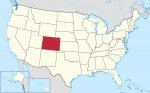
The State of Colorado
AT A GLANCE Name: Colorado is a Spanish word that means “colored red.” The name was first given to the Colorado River by Spanish explorers because it flows through red stone canyons. Nickname: Centennial State Capital: Denver Size: 104,100 sq. mi. Population: 5,356,000 (2014) Statehood: Colorado became the 38th state on August 1, 1876. Electoral […]
The State of California
AT A GLANCE Name: California is named after Califia, a mythical island paradise described by Garci Ordonez de Montalvo in his 16th-century novel Las Sergas de Esplandian. Nickname: Golden State Capital: Sacramento Size: 158,869 sq. mi. Population: 39,144,818 (2015 est) Statehood: California became the 31st state on September 9, 1850. Electoral votes: 55 (2016) U.S. […]
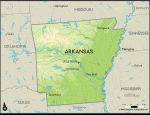
The State of Arkansas
AT A GLANCE Name: The word Arkansas is from the French name for the Quapaw tribe, the Arkansa, and the region the tribe inhabited. Nicknames: Natural State, Razorback State, Land of Opportunity Capital: Little Rock Size: 53,182 sq. mi. Population: 2,966,000 (2014) Statehood: Arkansas became the 25th state on June 15, 1836. Electoral votes: 6 […]
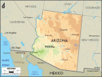
The State of Arizona
AT A GLANCE Name: Arizona comes from the Native American word Arizonac, which means “little spring” or “young spring.” Nickname: Grand Canyon State Capital: Phoenix Size: 114,006 sq. mi. Population: 6,731,000 (2014) Statehood: Arizona became the 48th state on February 14, 1912. Electoral votes: 11 (2016) U.S. Representatives: 9 (until 2003) State tree: paloverde State flower: saguaro […]
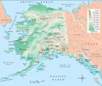
The State of Alaska
AT A GLANCE Name: Alaska comes from an Aleut word meaning “great land.” Nicknames: Last Frontier, Land of the Midnight Sun Capital: Juneau Size: 615,230 sq. mi. Population: 736 732 (2014) Statehood: Alaska became the 49th state on January 3, 1959. Electoral votes: 3 (2016) U.S. Representatives: 1 (until 2016) State tree: Sitka spruce State flower: forget-me-not State […]
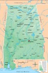
The State of Alabama
AT A GLANCE Name: Alabama comes from the word Alibamu, the name of a Native American tribe that lived in the area. The name may mean “to clear the vegetation.” Nicknames: Heart of Dixie, Camellia State, Yellowhammer State Capital: Montgomery Size: 52,237 sq. mi. Population: 4,849,000 (2014) Statehood: Alabama became the 22nd state on December 14, 1819. Electoral […]
The United States Looks Ahead
Now is but a minute blip on the span of time. It is the product of countless past processes and events. By looking to the past, we can better understand the present, and the past also provides keys to predicting the future. This chapter attempts to answer a very difficult question: What does the future hold for the United […]
Living in the United States Today
For the majority of Americans, life is good. Few countries can match the level of health care, longevity, income, or educational attainment enjoyed by American citizens. The same can be said for the nation's transportation and communications infrastructure, services, and many other developments that Americans often take for granted. In 2006, the United States ranked eighth among the world's countries in […]
The United States’ Economy
With an annual gross national product (GNP) of about $13 trillion in 2006, the United States is the world's largest and most powerful economy by a wide margin. By any measure, the country is an economic giant. In fact, it is responsible for about 30 percent of all of the world's economic production and services! To place the country's economic […]
Government and Politics
Epluribus unum is perhaps the best-known motto of the United States of America. Translated from Latin, it means “From many, one,” or “Out of many, one.” In working to achieve this goal, the nation's Founding Fathers and subsequent leaders faced a challenge of herculean dimensions. You have already learned that, from the very beginning, this land has been home to […]
People and Culture
These lines, part of a poem written by Emma Lazarus, appear on the Statue of Liberty. They offer a very appropriate introduction to this chapter on the American population. The United States has been and continues to be a grand human experiment conducted on a colossal scale. It has often been called a “country of immigrants,” people who arrived from […]
The United States Through Time
American historical geography offers an amazing trip through the corridors of time. It is a journey replete with mystery, adventure, and incredible good fortune. It also chronicles occasional obstacles, detours, and hardships. This chapter investigates the country's past. Geographer Erhard Rostlund once observed that “the present is the fruit of the past and contains the seeds of the future.” Just as […]
Physical Geography
Nature has blessed and in some ways cursed the United States. No country on Earth can match America’s diverse physical conditions and the resulting natural landscapes. The United States holds the distinction of being the only country that has within its territory all of the world’s climates and ecosystems (a combination of climate, natural vegetation and animal life, soils, […]
Introducing the United States
These well-known lyrics, written by Katharine Lee Bates, hold as true today as they did in 1893, when the original verses were penned. On a trip from her Massachusetts home to Colorado Springs, Colorado, Bates was awed by the magnificent view of the Great Plains from atop majestic Pikes Peak. The United States of America truly is a beautiful […]
France’s Future
Prediction is always a chancy thing. We may ask, “What will France become in the future, how may she change?”We can give few firm answers, though.What we can do is to try to project a short distance into the future some of the trends of recent times, and to at least raise some possibilities with respect to certain matters. […]
France’s Economy and Communications
France ranks fourth among countries in terms of its economy, with a gross domestic product (GDP) of around $1.5 trillion. Per-capita purchasing power is the equivalent of about U.S. $24,500 per year (compared with the U.S.'s $34,100 in 2002). AGRICULTURE France is an agriculturally favored country—60% of its land is arable and over half is cultivated—and produces prodigious quantities of […]
France’s Government
NATIONAL GOVERNMENT The constitution of today's Fifth Republic—“a subtle blend of authoritarianism and parliamentary democracy” (wrote James Corbett)—provides for a president and for a bicameral legislature consisting of a Senate and a National Assembly. The president of the republic (currently, Jacques Chirac) is elected for a seven-year term by direct universal suffrage on the part of those over 18 years of […]
Population, Culture Regions, and Social Institutions
Fifty million Frenchmen can't be wrong,” goes the old saying, but there are now more than sixty million French citizens in metropolitan and overseas France. They account for 16% of the European Union's population and rank France twentieth among world countries. Approximately 75% of the country's population is urban, living in towns of 2,000 or more people. This is in […]
France in the Modern Era (1830–Present)
In many respects, a three-day Paris revolution in 1830, which installed Louis Philippe as king, marks the beginning of the modern era for France. In that year, the country began to rebuild an overseas empire, as the conquest of Algeria began. Important political changes occurred as well, including a reduction of lavish living by kings and the endorsement of more […]
French History to 1830
A deep sense of the past is very much part of French character. Glorious monuments of that dramatic and creative past are revered treasures, the inheritance of the nation. Because of its respect for the past, France exceeds most other countries in its historic-preservation efforts. The history of any country, France included, is made up both of important individual events […]
Natural Environments and Landscapes
France possesses a varied and productive physical environment. In this chapter, you will learn about the country's diverse land features, climates, soils, wild vegetation, and mineral resources. LANDFORMS Although considered a lowland country, France's physical geography is, in fact, extremely varied, ranging from high, rugged mountains to low-lying sandy coastal plains. Running northward and eastward through France is a major drainage […]
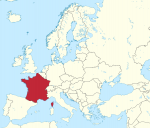
Introducing France
Historically and culturally, France is one of the most significant nations of Western Europe. The country is favored by nature, with a variety of landforms, climates, and resources as well as with rich and varied agricultural lands. Strategically, it is located between the Mediterranean Sea and the Atlantic Ocean. The country has played a pivotal economic, political, and cultural role in […]
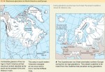
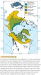
The Ice Age
Glaciation occurs when temperatures fall in regions of ample snowfall, allowing ice to accumulate and build. Although glaciation is a general term for the glacier growth and landform modification produced by glaciers, here we use it to refer to the period when continental ice sheets grow and spread outward over vast areas. When the climate warms or snowfall decreases, ice sheets become thinner and cover less […]
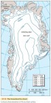
Ice Sheets and Sea Ice
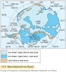
The ice sheets of Antarctica and Greenland are huge plates of ice, thousands of meters thick in the central areas, resting on large land masses. The Greenland Ice Sheet has an area of 1.7 million km2 (about 670,000 mi2) and occupies about seven-eighths of the entire island of Greenland (Figure 17.11). The only land exposed is a narrow, mountainous coastal strip. […]
Alpine Glaciers
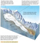
Figure 17.5 shows a cross section of an alpine glacier, illustrating a number of features. The glacier forms in a cirque—a high rock basin in which snow accumulates for year after year until it forms a glacier. Although the uppermost layer of a glacier is brittle, the ice beneath behaves as a plastic substance that flows slowly (Figure 17.6). An alpine […]
Glaciers
Not long ago, during the Ice Age, much of northern North America and Eurasia was covered by massive sheets of glacial ice. As a result, glacial ice has shaped large landforms in midlatitude and subarctic zones. Today, we find glacial ice in the Greenland and Antarctic Ice Sheets and in many smaller masses in high mountains. Glacial ice sheets have […]
Ice Sheets, Sea Ice, and Global Warming
What effects will global warming have on the Earth's ice sheets and sea ice? In general, global climate models predict two types of changes in the Earth's ice sheets. First, warming on land and ocean will cause the melting and thinning of the edges and ice shelves of the Greenland and Antarctic ice caps. This will increase sea level. Second, warming […]
Sand Dunes and Loess
A sand dune is any hill of loose sand shaped by the wind. Sand dunes form where there is a source of sand—for example, a sandstone formation that weathers easily to release individual grains, or perhaps a beach supplied with abundant sand from a nearby river mouth. Active dunes constantly change shape under wind currents, but they must be free of […]
Wind Action
Wind plays a direct role in shaping coastal landforms, carrying sand and other sediments, and depositing them at new locations. We use the term eolian, which comes from “Aeolus,” the name of the Greek god of the winds, to describe wind-generated landforms and processes. Dunes are thus eolian landforms. Figure 16.27 is a global map showing regions where eolian processes and landforms are found. […]
Types of Coastlines
Although every coastline is a unique creation of ocean waves acting on distinctive land masses, we can identify seven important types of coasts, shown in Figure 16.18. Coastlines of submergence are formed when the rising sea level partially drowns a coast or when part of the crust sinks. This group includes ria coasts and fiord coasts. Another group of coastlines […]
The Work of Waves and Tides
Wind, like running water, glacial action, and mass wasting, is an agent that shapes distinctive landforms. Wind can move material directly, picking up fine particles and carrying them from one place to another. Or it can act indirectly, by the action of wind-driven waves. What makes wind and breaking waves different from the other agents is that they can move material […]
Global Change and Coastal Environments
Global climate change over the remainder of the twenty-first century will have major impacts on coastal environments. The changes include increases in seasurface temperature and sea level, decreases in sea-ice cover, and changes in salinity, wave climate, and ocean circulation. What changes have already occurred? According to recent reports of the Intergovernmental Panel on Climate Change, sea level has risen about 15 […]
Fluvial Landscapes
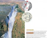
GREAT WATERFALLS Large waterfalls are comparatively rare the world over, since the stream gradation process drains lakes and removes falls and rapids. But when tectonic activity fractures and dislocates crustal blocks, erosion may be hard pressed to keep up. As a result, we see great waterfalls on several large rivers in the African Rift Valley region. One of these is Victoria […]
The Work of Streams and Stream Gradation
Streams carry out three closely related activities—stream erosion, stream transportation, and stream deposition. Mineral materials, from bedrock or regolith, are removed from the floor and sides of the stream channel by erosion. The particles are suspended in the stream by turbulent water motion or are dissolved and held in solution. The transported particles are finally deposited on the streambed and floodplain, or […]
Slope Erosion
Most of the world's land surface has been sculpted by running water. Waves, glacial ice, and wind also carve out landforms, but for physical geographers, running water is the most important. That's because landforms made by glacial ice, wind, and waves are restricted to certain areas on the globe. We'll look at some of these other landformcreating agents in later chapters, […]
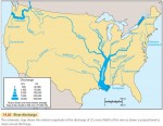
Surface Water as a Natural Resource
Fresh surface water is a basic natural resource essential to human agricultural and industrial activities. Runoff held in reservoirs behind dams provides water supplies for great urban centers, such as New York City and Los Angeles, as well as irrigation water for agriculture. We can also generate hydroelectric power from surface water where the gradient of a river is steep. […]
Lakes
A lake is a body of standing water with an upper surface that is exposed to the atmosphere and does not have an appreciable gradient. Ponds, marshes, and swamps with standing water can all be included under the definition of a lake. Lakes receive water from streams, overland flow, and ground water, and so they form part of drainage systems. Many […]
Streamflow and Floods
Stream discharge increases after heavy rainfall or snowmelt. But there is a delay in this increase because it takes time for the water to move into stream channels. The length of this delay depends, among other factors, on the size of the drainage basin feeding the stream. Larger drainage basins show a longer delay. It's easiest to look at the […]
Surface Water
OVERLAND FLOW AND STREAMFLOW Runoff that flows down the land slopes in broadly distributed sheets is called overland flow. This is different from streamflow, in which the water runs along a narrow channel between banks. Overland flow can take several forms. Where the soil or rock surface is smooth, the flow may be a continuous thin film, called sheet flow. […]
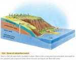
Ground Water
Water from precipitation can flow through the soil-water belt under the force of gravity. We call this flow percolation. Eventually, the percolating water reaches ground water. Ground water is the part of the subsurface water that fully saturates the pore spaces in bedrock, regolith, or soil (Figure 14.6). The top of the saturated zone is marked by the water table. Above […]
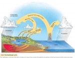
The Hydrologic Cycle Revisited
Water is essential to life. Nearly all organisms require constant access to water or at least a water-rich environment for survival. Humans are no exception. We need a constant supply of fresh water from precipitation over the lands. Some of this water is stored in soils, regolith, and pores in bedrock. And a small amount of water flows as fresh water […]
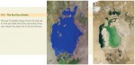
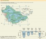
The Aral Sea
East of the Caspian Sea, astride the former Soviet republics of Kazakhstan and Uzbekistan, lies an immense saline lake—the Aral Sea. Fed by meltwaters of high glaciers and snowfields in the lofty Hindu Kush, Pamir, and Tien Shan Ranges, the lake endured through thousands of years as an oasis for terrestrial and aquatic wildlife deep in the heart of the central […]
Processes and Landforms of Arctic and Alpine Tundra
The treeless arctic and alpine tundra environment is severely cold in winter. In the tundra, soil water is solidly frozen for many months. During the short summer season, however, the surface thaws, leaving the soil saturated and vulnerable to mass wasting and water erosion. With the return of cold temperatures, the freezing of soil water exerts a strong mechanical influence on the […]
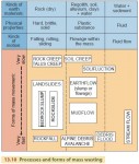
Mass Wasting
So far, we've looked at a selection of processes that alter rock chemically or break them into fragments. But what happens to these pieces once they've been loosened from the parent rock? The rock fragments are subjected to gravity, running water, waves, wind, and the flow of glacial ice. In this chapter we'll concentrate on the effect of gravity, and we'll […]
Weathering
In the last few chapters, we've looked at the Earth's crust—its mineral composition, its lithospheric plates, and the landforms created by volcanic and tectonic activity. Now let's examine the shallow surface layer in which life exists. We'll look first at how rocks are softened and how they break up. Later, we'll see how the resulting rock materials move downhill under the […]
The Madison Slide
For some 200 vacationers camping in a deep canyon on the Madison River just downstream from Hebgen Lake, not far west of Yellowstone National Park, the night of August 17, 1959, began quietly, with almost everyone safely bedded down in their tents or camping trailers. Up to a certain point, it was everything a great vacation should be—that point in time […]
Landforms and Rock Structure
Over the world's vast land area, you'll see many types of rock and rock structures. In many cases, rock structure controls the locations of uplands and lowlands, as well as the routes of streams and rivers. Rock structure affects landforms because different types of rocks are worn down by erosion at different rates. Some rock types are easily eroded, while others are […]
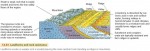
Earthquakes
You've probably seen the destruction wrought by e arthquakes on the television news. Californians know about this first-hand, and several other areas in North America have also experienced strong earthquakes. Earthquakes range from faint tremors to wild motions that shake buildings apart. Most earthquakes are produced by sudden slip movements along faults. These happen because rock on both sides of the fault is slowly bent […]
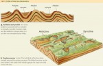
Tectonic Landforms
There are two basic forms of tectonic activity: compression and extension. Compression occurs when lithospheric plates are squeezed together along converging lithospheric plate boundaries, while extension happens along continental and oceanic rifting, where plates are being pulled apart. FOLD BELTS Let's start by looking at folding produced by compression. When two continental lithospheric plates collide, the plates are squeezed together at the boundary. The crust crumples, creating […]
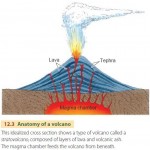
Volcanic Landforms
Landforms are the surface features of the land—for example, mountain peaks, cliffs, canyons, plains, beaches, and sand dunes. Landforms are created by many different processes that we will describe in the remainder of this book. Geomorphology is the scientific study of the processes that shape landforms. In this chapter, we will look at landforms produced directly by volcanic and tectonic processes. […]
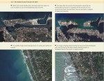
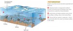
The Indian Ocean Tsunami of 2004
One of the most dangerous side effects of tectonic activity is the tsunami—a great ocean wave produced by an undersea earthquake or volcanic explosion. When a tsunami arrives at a coastline, it causes a temporary and rapid rise of sea level. Ocean waters rush landward and surge far inland, destroying coastal structures and killing inhabitants. After some minutes, the waters retreat, continuing […]