containment
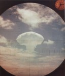
CONTAINMENT IS a political concept that served as the muted geopolitical battle cry for the UNITED STATES in the four decades of the Cold War (1947–89). It was first articulated in an embassy report from a young diplomat in Moscow dated February 22, 1946. In the “long telegram” George F. Kennan laid out a philosophical […]
Connecticut
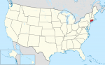
CONNECTICUT IS the southernmost of the New England states in the northeastern UNITED STATES and has borders with MASSACHUSETTS in the north, NEW YORK in the west, and RHODE ISLAND to the east. There is also a very small area in the very northeast corner where Massachusetts extends south creating an eastern border. To the […]
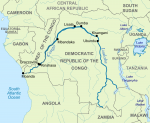
Congo River
FROM ITS SOURCE on a savanna PLATEAU just south of Lake TANGANIKA, the Congo River flows some 2,880 mi (4,630 km) through equatorial africa before eventually emptying into the ATLANTIC OCEAN. While no other major river in the world transects the equator even once, the Congo River twice crosses the equator in its journey to […]
Congo, Democratic Republic of
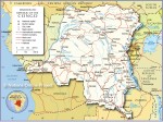
Area 905,563 square mi (2,345,410 square km) Population 69.36 million (2014) Capital Kinshasha Highest Point 16,765 ft (5,110 m) Lowest Point 0 m GDP $32.96 billion (2014) Natural Resources diamonds, gold, silver, tin, bauxite. THE DEMOCRATIC Republic of Congo (DRC) is strategically located as the geographic centerpiece of Africa. Smaller in area than only SUDAN […]
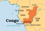
Congo
Area 132,047 square mi (342,000 square km) Population 4.559 million (2014) Capital Brazzaville Highest Point 2,963 ft (903 m) Lowest Point 0 m GDP $14.14 billion (2014) Primary Natural Resources petroleum, wood, potassium, potash, gold. THE REPUBLIC OF Congo is located in western Africa and covers an area slightly smaller than MONTANA. It is bordered […]
computer mapping
COMPUTER MAPPING IS the general term used to describe the process of developing digital maps from aerial photographs, satellite images, global positioning systems (GPS) records, paper maps, and other archival data sources. GEOGRAPHIC INFORMATION SYSTEMS (GIS) are currently the most common implementation of computer mapping systems. A GIS consists of an organized collection of computer […]
Comoros
Area 846 square mi (2,170 square km) Population 752,400 (2014) Capital Moroni Highest Point Le Kartala 7,788 ft (2,360m) Lowest Point 0 m GDP $647.7 million (2014) Natural Resources tourism, arable land, agriculrural products. COMOROS IS ONE of the world's poorest, and also most politically unstable countries. Located off the east coast of Africa, at the northern end of the […]
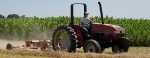
commercial agriculture
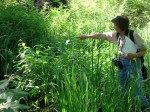
PRIOR TO THE FIRST AGRICULTURAL REVOLUTION, people relied on hunting and gathering to obtain food supplies. The agricultural revolution began as the individuals in the society began to cultivate soil, plant seeds, and use plows and animals to assist with the cultivation of the soil. This change from a hunting and gathering society did not […]
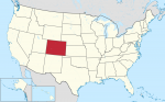
Colorado
COLORADO IS ONE of the Rocky Mountain states located in the west-central part of the UNITED STATES. All of Colorado is more than 3,300 ft (1,000 m) above sea level. With an average elevation of 6,800 ft (2,070 m), Colorado is the highest of all the states. Colorado is a Spanish word meaning “reddish colored” […]
colonialism
FROM THE ONSET of trade, the merchant traders established colonies in the foreign places where they did business. Those early merchant colonies were not colonialist in the strict sense. The merchants resided in foreign cities by the grace of the city officials. More commonly, colonialists dominated the indigenous peoples. The Greeks and Romans established military […]
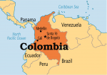
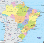
Colombia
Area 439,735 square mi (1,138,910 square km) Population 48.93 million 2014 Capital Bogota Highest Point 18,947 ft (5,775 m) Lowest Point 0 m GDP $377.7 billion 2014 Primary Natural Resources petroleum, natural gas, coal, iron ore. COLOMBIA IS A country located in northwestern South America. Named for Christopher Columbus, it is the only South American […]
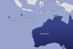
Cocos Islands
THE COCOS (or Keeling) Islands are a dependency of AUSTRALIA located in the INDIAN OCEAN, about 1,675 mi (2,700 km) northwest of Perth, and 620 mi (1,000 km) southwest of JAVA, INDONESIA. Unlike the volcanic peak of their closest neighbor, CHRISTMAS ISLAND, 560 mi (900 km) to the northeast, the Cocos Islands consist of two flat coral atolls, roughly 15.5 mi […]
coastal zone
THE COASTAL ZONE is where nature breathes its essence into poets and painters. Ancient Greeks believed it was where Neptune's energy encounters land. People living in the UNITED STATES call this transition between land and sea the shore, coast, or beach. Robert Gabler et al., define the coastal zone as “the dynamic region on land […]
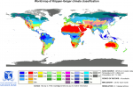
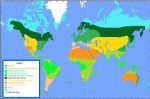
climate classification
CLIMATE IS an average or aggregate of daily weather conditions over a period of years. Latitude, distance from oceans, atmospheric and oceanic circulation pattern, elevation, and local geographical features control the climate of a place. The controls of climate result in a plethora of interrelated elements of climate, ranging from temperature, pressure, wind, humidity, clouds, […]
climate
THE TERM climate refers to the long-term averages of insolation (solar radiation absorbed by Earth), temperature, precipitation, cloud cover, air masses, atmospheric pressure, winds, and cloud coverage. Of these, temperature and precipitation are the most important factors in establishing climate type. A place may have rain on one day, clear conditions for a week, and […]
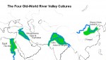
civilizations, early river
Early river valley civilizations arose in Mesopotamia, EGYPT, the INDUS RIVER Valley, and CHINA. Earlier agricultural societies (8,000 to 13,000 years ago) were largely subsistence cultures. The river civilizations had food enough to provide for classes of people other than just farmers. These societies all used agricultural surpluses to establish civilizations with cities and trade and […]
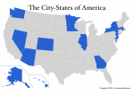
city-states
A CITY-STATE IS AN independent political entity composed of a large and important town and surrounding countryside. In ancient times, city-states, such as the Greek city-states and Rome, sometimes became great economic and military powers that secured far-flung empires, thereby imposing their will and culture on other civilizations. In late medieval and Renaissance ITALY, powerful […]
city types
CITIES ARE INFLUENCED by a broad variety of contexts and factors, including particular groups of people. As a consequence of numerous influences, the city may, to some extent, specialize in and be characterized as being of a particular type. To refer to people and government regimes, for example, a number of particular city types can […]
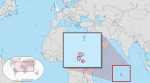
Christmas Island
CHRISTMAS ISLAND IS AN isolated island in the INDIAN OCEAN, located about 220 mi (360 km) southwest of JAVA, INDONESIA, and 1,400 mi (2,300 km) northwest of AUSTRALIA, to which it belongs as a dependency. Maintained chiefly as a phosphate-mining colony since the 19th century, it is now being developed as a tropical island holiday […]
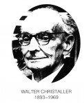
Christaller, Walter (1893–1969)
A GERMAN geographer, Walter Christaller helped bring quantitative and statistical disciplines to the study of geography. Christaller was born in Berneck, GERMANY; his father was a clergyman and his mother an author. Before 1914, he attended university in Heidelberg and in Munich. He enlisted during World War I, and became an officer. Returning after the […]
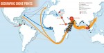
choke point
A CHOKE POINT IS ANY narrow passage that restricts traffic. It literally connotes a location where the flow could be choked off. As a military term, it refers to areas in lines of sea, ground, air or space communications (physical travel) that restrict freedom of movement by slowing and confining. This allows an adversary to […]
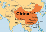
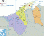
China
Area 3,645,468 square mi (9,596,960 square km) Population 1.364 billion 2014 Capital Beijing Highest Point 29,035 ft (8,850 m) Lowest Point -505 ft (-154 m) GDP $10.36 trillion 2014 Primary Natural Resources coal, iron ore, petroleum, natural gas. CHINA IS ONE of the largest countries in the world, with more than 3.6 million square mi (9.6 […]
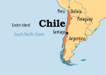
Chile
Area 302,778 square mi (756,950 square km) Population 17.77 million 2014 Capital Santiago Highest Point 22,573 ft (6,880 m) Lowest Point 0 m GDP $258.1 billion 2014 Primary Natural Resources copper, fish, agricultural products. CHILE IS A LONG and narrow country in South America, about 3,999 mi (6,435 km) long and an average of 112 […]
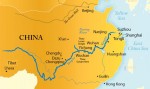
Changjiang (Yangzi River)
THE CHANGJIANG cuts through the heart of CHINA and is regarded by the Chinese as the geographical marker dividing the country into north and south. It winds its way through the 10 provinces of Qinghai, Tibet, Yunnan, Sichuan, Hubei, Hunan, Jiangxi, Anhui, Jiangsu and Shanghai before reaching the East China Sea. Its fertile ALLUVIAL PLAINs produce great amounts of […]
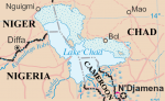
Chad, Lake
LAKE CHAD IS A shallow freshwater lake located in west-central Africa. Only 23 ft (7 m) at its deepest, it is 820 ft (250 m) above sea level, and was once larger than the state of VERMONT. In the 1960s, Lake Chad was approximately the size of lake ERIE, one of the Great Lakes located […]
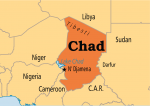
Chad
Area 495,752 square mi (1,284,000 square km) Population 13.21 million (2014) Capital N’Djamena Highest Point 11,204 ft (3,415 m) Lowest Point 525 ft (160 m) GDP $13.92 billion (2014) Primary Natural Resources petroleum, uranium, fish. THE REPUBLIC OF CHAD is a LANDLOCKED country located in north-central Africa. It is bounded by LIBYA, NIGER, NIGERIA, CAMEROON, […]
central business district
Methods for the delimitation of the CBD include mapping land use intensities referring to the central business height index, recording the percentage of the land uses of each floor of each building within the CBD, and calculation of high-level pedestrian flows. The Manhattan CBD is, for example, characterized by very high offices blocks and a […]
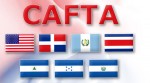
Central America Free Trade Agreement
THE CENTRAL America Free Trade Agreement (CAFTA) is a treaty between the UNITED STATES and the countries of Central America (HONDURAS, GUATEMALA, EL SALVADOR, NICARAGUA and COSTA RICA)—what the Russians refer to as the “near abroad.” This is a parallel to the earlier NAFTA (North American Free Trade Agreement). The objective is a free-trade association […]
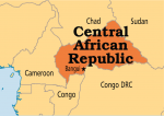
Central African Republic
Area 240,535 square mi (622,984 square km) Population 4.709 million (2014) Capital Banqui Highest Point 4,658 ft (1,420 m) Lowest Point 1,099 ft (335 m) GDP $1.783 billion (2014) Primary Natural Resources diamonds, uranium, gold. DEEP IN THE HEART of the African continent, the LANDLOCKED Central African Republic is on a heavily forested plateau about […]
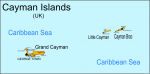
Cayman Islands
THE CAYMAN Islands are one of the UNITED KINGDOM few remaining colonies in the CARIBBEAN SEA. The group, lying roughly 150 mi (250 km) northwest of JAMAICA, consists of three main islands, Grand Cayman, Little Cayman, and Cayman Brac. They were first named Las Tortugas by Christopher Columbus in 1503 because of the abundance of […]
Caucasus Mountains
THE CAUCASUS MOUNTAINS are the highest mountain range in Europe, but lie at the very eastern extremity of what geographers consider to be Europe. In fact, the dividing line traditionally used to divide Europe from Asia runs directly through the center of the range. Forming both a barrier and a connector for civilizations between the […]
Catholic Church
SINCE THE BEGINNING OF Christianity, the extension and growth of the Catholic Church were a means to explore, map, and discover the world. Explorations were the first step in establishing missions in foreign lands, the cause of great travels around the globe. The Acts of the Apostles, and also ancient and medieval legends, tell about […]
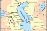
Caspian Sea
THE CASPIAN SEA IS ONE of the world's largest bodies of water, situated in a depression between RUSSIA, KAZAKHSTAN, TURKMENISTAN, IRAN, and AZERBAIJAN. It is unique among the world's inland seas in that it is completely isolated from the rest of the global ocean and has a distinctive continental climate which gives the area extremes […]
cartography
A TERM DERIVED from the word for chart (charte) or drawing, cartography is traditionally defined as the art and science of making maps. But over the years, a great deal of theoretical and practical research has been done in all aspects of the subject, including work on map projections, map designs, map visualization, cartograms, terrain models, and the incorporation of new computer-based […]
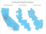
cartogram
ONE OF THE LIMITATIONS of the traditional paper map is that real world areas with large populations are usually small in physical size and therefore represented as small area units on a map. As such, traditional paper maps have tended to mask geographic patterns in small area units that are of importance and interest on the map. The […]
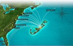
Caribbean Sea
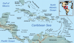
THE CARIBBEAN SEA is a suboceanic BASIN in the western ATLANTIC OCEAN. The sea covers just over 1 million square miles (2.6 million square km) and contains numerous islands. The islands, which vary greatly in size, cover some 91,000 square mi (235,688 square km). CUBA is by far the largest at 44,000 square mi (113,959 […]
capitals
A CAPITAL IS A CITY or town that serves as the administrative center of a political unit such as a country, state, or province. The word capital is ultimately derived from the Latin word for “head” (caput). Capitals of counties in the UNITED STATES are generally known as “county seats”; in England and IRELAND such […]
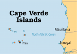
Cape Verde
Area 1,557 square mi (4,033 square km) Population 503,600 2014 Capital Praia Highest Point Mt. Fogo 9,281 ft (2,829 m) Lowest Point 0 m GDP $1.871 billion 2014 Primary Natural Resources salt, basalt, limestone, kaolin, fish. CAPE VERDE IS a volcanically produced archipelago, consisting of 10 major islands and five islets in the ATLANTIC OCEAN, […]
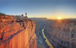
canyon
A CANYON IS A deep, narrow passage cut through the surface of the Earth with steep cliffs on both sides. Sometimes called a gorge or ravine, canyons are often formed in mountainous, arid, or semiarid regions where riparian EROSION is much greater than erosion from general weathering. They range in size from an arroyo, or […]
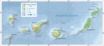
Canary Islands
THE CANARY ISLANDS lie just 93 mi (150 km) off the northwest coast of Africa in the ATLANTIC OCEAN but have been politically and culturally attached to SPAIN, 830 mi (1,350 km) to the northeast, since the 14th century. Today the seven islands, an autonomous region of Spain, are among the most popular holiday destinations […]
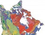
Canadian Shield
THE CANADIAN or Laurentian Shield, the largest natural region of North America at 1.1 million square mi (3 million square km), is located north of the St. Lawrence Lowland and east of the Interior Plains. It is composed of igneous and metamorphic rock of Precambrian origin, some of the oldest rock on Earth. More than […]
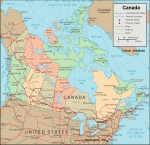
Canada
Area 3,850,000 square mi (9,984,670 square km) Capital Ottawa Population 35.54 million 2014 Highest Point 19,550 ft (5,959 m) Lowest Point 0 m GDP $1.787 trillion 2014 Primary Natural Resources iron ore, nickel, zinc, copper, gold. CANADA ENCOMPASSES the second-largest land area of any country after RUSSIA. Like its southern neighbor, the UNITED STATES, Canada's […]
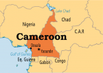
Cameroon
Area 183,569 square mi (475,440 square km) Population 22.82 million (2014) Capital Yaounde Highest Point 13,435 ft (4,095 m) Lowest Point 0 m GDP $32.55 billion (2014) Primary Natural Resources petroleum, bauxite, iron ore, timber CAMEROON IS A triangle-shaped nation slightly larger than CALIFORNIA. It is wedged between NIGERIA and EQUATORIAL GUINEA on Africa's west-central […]
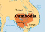
Cambodia
Area 69,884 square mi (181,040 square km) Population 15.41 million 2014 Capital Phnom Penh Highest Point 5,938 ft (1,810 m) Lowest Point 0 m GDP $16.71 billion 2014 Primary Natural Resources timber, gemstones, hydropower potential. BORDERED BY VIETNAM, LAOS, and THAILAND, Cambodia, with a near circular shape, is a perfect example of a compact country. […]
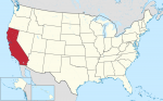
California
THE MOST POPULOUS state in the UNITED STATES, California also has the richest and most urbanized citizenry. It is the third largest state, famous for its climate, unique industries, agriculture, geographic variety, and lifestyles. California covers 158,706 square mi (411,049 square km), is 252 mi (406 km) at its widest point, and is 824 mi […]
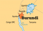
Burundi
Area 10,759 square mi (27,830 square km) Population 10.48 million 2014 Capital Bujumbura Highest Point 8,760 ft (2,670 m) Lowest Point 2,539 ft (772 m) GDP $3.094 billion 2014 Primary Natural Resources coffee, tea, cotton, minerals. BURUNDI IS A landlocked country in eastern Africa. It has borders with the Democratic Republic of the CONGO, RWANDA, […]
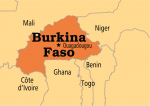
Burkina Faso
Area 105,840 square mi (274,200 square km) Population 17.42 million 2014 Capital Ougadougou Highest Point 2,457 ft (749 m) Lowest Point 656 ft (200 m) GDP $12.54 billion 2014 Primary Natural Resources manganese, limestone. A LANDLOCKED republic located in West Africa, bordering GHANA, COTE D'IVOIRE, and TOGO to the south, BENIN to the southeast, NIGER […]
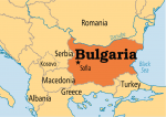
Bulgaria
Area 42,900 square mi (111,910 square km) Population 7.226 million 2014 Capital Sofia Highest Point 9,596 ft (2,925 m) Lowest Point 0 m GDP $55.73 billion 2014 Primary Natural Resources bauxite, coal, copper, lead, timber. BULGARIA IS ONE OF 10 countries in the Balkan Peninsula in southeastern Europe. The peninsula is a mountainous region with […]
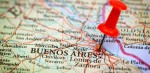
Buenos Aires
BUENOS AIRES IS the largest city in ARGENTINA, and as part of a federal district, it serves as the country's capital. The city's name means “good airs” and derives from the name of a patron saint of navigators known as Nuestra Senora Santa Maria del Buen Aire. Measuring 77 square mi (199 square km), the […]
Brunei
Area 2,055 square mi (5,770 square km) Population 423,200 2014 Capital Bandar Seri Begawan Highest Point Bukit Pagon 6,105 ft (1,850 m) Lowest Point 0 m GDP $17.26 billion 2014 Primary Natural Resources petroleum, natural gas. THE SULTANATE of Brunei is one of the world's smallest countries, but also one of the world's richest. A […]
British Indian Ocean Territory
THE BRITISH Indian Ocean Territory (BIOT) is an archipelago in the INDIAN OCEAN, south of INDIA, about one-half of the way from Africa to INDONESIA. On November 8, 1965, the British government created the (BIOT). The BIOT consisted of the Chagos Archipelago, excised from the British Crown Colony of Mauritius; and the Aldabra and Farquhar […]
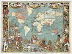
British Empire
IN THE 15th and 16th centuries, English trading ships were already sailing to JAPAN via Africa, INDIA, and CHINA, but there was no English sovereignty in these places. The term empire then designated the association between England, Scotland, IRELAND, and Wales. During the 17th and 18th centuries, a network of territories stretching from America to […]
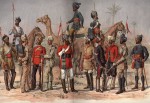
British East India
IT CAN BE ARGUED that Portuguese, Dutch, and French merchants exploited India; Britain remade the subcontinent. British East India grew from a series of coastal trading posts to encompass the part of the Indian subcontinent taken by the current states of INDIA, BANGLADESH, and PAKISTAN. The subcontinent's southern peninsula extends to the HIMALAYAS mountains that […]
Brazil
Area 3,286,488 square mi (8,511,965 square km) Population 202.0 million 2014 Capital Brasilia Highest Point 9,888 ft (3,014 m) Lowest Point 0 m GDP $2.346 trillion 2014 Primary Natural Resources bauxite, gold, iron ore, uranium, petroleum. BRAZIL IS THE LARGEST and most populous country in South America. The country occupies almost half of the continent. […]
Bouvet Island
BOUVET ISLAND, a territory of NORWAY, is known as one of the peri-Antarctic islands, small uninhabited rocks and volcanic islands that circle the frozen continent. It was discovered by Jean-Baptiste Charles Bouvet de Lozier, a lieutenant in the French East Indies Company, on New Year's Day, 1739, but not found again until nearly a century […]
boundaries, political
POLITICAL BOUNDARIES are frequently defined as borders constructed and imposed on or around a geographic territory in order to distinguish between areas of governance or types (strategies) of political control. They function both as a tool for managing a group of peoples and as a way of minimizing conflict and organizing efficient political units. Political boundaries […]
boundaries, natural
GOVERNMENTS USE physical features as boundaries of political units: boundaries of countries, states, counties, cities, and so forth. (Not all political boundaries follow natural features. A boundary can be geometric, meaning it is be composed of straight-line segments and arcs. There is a cultural type of boundary, as well. This boundary usually separates different ethnic […]
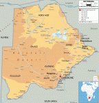
Botswana
Area 231,803 square mi (600,370 square km) Population 2.039 million (2014) Capital Gaborone Highest Point 4,890 ft (1,491 m) Lowest Point 1,682 ft (513 m) GDP $15.81 billion (2014) Primary Natural Resources diamonds, copper, silver. BOTSWANA IS a LANDLOCKED country in southern Africa, approximately 310 mi (500 km) from the nearest coastline to the southwest. […]
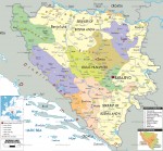
Bosnia and Herzegovina
Area 19,940 square mi (51,129 square km) Population 3.825 million 2014 Capital Sarajevo Highest Point Maglic 7,826 ft (2,386 m) Lowest Point 0 m GDP $18.34 billion 2014 Primary Natural Resources coal, iron, bauxite, zinc, hydropower. BOSNIA AND HERZEGOVINA was one of the component states of the former federation of Yugoslavia until it declared its […]
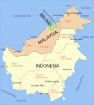
Borneo
THE ISLAND OF BORNEO is the largest island of the Malay archipelago and the third-largest island in the world (after GREENLAND and PAPUA-NEW GUINEA), covering 287,420 square mi (736,974 square km). It is also one of the least explored places on Earth and retains much of the mystery for today's tourists that it did for […]
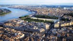
Bordeaux
BORDEAUX IS THE eighth-largest city in FRANCE, and the capital of the historic southwestern province of Aquitaine. Bordeaux is also considered the wine capital of the world, and has been famous for its viticulture since the days of the Roman Empire. Unlike other major French cities, Bordeaux is not known for its energetic lifestyle or […]
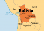
Bolivia
Area 424,164 square mi (1,098,580 square km) Population 10.85 million 2014 Capital La Paz Highest Point 21,463 ft (6,542 m) Lowest Point 295 ft (90 m) GDP $34.18 billion 2014 Primary Natural Resources tin, natural gas, petroleum, zinc. BOLIVIA IS A COMPLEX and fascinating country. Located in the center of South America, it shares borders […]
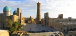
Bokkara
BOKKARA (ALSO BUKHARA) is a city that lies on the SILK ROAD of Central Asia in the Asian republic of UZBEKISTAN. Its name, bestowed by its Sogdian occupiers in the 3rd century B.C.E., derives from the Sanskrit word vikhara, meaning “monastery.” Bokkara lies in the ARAL SEA basin and was founded some 3,000 years ago […]
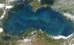
Black Sea
THE BLACK SEA IS a body of salt water that stretches 630 mi (1,014 km) from east to west. TURKEY faces its southern shore, BULGARIA and ROMANIA lie west of the Black Sea, and UKRAINE, RUSSIA, and GEORGIA border it to the north, northeast, and east, respectively. The Black Sea stretches 330 mi (530 km) […]
Biosphere
THE ENVIRONMENT of the Earth can be broadly divided into four major systems: the atmosphere, hydrosphere, lithosphere, and biosphere. Russian scientist Vladimir Vernadsky coined the term biosphere in 1929. The term refers to the life zone of Earth that includes the air, land, and water occupied by all organisms including humans. This life zone distinguishes […]
bioreserve
BIORESERVES, also known as BIOSPHERE reserves, are an internationally recognized type of conservation reserve. In 1970, the 16th General Conference of UNESCO (part of the United Nations), acting on the recommendations of the conference, launched the long-term intergovernmental and interdisciplinary program known as Man and the Biosphere (MAB). Crucial for the program was a project […]
Biome
A BIOME IS A classification of large areas of plant formations. The world's vegetation communities can be described in many ways depending on scale and controlling factors. The early plant geographers, notably F. E. Clements and V. E. Shelford, working in the UNITED KINGDOM and the UNITED STATES in the early 20th century, defined and […]
Bight of Benin
A “BIGHT” REFERS TO a bend or curve, most often a crescent shape, that forms an open bay in a coastline. The Bight of Benin is a roughly 500-mi- (800-km-) long bend in the West African coast, stretching from near the mouth of the Volta River (Cape Saint Paul) in GHANA eastward across the coastlines […]
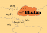
Bhutan
Area 29,204 square mi (47,000 square km) Population 765,600 2014 Capital Thimphu Highest Point 24,780 ft (7,553 m) Lowest Point 318 ft (97 m) GDP $1.821 billion 2014 Primary Natural Resources hydropower. BHUTAN IS A LANDLOCKED country located in the eastern part of the HIMALAYAN MOUNTAINS, bordered by INDIA in the south, east, and west […]
Bermuda
BERMUDA IS A UNITED KINGDOM overseas territory located 700 miles southeast of NEW YORK CITY in the North ATLANTIC OCEAN. With an area of 36.2 square mi (53.3 square km), the island colony has a population of 64,482 (2003). Bermuda is a primary tourism destination for East Coast Americans, and its capital, Hamilton, serves as […]
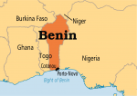
Benin
Area 43,483 square mi (112,620 square km) Population 10.60 million 2014 Capital Porto-Novo Highest Point 2,158 ft (658 m) Lowest Point 0 m GDP $8.747 billion 2014 Primary Natural Resources oil, limestone, marble, timber. BENIN IS LOCATED in West Africa and is bordered to the west by TOGO, to the north by NIGER and BURKINA […]
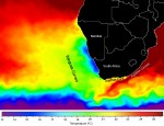
Benguela Current
THE BENGUELA CURRENT is one of the world's four major eastern boundary currents. It flows northward off the coast of southwestern Africa along the western coasts of SOUTH AFRICA, NAMIBIA, and southern ANGOLA. The Benguela Current, along with the South Equatorial Current, and the northern part of the Antarctic Circumpolar Current make up the South […]
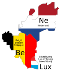
Benelux
BENELUX IS THE name of the customs union created in 1956, named for the initial syllables of its three member states: BELGIUM, NETHERLANDS, and LUXEMBOURG. The name originally applied to the economic pact between the three countries, the Benelux Economic Union, but is now also used to refer to the three countries as a geopolitical […]
Benares
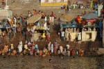
BENARES (also Banaras, Varanasi) is an ancient city in the state of Uttar Pradesh, in northern INDIA. Its population is just over 1 million (1991). Although the name Benares appears on many maps, it is actually a corruption of the official Indian name of the city, Varanasi. In addition to many religious institutions and festivals, […]
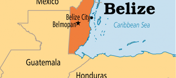
Belize
Area 8,865 square mi (22,966 square km) Population 339,800 2014 Capital Belmopan Highest Point 3,805 ft (1,160 m) Lowest Point 0 m GDP $1.624 billion 2013 Primary Natural Resources bananas, cocoa, citrus, sugar, fish. BELIZE (“BELICE” IN SPANISH), formerly the Settlement of Belize in the Bay of Honduras (prior to 1862), British Honduras (1862–1973), and […]
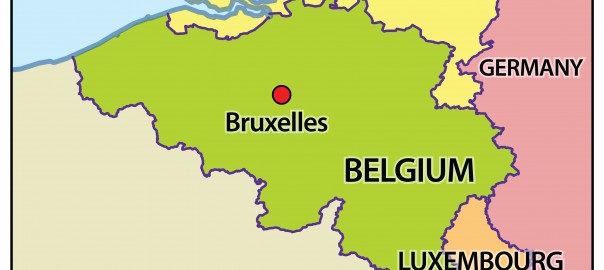
Belgium
Area 11,790 square mi (30,510 square km) Population 11.23 million 2014 Capital Brussels Highest Point Signal de Botrange 2,290 ft (694 m) Lowest Point 0 m GDP $533.4 billion 2014 Primary Natural Resources coal, natural gas. ALTHOUGH IT OCCUPIES a central position at the economic crossroads of western Europe, and its people have been central […]
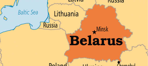
Belarus
Area 128,997 square mi (207,600 square km) Population 9.470 million 2014 Capital Minsk Highest Point 1,135 ft (346 m) Lowest Point 295 ft (90 m) GDP $76.14 billion 2014 Primary Natural Resources forests, peat deposits, oil. BELARUS, FORMALLY BELORUSSIA, also called White Russia, is bounded on the west by POLAND, on the northwest by LATVIA […]
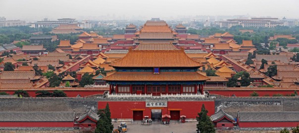
Beijing
BEIJING IS LOCATED in the northern part of the North China Plain, about 100 mi (160 km) northwest of the Bohai Sea. As capital of the People’s Republic of CHINA, Beijing is the core of a special municipal district, giving the region political status equivalent to that of an entire province. For this reason, the […]
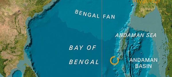
Bay of Bengal
THE BAY OF BENGAL is a triangle-shaped water body, which is an extension of the INDIAN OCEAN to the north. It is stretched over an area of 5.7 million square mi (14.7 million square km) with an average depth of approximately 8,530 ft (2,600 m). Countries that surround the bay are SRI LANKA, INDIA, BANGLADESH, MYANMAR […]
basin
BASINS ARE LARGE-SCALE depressions in the land surface or seafloor. Their sides may dip gently or steeply, but their bottoms are always wider than they are deep. Streams flowing into basins often fill their floors with sediments. Lakes typically occupy lower parts of the basins on land, thus they may fully emerge as lakes dry […]
bases of trade
GEOGRAPHIC BASES of trade are places established for the trade or exchange of commodities and/or the transshipment or warehousing of goods. While a base of trade may develop into a multifunctional administrative and/or ceremonial center, its original function as a nodal point at the intersection of at least two discreet networks remains the center's primary […]
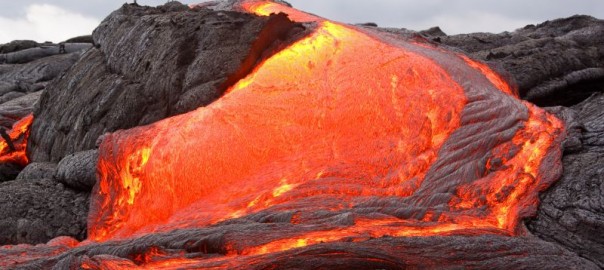
basaltic flows
THE WORD basalt is said to have an Ethiopian origin, meaning “black stone.” Basalt is a dark gray to black, dense to finely grained igneous rock that is the result of lava eruptions. Basalts are not only the most abundant lavas, but they are also the most voluminous. Basalt, when exposed to the air, becomes […]
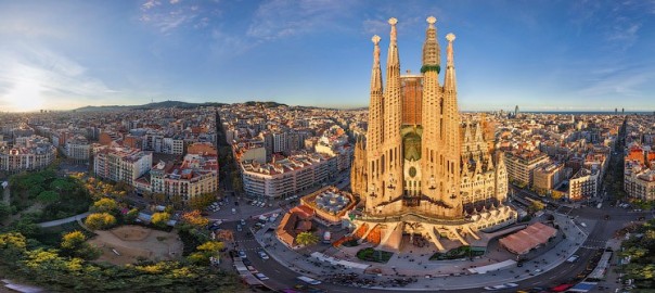
Barcelona
BARCELONA IS THE second-largest city in SPAIN after MADRID and is the capital of the autonomous region of Catalunya/Cataluna (Catalonia), which is situated in the northeast of Spain. The region is bordered to the north by the PYRENEES mountain range, which acts as a natural border between Spain, ANDORRA, and FRANCE; to the east the […]
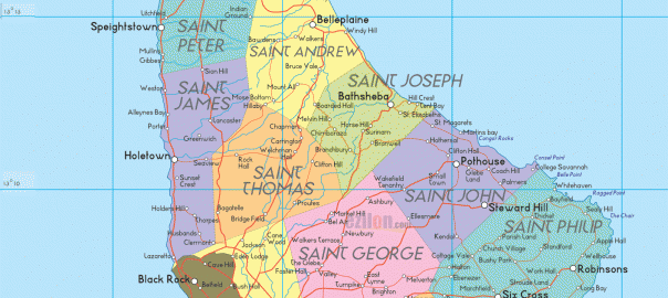
Barbados
Area 168 square mi (431 square km) Population 286,100 2014 Capital Bridgetown Highest Point Mount Hillaby 1,109 ft (336 m) Lowest Point 0 m GDP $4.348 billion 2014 Primary Natural Resources petroleum, fish, natural gas. BARBADOS IS ONE of the clearest success stories of the CARIBBEAN SEA, with one of the most prosperous economies and stable […]
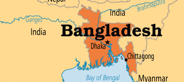
Bangladesh
Area 55,126 square mi (133,910 square km) Population 158.5 million 2014 Capital Dhaka Highest Point 4,035 ft (1,230 m) Lowest Point 0 m GDP $173.8 billion 2014 Primary Natural Resources natural gas, arable land, coal. BANGLADESH HAS been an independent country since 1971, when it seceded from PAKISTAN in South Asia. Prior to Muslim occupation […]
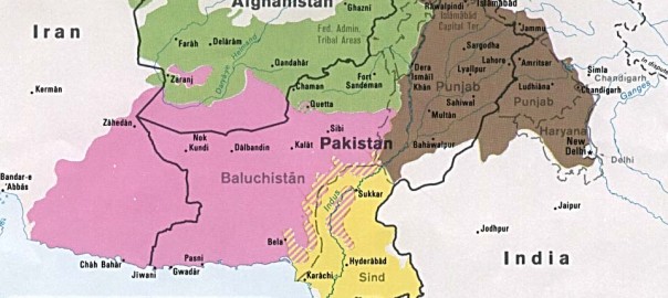
Baluchistan
BALUCHISTAN, A SOUTHWESTERN province of PAKISTAN, extends from the Gomal River in the northeast to the ARABIAN SEA in the south and from the borders of IRAN and AFGHANISTAN in the west and northwest to the Sulaiman Mountains and Kirthar hills in the east. In its continuity to the west lies Iranian Baluchistan. The land […]
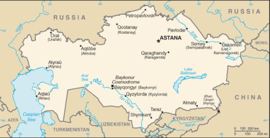
Balkhash, Lake
LOCATED IN eastern KAZAKHSTAN, Lake Balkhash is the world’s sixteenth-largest lake, covering a surface area of about 7,000 square mi (18,000 square km); however, its size is being reduced by overutilization of streams that flow into the lake. Closed, with no outflow, Lake Balkhash, like the ARAL SEA at the opposite end of Kazakhstan, has […]
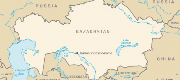
Baikonur
BAIKONUR IS THE former Soviet Union's primary space launch facility. In the early days of the Soviet space program, rockets were launched from Kasputin Yar, a small field in the lower VOLGA RIVER basin not far from Stalingrad (modern Volgograd). However, this launch facility had numerous problems. Mists rising from the Volga River frequently delayed […]
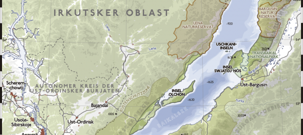
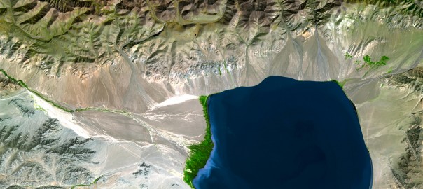
Baikal, Lake
THE BAIKAL, the world's deepest lake, stretches 391 mi (636 km) long and nearly 50 mi (80 km) wide. On the northeastern borders of central Asia, it lies at an altitude of 1,494 ft (455.6 m) above the PACIFIC OCEAN sea level. With an area of 12,162 square mi (31,500 square km), the Baikal ranks […]
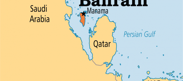
Bahrain
Area 256 square mi (665 square km) Population 1.344 million 2014 Capital Manama Highest Point 400 ft (122 m) Lowest Point 0 m GDP $33.87 billion 2014 Primary Natural Resources oil, natural gas, fish, pearls. BAHRAIN IS LOCATED in the MIDDLE EAST; it is an archipelago in the PERSIAN GULF, east of SAUDI ARABIA. Bahrain […]
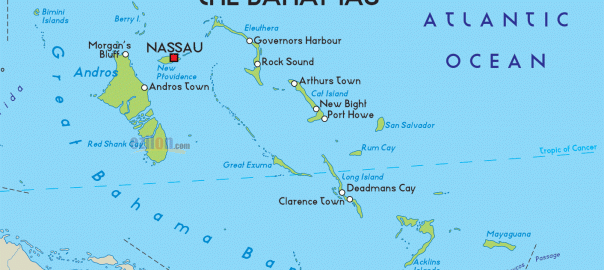
Bahamas
Area (land) 1,509 square mi (3,870 square km) Population 382,600 2014 Capital Nassau Highest Point 208 ft (63 m) Lowest Point 0 m GDP $8.511 billion 2014 Primary Natural Resources timber, salt, aragonite. THE ISLAND OF San Salvador is cited as the first landing spot in the New World by the explorer Christopher Columbus on […]
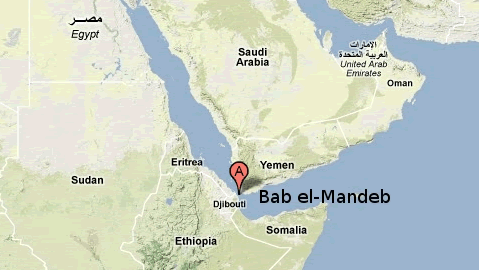
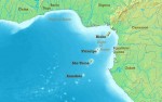
Bab el Mandeb
CONNECTING THE RED SEA with the Gulf of Aden and the ARABIAN SEA, bounded by DJIBOUTI, ERITREA, and YEMEN, the Bab el Mandeb is a STRAIT and CHOKE POINT. It separates the Arabian Peninsula from East Africa (HORN OF AFRICA). As its Arabic name implies (“Gate of Tears”), it is a place of worry for […]
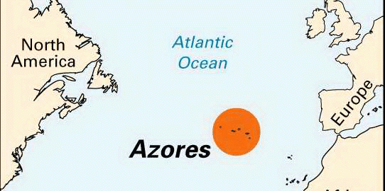
Azores
THE AZORES IS AN archipelago of nine islands situated in the middle of the North ATLANTIC OCEAN, usually divided in three groups according to geographic proximity: the Eastern Group (Santa Maria and Sao Miguel), the Central Group (Terceira, Graciosa, Sao Jorge, Pico, and Faial), and the Western Group (Flores and Corvo). The Azores constitutes, along with […]
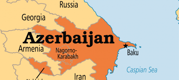
Azerbaijan
Area 53,820 square mi (86,600 square km) Population 9.538 million 2014 Capital Baku Highest Point 15,551 ft (4,740 m) Lowest Point Caspian Sea -92 ft (-28 m) GDP $75.20 billion 2014 Primary Natural Resources petroleum, natural gas. AZERBAIJAN, A FORMER Soviet republic, now officially the Republic of Azerbaijan, is a nation with a Turkic and […]
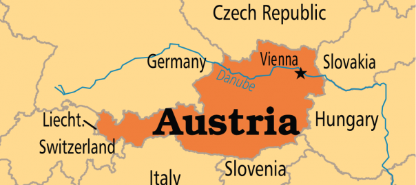
Austria
Area 32,377 square mi (83,858 square km) Population 8.534 million 2014 Capital Vienna Highest Point 12,457 ft (3,797 m) Lowest Point 377 ft (115 m) GDP $436.3 billion 2014 Primary Natural Resources natural gas, iron, timber. LANDLOCKED AUSTRIA (Osterreich in German) is located at the cultural and geographical crossroads of Central Europe. It is also […]
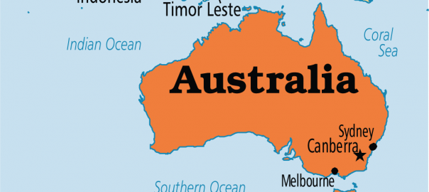
Australia
Area 2,967,895 square mi (7,686,850 square km) Population 23.49 million 2014 Capital Canberra Highest Point 7,311 ft (2,229 m) Lowest Point 49 ft (15 m) GDP $1.454 trillion 2014 Primary Natural Resources gold, silver, uranium. THE COMMONWEALTH of Australia is the world's sixth-largest country and is located on the world's smallest continent between the INDIAN […]
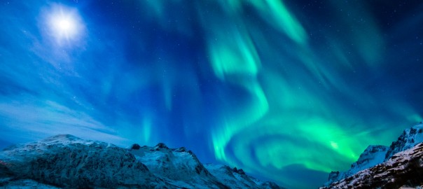
Aurora borealis
NORTHERN LIGHTS, or the aurora borealis, are shimmering lights that shine above the Earth near the geomagnetic North Pole. The lights, often bright enough to read by, are usually green or red. The phenomenon is caused when a solar storm discharges high-energy particles that are channeled into a ring by the Earth's magnetic field. The […]
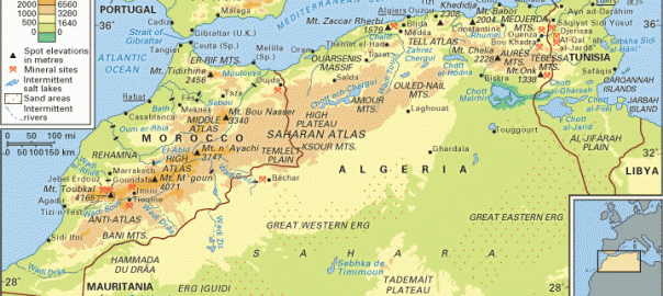
Atlas Mountains
THE ATLAS MOUNTAINS of northwest Africa are an elaborate assemblage of mountain ranges that trend from southern coastal MOROCCO and the CANARY ISLANDS, through ALGERIA into coastal TUNISIA. Extending more than 1,500 km (932 mi) and chiefly composed of sedimentary and igneous rocks that have been folded and faulted over the past 85 to 150 […]
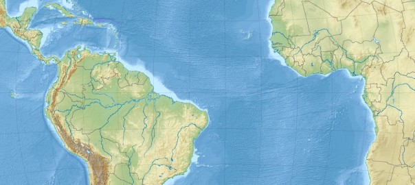
Atlantic Ocean
THE NAME OF THE Atlantic Ocean is derived from the Greek god Atlas and means “Sea of Atlas.” Its area is approximately 41 million square mi (106 million square km) including its adjacent seas; volume is approximately 85 million cubic mi (354 million cubic km), including adjacent areas. The average depth of the ocean with […]
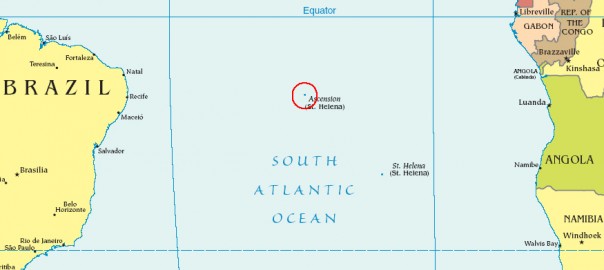
Ascension Island
ASCENSION ISLAND IS an overseas territory that forms part of a single territorial grouping (with ST. HELENA and Tristan da Cunha) under the sovereignty of the British crown. Ascension is a small island, 35 square mi (90 square km), of volcanic origin between Africa and South America, just south of the equator. The capital is […]