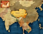
Representing Africa II: Exploration, Colonialism, and Imperialism
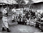
The earliest European human geographies of Africa were geographies of exploration and conquest, and from the era of the Atlantic slave trade through colonialism (a span of exploitation of Africa stretching from about 1450 into the 1960s and 1970s), they shaped the way much of the world views Africa. Through the Atlantic slave trade, an estimated 11.6 million Africans were forcibly […]
Representing Africa I: The Early Years
When non Africans talk about Africa today, it is often in the context of discussions of poverty, disease, warfare, or political instability. Africans are often represented as villains or victims. This was not at all the way the outside world's understanding of Africa began. Indeed, the whole notion of any generalized collective understanding of a landmass or entity called 'Africa' took […]
Introduction: Defining Africa
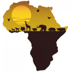
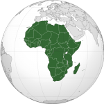
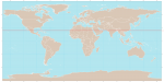
Africa is huge, diverse, and complex. Africa is identified as the world's second largest continent, covering more than 30 million square kilometers. Its diversity and complexity extend to its physical geography, climatology, and biogeography. Africa has many vast plateaus, five major basins, long stretches of fertile volcanic mountains not far from desolate wastelands below sea level, lakes that are among the world's […]
Conclusion: The Politics of Affect
For human geography, and for our roles as researchers, thinking with and using the concept of affect plugs us into the qualitative means and strategies we have for investigating the everyday worlds in which we live. Affect based research thus operates a strong political gesture in directing attention to the affective affinities produced among forms of life where we […]
Modes of Thinking Affect
Summarizing and working through the concept of affect, it is helpful to think of it in four different ways. The first two take affect to be a material thing, firstly understanding it as a phenomena and secondly as a force; then it can be addressed directly as a theory before finally understanding affect as a mode of expression. So […]
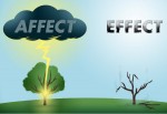
Affect
Affect is at once an actual phenomenon and a virtual force, a material effect and an immaterial disposition. As a conception, it pairs dangerously close to our understandings of emotion and therefore exists as something familiar and seemingly knowable despite not having objective tangibility. As a result of this it is often rendered academically in fairly abstract and philosophically […]

Activism and Academia: Contradictory Spaces?
Many of the remarks above gesture to the complications of working in the 'third space' between activism and academia, not least because the academy is traditionally suspicious of highly engaged, participatory, and transparently ethico politically 'committed' inquiry, but also sometimes because activists are (often justifiably) suspicious of what these academics are 'really' after (ultimately career boosting or wishing to make a […]
Responsible Activist Geographies
First, the motivation of activist geographies is to develop practices aimed at social transformation rather than merely the 'production of knowledge' and/or the 'solving' of 'local' problems. Activist research moves beyond the acquisition, cataloging, ordering, and the publishing of information toward jointly producing knowledge with resisting others to produce critical interpretations and readings of the world which are accessible, understandable to […]
Activist Methodologies, Collaborations, and Everyday Life
This eruption of activist and related geographies within the discipline is taking place at a time in which there is increased social mobilization and conflict around the world. Issues such as globalizing capitalism, trade agreements, failed development, neoliberalism, and the war on terrorism have been met by opposition ranging from the Zapatista rebellion in Chiapas, itself both locally played out and stretching […]

Toward More Fully Activist Geographies
Since the 1970s, Marxist, feminist, and, more broadly, radical and critical geographers have produced outstanding scholarship and theorizing, substantively researching sociospatially constituted oppressions, inequalities, and injustices. Yet, there has often remained an uneasiness about the relative disconnect between such work and the potential of the discipline to contribute genuine activist interventions aiming to right the wrongs of such oppressions and the […]

Activist Geographies
Geographers have been activists in two primary ways. First, geographers have constructed new theories and explanations for social phenomena that have both substantially altered the ways that students and researchers understand problems, and the ways that academia evaluates research. Geographers, and other social scientists, have challenged the status quo in scholarly approaches, methods, and substantive areas by offering conceptual frameworks that have highlighted the […]
Geographies of Activism Types and Catalysts of Activism
Activism centers on a variety of different issues, can be reformist or radical in its objectives, and consists of distinct methods ranging from peaceful civil disobedience to violence. The catalysts for activism often center on visible and substantial change in social values, political debates and decision makers, economic activities, or urban land use patterns, but require awareness or knowledge of the […]
Network Geographies
ANT can be said to be proposing network geographies. There are two aspects of this proposal that need mentioning: first are the basic characteristics of the geographical imagination advocated by ANT, and second is the methodological implication of this perspective for geographical research. Topological World Space and time are central to ANT. Actor-networks necessarily depend on nonhuman actors […]

Moves into Geography – Bypassing Dualisms
The move of ANT into the realm of human geography happened parallel to a general conceptual development in the field. This was not least expressed by the cultural turn, the general rise of feminist studies to prominence, and a broad relational view as, for instance, framed in the non representational theory. The import of ANT perspective into the fields of […]
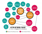
Actor-Network Theory
Material Relationalism The origins of actor-network theory (ANT) can be traced to science and technology studies (STS) and sociology of scientific knowledge (SSK) in the early 1980s. The approach has from the start been especially associated with the figures of Bruno Latour, Michel Callon, and John Law, who are much inspired by the French philosophers Michel Foucault, Michel Serres, Gilles Deluze, and […]
Activist Geographies – Introduction
Activist geographies are concerned with action, reflection, and empowerment (of oneself and others) in order to challenge oppressive power relations. As a fusion of theory and practice (praxis), activist geographers seek to forge mutual solidarity with resisting others – communities, groups, social movements, or nongovernment organizations who are challenging various practices of dominating power – through critical collaboration. The objectives can […]

Activism
Introduction Activism is most commonly associated with collective or group action by ordinary people, usually volunteers, who come together to change what they consider to be unacceptable or unfair circumstances. These individuals come together in a shared belief about the nature of the problem, and the means to best address the issue, using political opportunity structures to enable their influence on […]
zones of convergence/divergence
A BROAD AREA WHERE two tectonic plates are colliding is a zone of convergence. An area where plates are moving apart is a zone of divergence. Convection in Earth's mantle drives the two motions. Convergence occurs above descending limbs of convective cells, whereas divergence takes place above cells' rising limbs. The two zones' geologies are similar in many ways—they both have mountain […]
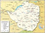
Zimbabwe
Area 150,803 square mi (390,580 square km) Population 15.25 million (2014) Capital Harare Highest Point 8504 ft (2,592 m) Lowest Point 531 ft (162 m) GDP $14.20 billion (2014) Primary Natural Resources corn, cotton, wheat, coffee, peanuts. ZIMBABWE IS a LANDLOCKED country in southern Africa. It is bordered by SOUTH AFRICA, MOZAMBIQUE, BOTSWANA, and ZAMBIA. The name […]
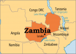
Zambia
Area 290,584 square mi (752,614 square km) Population 15.72 million (2014) Capital Lusaka Highest Point 7,549 ft (2,301 m) Lowest Point 1,079 ft (329 m) GDP $27.07 billion (2014) Primary Natural Resources copper, zinc, lead, coal, gold. ZAMBIA IS LOCATED in central Africa and is slightly larger than the state of TEXAS. It is completely LANDLOCKED, with […]
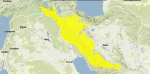
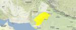
Zagros Mountains
THE ZAGROS MOUNTAINS are a complex chain of mountains and ridges in the westernmost part of IRAN. The range divides the region between the fertile plains of Mesopotamia and the Persian Gulf lowlands to the west, and Iran's dry inland plateau to the east. The ridges run roughly northwest to southeast, 930 mi (1,500 km) in length, from Kurdistan to the […]
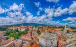
Zagreb
ZAGREB IS THE capital of CROATIA, and it is emerging as one of the leading cities of the regeneration of the Balkan Peninsula. Although it is one of Europe's oldest cities, it also is one of Europe's newest capital cities, since Croatia gained independence from Yugoslavia in 1991. With a population of nearly 900,000 people, Zagreb is much larger than any […]
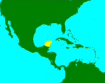
Yucatan Peninsula
THE YUCATAN PENINSULA is made up of three states: Campeche, Quintana Roo, and Yucatan, which also include major resort areas such as Cancun, Cozumel, and Playa del Carmen. The Yucatan Peninsula extends northward from Central America and is bordered on the east by the CARIBBEAN SEA and on the north and west of the peninsula by the Gulf of Mexico. The Yucatan […]
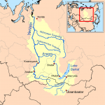
Yenisey-Angara River
THE YENISEY AND ANGARA rivers form a dividing line between western and eastern SIBERIA. Like the other major rivers of the region, they flow from highlands in the south across the flat north Siberian plains to the ARCTIC OCEAN. The watershed also includes the subbasin of Lake BAIKAL, the second-largest body of fresh water in the world. Most of the Yenisey-Angara basin […]
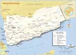
Yemen
Area 203,850 square mi (527,970 square km) Population 26.18 million 2014 Capital Sana'a Highest Point the jabal an nabi shu'ayb 12,335 ft (3,760 m) Lowest Point 0 m GDP $35.95 billion 2013 Primary Natural Resources negligible. YEMEN, NO MATTER how it is defined or what its current political structure, has always controlled the southwestern tip of the […]
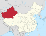
Xinjiang
THE XINJIANG UYGUR Autonomous Region (eastern Turkistan) is one of the CHINA's five autonomous regions and the largest provincial division. Xinjiang has an area of 635,871 square mi (1,646,900 square km) and a population of 19,250,000, and its capital is Urumqi. Xinjiang borders Tibet, Qinghai, Gansu, MONGOLIA, KAZAKHSTAN, KYRGYZSTAN, TAJIKISTAN, AFGHANISTAN, PAKISTAN, RUSSIA, and INDIA. Natural resources include crude oil, gas, iron, copper, […]
xerophytes
BIOGEOGRAPHERS AND ecologists usually classify plants according to their water needs. Since the global distribution of water varies from dry to wet, plants also vary in their adaptation to the availability of water. Xerophytes are plants of the arid regions. The Greek prefix xero- means dry in contrast to hygro- (wet) and meso- (intermediate). Xerophytes as a class of plants are […]
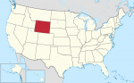
Wyoming
Wyoming is one of the ROCKY MOUNTAIN states located in the west-central UNITED STATES. Rectangular in shape, it is bordered by MONTANA to the north, SOUTH DAKOTA and NEBRASKA to the east, COLORADO and UTAH to the south and IDAHO to the west. With an area of 97,818 square mi (253,348 square km), Wyoming ranks 10th nationally in size. With […]
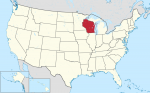
Wisconsin
Wisconsin lies on the western border of Lake MICHIGAN. Covering some 65,503 square mi (169,652 square km), the state ranks 23rd overall in size. With nearly half of the state's 5,363,675 population (2000) living in five major urban areas, the state has a comfortable country feeling with approximately 44 people per square mi (114 per square km). Madison, the state capitol, […]
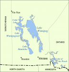
Winnipeg, Lake
LOCATED IN THE SOUTHEAST portion of the Canadian province of Manitoba, Lake Winnipeg (Cree for “murky or muddy waters”) is 266 mi (428 km) long and has an area of 9,417 square mi (24,390 square km). English explorer Henry Kelsey was the first European to visit the area in 1690 and is believed to have given the lake its name. The […]
wine geography
FROM THE TIME THAT the seafaring Phoenicians introduced wine to Egypt—and wealthy Egyptians grew grapes in a warm but otherwise imperfect climate 4,500 years ago—several geographic rules have guided the trade. First, it was never difficult to cultivate a taste for wine. If far-flung commerce proved impossible at certain times and places, the product could be sustained by a few advocates and […]
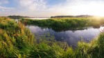
wetlands
WETLANDS ARE WATER-BASED ecosystems that cover approximately 6 percent of the Earth's land area. an estimated 3.3 million square mi (8.6 million square km). Wetlands occur on every continent except ANTARCTICA and in every climatic zone from the humid tropics to DESERT to tundra. Three climatic zones of the world (tropical, subtropical, and boreal) support 70 percent of the world's wetlands. Together, […]
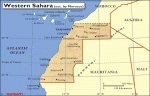
Western Sahara
Area 102,703 square mi (266,000 square km) Population 261,794 (2014) Capital None; occupied by Morocco Highest Point 2,700 ft (823 m) Lowest Point -180 ft (-55 m) GDP per capita na Primary Natural Resources phosphate. AS OF 2005, WESTERN SAHARA, formerly called Spanish Sahara, was officially occupied by MOROCCO. Western Sahara is one of the most inhospitable […]
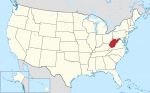
West Virginia
WITH ITS CAPITAL at Charleston, West Virginia occupies 24,181 square mi (62,629 square km). Its lowest point is the Potomac River at 210 ft (73m) near Harper's Ferry. It's highest point is Spruce Knob at 4,863 ft (1,483 m) and its primary natural resources are coal, natural gas, stone, salt, oil, and mineral springs. West Virginia (population 1,808,344) is known as the […]
weather
THROUGHOUT HISTORY, humankind has always been in awe of the weather. Ancient civilizations considered it to be the work of the gods. Even as recently as the 1700s, it was thought that weather occurred in only one place and simply stayed put. Benjamin Franklin was one of the first who published his speculations that this was untrue when he learned that […]
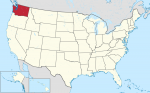
Washington
THE STATE OF WASHINGTON in the northwest UNITED STATES has an area of 71,303 square mi (184,674 square km) and a population of 5,894,121 (2000). Bordered by OREGON to the south and CANADA to the north, Washington State boasts a dramatic range of geographic diversity, including dense forests, mountain ranges, an ocean coast, and arid farmland. The capital is Olympia and the […]
Wallis and Futuna Islands
THE WALLIS AND FUTUNA ISLANDS (overseas territory of FRANCE) are a collection of tiny islands in the South PACIFIC OCEAN. Consisting of three hereditary kingdoms, its government is an anomaly as an integral part of the French Republic, but there is little impetus for change, in either traditional government or its affiliations with France. Part of an arc of islands stretching […]
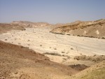
wadi
A WADI IS A RAVINE or gully in the MIDDLE EAST or northern Africa that is dry for most of the year. The word wadi means “valley” or “ravine” in Arabic. When the rainy season comes, great quantities of water may rush through the wadis, destroying lives and property. Most of the year, wadis are either dry or have intermittent stream […]
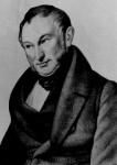
Von Thunen, Johann H. (1780–1850)
JOHANN HEINRICH von Thunen was an important theorist in the science of land use. His work brought together the fields of economics and geography to provide an illustration of the balance between land cost and transportation costs. Although his land system was designed to calculate optimal distribution in the context of preindustrialized Europe—before the development of railroads, for example—the equations and principals he […]
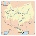
Volga River
THE VOLGA RIVER is considered to be the mother of Russian rivers. Europe's longest, it drains an area of 550,288 square mi (1,410,994 square km), roughly 40 percent of European RUSSIA. From its origins in the heavily forested hills near the Baltic Sea to its mouth on the CASPIAN SEA 2,300 mi (3,700 km) away, the river passes through much of […]
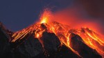
volcanoes
A VOLCANO IS ANY vent on the surface of the Earth, or another world, which allows molten rock, ash, steam, gas, or pyroclastic debris to spill out. Volcanoes proliferate along the edges of the Earth's tectonic plates, and are found on other satellites in our solar system, such as Io, one of Jupiter's moons. In a volcano, a tunnel or conduit […]
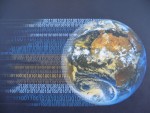
virtual geography
THE INTERNET TOGETHER with a new generation of related computer software and hardware is producing a revolution in how we conceptualize and interact with geographic places and spaces. This revolution is sustained by the continual diffusion of information and communication technologies (ICT) into many segments of a globally connected society. These ICT forms include immersive multimedia, video conferencing, computer-aided design (CAD), electronic […]
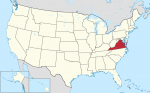
Virginia
NAMED FOR QUEEN Elizabeth I of England who was known as the Virgin Queen, the Commonwealth of Virginia is officially known as The Old Dominion State. The state is also frequently referred to as the “Mother of Presidents” because eight presidents were born in the state, including George Washington and Thomas Jefferson. Jamestown, on the banks of the James River, was one […]
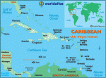
Virgin Islands (U.S.)
A TERRITORY OF THE UNITED STATES, roughly 65 km (40 mi) east of PUERTO RICO, these islands were named by Christopher Columbus in honor of the 11,000 martyred companions of Saint Ursula, Las Once Mil Virgenes. Today, these islands are split into two groups: the largest islands form an organized, unincorporated territory of the United States, while the smaller islands to the […]
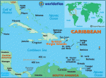
Virgin Islands (British)
AN OVERSEAS TERRITORY of the UNITED KINGDOM, and poorer cousins to the U.S. VIRGIN ISLANDS, the British Virgin Islands have looked to their larger and more populous neighbors to the west for much of their economic and cultural influences: most tourists to the islands are from the mainland UNITED STATES, and the islands have used U.S. currency since 1959. But recent British […]
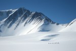
Vinson Massif
VINSON MASSIF IS THE highest peak (16,077 ft or 4,901 m) on the ANTARCTICA continent. It forms the southern outlier of the Sentinel Range, the northern range of the Ellsworth Mountains. The Ellsworth Mountains, divided into the Sentinel Range and the Heritage Range by the Minnesota Glacier, lie in the eastern part of Ellsworth Land, inland from the Ronne Ice Shelf. Vinson […]
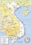
Vietnam
Area 204,779 square mi (329,560 square km) Population 90.73 million 2014 Capital Hanoi Highest Point 10,315 ft (3,144 m) Lowest Point 0 m GDP $186.2 billion 2014 Primary Natural Resources phosphates, coal, manganese, bauxite. THE SOCIALIST REPUBLIC of Vietnam was formed into a single country in 1976 when the North and South Vietnam states were united after […]
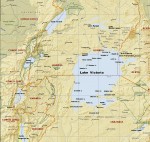
Victoria, Lake
WITH AN AREA of 26,830 square mi (69,490 square km), Lake Victoria is the largest lake in Africa and, after Lake SUPERIOR in North America, the second largest lake in the world. At 3,720 ft (1,130 m) above sea level, Lake Victoria is bordered by UGANDA, KENYA, and TANZANIA. It is 209 mi (337 km) at its greatest length and 150 […]
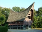
vernacular housing
HUMAN GEOGRAPHERS often distinguish between the natural environment and the built environment. The latter, also known as the cultural landscape, consists of that part of our milieu that has been modified by human action. One category of cultural landscape is created by folk cultures, which are often found in rural areas; such people generally change slowly and in small increments. They may […]
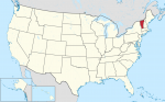
Vermont
BOUNDED BY THE Canadian province of Quebec to the north, MASSACHUSETTS to the south, NEW HAMPSHIRE to the east, and NEW YORK to the west, Vermont covers an area of 9,609 square mi (24,887 square km) and is located in the westernmost portion of the New England region of the UNITED STATES. Its highest point, Mt. Mansfield, reaches an elevation of […]
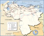
Venezuela
Area 352,144 square mi (912,050 square km) Population 30.69 million 2014 Capital Caracas Highest Point 16,427 ft (5,007 m) Lowest Point 0 m GDP $381.3 billion 2012 Primary Natural Resources petroleum, natural gas, iron ore, gold. VENEZUELA IS A COUNTRY in northern South America. A former Spanish colony, Venezuela formed part of the country of Gran Colombia […]
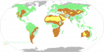
vegetation zones
THE COMPOSITION OF associations among plant species tends to vary regularly across gradients of altitude, latitude, temperature, soil types, and other variables. Making use of this observation, biogeographers are able to delineate distinct sets of conditions along such gradients that reflect changes, sometimes abrupt, in the distribution of plant associations. Where two or more such changes occur, the ecology of a […]
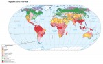
vegetation geography
GEOGRAPHERS ARE CONCERNED with studying elements of the natural and human environments. They want to determine the relationships between these elements and wish to explain their patterns of location. Vegetation is an important and highly visible element of the natural and cultural environment. To the trained eye, vegetation offers a rapid means of determining habitat suitability for various human endeavors. One way […]
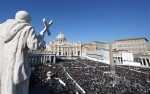
Vatican City
Map Page 1131 Area .273 square mi (.44 square km) Population 911 (2003) Highest Point Vatican Gardens 252.6 ft (77 m) Lowest Point Saint Peter's Square 62.4 ft (19 m) GDP per capita not available Primary Natural Resources none. THE STATE OF VATICAN City is the world's smallest independent state. This tiny city situated on a […]
Vanuatu
Area 4,758 square mi (12,200 square km) Capital Port-Vila Population 258,900 2014 Highest Point 6,194 ft (1,877 m) Lowest Point 0 m GDP $815.0 million 2014 Primary Natural Resources manganese, hardwood forests, fish. UPON ACHIEVING independence from FRANCE and Great Britain in 1980, the peoples of the islands known as the New Hebrides renamed the island nation […]
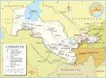
Uzbekistan
Area 172,742 square mi (447,400 square km) Population 30.76 million 2014 Capital Tashkent Highest Point 14,111 ft (4,301 m) Lowest Point -39ft (-12 m) GDP $62.64 billion 2014 Primary Natural Resources natural gas, petroleum, coal. THE REPUBLIC OF Uzbekistan, the most populous Central Asian republic of the former Soviet Union, is one of the world’s only countries […]
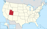
Utah
THE BEEHIVE STATE, covering an area of 84,990 square mi (220,124 square km), is located in the southwest United States and features a dry, mountainous topography. Utah is rectangular in shape, except for a small corner cut away in the northeastern portion of the state. The state is bounded to the north by IDAHO and WYOMING, to the east by COLORADO, […]

U.S. Minor Outlying Islands
EIGHT TINY SPECKS of land dotting the PACIFIC OCEAN are the marks of the U.S. military presence in the region during the two major conflicts of the 20th century. The names Wake and Midway are forever linked to major air and land battles of World War II. The others are little known and are mostly maintained now as nature preserves and […]
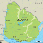
Uruguay
Area 68,039square mi (176,220 squarekm) Population 3.420 million 2014 Capital Montevideo HighestPoint 1,686 ft (514 m) LowestPoint 0 m GDP $57.47 billion 2014 Primary Natural Resources rice, wheat,corn, barley, livestock, fish. THE ORIENTAL REPUBLIC of Uruguay, more simply known as Uruguay, is a South American country with a population of about 3.4 million people and situated along the […]
urbanization
URBANIZATION IS THE process by which large numbers of people become permanently concentrated in relatively small areas, forming cities. The definition of what constitutes a city changes from time to time and place to place, but it is most usual to explain the term as a matter of demographics. The United Nations has recommended that countries regard all places with more than […]
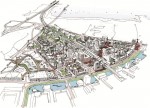
urban planning
URBAN PLANNING IS A dynamic process that involves designing or planning urban spaces or urban communities. It also involves considerations ranging from land use and zoning to environmental concerns, preservation, gentrification, and issues of growth and urban sprawl. Urban planning frequently requires responding to changes in both neighborhoods and overall urban areas, including changes in the age, class and racial composition of the […]
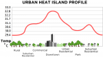
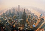
urban heat island
BY 2015, GLOBAL settlement patterns are projected to cross a threshold where, for the first time in human history, the majority of people will be urban dwellers. By 2025, cities are expected to contain approximately 6 billion people—two-thirds of the world's population. This unprecedented expansion of the number, size, and population of urban areas will have a significant impact on urban climates […]
Ural Mountains
THE URALS EXTEND over 1,553 mi (2,500 km) from the ARCTIC OCEAN to the steppes of KAZAKHSTAN. The territory of nearly 318,148 square mi (824,000 square km) is subdivided in the oblasti (districts) of Perm, Cheliabinsk, Kurgansk, Orenburg, and the Autonomous Republics of Udmurtia and Bashkiria. The Ural highlands, with the highest peak of Narodnaya (6,213 ft or 1,894 m), separate the […]
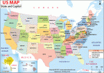
United States
Area 3,717,813 square mi (9,629,091 square km) Population 318.9 million 2014 Capital Washington, D.C. Highest Point 20,321 ft (6,194 m) Lowest Point -282 ft (-86 m) GDP $17.42 trillion 2014 Primary Natural Resources coal, copper, lead. THE UNITED STATES is a country in North America bordered by CANADA to the north, MEXICO to the south, the PACIFIC […]
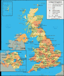
United Kingdom
Area 94,526 square mi (244,820 square km) Population 64.51 million 2014 Capital London Highest Point 4,406 ft (1,343 m) Lowest Point -13.2 ft (-4 m) GDP $2.989 trillion 2014 Primary Natural Resources coal, petroleum, natural gas. THE UNITED Kingdom of Great Britain and Northern Ireland (UK) is the full name of a state in western Europe composed […]
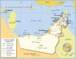
United Arab Emirates
Area 32,000 square mi (82,880 square km) Population 9.086 million 2014 Capital Abu Dhabi City Highest Point 5,010 ft (1,527 m) Lowest Point 0 m GDP $399.5 billion 2014 Primary Natural Resources petroleum, natural gas. THE UNITED ARAB EMIRATES (UAE) is a federation of seven emirates in the Arabian Peninsula, established in 1971 (formerly six, the […]
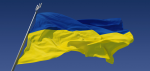
Ukraine
Area (233,089 square mi (603,700 square km) Population 45.36 million 2014 Capital Kyiv (Kiev) Highest Point 6,762 ft (2,061 m) Lowest Point 0 m GDP $131.8 billion 2014 Primary Natural Resources iron ore, coal, manganese, oil. WHERE EUROPE EDGES into Eurasia, there lies Ukraine, from ancient times known for its fertile black soil, or chornozem, imparting to […]
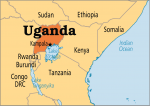
Uganda
Area 146,608 square mi (236,040 square km) Population 37.78 million (2014) Capital Kampala Highest Point 16,765 ft (5,110 m) Lowest Point 2,037 ft (621 m) GDP $27.00 billion (2014) Primary Natural Resources copper, cobalt, hydropower. UGANDA IS A LANDLOCKED east-central African country bounded by TANZANIA and RWANDA on the south, CONGO (formerly Zaire) on the west, SUDAN […]
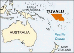
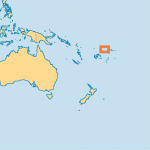
Tuvalu
Area 4 square mi (10 square km) Population 9,893 2014 Capital Funafuti Highest Point 15 ft (4.6 m) Lowest Point 0 m GDP $37.86 million 2014 Primary Natural Resources copra, fisheries, tourism, coconuts. TUVALU IS ONE OF the world's smallest sovereign nations and remote countries. Tuvalu is a group of nine atolls scattered between the 501,932 square […]
Turks and Caicos islands
AN OVERSEAS DEPENDENT territory of the UNITED KINGDOM, the Turks and Caicos islands lie at the southeastern end of the BAHAMAS chain, north of HAITI in the CARIBBEAN SEA. Physically, culturally, and economically similar to the Bahamas, the islands have nevertheless maintained a separate identity across three centuries of British rule and continue to hold fast to their British roots in the […]
Turkmenistan
Area 188,456 square mi (488,100 square km) Population 5.307 million 2014 Capital Ashgabat Highest Point 10,298 ft (3,139 m) Lowest Point -265 ft (-81 m) GDP $47.93 billion 2014 Primary Natural Resources petroleum, natural gas, coal. TURKMENISTAN, KNOWN for its deserts, oil potential, and strong authoritarian government, achieved its independence in 1991 following the collapse […]
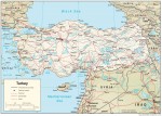
Turkey
Area 301,384 square mi (780,580 square km) Population 75.93 million 2014 Capital Ankara Highest Point 16,945 ft (5,166 m) Lowest Point 0 m GDP $798.4 billion 2014 Primary Natural Resources antimony, barite, coal, copper, emery. TURKEY IS A NEAR Middle Eastern country located in northwestern Asia with a toehold in extreme southeastern Europe. It is about the […]
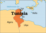
Tunisia
Area 63,170 square mi (163,610 square km) Population 11.00 million (2014) Capital Tunis Highest Point 5,065 ft (1,544 m) Lowest Point -56 ft (-17 m) GDP $48.61 billion (2014) Primary Natural Resources oil, olives, olive oil, grain, tomatoes. LONG BEFORE THE ROMANS sacked the Phoenician city of Carthage, Tunisia, located in the center of the North Africa's […]
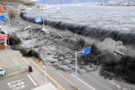
tsunamis
TSUNAMI, a Japanese word whose characters translate as “harbor wave,” has become the internationally used term that refers to a series of waves traveling across the ocean with extremely long wavelengths (the distance between wave crests), considerable length, and high velocity. The image most people have of a tsunami is a large, steep wave breaking on the shore. This image is hardly, […]
Tropic of Capricorn
THE TROPIC of Capricorn is an imaginary line encircling the Earth at the latitude of 23 degrees 30 minutes south of the equator. It is the farthest southern latitude at which the sun can appear directly overhead. It is the southern counterpart to the TROPIC OF CANCER. Below this line is the southern temperate zone and north of the line are […]
Tropic of Cancer
THE TROPIC of Cancer is an imaginary line encircling the Earth at the parallel latitude of 23 degrees 30 minutes North of the equator. This is the northern boundary of the Torrid Zone and the most northerly latitude at which the sun can shine directly overhead. It is at this point that the sun's midday rays are vertical at the summer […]
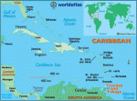
Trinidad and Tobago
Area 1,980 square mi (5,128 square km) Population 1.354 million 2014 Capital Port-of-Spain Highest Point 3,102 ft (940 m) Lowest Point 0 m GDP $28.88 billion 2014 Primary Natural Resources petroleum, natural gas, cocoa, sugarcane, rice. THE TWO CARIBBEAN SEA islands of Trinidad and Tobago had separate histories until they were joined together as one colony under […]
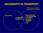
transportation geography
THE DISCIPLINE OF GEOGRAPHY aims to describe and explain the nature of spatial variation as observed on the Earth's surface. There have been a number of ways proposed to divide the discipline, but in the end it is easy to see a HUMAN GEOGRAPHY (the human use of the Earth's surface), a PHYSICAL GEOGRAPHY (natural processes on the Earth's surface), and […]
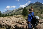
transhumance
TRANSHUMANCE IS THE ancient custom of moving domestic animals from one grazing ground to another, as from lowlands to highlands, with the changing of seasons; sheep, cattle, and goats have all been involved in this annual domestic migration process. The origin of the word partially comes from the French transhumer, to move livestock seasonally. The purpose of transhumance is to move […]
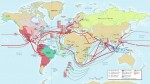
trade routes
THE SIMPLE DEFINITION of a trade route is an area or proscribed passage by land or sea used by merchants and caravans for economic purposes. A trade route can be established between any multiple points linked by trade, whatever the distance between them, and can exist within a small area or specific region or over vast distances between a number of […]
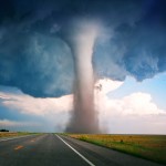
tornadoes
A TORNADO IS A RAPIDLY rotating column of air under a thundercloud. The term is believed to have come from the Spanish tronada, meaning thunderstorm. However, alternate etymologies have been traced from various Spanish and French words meaning “to turn.” Common names for a tornado include twister and funnel cloud. The biblical “whirlwind” was probably a tornado. Wind speeds within a tornado […]
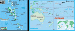
Tonga
Area 289 square mi (748 square km) Capital Nuku'alofa Population 105,600 2014 Highest Point 3,409 ft (1,033 m) Lowest Point 0 m GDP $434.4 million 2014 Primary Natural Resources fish, fertile soil. THE KINGDOM OF TONGA is one of the few states in the south PACIFIC OCEAN to have retained its traditional monarchy and much of its […]
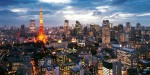
Tokyo
THE CAPITAL OF JAPAN, Tokyo is one of the world's largest, most densely populated, and most influential cities, with a population of more than 12 million (2003). The Tokyo Metropolis (Tokyo-to) has an area of 828 square mi (2,145 square km) and for administration purposes consists of 23 wards, 26 cities, 1 county, 4 island administrative units, and 15 towns and villages. […]
Tokelau
Area 3.86 square mi (10 square km) Population 1,418 (2004) Capital none Highest Point 16 ft (5 m) Lowest Point 0 m GDP per capita $1,000 (estimate 1993) Primary Natural Resources copra, fisheries, craft goods. A COUNTRY LOCATED in the South PACIFIC OCEAN halfway between HAWAII and NEW ZEALAND, Tokelau covers a huge area of ocean but […]
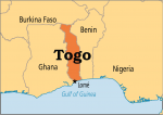
Togo
Area 35,284 square mi (56,785 square km) Population 7.115 million (2014) Capital Lome Highest Point 3,234 ft (966 m) Lowest Point 0 m GDP $4.518 billion (2014) Primary Natural Resources coffee, cocoa, cotton, yams, cassava (tapioca). TOGO SITS ON the southern end of the western portion of Africa. This narrow strip of land has 35 mi […]
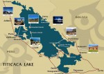
Titicaca, Lake
HIGH IN THE ANDES MOUNTAINS between BOLIVIA and PERU at 12,580 ft (3,810 m) above sea level, Lake Titicaca is said to be the highest fresh-water lake on Earth navigated by large vessels. Forty-one islands, some of them densely populated, rise from its shores. The lake covers 3,200 square mi (8,300 square km) and extends in a northwest-to-southeast direction for 120 […]
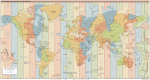
time zones
TIME ZONES ARE industrial humanity's way of dealing with the phenomenon of the sun illuminating a round, rotating Earth. While a person in CHICAGO, ILLINOIS, observes high noon, a person in LONDON, England, is observing sunset, a person in Honolulu, HAWAII, is observing sunrise, and a person in MUMBAI, INDIA, is using artificial light to illuminate the night. So long as […]
Tibetan Plateau
LOCATED IN THE southern part of western CHINA, this huge (900,000 square mi or 2,500,000 square km wide) and mostly barren tableland represents onefourth of the People's Republic of China (PRC). Chinese geographers, who have conventionally called it Qinghai-Xizang gaoyuan, have defined the plateau as the area above the 9,000 ft (3,000 m) contour line. Outside China, the Tibetan Plateau is better […]
Tibesti Massif
THE TIBESTI MASSIF is a giant triangular massif located in southern LIBYA and northern CHAD. It lifts abruptly out of the SAHARA DESERT and is visually impressive. The massif covers an area of over 38,610 square mi (100,000 square km); over 11,583 square mi (30,000 square km) of this area consists of volcanic rock. The Tibesti Massif is separated from the […]
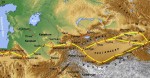
Tian Shan
TIAN SHAN, THE name that Chinese geographers have given to the “Heavenly Mountains,” can also be spelled T'ien-shan or Tien Shan. The Junggar Mongols who inhabit the area call this mountain range Tengri Uul or Tengri Agula. A frequent component in place names in western CHINA, tengri in Mongol has the same meaning as tian in Chinese: “sky” and “God.” The […]
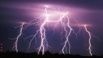
thunderstorms
THUNDERSTORMS ARE produced by cumulonimbus clouds and include thunder and lightning. They form when the troposphere is unstable or conditionally unstable for a large portion of its depth and may have tops of 40,000 to 50,000 ft (12,000 to 15,000 m) or higher. In addition, thunderstorms require a source of atmospheric moisture and a “trigger”—a feature that initiates upward vertical motion in […]
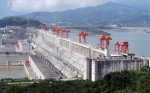
Three Gorges
THE MOUNTAINS OF the Three Gorges (Qutang, Wu, and Xiling) are some of the most spectacular scenery in all of CHINA. Located in the middle section of the Yangzi River (CHANGJIANG) they have long been the object of countless paintings, photographs, and other representations. And now they are the site of the world's largest hydroelectric project. The Yangzi is the world's […]
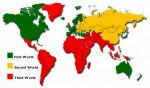
third world
THE TERM third world is said to have been coined by demographer Alfred Sauvy in a 1952 article in the French magazine L'Observateur, which he ended by comparing the underdeveloped nations of the world to the peasants who led the French Revolution: “this ignored Third World, exploited, scorned.” Some say French President Charles de Gaulle first used it; however, Sauvy's article is […]
Thar Desert
THE THAR DESERT, often called the Indian Desert, extends for about 400 mi (644 km) from southwest to northeast and has a maximum width of about 225 mi (362 km). The desert is limited to the south by the Great Rann of Cutch. To the west lies the valley-plain of the INDUS RIVER and to the northwest that of the […]
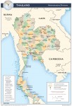
Thailand
Area 319,385 square mi (514,000 square km) Population 67.73 million 2014 Capital Bangkok Highest Point 8,451 ft (2,576 m) Lowest Point 0 m GDP $404.8 billion 2014 Primary Natural Resources tin, rubber, natural gas, tungsten, timber. THE KINGDOM OF Thailand, a Southeast Asian country, is bordered by MYANMAR (Burma) to the west, LAOS to the north and […]
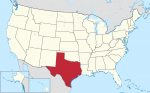
Texas
TEXAS IS A SOUTHWESTERN state of the UNITED STATES, bordering LOUISIANA, OKLAHOMA, and NEW MEXICO. MEXICO lies across the RIO GRANDE to the south. Texas also has a 350-mi (560-km) coastline along the Gulf of Mexico. Texas now ranks second among the states in both area and population. With a total area of 268,581 square mi (695,622 square km), Texas is […]
territoriality
THE CENTRAL FOCUS of POLITICAL GEOGRAPHY is best understood from the point of view of the twin concepts of territory and territoriality. Neither of these can be understood apart from each other. In order to talk of territory, one must talk of territoriality and vice versa. The word has possible roots in the Latin terratorium meaning “earth,” and terrere, meaning “to frighten.” […]
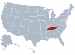
Tennessee
NAMED BY THE Cherokee Native Americans, the U.S. state of Tennessee, which is officially known as the Volunteer State, is celebrated throughout the world as the home of American country music. Tennessee is bounded on the north by KENTUCKY and VIRGINIA, on the south by GEORGIA, ALABAMA, and MISSISSIPPI, on the east by NORTH CAROLINA, and on the west by ARKANSAS and […]
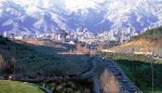
Tehran
THE CAPITAL of modern IRAN, Tehran is one of the largest cities of the world with a metropolitan population of 15 million people. Located on the northernmost limit of the central Iranian plateau, the city is appropriately 3,750 ft (1,143 m) above sea level. To the northeast are the Iranian uplands and the snowcapped Mt. Demovend, legendary home to Zoroaster. The city's […]
Tashkent
TASHKENT (ALSO TOSHKENT) is the capital of the Central Asian republic of UZBEKISTAN, which gained its independence when the Soviet Union was dissolved in 1991. Located on the banks of the Chirchik River in the Kyzlkum desert and the foothills of the TIAN SHAN/Pamir mountains, Tashkent is an oasis with a population of about 2.3 million. It enjoys a continental desert climate […]